• Get your Camino Frances Guidebook here.
  • For 2024 Pilgrims: €50,- donation = 1 year with no ads on the forum + 90% off any 2024 Guide. More here.
    (Discount code sent to you by Private Message after your donation)
  • ⚠️ Emergency contact in Spain - Dial 112 and AlertCops app. More on this here.

Search 69,459 Camino Questions

Grade of ascent out of St. Jean

Marathonwmn

New Member
Time of past OR future Camino
(2016)
As best I can figure, the average grade from St. Jean-Pied-de-Port to the top of Col de Lepoeder is 9.62%. Does anyone know for sure? I'm starting to think about training for the Camino Francés and would like to work this into my training.

Thanks!
 
3rd Edition. More content, training & pack guides avoid common mistakes, bed bugs etc
Steep.

I set my treadmill at 7% when walking at home in the Winter.

That said, it is just a matter of putting one foot in front of the other. The only thing that changes is the speed/pace you perform that action. :)


Ultreya,
Joe
 
New Original Camino Gear Designed Especially with The Modern Peregrino In Mind!
As best I can figure, the average grade from St. Jean-Pied-de-Port to the top of Col de Lepoeder is 9.62%. Does anyone know for sure? I'm starting to think about training for the Camino Francés and would like to work this into my training.

Thanks!
Maybe it is. But what does that tells/helps you? What about the grade from Villafranca Montes de Oca??? Or Portomarin? Or...???
Just take care of your feet and you'll be OK.

Ultreia!
 
It is possible to check out the route on the Google Earth application, which I did some time ago to answer a similar question. The average grade does quite a lot to hide the quite variable nature of the slope you will face. My recollection is that there are some sections that might be three, or even more, times the average.

Also, just using an arithmetic average (overall elevation gain/distance) actually disguises the real average. You really need to sum the individual elevation gains and individual elevation losses to get the real average slope. I suspect it will be closer to 12% than 9.6%.
 
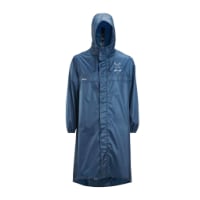
Very light, comfortable and compressible poncho. Specially designed for protection against water for any activity.

Our Atmospheric H30 poncho offers lightness and waterproofness. Easily compressible and made with our Waterproof fabric, its heat-sealed interior seams guarantee its waterproofness. Includes carrying bag.

€60,-
As best I can figure, the average grade from St. Jean-Pied-de-Port to the top of Col de Lepoeder is 9.62%. Does anyone know for sure? I'm starting to think about training for the Camino Francés and would like to work this into my training.

Thanks!

Set the stairmaster to 'Everest'. If you have trained to climb Everest then Col de Lepoeder will be easy.
 
Transport luggage-passengers.
From airports to SJPP
Luggage from SJPP to Roncevalles
Down bag (90/10 duvet) of 700 fills with 180 g (6.34 ounces) of filling. Mummy-shaped structure, ideal when you are looking for lightness with great heating performance.

€149,-
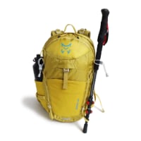
Technical backpack for day trips with backpack cover and internal compartment for the hydration bladder. Ideal daypack for excursions where we need a medium capacity backpack. The back with Air Flow System creates large air channels that will keep our back as cool as possible.

€83,-
The gradient of the hill after Castrojeriz is 12% . I remember the signage vividly going up.
Yeah, that one was the killer for me. We dilly-dallied in Castrojeriz far too long and got a late start up that hill, which made it extremely hot and sunny in addition to the long climb. And going down was not all that easy either. I seem to recall a sign on the backside that said 18% grade.
 
The sunrise from the top of the hill after Castrojeriz is stunning! Be on the top when the sun rise!
 
Yeah, that one was the killer for me. We dilly-dallied in Castrojeriz far too long and got a late start up that hill, which made it extremely hot and sunny in addition to the long climb. And going down was not all that easy either. I seem to recall a sign on the backside that said 18% grade.

Here's the proof folks!IMG_1358.JPG Camino 2014 2014-05-31 027.JPG
 
Get a spanish phone number with Airalo. eSim, so no physical SIM card. Easy to use app to add more funds if needed.
Bicyclists love this downhill. I swear I saw one youngster 'take air' before practically flying down this hill. There would be a tendency, I expect, for walkers to zig zag down this hill in an effort to lessen the effect of the steep gradient on the legs. I strongly recommend that walkers keep to a straight line, not only on downhills, but always, as one never knows what bicyclist might come tearing up from behind. (Enough has been said on other threads about the difficulties between walker peregrinos and bicycle peregrinos.)
 
Bicyclists love this downhill. I swear I saw one youngster 'take air' before practically flying down this hill.
And the downhill side is rough-textured concrete...I can only imagine the road rash that young cyclist would suffer if he layed his bike down.
 
New Original Camino Gear Designed Especially with The Modern Peregrino In Mind!
I would grade it a 10 of 10 in terms of making pilgrims ask themselves profound questions such as "what was I thinking when I decided to start at SJPP?" ..... "I wish that Jesus died a year sooner ..... then the Brierley guide would have me start from Ronconvalles" ...... "how the hell did a rather chubby Nepolian ever get out of SJPP much less in and out of Spain" ....... "......Taxi ...."
 
I would grade it a 10 of 10 in terms of making pilgrims ask themselves profound questions such as "what was I thinking when I decided to start at SJPP?" ..... "I wish that Jesus died a year sooner ..... then the Brierley guide would have me start from Ronconvalles" ...... "how the hell did a rather chubby Nepolian ever get out of SJPP much less in and out of Spain" ....... "......Taxi ...."
how many degrees is that? I don't work these % very well
 
A selection of Camino Jewellery
Why ask? It's steep and as someone else said (gets even steeper) the first little lift out of SJPdP gave me reason to question my sanity back in 2011. I have since found over the years there are even worse climbs and descents.
 
how many degrees is that? I don't work these % very well
If it helps, here's what I use as my milepost ---- The steepest hike I've done has an average grade of 34.4%; much of it was scrambling i.e. using hands and feet. As long as I can remain upright, I count my blessings. :)
 
If it helps, here's what I use as my milepost ---- The steepest hike I've done has an average grade of 34.4%; much of it was scrambling i.e. using hands and feet. As long as I can remain upright, I count my blessings. :)
ah that was what I found myself on yesterday's training, lost on Dartmoor at one point couldn't go up or down - quite ridiculous - still back now and none the worse for wear except I regard yesterday as cross training! (stretching some muscles that don't usually come into play)not putting the miles in -
 
The one from Galicia (the round) and the one from Castilla & Leon. Individually numbered and made by the same people that make the ones you see on your walk.
If it helps, here's what I use as my milepost ---- The steepest hike I've done has an average grade of 34.4%; much of it was scrambling i.e. using hands and feet. As long as I can remain upright, I count my blessings. :)
How about the descents when it takes hours to crab walk to the bottom?
 
Hi,

Interesting perhaps ?

HERE a web page where, by putting your mouse cursor under the curve, you can follow on the map the altitude of your footsteps on the route to Ronvevalles ... Don't forget to zoom the map ...

HERE also all the ways available in the Pyrénées-Atlantiques département.

Théo
 
Very light, comfortable and compressible poncho. Specially designed for protection against water for any activity.

Our Atmospheric H30 poncho offers lightness and waterproofness. Easily compressible and made with our Waterproof fabric, its heat-sealed interior seams guarantee its waterproofness. Includes carrying bag.

€60,-
The sign for the old route out of Ourense on the Camino Sanabres:

upload_2014-8-25_13-29-54.png

Based on the number of breathers I needed going up this hill, it was steeper than the climb up to Ibaneta!
 

Most read last week in this forum

La Voz de Galicia has reported the death of a 65 year old pilgrim from the United States this afternoon near Castromaior. The likely cause appears to be a heart attack. The pilgrim was walking the...
Just reading this thread https://www.caminodesantiago.me/community/threads/news-from-the-camino.86228/ and the OP mentions people being fined €12000. I knew that you cannot do the Napoleon in...
This is my first posting but as I look at the Camino, I worry about 'lack of solitude' given the number of people on the trail. I am looking to do the France route....as I want to have the...
I’m heading to the Frances shortly and was going to be a bit spontaneous with rooms. I booked the first week just to make sure and was surprised at how tight reservations were. As I started making...
My first SPRINGTIME days on the Camino Francés 🎉 A couple of interesting tidbits. I just left Foncebadón yesterday. See photo. By the way, it's really not busy at all on my "wave". Plenty of...
The Burguete bomberos had another busy day yesterday. Picking up two pilgrims with symptoms of hypothermia and exhaustion near the Lepoeder pass and another near the Croix de Thibault who was...

❓How to ask a question

How to post a new question on the Camino Forum.

Similar threads

Forum Rules

Forum Rules

Camino Updates on YouTube

Camino Conversations

Most downloaded Resources

This site is run by Ivar at

in Santiago de Compostela.
This site participates in the Amazon Affiliate program, designed to provide a means for Ivar to earn fees by linking to Amazon
Official Camino Passport (Credential) | 2024 Camino Guides
Back
Top