• For 2024 Pilgrims: €50,- donation = 1 year with no ads on the forum + 90% off any 2024 Guide. More here.
    (Discount code sent to you by Private Message after your donation)
  • ⚠️ Emergency contact in Spain - Dial 112 and AlertCops app. More on this here.

Michelin Guide for the Arles route?

SUSIE

Camino addict....
Hi
I would like to know if there is a Michelin Guide for the Arles route like the one for the Le Puy - St Jean Pied du Port?
If not where can I find between town to town a gradient/ altitude map.
I have the Miam Miam guide for Arles route and they don't have this.
I have seen the general gradient/ altitude for the whole route but don't find this helpful.
Thank you
 
St James' Way - Self-guided 4-7 day Walking Packages, Reading to Southampton, 110 kms
A selection of Camino Jewellery
When we walked the Arles route in 2013 we used the Miam Miam Dodo book almost exclusively. We had the CSJ (Confraternity of St. James) two guidebooks that we referenced occasionally because they were in English. We bought the Sentier book Falcon referenced in Toulouse but never really used it. It did have good maps in it, but like the MMDD it was in French. The route is very well marked and even if you don't have another guidebook you'll be fine. Enjoy the walk.....it's beautiful. Dayton and Karen
 
When we walked the Arles route in 2013 we used the Miam Miam Dodo book almost exclusively. We had the CSJ (Confraternity of St. James) two guidebooks that we referenced occasionally because they were in English. We bought the Sentier book Falcon referenced in Toulouse but never really used it. It did have good maps in it, but like the MMDD it was in French. The route is very well marked and even if you don't have another guidebook you'll be fine. Enjoy the walk.....it's beautiful. Dayton and Karen

Thank you Falcon I have ordered the 2 books suggested in this thread.

Karen thank you for your reply I can speak and read a little French so the books will help hopefully mainly for the gradients between towns hopefully as in the Michelin guide for Le Puy route.

I would really love to see your stages and how many days it took?
regards
Susie
 
Down bag (90/10 duvet) of 700 fills with 180 g (6.34 ounces) of filling. Mummy-shaped structure, ideal when you are looking for lightness with great heating performance.

€149,-
Susie, We started in Montpelier and it took us 35 consecutive days to reach Puente la Reina. Here are our stages:
Montpelier > Montarnaud - 26.4 kms.
Montarnaud > Saint-Guilhem Le-Desert - 20.5
Saint-Guilhem > Saint-Jean de-la-Blaquière - 19.8
Saint-Jean > Lodève - 14
Lodève > La Séguinerie (Saint-Martin) -32.5
La Séguinerie > Saint-Gervais sur-Mare - 21.2
Saint-Gervais > Murat sur-Vèbre - 22.3
Murat sur-Vèbre > La Salvetat sur-Agout - 21.6
La Salvetat > Anglès - 16.8
Anglès > Boissezon - 25
Boissezon > Catres - 15.5
Castres > Abbaye Sainte- Scolastique - 19.7
Abbaye > Les Cassès - 33.5
Les Cassès > Villefranche de-Lauragais - 32
Villefranche > Donneville - 25.1
Donneville > Toulouse - 20
Toulouse (Pibrac) > L'Isle-Jourdain - 29
L'Isle-Jourdain > Gimont - 22.1
Gimont > La Croisée de St Cricq - 26
La Croisée > Montesquiou - 32.9
Montesquiou > Marciac - 21
Marciac > Maubourguet - 16.7
Maubourguet > Anoye - 23
Anoye > Pau - 30
Pau > Lacommande - 20.1
Lacommande > Oloron Sainte-Marie - 15.2
Oloron Sainte-Marie > Bedous - 28.5
Bedous > Urdos - 17.5
Urdos > Canfranc-Estación - 20
Canfranc-Estación > Jaca - 21.6
Jaca > Arrés - 25
Arrés > Ruesta - 24.5
Ruesta > Sangüesa - 21
Sangüesa > Monreal - 28.8
Monreal > Puente la Reina - 27.4

We had snow, lots of rain and days and days of mud....that's why some of the days were shorter. But all in all a fabulous walk. Difficult in stages (but aren't all Caminos!!!!!) but very manageable. I'm sure you will enjoy it.
Bon Chemin

DAYTON and Karen
 
Hi Karen and Dayton
Thank you for your route of stages. I will study it well....
I hope to walk the end of August.
Were there any stages that were just road walking and could you suggest missing them?
Cheers
Susie
 
Hi
where can I find between town to town a gradient/ altitude map.

You can see/download the route on the gr-infos.com site (Voie d'Arles is the GR 653).

I found it useful to download the google earth files. I do not remember if the elevation profile is available directly or if you have to post process on a site like gpsvisualizer. Feel free to ask. (I also found it invaluable to import these files on mobile devices to supplement trailside markers).
 
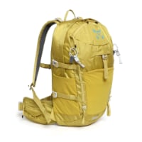
Technical backpack for day trips with backpack cover and internal compartment for the hydration bladder. Ideal daypack for excursions where we need a medium capacity backpack. The back with Air Flow System creates large air channels that will keep our back as cool as possible.

€83,-
Hi Karen and Dayton
Thank you for your route of stages. I will study it well....
I hope to walk the end of August.
Were there any stages that were just road walking and could you suggest missing them?
Cheers
Susie
Hi Karen and Dayton
Thank you for your route of stages. I will study it well....
I hope to walk the end of August.
Were there any stages that were just road walking and could you suggest missing them?
Cheers
Susie
Hi Susie, Sorry we didn't get back to you at the end of April. We were heading to do the Camino Portuguese and we just missed your note. I guess you're in France now. There wasn't really a stage that was ALL road walking. A little bit here, a bit there. Long stretches on the Canal du Midi coming into Toulouse but it was really relaxing. Hope you have a great walk. Dayton and Karen
 
Susie, We started in Montpelier and it took us 35 consecutive days to reach Puente la Reina. Here are our stages:
Montpelier > Montarnaud - 26.4 kms.
Montarnaud > Saint-Guilhem Le-Desert - 20.5
Saint-Guilhem > Saint-Jean de-la-Blaquière - 19.8
Saint-Jean > Lodève - 14
Lodève > La Séguinerie (Saint-Martin) -32.5
La Séguinerie > Saint-Gervais sur-Mare - 21.2
Saint-Gervais > Murat sur-Vèbre - 22.3
Murat sur-Vèbre > La Salvetat sur-Agout - 21.6
La Salvetat > Anglès - 16.8
Anglès > Boissezon - 25
Boissezon > Catres - 15.5
Castres > Abbaye Sainte- Scolastique - 19.7
Abbaye > Les Cassès - 33.5
Les Cassès > Villefranche de-Lauragais - 32
Villefranche > Donneville - 25.1
Donneville > Toulouse - 20
Toulouse (Pibrac) > L'Isle-Jourdain - 29
L'Isle-Jourdain > Gimont - 22.1
Gimont > La Croisée de St Cricq - 26
La Croisée > Montesquiou - 32.9
Montesquiou > Marciac - 21
Marciac > Maubourguet - 16.7
Maubourguet > Anoye - 23
Anoye > Pau - 30
Pau > Lacommande - 20.1
Lacommande > Oloron Sainte-Marie - 15.2
Oloron Sainte-Marie > Bedous - 28.5
Bedous > Urdos - 17.5
Urdos > Canfranc-Estación - 20
Canfranc-Estación > Jaca - 21.6
Jaca > Arrés - 25
Arrés > Ruesta - 24.5
Ruesta > Sangüesa - 21
Sangüesa > Monreal - 28.8
Monreal > Puente la Reina - 27.4

We had snow, lots of rain and days and days of mud....that's why some of the days were shorter. But all in all a fabulous walk. Difficult in stages (but aren't all Caminos!!!!!) but very manageable. I'm sure you will enjoy it.
Bon Chemin

DAYTON and Karen

The new Miam Miam Dodo 2016-17 is now available directly from the publishers. Do you think that this would suffice as the German Rother guide is rather out of date....I plan to walk in September next year from Arles to Puenta de la Reina and aim to do it in 30 to 32 days. Anyone want to join???

Filly
 
Filly, Yes, I think the new MMD book would suffice. Getting from Arles to Puente la Reina in 30-32 days would be aggressive but the beautify of a Camino is that you can adjust along the way. Good luck and I'm sure you will enjoy the route. Dayton and Karen
 
Get a spanish phone number with Airalo. eSim, so no physical SIM card. Easy to use app to add more funds if needed.
Back
Top