• Get your Camino Frances Guidebook here.
  • For 2024 Pilgrims: €50,- donation = 1 year with no ads on the forum + 90% off any 2024 Guide. More here.
    (Discount code sent to you by Private Message after your donation)
  • ⚠️ Emergency contact in Spain - Dial 112 and AlertCops app. More on this here.

Search 69,459 Camino Questions

Maps for a Blog before I begin...

Time of past OR future Camino
Frances (16,'17,'18)
Finisterre/Muxia( '17, '18)
Portuguese Central & Coastal ('18)
Hello, fellow travelers. I am setting up a simple travel blog, TravelPod, that supposedly enables me to post from my phone, my only camera. I would like to post a few Camino maps and wonder if there are sites that allow me to use their maps without copyright questions. My mini-blog, "Irenie's Way on the Camino, 2016," isn't yet up, but I'd like a map for the cover picture. In less than one week, I'll be flying from California to London, then to Paris by train and on to Bayonne and SJPdP for August 17 beginning. I'm so excited, I can barely contain the combination of elation and apprehension. I thought I was all ready a few months ago, with the "right" gear, but at this late date, I'm still working on the best pack, (weight is the factor for me) but my boots are fine. So I get it. I just have to begin and see how all the plans I've dreamed about and made and changed, fit into this reality. A friend and I are starting out this walk to celebrate our 70th birthdays. I'm not sure how far we will walk together or if I will stay on the Frances or maybe change to the Ingles, but that will be the adventure. We have different timelines. Thank you for any help you can give me and a huge thank you for this forum which has been a priceless source of help and support for months. Buen Camino, Irenie
 
Get a spanish phone number with Airalo. eSim, so no physical SIM card. Easy to use app to add more funds if needed.
Irenie,

OpenStreetMap (https://www.openstreetmap.org) has open-source, freely distributable Google-Earth style maps you could use.

Or, if you want something a little more vintage, sites like the Beinecke Digital Collections at Yale (http://brbl-dl.library.yale.edu/vufind/) have maps that are well into the public domain...for instance I quite like this one:
http://brbl-zoom.library.yale.edu/viewer/15487482

Buen Camino,

-Jason
Thank you, Jason. I'll check out your suggestions. I also would like to find the map I saw on a Pilgrim's blog that was used with the note that it must contain the copyright information. Buen Camino.
 
3rd Edition. More content, training & pack guides avoid common mistakes, bed bugs etc
Hi Irenie - best wishes for your blog project.

There are many sites using OpenStreetMap (OSM) data for specific purposes. One I really like is:

http://hiking.waymarkedtrails.org/#?map=7!42.4478!-4.6252

They layer walking trails onto OSM in really nice ways. You can even zoom in on specific trails (such as the Francés - the link above is centered over the Francés). There is a toggle at the top to change it to show trails specific to bicycle, mountain bike, and horse routes. There is a button at the bottom-right that displays a listing of all the routes that are available within the region you are currently looking at -- amazingly helpful.

I often use that site when I am in an area that is new to me and want to find a nearby trail for a day-hike. Highly recommended site.

Also, since it is based on OSM data, anyone can contribute trail data. OSM is an entirely community-driven non-profit project.

Thank you, @stratophile. This looks interesting and I hope I find time to play with that site. Also, I wondered, do you know if camino images like the shell, way markers and arrows are available somewhere online?
 
There are thousands of images on Flikr that are CC-licensed. You'll also likely find good images on Wikipedia's Commons. There are many other sites, too, that have CC-licensed artwork / photos. And for specific types of Camino images, perhaps ask in the forums here. You shouldn't have much trouble finding imagery for your project.
 
Join our full-service guided tour and let us convert you into a Pampered Pilgrim!
The first edition came out in 2003 and has become the go-to-guide for many pilgrims over the years. It is shipping with a Pilgrim Passport (Credential) from the cathedral in Santiago de Compostela.
Also, I wondered, do you know if camino images like the shell, way markers and arrows are available somewhere online?
I don't have firsthand experience using this site, I just stumbled onto it. The nice thing about it is that its terms of usage seem very clear - "All images and videos on Pixabay are released free of copyrights under Creative Commons CC0. You may download, modify, distribute, and use them royalty free for anything you like, even in commercial applications. Attribution is not required."

https://pixabay.com/en/photos/?image_type=&cat=&min_width=&min_height=&q=Jacobsweg&order=popular

As with anything, it is a very good idea to practice it before you leave home (do some practice posts - which you can delete, make sure you are comfortable doing basic editing on your phone, etc.).

¡Buen Camino!
 
Hello, fellow travelers. I am setting up a simple travel blog, TravelPod, that supposedly enables me to post from my phone, my only camera.
This tip might be a bit complicated for what you want to do but I'm adding it anyway in case there are any other readers that may want to try something a bit fancy.

Here are two sites that allow you to use Google Maps by generating HTML links and code. With these you can add points to the maps and the track that you followed and you may even get Google Street View.
http://www.gpsvisualizer.com/
https://mappingsupport.com/p/gmap4.php

It isn't as easy to use as just adding an image of a map to a webpage but you get custom maps.

Examples at:
http://www.gpsvisualizer.com/examples/
https://mappingsupport.com/p/gmap4_examples.html

Help at:
http://www.gpsvisualizer.com/tutorials/
https://mappingsupport.com/p/gmap4_help.html

See how I used mappingsupport.com in a comment on one of my photos on this website to locate a tree that was in the picture:
https://www.caminodesantiago.me/community/camino-photos/vegetable-garden.4420/
 
There are thousands of images on Flikr that are CC-licensed.
In the comment for the picture that I already mentioned
https://www.caminodesantiago.me/community/camino-photos/vegetable-garden.4420/
there is link to Flickr that shows how to get a bunch of Flickr photos that were taken close to some point (the latitude and longtitude are embedded in the link.) Then you can see photos that may be used with license. Or you could do what I did and just leave up the bunch of them to be looked at without doing any copying.
 
New Original Camino Gear Designed Especially with The Modern Peregrino In Mind!
I don't have firsthand experience using this site, I just stumbled onto it. The nice thing about it is that its terms of usage seem very clear - "All images and videos on Pixabay are released free of copyrights under Creative Commons CC0. You may download, modify, distribute, and use them royalty free for anything you like, even in commercial applications. Attribution is not required."

https://pixabay.com/en/photos/?image_type=&cat=&min_width=&min_height=&q=Jacobsweg&order=popular

As with anything, it is a very good idea to practice it before you leave home (do some practice posts - which you can delete, make sure you are comfortable doing basic editing on your phone, etc.).

¡Buen Camino!
There are thousands of images on Flikr that are CC-licensed. You'll also likely find good images on Wikipedia's Commons. There are many other sites, too, that have CC-licensed artwork / photos. And for specific types of Camino images, perhaps ask in the forums here. You shouldn't have much trouble finding imagery for your project.

Thanks again, @Latecomer and @stratophile. These are the type of sites I was looking for and you are right about practicing on my phone before I leave, but I am approaching liftoff soon and can't believe how many last minute needs call my name. It's much different using the phone for blogging than the computer and I'm in awe of those of you who have managed multiple years of blogging and sharing the Camino. I'll be happy just to update friends and relatives on this simple TravelPod, although my first choice would have been a WordPress blog, but time is the boss right now. Buen Camino
 
In the comment for the picture that I already mentioned
https://www.caminodesantiago.me/community/camino-photos/vegetable-garden.4420/
there is link to Flickr that shows how to get a bunch of Flickr photos that were taken close to some point (the latitude and longtitude are embedded in the link.) Then you can see photos that may be used with license. Or you could do what I did and just leave up the bunch of them to be looked at without doing any copying.
Thanks @Rick of Rick and Peg, you've provided excellent links. Some are too technical for the time I have and my iPhone, but I am glad to know about them. Thanks to all who have given me a wealth of ideas and links to use on the Camino and after. I had planned to turn off my Cellular on the Camino and use Wifi mostly. Will that also turn off the location services that give me locations of photos? I'm probably answering my own question! Is GPS connected only with cellular enabled? I'm using only my iPhone 6s+ for camera, to save weight and for a little freedom. Buen Camino.
 
Thank you, @stratophile. This looks interesting and I hope I find time to play with that site. Also, I wondered, do you know if camino images like the shell, way markers and arrows are available somewhere online?
Like these?
002.png is one I drew up to go on my Garmin GPS but it works well in GoogleEarth too.
Feel free to use! If you can't download them email me at canterburypilgrim@hotmail.co.uk
and I'll send them to you.
 

Attachments

  • cross.png
    cross.png
    1.9 KB · Views: 4
  • Shell.png
    Shell.png
    3.1 KB · Views: 4
  • 002.png
    002.png
    282 bytes · Views: 4
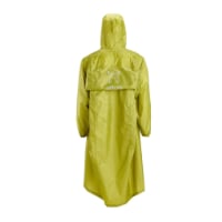
Very light, comfortable and compressible poncho. Specially designed for protection against water for any activity.

Our Atmospheric H30 poncho offers lightness and waterproofness. Easily compressible and made with our Waterproof fabric, its heat-sealed interior seams guarantee its waterproofness. Includes carrying bag.

€60,-
Like these?
002.png is one I drew up to go on my Garmin GPS but it works well in GoogleEarth too.
Feel free to use! If you can't download them email me at canterburypilgrim@hotmail.co.uk
and I'll send them to you.
More thanks to you, @ Jeff Crawley and all of you techies who are combining art with the technology that connects us on the Camino. I easily downloaded the small files and appreciate your generosity.
 
Actually on a blog/web site you can just, completely legally and free, embed Google maps - print is a completely other kettle of fish ...
Buen Camino, SY
 
Actually on a blog/web site you can just, completely legally and free, embed Google maps - print is a completely other kettle of fish ...
Buen Camino, SY
@SYates, so helpful. I have seen some maps with copyright tags that give permission if the user displays the copyright. And yes, printing is another story. Now, to be able to use my phone, even a larger size, to blog or communicate with others, will be the challenge! Buen Camino.
 
The one from Galicia (the round) and the one from Castilla & Leon. Individually numbered and made by the same people that make the ones you see on your walk.
Many blogging platforms support 'blog by email' basically meaning you compose your blog post (normally with a max of 3 pics) as an email and send it to a dedicated email attached to your blog and it gets published nearly magically on your blog ;-)

Buen Camino, SY
 
Many blogging platforms support 'blog by email' basically meaning you compose your blog post (normally with a max of 3 pics) as an email and send it to a dedicated email attached to your blog and it gets published nearly magically on your blog ;-)

Buen Camino, SY
Thanks, @SYates. I have an existing blog and think I read something about this. It's a blogspot and doesn't have the blogger app support any longer and I read many complaints. If I have time, though, I'll check it out. It wasn't too user-friendly to post directly from the phone, though. I read that WordPress is a better platform. Too much to do and not enough time!
 
I strongly recommend Wordpress, it isn't difficult to export/import your existing blog from Blogspot to Wordpress https://wordpress.com and it is free and allows for blogging by email and many more nice things. Buen Camino, SY
 
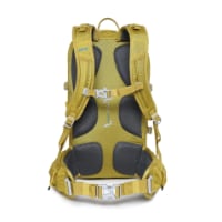
Technical backpack for day trips with backpack cover and internal compartment for the hydration bladder. Ideal daypack for excursions where we need a medium capacity backpack. The back with Air Flow System creates large air channels that will keep our back as cool as possible.

€83,-
I strongly recommend Wordpress, it isn't difficult to export/import your existing blog from Blogspot to Wordpress https://wordpress.com and it is free and allows for blogging by email and many more nice things. Buen Camino, SY
@SYates
If I can, I'll check out exporting my blog. Wish I had more time. Less than 4 days before I leave my home for 6 weeks of adventure and dealing with a few glitches from overtraining and gear changes. I was more ready a few months ago, but hiking and training in our Sierra Foothills has helped me not only understand my own fitness level and limits, but how to maximize my energy and unique physical structure and the need for less than 11 lbs. in my bag and how challenging it is to achieve that weight. Thanks. By the way your book is so helpful. I have it on my Kindle app. Buen Camino. Irene
 
I had planned to turn off my Cellular on the Camino and use Wifi mostly. Will that also turn off the location services that give me locations of photos? I'm probably answering my own question! Is GPS connected only with cellular enabled? I'm using only my iPhone 6s+ for camera, to save weight and for a little freedom. Buen Camino.
Although I have no experience using an iPhone 6s+ for GPS the following and other posts indicate it should not be a problem.
https://www.reddit.com/r/iphone/comments/3goslg/iphone_6_wo_dataservice_gps_still_works_but_how/
I would recommend:

1. You test this now - it would take 2 minutes - Go into airplane mode - make sure Location Services is turned on - take a photo - check whether GPS data is on the photo.

2. You download some type of offline maps for Spain before you leave - I used Maps.me a year ago (on Android) and it worked great for me. Offline Map functionality has improved in Google Maps in the past year but I have not used it enough to have an opinion on it. Without offline maps your GPS won't help you much if you don't have data and need to reroute or find something.

3. Consider getting a SIM card for your phone in Spain, for about 30 Euros for your whole trip you will have more flexibility. (I am quite certain that the 6S plus on Verizon is unlocked by default, AT&T & Sprint might require unlocking).

¡Buen Camino!
 
Rather than create my own blog, I'm going to use FindPenguins.com to create a blog that will allow my friends and family to follow me on my Camino. It has a built in mapping feature, and you can add multiple pictures and text per day.
 
3rd Edition. More content, training & pack guides avoid common mistakes, bed bugs etc
Although I have no experience using an iPhone 6s+ for GPS the following and other posts indicate it should not be a problem.
https://www.reddit.com/r/iphone/comments/3goslg/iphone_6_wo_dataservice_gps_still_works_but_how/
I would recommend:

1. You test this now - it would take 2 minutes - Go into airplane mode - make sure Location Services is turned on - take a photo - check whether GPS data is on the photo.

2. You download some type of offline maps for Spain before you leave - I used Maps.me a year ago (on Android) and it worked great for me. Offline Map functionality has improved in Google Maps in the past year but I have not used it enough to have an opinion on it. Without offline maps your GPS won't help you much if you don't have data and need to reroute or find something.

3. Consider getting a SIM card for your phone in Spain, for about 30 Euros for your whole trip you will have more flexibility. (I am quite certain that the 6S plus on Verizon is unlocked by default, AT&T & Sprint might require unlocking).

¡Buen Camino!
More thanks, @Latecomer, my phone is AT&T and unlocked. I've been puzzling through the choices of Sim cards, WiFi only, and phone plans. Advantages to each of course. I'm down to the wire. With a Sim for Spain, I will be in London from August 9 to 15, France August 15 to 17. In Roncesvalles 18 and after, but likely not able to get a Spanish card until Pamplona. I will check out the use of GPS without cellular. Today has been a brainstorming session. Wow! You forum members are awesome. I'm grateful!
Rather than create my own blog, I'm going to use FindPenguins.com to create a blog that will allow my friends and family to follow me on my Camino. It has a built in mapping feature, and you can add multiple pictures and text per day.

Hi, Trecile, I remember you mentioned FindPenguins before. I started with it and moved over to TravelPod, which also has mapping. I waited too long to test the waters with my iPhone only, so I will either just send emails or use the TravelPod and then blog in my own blog, Beyond Borders, which is more than travel, but includes it. I think you are starting a little after me. We will be in SJPdP on August 16, after a late night in Bayonne and Paris and London before. What a whirlwind. It will be quite the adventure to leave some of this technical and material life in the background for a while. Traveling light in more ways than just my backpack. Muchas gracias. Buen Camino.
 
More thanks, @Latecomer, my phone is AT&T and unlocked. I've been puzzling through the choices of Sim cards, WiFi only, and phone plans. Advantages to each of course. I'm down to the wire. With a Sim for Spain, I will be in London from August 9 to 15, France August 15 to 17. In Roncesvalles 18 and after, but likely not able to get a Spanish card until Pamplona. I will check out the use of GPS without cellular. Today has been a brainstorming session. Wow! You forum members are awesome. I'm grateful!


Hi, Trecile, I remember you mentioned FindPenguins before. I started with it and moved over to TravelPod, which also has mapping. I waited too long to test the waters with my iPhone only, so I will either just send emails or use the TravelPod and then blog in my own blog, Beyond Borders, which is more than travel, but includes it. I think you are starting a little after me. We will be in SJPdP on August 16, after a late night in Bayonne and Paris and London before. What a whirlwind. It will be quite the adventure to leave some of this technical and material life in the background for a while. Traveling light in more ways than just my backpack. Muchas gracias. Buen Camino.
I looked at TravelPod, but unfortunately they didn't see fit to develop an Android app. :(
 
3rd Edition. More content, training & pack guides avoid common mistakes, bed bugs etc

Most read last week in this forum

To me the most Dangerous stage on the Camino Frances was from Foncebadon to Ponferrada in the rain. Never forget the riverbed rocks from El Acebo to Ponferrada totally treacherous, seen several...
...I am on day eight of walking the Francés at the moment. It is quite busy. A lot of talk about beds (and the need to book ahead). I don't book. Today I tried really hard not to get a bed. I...
I started from Pamplona this morning for a quick week walking before starting service as a hospitalera next week back in Pamplona. The trail up to Alto de Perdón has only a few big puddles left...
I’m heading to the Frances shortly and was going to be a bit spontaneous with rooms. I booked the first week just to make sure and was surprised at how tight reservations were. As I started making...
Ultreia, y'all! I am excited to start my first camino soon and have a question about the first time I use my Pilgrim's Passport. I have one already (purchased from Ivar) but was still planning to...
Hello, I would be grateful for some advice from the ones of you who are walking/have recently walked from SJPdP :) 1 - How busy is the first part of the camino right now? I read some reports of a...

❓How to ask a question

How to post a new question on the Camino Forum.

Similar threads

Forum Rules

Forum Rules

Camino Updates on YouTube

Camino Conversations

Most downloaded Resources

This site is run by Ivar at

in Santiago de Compostela.
This site participates in the Amazon Affiliate program, designed to provide a means for Ivar to earn fees by linking to Amazon
Official Camino Passport (Credential) | 2024 Camino Guides
Back
Top