• For 2024 Pilgrims: €50,- donation = 1 year with no ads on the forum + 90% off any 2024 Guide. More here.
    (Discount code sent to you by Private Message after your donation)
  • ⚠️ Emergency contact in Spain - Dial 112 and AlertCops app. More on this here.

Search 69,459 Camino Questions

The "real" Caminho da Costa Lisboa - Santiago

Rainerbernd

Active Member
Time of past OR future Camino
On St James ways since 1971
Last edited:
The 2024 Camino guides will be coming out little by little. Here is a collection of the ones that are out so far.
Thank you, that answers some of my questions as I'm planning on walking some of this route from Lisbon then some of the Camino du mar up to Fatima. I then plan to join the central route at Ansiao to Porto where I'll take the coastal route to pick up the Variente espiritual and onto Santiago. It's an idea at the moment, I've just got to work out places to stay plus I might take my small tent for the occasional night without accommodation. I then need to find out how far apart are water and food.
 
Thank you, that answers some of my questions as I'm planning on walking some of this route from Lisbon then some of the Camino du mar up to Fatima. I then plan to join the central route at Ansiao to Porto where I'll take the coastal route to pick up the Variente espiritual and onto Santiago. It's an idea at the moment, I've just got to work out places to stay plus I might take my small tent for the occasional night without accommodation. I then need to find out how far apart are water and food.


Olá,

the "real" Caminho da Costa is only for adventurers and explorers, using a tent. It is not the Caminho do Mar! Along the coast, out of greater Lisboa and Cascais, there isn´t any infrastructure for pilgrims! Choosing this way you have to plan carefully where to get food and water. If you look on the map, there are many baias and rivers you have to walk around getting a bridge. And not to forget the many small and big canyons It´s not easy!

Bom caminho, Rainer
 
Last edited:
Technical backpack for day trips with backpack cover and internal compartment for the hydration bladder. Ideal daypack for excursions where we need a medium capacity backpack. The back with Air Flow System creates large air channels that will keep our back as cool as possible.

€83,-
Olá peregrinos,

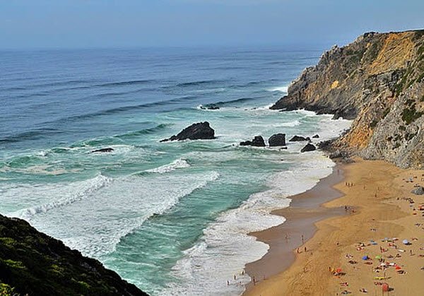
in an other forum I was asked about a way along the coast from Lisboa to Santiago. Well, some say take the Caminho do Mar, but it´s mostly inland.

For the real coastal way have a look:

http://www.gpsies.com/map.do;jsessi...Id=qouwwqakdmvxcoom&language=en&client=summit

Bom caminho, Rainer
Rainer, have you walked this route? If you zoom in, you will see that at least the part that I looked at is not on the coast either. It´s closer to the coast than the Caminho do Mar, but it is not ON the coast. For instance, it doesn´t go out to the Cabo da Roca, nor down to the beach at Adraga, so you will be oh so close but not on the coast. Maybe north of Lisbon it changes, I didn't really study it carefully.

BTW, do you know if this is the same as the Trilho das Areias? http://trilho-das-areias.webnode.com/

Olá,

I haven´t walked the entire route, only some parts, but flown over it various times. It doesn´t go out to Cabo da Roca? The blue line goes a bit into Estrada do Cabo da Roca and then back. From this point it´s about 450 m to the Cabo. I guess this is only only a problem of drawing , nothing else. At Cabo da Roca you can get the last German Bratwurst before America! There you can also take the yellow marked GR 11E, it´s nearer to the ocean. About Praia da Adagra - the distance blue marked way to the ocean is only 300 - 400 metres. Is that a big problem? Why should pilgrims go down to the beach and then back? Along the waterfront the only way is climbing the rocks. The cliff is about 80 m high!

Praia-da-Adraga.jpg


Well, the "path" can´t be always at the coast because of the terrain, marshland, swamps, rocks, canyons and sandy beaches. Not to forget the baias and the rivers. It is nearly impossible to walk all the way along the waterfront. In general the way is very very close to the ocean. Btw zooming in, please have a look at the scale.
 

Attachments

  • Praia-da-Adraga.jpg
    Praia-da-Adraga.jpg
    63.9 KB · Views: 12
Last edited:
I'm planning on walking some of the route then cutting inland to pick up the camino du mar, I am taking my tiny tent anyway as already planned to stealth camp some nights. Looking at the route there are some water points among the way, a few churches, the occasional tourist info, restaurants and campsites so it shouldn't be too bad, it's in Europe not the Amazon basin.
 
3rd Edition. More content, training & pack guides avoid common mistakes, bed bugs etc
I'm planning on walking some of the route then cutting inland to pick up the camino du mar, I am taking my tiny tent anyway as already planned to stealth camp some nights. Looking at the route there are some water points among the way, a few churches, the occasional tourist info, restaurants and campsites so it shouldn't be too bad, it's in Europe not the Amazon basin.

Olá Fatty Walker,

you are right, there are some points for providing with food, water and some things more. As I remember, the speed over ground was about 80 - 100 mph with our airplane (DO 27) , there are stages from 20 - 30 km through nowhere, but not many. Stealth camping should be no problem - hidden in one of the many canyons.

Not to forget a special point on the way. At Foz do Arelho/Lagoa de Obidos you can pass the waterfront only when it is low tide - water up to the knees or something lower, my experience. On high tide and strong westerly wind you sometimes have to walk around the Lagoa

Happy planing and bom caminho
 
Last edited:
Olá Fatty Walker,

you are right, there are some points for providing with food, water and some things more. As I remember, the speed over ground was about 80 - 100 mph with our airplane (DO 27) , there are stages from 20 - 30 km through nowhere, but not many. Stealth camping should be no problem - hidden in one of the many canyons.

Not to forget a special point on the way. At Foz do Arelho/Lagoa de Obidos you can pass the waterfront only when it is low tide - water up to the knees or something lower, my experience. On high tide and strong westerly wind you sometimes have to walk around the Lagoa

Happy planing and bom caminho


Thanks for that, looking at the map I was planning on heading east around there and following the path at the Rio da Cal and picking up the camino du mar at Caldas da Rainha.
 
I've messed about with the various gps routes that I've found on the different caminos between Lisbon and Santiago and taken the bits that I think would work for me. It's added in extra straight bits that I don't know how to get rid of in the middle of the route but you can still tell the route I'm going to take in Google earth.
 

Attachments

  • 2017-04-29_10-07-12.kmz
    106.8 KB · Views: 55
Ideal pocket guides for during & after your Camino. Each weighs only 1.4 oz (40g)!

❓How to ask a question

How to post a new question on the Camino Forum.

Forum Rules

Forum Rules

Camino Updates on YouTube

Camino Conversations

Most downloaded Resources

This site is run by Ivar at

in Santiago de Compostela.
This site participates in the Amazon Affiliate program, designed to provide a means for Ivar to earn fees by linking to Amazon
Official Camino Passport (Credential) | 2024 Camino Guides
Back
Top