• For 2024 Pilgrims: €50,- donation = 1 year with no ads on the forum + 90% off any 2024 Guide. More here.
    (Discount code sent to you by Private Message after your donation)
  • ⚠️ Emergency contact in Spain - Dial 112 and AlertCops app. More on this here.

Search 69,459 Camino Questions

LIVE from the Camino Arles to Somport reports

Karl G

Member
Time of past OR future Camino
August and September 2019 - Arles
As I make my way across this route I will share some observations and thoughts in the hope that it will be helpful to others considering this route. I’m on day 6 at the moment - in Saint Saturnin de Lucian (between Saint Guilhem le Desert and Saint Jean de la Blaquière. A couple of points in general:
- This route would be best traveled when the temperatures are more moderate. There can be long distances between towns - 15 km or more - and water can become an issue in the heat. I managed to go through 2.5 liters in 14 km during a 95F/35C heat wave. Take every opportunity to refill— Offices of Tourisme, Gite’s, fountains marked potable, and bars ( be sure to buy “une cannette de coca” or something before asking for water for your pack.)
- Plan to have trail mix or fruit as it is entirely likely you will not be able to have a lunch. Again, towns can be far apart, or you can arrive at the wrong time or on the wrong day.
- Gronze.com (access it via Chrome if you want an English translation) is excellent for a general overview for route planning and accommodation choices.
- Book a day or even two days in advance if traveling in the high season - basically after June and before September 15th. Later in the trip I spoke with a couple at the Gite where I was staying. They were on their 10th Camino and they were booking three and four days out.
- Recognize that after Montpellier you are very committed. Trains are non-existent for many days and buses limited.
- Do not plan on relying solely on way marks, Gronze, Miam Miam Dodo or the like for navigation. Use a good app like Windy Maps or plan on spending significant time on detours. An excellent fail-safe for staying on the trail is to download the tracks from the Travel tab on Gronze and then copy them into a GPS application like Gaia GPS.
- At this writing there are two places in Montpellier where the route is blocked by construction. There are no detours or alternate markings available. You are on your own. Windy Maps was a must for me in those situations.
- Learn some basic French. You will find some English speakers occasionally but almost always I’ve had to rely pretty much entirely on my very basic French.
- People are likely to be very friendly, encouraging, and helpful when they can be. At least that has been my experience.

On to some specifics:
Unless beginning at the beginning is very important to you or the history of the route compels you to go through Arles, Saint Gilles, and Montpellier I’d highly recommend skipping this section. Way markings on day one were virtually non existent. They got better after that but at times would disappear inexplicably for significant distances. Without Windy Maps I would have been lost countless times. There is limited shade during this section and the route is mostly on black top roads. There is some scenery but not a lot other than a lot of vineyards.

After Grabels it changes dramatically. I’m two days past that point and the way markings have been very good, the scenery excellent, and the route has been mostly trails with a good deal of shade. A dramatically better experience. I even saw two other peligrins today - the first since I’ve started. I will update this report with another post after a few more stages but things are looking up.
 
Last edited:
Ideal sleeping bag liner whether we want to add a thermal plus to our bag, or if we want to use it alone to sleep in shelters or hostels. Thanks to its mummy shape, it adapts perfectly to our body.

€46,-
As I make my way across this route I will share some observations and thoughts in the hope that it will be helpful to others considering this route. I’m on day 6 at the moment - in Saint Saturnin de Lucian (between Saint Guilhem le Desert and Saint Jean de la Blaquière. A couple of points in general:
- This route would be best traveled when the temperatures are more moderate. There can be long distances between towns - 15 km or more - and water can become an issue in the heat. I managed to go through 2.5 liters in 14 km during a 95F/35C heat wave. Take every opportunity to refill— Offices of Tourisme, Gite’s, fountains marked potable, and bars ( be sure to buy “une cannette de coca” or something before asking for water for your pack.)
- Plan to have trail mix or fruit as it is entirely likely you will not be able to have a lunch. Again, towns can be far apart, or you can arrive at the wrong time or on the wrong day.
- Gronze.com (access it via Chrome if you want an English translation) is excellent for a general overview for route planning and accommodation choices.
- Book a day or even two days in advance if traveling in the high season - basically after June and before September 15th.
- Recognize that after Montpellier you are very committed. Trains are non-existent for many days and buses limited.
- Do not plan on relying solely on way marks, Gronze, Miam Miam Dodo or the like for navigation. Use a good app like Windy Maps or plan on spending significant time on detours.
- At this writing there are two places in Montpellier where the route is blocked by construction. There are no detours or alternate markings available. You are on your own. Windy Maps was a must for me in those situations.
- Learn some basic French. You will find some English speakers occasionally but more than once I’ve had to rely pretty much entirely on my very basic French.
- People are likely to be very friendly, encouraging, and helpful when they can be. At least that has been my experience.

On to some specifics:
Unless beginning at the beginning is very important to you or the history of the route compels you to go through Arles, Saint Gilles, and Montpellier I’d highly recommend skipping this section. Way markings on day one were virtually non existent. They got better after that but at times would disappear inexplicably for significant distances. Without Windy Maps I would have been lost countless times. There is limited shade during this section and the route is mostly on black top roads. There is some scenery but not a lot other than a lot of vineyards.

After Grabels it changes dramatically. I’m two days past that point and the way markings have been very good, the scenery excellent, and the route has been mostly trails with a good deal of shade. A dramatically better experience. I even saw two other peligrins today - the first since I’ve started. I will update this report with another post after a few more stages but things are looking up.
Very helpful information as I’m about to walk part of the Arles Camino starting end of next week. From the above I’ve decided not to start in Arles but join route in Montpellier, hoping to avoid road blocks. I’ll book a day or two in advance, as you suggest. Luckily I do have some basic French! I look forward to your further posts
 
- This route would be best traveled when the temperatures are more moderate. There can be long distances between towns - 15 km or more - and water can become an issue in the heat. I managed to go through 2.5 liters in 14 km during a 95F/35C heat wave.

Else avoid hiking it in the exceptional heat of this summer 2019, or any other summers with a particularly strong Saharan anticyclone ...

This year was the second time on at least a part of that Way, in 2005 I did about half of it before switching towards Lourdes, and whilst that was summer too, it was nowhere near as bad as the summer this year.

- Book a day or even two days in advance if traveling in the high season - basically after June and before September 15th.

Well, I'm not sure where you're staying -- but yes, that would certainly be good advice for those staying more often in hotels or gîtes, or in those small pilgrim family places that might have only 2 or 3 beds.

As for the more Camino-like accommodation in the refugios/albergues that exist, well the one in Saint-Gilles has a tendency to be a lot fuller than the others ; that was so in both 2005 at the old one which was much smaller, and in 2014 both times I slept there (on the floor in my sleeping bag both times as all the beds were taken) -- even this year in April the place was half full.

- Recognize that after Montpellier you are very committed. Trains are non-existent for many days and buses limited.

I doubt that I'll ever fully understand this notion of using public transport on a Camino except for reasons of health and/or medical or other urgent necessity -- even though my handicap has been forcing me into it from time to time this year ; and of course to and from your starting and finishing points.

- At this writing there are two places in Montpellier where the route is blocked by construction. There are no detours or alternate markings available. You are on your own. Windy Maps was a must for me in those situations.

Montpellier is a city with a street plan that can be pretty confusing, that's certain ...

Unless beginning at the beginning is very important to you or the history of the route compels you to go through Arles, Saint Gilles, and Montpellier I’d highly recommend skipping this section. Way markings on day one were virtually non existent. They got better after that but at times would disappear inexplicably for significant distances.

There are at least four variant routes between Arles and Saint-Gilles, and I'd guess that the only one of them with half competent waymarking would be the tarmac cycling route. And that's not even including the way up from the Saintes-Maries-de-la-Mer ...

But as for the "beginning", traditionally that's not actually in Arles but in Saint-Gilles du Gard.

Arles was simply the only place where you used to be able to get across the river by bridge, else IIRC you had to cross at Avignon very far north. Arles was more of a Camino crossroads rather than being a gathering point in its own right like Paris, Tours, Vézelay, or Le Puy.

Dunno if that helps ...
 
Last edited:
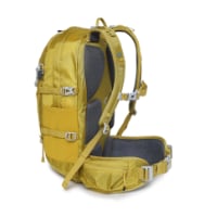
Technical backpack for day trips with backpack cover and internal compartment for the hydration bladder. Ideal daypack for excursions where we need a medium capacity backpack. The back with Air Flow System creates large air channels that will keep our back as cool as possible.

€83,-
Very helpful information as I’m about to walk part of the Arles Camino starting end of next week. From the above I’ve decided not to start in Arles but join route in Montpellier, hoping to avoid road blocks. I’ll book a day or two in advance, as you suggest. Luckily I do have some basic French! I look forward to your further posts
[/QUOTE]
If you walk from Montpellier you may still run into the second construction project which was on the outskirts of town just before the D65. I’ve seen it suggested on another site to take a tram and bus to Grabels. If you can figure that out you’ll avoid that second and most confusing interruption. You’ll miss about 10 km of street walking through the sprawling suburbs.

Be sure to bring your poles. I can’t imagine the past few days without them. They have been indispensable. Enjoy your journey!
 
Very helpful information as I’m about to walk part of the Arles Camino starting end of next week. From the above I’ve decided not to start in Arles but join route in Montpellier, hoping to avoid road blocks. I’ll book a day or two in advance, as you suggest. Luckily I do have some basic French! I look forward to your further posts
If you walk from Montpellier you may still run into the second construction project which was on the outskirts of town just before the D65. I’ve seen it suggested on another site to take a tram and bus to Grabels. If you can figure that out you’ll avoid that second and most confusing interruption. You’ll miss about 10 km of street walking through the sprawling suburbs.

Be sure to bring your poles. I can’t imagine the past few days without them. They have been indispensable. Enjoy your journey!
[/QUOTE]
Thank you! I’ll certainly take your advice about checking out the tram route to Grabels. I arrive Montpellier mid afternoon so should be plenty of time to find transport there. Will book into albergue there too. Also I have my trusty poles! I’ll probably only walk as far as Castres to catch train back to London, as haven’t time for further this time. Good luck with your Camino and I look forward to hearing more news as you progress. Helen
 
OK, time for an update. I’ve walked Grabels to Saint Jean de Foz. Then to Saint Satunin de Lucian. Then to Lodeve, then to Lunas, and today to Saint Gervais sur Mare. In general, waymarkings have been very good. Given the remoteness of today, I am surprised there were not more waymarks to be honest. Especially since the downside of going the wrong way from Lunas to Saint Gervais sur Mare is great.

I don’t recall much of significance from Grabels to St. Jean de Foz. It was long and uphill but the scenery was great and mostly trail. A pleasure to walk. I stayed at Loge Loriot and would recommend it in a hearbeat. The town is small but there was a restaurant open for dinner in the square so life was good.

I had had a series of long and challenging days so I wasn’t sure I was up for a full stage and followed Gronze’s recommendation to consider not going all the way to Saint Blaquière. I couldn’t get a hotel in Montpeyroux and booked the only thing available in Saint Satunin de Lucian. It was pricey but turned out both the hosts were lifesavers. It was a relatively short walk but I needed a break from the long walks. Caution - there is no boulangerie, epicurie, and only one restaurant - and it was closed. The nearest places to go to eat were 5 km or so away. Yikes! This is a really tiny town. Fortunately the hosts took mercy on my and made me a sandwich and for dinner provided some glasses of their own wine and a couple of Croque Monsieurs. As a side note, it was on this leg that I passed my first two pilgrims since leaving Arles.

Onto Lodeve. This was a tougher day than I imagined. The two climbs were steep but well marked. I realized somewhere on this leg that you can download the Gronze tracks into Gaia GPS and added that to my navigation aids. More on that later. I was whipped by the time I made it to Lodeve. Both climbs were steep and so were the downhills. But Lodeve is a welcome urban center. The cars sounded like Formula One racers as I approached town. But, I knew an ATM, a Supermarche, and a Pharmacy all awaited after a few days of isolation.

Lodeve to Lunas was interesting. I took the shortcut shown on Gronze. There is a long climb on this stage whether you take the shortcut or not. I passed another pilgrim this day who was going to Joncels. I didn’t have any trouble finding the alternate route but when you get to about three km or so from Lunas the nice farm trail and road disappears. You end up by a group of about three houses. There are no markings. But, I had been using the downloaded track so I was pretty sure I was in the right place. Fortunately there were some guys doing some work on one of the houses and they pointed out the trail. It’s a very narrow path that runs alongside a detached garage or other structure. Easy to miss as there is a car and motorcycle parked in front of it. The guy told me to stay to the right. Good thing he did because this is an extremely narrow and overgrown path. You can barely see it at times. Stay to the right when in doubt turned out too be excellent advice and I walked into Lunas which is one of the prettier towns thus far. Maybe the prettiest.

Today was the long day from Lunas to Saint Gervais sur Mare - nearly 30 kms with no services other than the small town of Mecles with a water fountain about 3 km from the end. The first climb is very steep in parts and rocky. The second climb is long but not as steep and on a logging road. I relied on the downloaded track from Gronze for this walk as @Jan_D has a great post detailing the challenges of this route. There are not as many waymarks as I would have expected and I can see how someone could get lost. It can be an intimidating stage but really what it needs is your respect. If you give it that you can safely make it. I would never want to walk it in the heat she did or if it was raining. Much too dangerous in those conditions. But I had cool weather and the track I downloaded kept me on the right trail at all times. There are some very steep and unstable paths the last 5 km or so going into Saint Gervais sure Mare. Be careful. Poles are a must and if you are fatigued you can easily lose your balance. Long story short, I used way less water than I expected due to the cool temps, made good time, enjoyed the views, and the restaurant in town served a good meal.

One last word, despite making bookings two days in advance I am stressed about tomorrow. The Gite never answered their phone or returned my emails and the hotel in town is sold out. My French is very basic and phone conversations are very iffy for me. I think I have a reservation at the farm/fromagerie about 2km off of the route mentioned in Gronze and in Jan’s post.

Time for me to call it a night. More in a few days from now.
 
Last edited:
Ideal sleeping bag liner whether we want to add a thermal plus to our bag, or if we want to use it alone to sleep in shelters or hostels. Thanks to its mummy shape, it adapts perfectly to our body.

€46,-
Great reports. Thanks very much. I have a real interest in this camino, but it won't be for another 2-3 years. I also must admit I am a bit intimidated by what I have read and heard about the sections in are in right now (i.e. from St-Guilhem-le-Desert to Murat-sur-Vebre). By the time I get around doing it this route, I will be in my mid-60s, so it may be quite a challenge. Have a great journey (and keep us up to date)!
 
Great reports. Thanks very much. I have a real interest in this camino, but it won't be for another 2-3 years. I also must admit I am a bit intimidated by what I have read and heard about the sections in are in right now (i.e. from St-Guilhem-le-Desert to Murat-sur-Vebre). By the time I get around doing it this route, I will be in my mid-60s, so it may be quite a challenge. Have a great journey (and keep us up to date)!
Well, I’m 63 so there’s hope yet! 🤣
 
Report for Saint Gervais sur Mare to Murat sur Vèbre and Murat sur Vèbre to La Salvetat sur Agout:

The first day in this section - to Murat sur Vèbre - was noticeably easier than yesterday. The climbing was still significant but less challenging overall. Only one section was particularly steep (you’ll know it when you get there) and there were services along the way, including a Gite and small restaurant about 14 km in that isn’t mentioned on Gronze. Saint Gervais had a boulangerie, an epicerie (you have to cross the river - it’s near the bar and boulangerie) and a restaurant but Murat seemed more full service having an ATM and a well stocked small grocery store (Vival) in the center of town. I spent the night at the Chambes d’hotes a la Ferme Feline. By crazy coincidence the woman who runs the rooms and fromagerie there drove by me as I was leaving the grocery market and pulled over to ask if I was staying at her place. Voila, the 2km walk was avoided as she drove me in.

It’s a unique place to stay as it is a working farm with lots of sheep.The room was very basic with a tiny salle de bain attached. Breakfast was adequate and the price was right - 30 euro. I also found that I could get a cell signal sitting at the bench that is at the start of their driveway, so that was better than expected.

Jan_D had tipped me off that there is a back way out of the farm/fromagerie which avoids doubling back into Murat. Simply walk to Le Causse (signposted by the farm) and join the GR 635 a few km away in Candoubre. The stage is a relatively shorter walk and less challenging again so I took a 400 meter detour to the right at the D162 to check out a menhir she had said was standing on the side of the road. It made for a nice little bonus.

The trip to La Salvetat was beautiful. Lots of forests, nice trails, a different feel altogether from the past week. There is some noticeably steep climbing a few km in but short.The longer climb is by the village of Villelongue. There is a steep section here but it smooths out after that. All in all this is a very nice walk.

I was having trouble finding anything at all for lodging two days from now and stopped in at the Office de Toursime. The woman there was my hero for the day. She worked her way through voice mails and alternate numbers to track down a place for me to stay when I get to Boissezon. She also told me the office had a Gite just for pelerins. She managed to get my existing reservation at a nearby hotel cancelled and put me in the Gite de Compestelle where I have a room to myself for 10.35 euros. This was great on the wallet but even better as there is a high speed car event in town and my hotel was over a bar with loud disco music, cars revving their engines, and party goers celebrating. The Gite is tres calme.

Both walks were well marked but I found using the downloaded tracks from Gronze.com into Gaia GPS helped me avoid wrong turns and smoothed the way from a navigation persepective. In retrospect I think I could have looked into making more distance today and tomorrow and seeing if that changed the accommodation availability. That’s worth considering if you are looking at this route.

More later.
 
Last edited:
3rd Edition. More content, training & pack guides avoid common mistakes, bed bugs etc
Report for Saint Gervais sur Mare to Murat sur Vèbre and Murat sur Vèbre to La Salvetat sur Agout:

The first day in this section - to Murat sur Vèbre - was noticeably easier than yesterday. The climbing was still significant but less challenging overall. Only one section was particularly steep (you’ll know it when you get there) and there were services along the way, including a Gite and small restaurant about 14 km in that isn’t mentioned on Gronze. Saint Gervais had a boulangerie, an epicerie (you have to cross the river - it’s near the bar and boulangerie) and a restaurant but Murat seemed more full service having an ATM and a well stocked small grocery store (Vival) in the center of town. I spent the night at the Chambes d’hotes a la Ferme Feline. By crazy coincidence the woman who runs the rooms and fromagerie there drove by me as I was leaving the grocery market and pulled over to ask if I was staying at her place. Voila, the 2km walk was avoided as she drove me in.

It’s a unique place to stay as it is a working farm with lots of sheep.The room was very basic with a tiny salle de bain attached. Breakfast was adequate and the price was right - 30 euro. I also found that I could get a cell signal sitting at the bench that is at the start of their driveway, so that was better than expected.

Jan_D had tipped me off that there is a back way out of the farm/fromagerie which avoids doubling back into Murat. Simply walk to Le Causse (signposted by the farm) and join the GR 635 a few km away in Candoubre. The stage is a relatively shorter walk and less challenging again so I took a 400 meter detour to the right at the D162 to check out a menhir she had said was standing on the side of the road. It made for a nice little bonus.

The trip to La Salvetat was beautiful. Lots of forests, nice trails, a different feel altogether from the past week. There is some noticeably steep climbing a few km in but short.The longer climb is by the village of Villelongue. There is a steep section here but it smooths out after that. All in all this is a very nice walk.

I was having trouble finding anything at all for lodging two days from now and stopped in at the Office de Toursime. The woman there was my hero for the day. She worked her way through voice mails and alternate numbers to track down a place for me to stay when I get to Boissezon. She also told me the office had a Gite just for pelegrins. She managed to get my existing reservation at a nearby hotel cancelled and put me in the Gite de Compestelle where I have a room to myself for 10.35 euros. This was great on the wallet but even better as there is a high speed car event in town and my hotel was over a bar with loud disco music, cars revving their engines, and party goers celebrating. The Gite is tres calme.

Both walks were well marked but I found using the downloaded tracks from Gronze.com into Gaia GPS helped me avoid wrong turns and smoothed the way from a navigation persepective. In retrospect I think I could have looked into making more distance today and tomorrow and seeing if that changed the accommodation availability. That’s worth considering if you are looking at this route.

More later.
Thank you so much for your detailed and very helpful reports. Must say I’m a bit concerned I’ll be strong enough - I’m a bit older than you and a lone female pilgrim. If possible, depending on distance between albergues, I will try to walk fewer daily kms, particularly over the challenging sections. I have the MMD which is usually good for listing accommodation, and have looked at Gronze online. Please keep writing!
 
Thank you so much for your detailed and very helpful reports. Must say I’m a bit concerned I’ll be strong enough - I’m a bit older than you and a lone female pilgrim. If possible, depending on distance between albergues, I will try to walk fewer daily kms, particularly over the challenging sections. I have the MMD which is usually good for listing accommodation, and have looked at Gronze online. Please keep writing!
Yes, if you have the time, taking it in smaller pieces would be a great idea - you’d also get to enjoy the natural beauty more. On the trek to Saint Gervais, starting at La Bousquet de Orb will help bring that day down in size. As I was walking from Lunas I was wondering why I hadn’t done that.
 
Last edited:
Salvetat sur Agout to Anglès, Anglès to Boissezon, Boissezon to Castres

I woke up in Salvetat with sore hips and a very tight left calf. Warning - sleeping in the GC - or likely anywhere in the old city is difficult. The church bells are loud and go off multiple times an hour all night long. The soreness in my hips I attribute to the bedding but the soreness of my leg was surprising. It was causing no problems at all the prior stages. After a stop at the boulangerie for a still-warm-from-the-oven baguette I headed off for Anglès. The pain in my calf was very noticeable and making my way out of town uphill was slow going.

Overall the day was OK. I have to admit to being ready at that point to be done with the climbing and descending. The scenery was fine but I was ready for a change. It’s a relatively easy day and I was glad to arrive at the little village of Angles.

Surprisingly this is a full service town. There’s an ATM, an epicerie, a small food market, and a bar that serves food. The bar/restaurant was getting ready to close for a couple of weeks and didn’t have anything but pizza to serve. That was OK by me but it really is just a frozen pizza put in the oven. Not the greatest but it did the trick.

The trail itself is pleasant but the waymarking starts to get a little lax on this stage and the next. There were times when it was a bit difficult to spot the upcoming marks and alternative trails did not have any “X” markings. I stuck to the downloaded tracks from Gronze and all was well. The confirming waymarks generally showed up fairly soon. NOTE: there was one point where the trail markings and the downloaded tracks differed. I ultimately went with the download and found it simply was a slightly shorter route. The download followed the farm road and the GR635 veered off for about a half km into the woods only to loop back to the track I was on.

In Anglès I splurged for a private room at La Bastide St. Paul and it was absolutely worth it. The room was old world charm with a modern bathroom, the bed comfortable, and had plenty of room to spread out in a very clean and tasteful accommodation. The host and his wife could not have been nicer, more personable, or more helpful. Alain was a former ship captain and spoke serviceable English as a result. He gave me some history of the town, took me over to the restaurant to be sure they could feed me, pointed out the grocery store, and brought ice for my sore calf and some Arnica essential oil to use as well. Breakfast was with him and his wife and I really hated to leave.

But leave I must and I continued onto Boissezon. The leg had improved by about 50% and this was another short day. You can start to see the elevation drop on this stage and periodically are rewarded with some sweeping vistas of the land and villages below. I actually ran into four hikers that day - doubling the count I had previously seen on the trail since leaving Arles. They were continuing onto Castres which is a long day but a good option if you are up for it. Boissezon has a pharmacy but not much else. I opted to stay in a room in a woman’s house and it was a big disappointment. She did provide a meal but the value wasn’t there and she is getting on in years and her housekeeping is slipping. I did get another chance to ice my leg though and slept well - no church bells!

I woke up as expected to rain, All day rain in the forecast and all day rain it was. It’s a good thing it rained today and not on the trip from Angles. On that trail you can see sections where deep ruts have been cut into the trail from streams caused by the rain. In one section these are so deep a path around them is forming in the bush next to it. You could literally have fallen into them and hurt yourself. I would think twice about doing Angles to Boissezon if there is a steady or significant rain. The way to Castres had some smaller streams running down the trail but were manageable. The rain today could best be described as a steady rain to a steady light rain. After a few hours it tailed off to a steady drizzle.

Farms and fields are much more prevalent now and the distance is short. About a couple of hours outside of Castres the fields give way to an increasingly urban environment. Despite high hopes for continued improvement of my calf, I was having a lot of difficulty those last few hours. I kept hoping I’d pass a bus stop to ride into town. New pains had developed and the existing ones were worse. I missed just such a bus by a minute and hobbled into town.

Castres is a real city. It’s got a nice historical district and has a strong history with the Chemin de Compestelle. There’s a Goya museum but I don’t think I’ll have time to visit. Instead, I’ll be taking a train tomorrow into Toulouse, skipping the next five stages. My calf is now starting to swell and walking to the Abbaye Sainte Scholastique near Dourgne where I had a reservation would be foolish given my difficulty walking.

So, at least three days of rest and recovery are planned and after that I’ll know more about what lies ahead. As much as I was expecting and determined to walk every stage, I am afraid my body is not going to allow that with the time I have available.

This point of the Arles route is very close to halfway so I’m feeling good about that. It’s also one of the few towns that has train service since Arles (Lunas and Montpellier being the others) - so keep that in mind when planning contingencies. Be sure you have enough extra days of time in case you need to stop and rest in one place to heal along the way.
 
Last edited:
Join our full-service guided tour and let us convert you into a Pampered Pilgrim!
Salvetat sur Agout to Anglès, Anglès to Boissezon, Boissezon to Castres

I woke up in Salvetat with sore hips and a very tight left calf. Warning - sleeping in the GC - or likely anywhere in the old city is difficult. The church bells are loud and go off multiple times an hour all night long. The soreness in my hips I attribute to the bedding but the soreness of my leg was surprising. It was causing no problems at all the prior stages. After a stop at the boulangerie for a still-warm-from-the-oven baguette I headed off for Anglès. The pain in my calf was very noticeable and making my way out of town uphill was slow going.

Overall the day was OK. I have to admit to being ready at that point to be done with the climbing and descending. The scenery was fine but I was ready for a change. It’s a relatively easy day and I was glad to arrive at the little village of Angles.

Surprisingly this is a full service town. There’s an ATM, an epicerie, a small food market, and a bar that serves food. The bar/restaurant was getting ready to close for a couple of weeks and didn’t have anything but pizza to serve. That was OK by me but it really is just a frozen pizza put in the oven. Not the greatest but it did the trick.

The trail itself is pleasant but the waymarking starts to get a little lax on this stage and the next. There were times when it was a bit difficult to spot the upcoming marks and alternative trails did not have any “X” markings. I stuck to the downloaded tracks from Gronze and all was well. The confirming waymarks generally showed up fairly soon. NOTE: there was one point where the trail markings and the downloaded tracks differed. I ultimately went with the download and found it simply was a slightly shorter route. The download followed the farm road and the GR635 veered off for about a half km into the woods only to loop back to the track I was on.

In Anglès I splurged for a private room at La Bastide St. Paul and it was absolutely worth it. The room was old world charm with a modern bathroom, the bed comfortable, and had plenty of room to spread out in a very clean and tasteful accommodation. The host and his wife could not have been nicer, more personable, or more helpful. Alain was a former ship captain and spoke serviceable English as a result. He gave me some history of the town, took me over to the restaurant to be sure they could feed me, pointed out the grocery store, and brought ice for my sore calf and some Arnica essential oil to use as well. Breakfast was with him and his wife and I really hated to leave.

But leave I must and I continued onto Boissezon. The leg had improved by about 50% and this was another short day. You can start to see the elevation drop on this stage and periodically are rewarded with some sweeping vistas of the land and villages below. I actually ran into four hikers that day - doubling the count I had previously seen on the trail since leaving Arles. They were continuing onto Castres which is a long day but a good option if you are up for it. Boissezon has a pharmacy but not much else. I opted to stay in a room in a woman’s house and it was a big disappointment. She did provide a meal but the value wasn’t there and she is getting on in years and her housekeeping is slipping. I did get another chance to ice my leg though and slept well - no church bells!

I woke up, as expected, to rain, All day rain in the forecast and all day rain it was. It’s a good thing it rained today and not on the trip from Angles. On that trail you can see sections where deep ruts have been cut into the trail from streams caused by the rain. In one section these are so deep a path around them is forming in the bush next to it. You could literally have fallen into them and hurt yourself. I would think twice about doing Angles to Boissezon if there is a steady or significant rain. The way to Castres had some smaller streams running down the trail but were manageable. The rain today could best be described as a steady rain to a steady light rain. After a few hours it tailed off to a steady drizzle.

Farms and fields are much more prevalent now and the distance is short. About a couple of hours outside of Castres the fields give way to an increasingly urban environment. Despite high hopes for continued improvement of my calf, I was having a lot of difficulty those last few hours. I kept hoping I’d pass a bus stop to ride into town. New pains had developed and the existing ones were worse. I missed just such a bus by a minute and hobbled into town.

Castres is a real city. It’s got a nice historical district and has a strong history with the Chemin de Compestelle. There’s a Goya museum but I don’t think I’ll have time to visit. Instead, I’ll be taking a train tomorrow into Toulouse, skipping the next five stages. My calf is now starting to swell and walking to the Abbaye Sainte Scholastique near Dourgne where I had a reservation would be foolish given my difficulty walking.

So, at least three days of rest and recovery are planned and after that I’ll know more about what lies ahead. As much as I was expecting and determined to walk every stage, I am afraid my body is not going to allow that with the time I have available.

This point of the Arles route is very close to halfway so I’m feeling good about that. It’s also one of the few towns that has train service since Arles (Lunas and Montpellier being the others) - so keep that in mind when planning contingencies. Be sure you have enough extra days of time in case you need to stop and rest in one place to heal along the way.
Oh dear, I’m sorry to hear about your calf - as you say, you must listen to your body and rest is the best cure.
I have changed my plans and decided to walk part of the Le Puy Camino again instead. Having tried to book accommodation on the Arles route from Montpellier, several places in the remote villages were fully booked or not responding - so as I’m walking on my own I was concerned about arriving somewhere after 20+kms up and down hillsides as you describe, and not having a bed for the night. The Le Puy Camino is lovely - good to walk alone and there are always people to meet in the evenings.
Perhaps I will plan to walk the Arles route another year with a friend, and prebook gites all the way beforehand. Then hope my body can cope...
Good luck with your leg recovery. Toulouse is a fascinating town.
 
After six days of rest, including frequent icing of my calf muscle, I am ready to begin again. I will start from Castres to the Abbaye at Dourgne tomorrow morning. I plan to walk the five Gronze stages to Toulouse and then skip forward to Auch by train. I’ll post more after I’ve been on the trail for a little while.
 
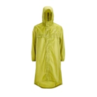
Very light, comfortable and compressible poncho. Specially designed for protection against water for any activity.

Our Atmospheric H30 poncho offers lightness and waterproofness. Easily compressible and made with our Waterproof fabric, its heat-sealed interior seams guarantee its waterproofness. Includes carrying bag.

€60,-
The route out of Toulouse becomes very complicated and poorly marked, so you are skipping a mentally tough section. You can get off the train at L'Isle Jourdain or Gimont, both very pleasant towns, and walk two or one flat days to Auch.
That’s good info about the interim stops before Auch. I knew about skipping the confusing exit and urban landscape by going to Pibrac but didn’t know the above. However, the overriding reason for fast forwarding to Auch is my schedule. I burned six days on recovery and only had 3 cushion.
 
I seem to remember liking Anglès myself ; walked with a girl to her bus stop, who had been a surprisingly good walking companion for a couple of days, in a sort of brotherly-sisterly way, and the sense of that was surprisingly mutual, since we really had so little in common except the Camino itself, then found a bed in a "hush-hush- this place was shut down by the Communist mayor so whatever you do make sure nobody sees you" church refugio, where I consoled myself IIRC with bread, sausage, and wine -- I've few memories of Castres, I think I just rushed through the place and made for Revel or perhaps even Villefranche on one of my longer hiking days that year, likely a 40K as I had slowed my pace the previous two days for the great company of the girl in question, so I was in fit & fighting mood.

After Castres anyway I shifted back into DIY mode -- partly because I just lost sight of the waymarkings, but it's OK as there's a huge network of potential secondary routes so it's hard to really get lost.

I went more or less straight anyway on non-waymarked little country roads between Revel and Villefranche-de-Lauragais, where a kindly local offered me a meal and a place to put my sleeping bag down and some rather pleasant conversation, and there I left the Arles way towards Lourdes via Nailloux, Auterive, Carbonne, up-river to Saint-Gaudens and La Barthe de-Neste, parallel to the Piémont, 'til finally joining the Piémont Way proper IIRC near Bourg-de-Bigorre. Though after Bagnères I DIY'd my route again to Lourdes LOL.

After Lourdes I pretty much followed the waymarking though, crossing over the Arles Way one last time at Oloron, then carrying on to SJPP to the Francès and Compostela.

Good times ... 👉 :cool:👉
 
Last edited:
The route out of Toulouse becomes very complicated and poorly marked, so you are skipping a mentally tough section. You can get off the train at L'Isle Jourdain or Gimont, both very pleasant towns, and walk two or one flat days to Auch.

Thr waymarking is FAR less important in the broad region around Toulouse than elsewhere, as there's a huge network of little country roads, so you really can get by just following your nose. I think I've been to L'Isle Jourdain once, and that it's a good place.

It's a pity about OP skipping all the way to Auch, but well injured is injured, nothing to be done --

The suburbs of Toulouse are certainly very extensive, but they are also mostly semi-rural rather than suburban per se (though I don't know exactly the ones that the Camino takes you through). Anyway Pibrac is not *that* far out from the city centre, even though the longer route there via Blagnac looks like it might be a little more pleasant than the shorter one via Colomiers. I would have taken the shorter route myself though.

After that however, the Camino to Auch looks easy-peasy, and also afterwards all the way to Morlaàs, though why on EARTH the waymarked version of it then tries to get you to avoid Pau is perfectly beyond me !! Short walk in, enjoy the city life of an afternoon having found wherever to sleep, re-stock and etc, then a pleasant morning walk along the Gave riverside cycling path to Artiguelouve, then to Oloron et cetera ...
 
Very light, comfortable and compressible poncho. Specially designed for protection against water for any activity.

Our Atmospheric H30 poncho offers lightness and waterproofness. Easily compressible and made with our Waterproof fabric, its heat-sealed interior seams guarantee its waterproofness. Includes carrying bag.

€60,-
After six days of rest, including frequent icing of my calf muscle, I am ready to begin again. I will start from Castres to the Abbaye at Dourgne tomorrow morning. I plan to walk the five Gronze stages to Toulouse and then skip forward to Auch by train. I’ll post more after I’ve been on the trail for a little while.
Bon chemin and buen Camino! I’m enjoying walking the Le Puy chemin GR65 again, across beautiful countryside. Will have to return home to London from Figeac...
 
Castres to Dourgne, Dourgne/Revel to Casses, Les Casses to Port Laurangais, Port Laurangais to Ayguesvive

Castre to Dourgne:
After a six day rest period I went back out on the trail to head to the Abbaye Sainte Scholastique in Dourgne. The leg was tight but the weather promising and the stage moderate. First things first, leaving Castres can be downright dangerous. There are some sections of road where the cars are traveling at speed and there is no shoulder. Traffic was moderately heavy so it wasn’t unusual for cars to be in the lanes in both directions. It’s either step off the road into the scrub or get hit. You can choose to walk through the long grass or brush if you like but it’s messy and frustrating. Anyhow, after about 5 km or so you finally start to leave the city. The waymarks, particularly coming out of the city are pretty weak in my opinion. Once again, the download of the GPS track from Gronze.com into Gaia GPS (both free apps) kept me on the path.

This stage is not as rural as I imagined it would be. In fact, once you enter Castres the nature of this Camino changes radically. It’s like an entirely different walk with plenty of civilization nearby most all of the time.

The afternoon turned hot again - 90+ F/32+ C. I was glad to find the Abbaye (thank you Windy Maps) and meet Sister Francoise, who is one of the liveliest and most cheerful persons you’ll ever meet. I got my bed for the night and after dinner made an early night of it. The Abbaye is clean and has a very nice sitting and kitchen area. As you might imagine, it is rather basic but very functional and a good place to stop.

Dourgne/Revel to Les Casses: After assessing my leg the day before it became apparent that taking on the entire 34 km stage would not be a good idea. Fortunately there is a bus stop right in front of the Abbaye that goes to Revel - halfway to Les Casses. A real bargain for 2 euro. Just outside of Revel you pick up the Rigole and the path is smooth and well shaded and you cannot possibly get lost as you simply follow the waterway pretty much the entire way to Les Casses. My hunch is some people will find this section boring, others will find it pleasant. Maybe even a mixture of both. The scenery doesn’t change much at all for many km. Fortunately it is pleasant scenery with the occasional jogger or bicyclist coming and going in either direction.

I stayed at the La Passeur-Ellle. I highly recommend it. Isabelle, the owner, is warm, welcoming, sincere, kind, intuitive, all of the things that make a great host. The grounds are spacious with flowers and fruit trees and it is extremely clean and well kept. The sleeping quarters are also roomy. And, to top it off, the dinner was superb. Definitely take the demi-pension option as there are no stores in town and the meal was excellent.

By the way, do not use Google Maps to locate the Gite. It will take you to the street address. The actual entrance is far more enticing and its an wide, grassy side-alley way across a creek into the garden. Follow the yellow signs to get there.

Les Casses to Port Laurangais:
Isabelle gave me a shortcut out of town to the GR 653 and I was soon on the trail along the Rigole again. This time the way was more rural passing through farmland on the left and the waterway on the right. The path was a bit slippery still from the prior night’s rain so the going was a little slower with frequent walking just off the path. Again, it would be hard to get lost for most of this stage as you are once again following the Rigole, albeit in a more natural setting.

I decided to leave the GR 653 and stay in Port Laurangais on the Canal du Midi (just before the northward turn towards Montferrand.) Windy Maps made this relatively easy. The reason for this deviation was that I wanted to go a little easier on my leg the next day, which was still a little tight. By cutting across on the Canal du Midi you can save 4 or so km.

Fasthotel is the only game in town and it is part of a rest stop for the A61 highway. Not my favorite place. Terrible WiFi, awful food at the nearby restaurant, and a generally subpar lodging experience. But, like I said, if you want to shave some distance, it’s the only game in town. On the plus side their breakfast was very good.

Port Laurangais to Ayguesvive:
Gronze.com discourages taking the Canal du Midi at this point but I am very glad I did. It was one of my most enjoyable days walking this Camino. The waterway is broader than the Rigole and provides a calm, peaceful setting with the occasional boat or two cruising slowly up or down the canal. It’s broken up by a number of locks which adds to the interest. Although there are sections that run very close to the A61 the hum of the motorway fades into the background, overwhelmed by the beauty of the tree lined canal.

Once again, there is no getting lost but having a tool like Windy Maps (which I greatly prefer over Google Maps) helps you find the right bridge to cross to find your way into Ayguesvive. I stayed at Accueil Pelerin de Ayguesvive. Once you cross the bridge, the owner has posted small yellow and blue signs to guide you on your way to his door.

This town has a nice Carrfour Express (open Sunday afternoons no less), a really good pizzeria (2015 French Champion finalist) and bus service to Toulouse. The husband and wife who run the Gite couldn’t be nicer or make you feel more at home. The bedroom is a little small but clean and well worth the price. It is a good place to stay.

The next day was calling for high winds and heavy rain with possible hail. I had already decided I would skip forward from Toulouse to Pau as I knew my calf was not up to carrying on from Auch as I had last planned. I did not want to arrive at the train station wet with another trip in front of me so I opted to take the bus to Toulouse. It was Saturday and the only bus run was at 7:26 am. Without missing a beat the owners suggested a 6:30 am breakfast so I could have a meal before leaving. And, on the way out, the host decided to walk with me to the bus stop to be sure I got off to a good start. Now that’s hospitality!

As it turned out, even though my leg felt good the day before, it has started to develop some swelling again so taking the bus was a fortunate choice. I now have three days in Pau to recuperate but I am seriously doubting that I will continue afterwards (other than at least the Urdos to Somport stage which I was thwarted from completing earlier this year when I walked with my son from Oloron-Sainte-Marie and he hurt his Achilles’ tendon.) I have a place reserved on the 29th in Bedous at my favorite B&B so I should have enough recovery time to make at least one more stage. I’ll simply take the early bus from Bedous to Urdos and finally complete that section that has eluded me.
 
Last edited:
Oloron-Sainte-Marie to Bedous
I did this stage in May with my youngest son but I’m including it for completeness. We stayed at the Accueil Pelerins Le Relais du Bastet. It’s very clean and a good place to stay. The only challenge is they close the doors at 8 so eating out is difficult as few places open before 7:30pm. We found a small pizza place that had a great calzone and pizza and made it back to the Gite in time for curfew.

Gronze calls for ending this stage at Sarrance but we wanted to press on to Bedous so we could then do Bedous to Urdos and have a shorter stage up to Somport. It is a fantastic stage. Much of the route follows the Gave d’Aspe through forest and occasional meadow. There are enough small villages along the way to make water and food a non-issue. The scenery was superb and it is one of my favorite walks. We stopped at the Hotel Les Pas Sages In Sarrance for lunch and it was one of the best meals I’ve had in France. Superb. We carried on the extra 8 km to Bedous and somehow our GPS recorded a lot more total distance at the end of the day than Gronze suggests so I’m wondering if there is a shortcut we missed somehow. The waymarks are generally good so the difference in distance will remain a mystery.

That said, it was well worth the distance walked. We splurged and stayed at Maison Luard in Bedous. Best lodging decision ever. Fantastic hosts who make a fabulous dinner. English and French spoken fluently and we had a great deal of laughter with the hosts and other guest. Comfortable, clean, great food, great hospitality.

Bedous to Urdos
The scenery in the Aspe Valley is incredible and we set out for Urdos the next morning. Although shorter, the walk was a little less enjoyable than the day before. You can start to sense the increasing elevation and uphill nature of the stage. We passed through a number of small villages along a mostly pastoral route until catching up with the Gave d’Aspe like the day before. However, once you pass Borce. It’s a bit of a slog from that point on as you are on the highway for a fair stretch as you make your way into Urdos and a bit of a climb. However, you are rewarded with an up close view of the massive Fort du Portalet built on and in the massive cliffs of the gorge.

We stopped for lunch in Borce but could not locate a restaurant. There was a small bar with some limited grocery items and some yogurt, cheeses and the like and we snacked there before carrying on. If I did it again we’d have gone to the other side of the road and through the neighboring town of Etsaut where there is a full service restaurant. It is easy to rejoin the GR 653 from there and I doubt there is any significant difference in distance traveled.

There are some confusing sections before Borce that require some backtracking and careful attention to the waymarks but they were well placed and not overly difficult to follow.

We stayed at the only hotel in Urdos, the Hotel des Voyageurs. I can’t recommend it but wouldn’t steer anyone away from it either. It is expensive for what it is and much more than Gronze indicates. The food was mediocre as well.

Unfortunately my son’s Achilles’ tendon was acting up and we had to end our waking in Urdos which left it as the final stage for me to take on on this trip.

Urdos to Somport
I completed this section yesterday. The weather was perfect and that’s important because this stage can be very dangerous. I’d read this and now understand why. There are many small creeks running across or down sections of the trail. They really don’t have any bank to speak of and will flood with the slightest increase in flow. So, if it rains the night before I’d expect a muddy mess. And, much of the early route is on paths cutting across steep slopes with only a foot or so to walk on. If it is at all muddy it would be a very easy thing to lose your footing and take a nasty tumble down the steep hillside. One section has a creek running down a very steep descent that lasts for a good 50 or more meters.

There was no rain for days prior to yesterday and I still had a number of muddy sections to traverse. Fortunately the good weather meant this simply took some patience to pick my way through the mess. I cannot imagine it if it had rained more recently. Put any thought of trying it out of your mind if there have been recent rains of any volume in the past couple of days.

If you are lucky enough to be able to take it on in good weather and good conditions you are rewarded with a stunning hike. There is one short, maybe 200 meter section, on the highway. Otherwise it is all farmland, meadows, and forests. The last 5 km or so was a beautiful forest. Those last 5 kilometers are very steep for the most part and your glutes may well be feeling it when you finally arrive at the top.

Waymarks were adequate although there a a few places where you have to look carefully to find them - including near the top where they are on small stakes just off of ground level.

It’s still 7 km to Canfranc Estacion if you are continuing on which is all downhill and certainly do-able if you started from Urdos instead of Borce or Etsaut. There is also a bus which runs fairly often if you’ve had it at that point. There is virtually nothing in Somport. One hostel, the Aysa, but it was closed as was it’s bar. It was September 30 so by all information available they should have been open. The reviews on Gronze are very mixed but it wouldn’t have mattered anyhow - no explanation for it’s closing so don’t plan on showing up and finding a room.

For me, this was the end of the road. My calf held up but was feeling it and I was glad I’d taken enough time off to allow me to make this stage. Well worth it!

E7C92A5B-6B7C-4156-A502-B7B509F66C9F.jpeg

CA3143EA-5093-49C8-BE56-0E38C48E8188.jpeg
 
Last edited:
A selection of Camino Jewellery
We carried on the extra 8 km to Bedous and somehow our GPS recorded a lot more total distance at the end of the day than Gronze suggests so I’m wondering if there is a shortcut we missed somehow. The waymarks are generally good so the difference in distance will remain a mystery.

When I was up there in 2014, they were in the process of waymarking a different route -- so the new one may be a bit longer but also easier than the old one was.
 
I just joined as a new member, and read your post concerning Oloron Sainte-Maire to Somport. I was thinking of walking it second week in April 2023. Now I am wondering whether the route through Saint Jean Pied de Port would not be wiser and safer.
 
Except for the need to avoid the final leg to Somport when it’s wet, the walk is fabulous. If you have to, there is a very convenient bus that runs from Urdos to Somport for 2 euro. If I’m not mistaken you can take it a little further to the train station if you plan on walking the Aragones and want to stay in town. Somport has next to nothing in it, basically an abandoned customs/border station and a sometimes open hostel.
 
Get a spanish phone number with Airalo. eSim, so no physical SIM card. Easy to use app to add more funds if needed.
Except for the need to avoid the final leg to Somport when it’s wet, the walk is fabulous. If you have to, there is a very convenient bus that runs from Urdos to Somport for 2 euro. If I’m not mistaken you can take it a little further to the train station if you plan on walking the Aragones and want to stay in town. Somport has next to nothing in it, basically an abandoned customs/border station and a sometimes open hostel.
I walked the section from Urdos up and over the Somport Pass just a couple of weeks ago and concur, nothing much has changed by the sound of your description. I also wrote earlier that this would be difficult, even trecherous during or after rainfall, but in dry weather as it was for me, it was stunning and I wouldn't miss it.
 
We walked the Aragonne route the first week of April in 2018. Heavy snow at the Somport pass with the trail closed most of the way to Jaca. Due to storms, you really cannot be sure it will
Be passable (even the buses were not running for two days)
 
We walked the Aragonne route the first week of April in 2018. Heavy snow at the Somport pass with the trail closed most of the way to Jaca. Due to storms, you really cannot be sure it will
Be passable (even the buses were not running for two days)
I really would like to limit my contacts with two legged creatures at least for a few days before reaching The Camino Frances. The weather being as crazy as it has been In southwestern France, will have to be considered, perhaps, at the last minute. After reading about walking through SJPP and Roncesvalles in Spain and the number of pilgrims, makes me wish to try this route in mid April.
 
New Original Camino Gear Designed Especially with The Modern Peregrino In Mind!
If you approach from the Spanish side, then weather is less of a factor since the bus will only go as far as it can up to the pass. If it’s snowing, your Camino may not start in Somport, but further down in Canfranc Estacion or perhaps even in Jaca (like our first time since that was where the road closure was). Regardless, the rest of the Aragones until it joins the CF was still delightful and worth the effort. If you hope to avoid the CF crowds, this is a fine alternative.
 
If you approach from the Spanish side, then weather is less of a factor since the bus will only go as far as it can up to the pass. If it’s snowing, your Camino may not start in Somport, but further down in Canfranc Estacion or perhaps even in Jaca (like our first time since that was where the road closure was). Regardless, the rest of the Aragones until it joins the CF was still delightful and worth the effort. If you hope to avoid the CF crowds, this is a fine alternative.
Assuming the weather in mid April is clement.
 

Most read last week in this forum

Good morning Pilgrims! In June I will leave Italy to try to get to Santiago. Around August I will be walking the part of the camino in France, and as I read through the various threads, I had a...

❓How to ask a question

How to post a new question on the Camino Forum.

Forum Rules

Forum Rules

Camino Updates on YouTube

Camino Conversations

Most downloaded Resources

This site is run by Ivar at

in Santiago de Compostela.
This site participates in the Amazon Affiliate program, designed to provide a means for Ivar to earn fees by linking to Amazon
Official Camino Passport (Credential) | 2024 Camino Guides
Back
Top