Maps tell stories. At one point in my career, I was Chief of Mapping and Geodesy for the Intelligence Center Pacific. Our major holdings were accurate to the last yearly cycle and displayed land masses as small as 100 meters across. That's not the story. Because of my access, I could, at the touch of a key, display maps and charts held not only among USA holdings, but those of other selected nations.
In my spare time, I would select a place and period in time, say 6500-3800 BC and the ancient city of UR in present day Iraq. I'd map out key reference points (roads, rivers, prominent mountains, etc) and then overlay them on present day maps.
Using satellite imagery (today Google Earth), I could see where many present day roads and rivers match closely with those of 8,000 years ago.
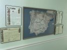
Much of the road network of the various Caminos, to this day, accurately remain close to the paths/Roman way of 1,000 + years ago.
Buen “can an old map lead me to lost Roman silver?” Camino
Arn


 Valentine’s Day to all Peregrinos everywhere.