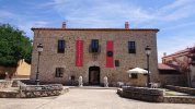
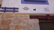
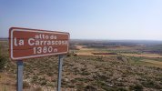
Day 25. Retortillo de Soria - Fresno de Caracena. 23.9 km
Reading the introduction to this published stage in the Amigos' guide, there are a few points that I thought worth mentioning. The first one is that despite a large portion of the walk "por carretera o por caminos asfaltados", there is a highlight which is the canyon of the río Caracena. The second one is that the province of Soria has suffered the exodus of population to larger cities, leaving behind small villages, with little or no services. The Amigos conclude their introduction by this advice:
Es necesario viajar provisto de víveres e incluso prever la posibilidad de dormir en algún sitio en condiciones precarias.
It is necessary to travel with provisions and even to plan for the possibility of sleeping somewhere in precarious conditions.
Indeed, the note "acogida no garantizada" is entered in the guide next to the names of all the places we will go through in this stage.
As for any Camino stage, there are variations:
@alansykes walked from Retortillo de Soria to Fresno de Caracena,
@Magwood and
@Ninja walked from Retortillo de Soria to Caracena including what looks like a diversion,
@Bad Pilgrim had stopped in Tarancueña and walked to San Esteban de Gormaz, and
@Undermanager walked from Retortillo de Soria to San Esteban De Gormaz, a 46 km effort which makes the slow walkers among us say "if only I could walk half of that!"

.
Now add to those options some extra homework in trying to figure out this route:
Retortillo to San Baudelio to sleep in
Berlanga de Duero. (35)
Berlanga de Duero to
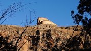
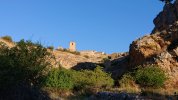
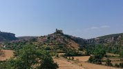
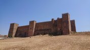
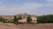
Gormaz (great castle, El Cid connection) to
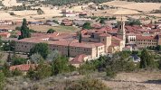
Burgo de Osma (30)
Burgo de Osma to San Esteban de Gormaz, back on the Lana (12) — and the first place I see to stop beyond San Esteban is Quintanarraya, another 30 km so that’s LONG. Maybe when AJ gets up to that point we can re-visit the question and do some sleuthing.
We'll get to San Esteban de Gormaz later, in the next stage, one mustn't rush slow walkers
")
. So before I look at
@Magwood 's walk, I'll take some notes from
@alansykes ' account to describe this stage, or at least, the bits that do not involve asphalt:
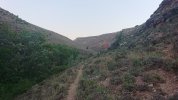
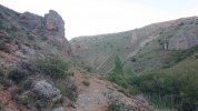
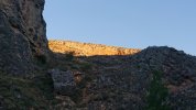
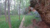
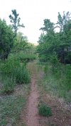
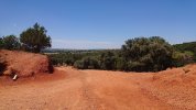
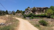
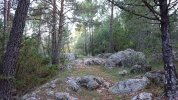
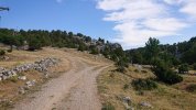
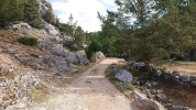
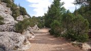
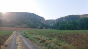
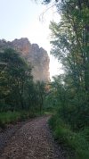
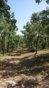
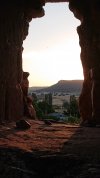
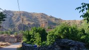
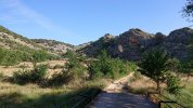
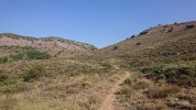
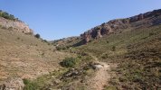
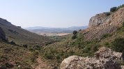
After Tarancueña it was amongst the most spectacular 3 hours of my life.
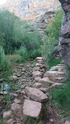
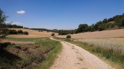
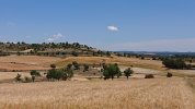
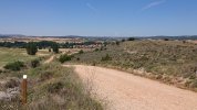
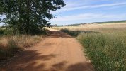
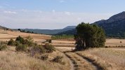
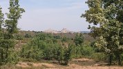
The camino follows the cañón of Caracena downhill until you reach Caracena itself. Total solitude; astonishing, sometimes jaw-dropping beauty, surrounded by high cliffs, circling eagles, autumn trees with leaves turning every colour from black red to pure gold, millions of wild rose hips (the valley must be even more spectacular when they are in flower), wild lavender, flowering thorns, juniper, thyme and more. Just amazing. Quite hard work, as the sometimes narrow path did not seem to be used much, and there were scrambles and stoney river crossings that would not be pleasant in rainy weather, but on a perfect autumn day it was too wonderful for words.
In her
blog,
@Magwood explains how she and
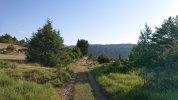
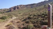
@Ninja followed the GR86, a route which is totally off road. Her photos are fantastic. And this is what she writes:
One of the most stunning camino walks.
Note from the Mods: As of January, 2023, there is no longer any place to stay in either Caracena or Fresno de Caracena. Many have called a taxi from San Esteban de Gormaz for pick-up in either of those two places and spend the night in San Esteban.
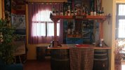
If you're going to stop in Caracena,
@Magwood shared the contact details of María Angeles, who runs the bar, and whose son provides basic but more than welcome accommodation for pilgrims.
If you're going to walk to Fresno de Caracena, then you'll stay:
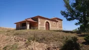
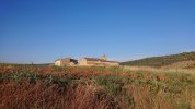
where the acogida is, to put it politely, basic - no beds, no showers, no hot water: a store room above the medical centre.
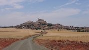
I guess that one must make a choice between visiting the church of San Baudelio, or walking through the canyon of the río Caracena. Or we could always become recidivists of the Lana and experience both sights in successive Caminos. Should the Romanesque prime over nature, there's no way slow walkers would make it in one piece from Retortillo to Berlanga de Duero. Fortunately, if the information on Google maps is right, there is a place to sleep in Arenillas, the
Casa del Curato. That would give us a 17 km day, followed by a 22 km day to San Baudelio and Berlanga de Duero.
Similarly, we would try to break the next portion of this escapade by stopping in Gormaz. The lodgings shown in Google maps in Gormaz might be for an entire house, so I am not sure we could stay in Gormaz. However, just off to the east of Gormaz is
La Casa Grande de Gormaz, which offers rooms. That would be an 18 km day, which would still give us time to visit the castle in Gormaz. Then it is approximately 16 km to get to Burgo de Osma, where there is a choice of accommodation. The 12 km to get back to the Lana at San Esteban would complete this diversion.
After watching the video below, I think in a real life Camino, my darling and I would stop in Caracena:


 . I wrote in my blog ... we walked up to see the castle. It’s huge and open for exploration. Nina was outside waiting for me to exit and thought she would take a photo of my smiling face as I emerged through the low doorway. Little did she know that I had decided the best way to avoid bashing my head was to exit rear end first. Result, a rather unexpected and silly photo.


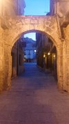
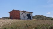
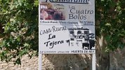
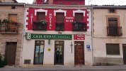
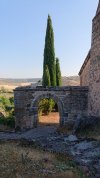
 It would be wonderful to walk a stage of 16 kms from Retortillo de Soria, to experience what Nina & Maggie did, and then stay at my favorite desolate village of Tarancueña. (The official camino, from the archway, is totally on tarmac for like 8 kms. I think most pilgrims would want to try Nina's alternative.) And I have said it before: In Tarancueña, there is a casa rural