• For 2024 Pilgrims: €50,- donation = 1 year with no ads on the forum + 90% off any 2024 Guide. More here.
    (Discount code sent to you by Private Message after your donation)
  • ⚠️ Emergency contact in Spain - Dial 112 and AlertCops app. More on this here.

Search 69,459 Camino Questions

Resolved: Help importing tracks into Google Maps

jungleboy

Spirit of the Camino (Nick)
Time of past OR future Camino
Some in the past; more in the future!
Edit: now resolved thanks to @Turigrino and @Theresa Brandon!

May I please ask for some help importing tracks for the Geira e dos Arrieiros into Google Maps? I am on camino with only my phone and as I understand it, I cannot create a map and import tracks into Google Maps on a mobile device. I can import to Maps.me or Wikiloc but these are far less preferable for me than Google Maps for various reasons.

Would someone who is comfortable with Google Maps like to help me please? The tracks are available in GPX or KML format here. If someone could create a map in Google Maps, import the tracks and DM me for my email address to share the map with me, I should be able to open it on my phone.

Thank you!
 
Last edited:
3rd Edition. More content, training & pack guides avoid common mistakes, bed bugs etc
Down bag (90/10 duvet) of 700 fills with 180 g (6.34 ounces) of filling. Mummy-shaped structure, ideal when you are looking for lightness with great heating performance.

€149,-
Edit: now resolved thanks to @Turigrino and @Theresa Brandon!

May I please ask for some help importing tracks for the Geira e dos Arrieiros into Google Maps? I am on camino with only my phone and as I understand it, I cannot create a map and import tracks into Google Maps on a mobile device. I can import to Maps.me or Wikiloc but these are far less preferable for me than Google Maps for various reasons.

Would someone who is comfortable with Google Maps like to help me please? The tracks are available in GPX or KML format here. If someone could create a map in Google Maps, import the tracks and DM me for my email address to share the map with me, I should be able to open it on my phone.

Thank you!

How did you resolve it?
Having the tracks on Google Maps would be useful!
 
It was 2.5 years ago so I can't quite remember! But the issue was that I was already on camino at the time and only had a phone with me and I needed a computer to do what I needed to do.

In the end I found tracks on Google Maps to not be as helpful as I thought, because (IIRC) they are overlaid on the map and the overlay keeps disappearing and you have to repeatedly go into some setting to have it show again (at least that was my experience). Eventually I decided Maps.me was better for tracks for that reason and others, so I use that for the trail and Google Maps for towns/cities, and even though using two map apps seems a bit cumbersome, it works well enough for me.
 
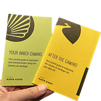
Ideal pocket guides for during & after your Camino. Each weighs only 1.4 oz (40g)!
Eventually I decided Maps.me was better for tracks for that reason and others, so I use that for the trail and Google Maps for towns/cities, and even though using two map apps seems a bit cumbersome, it works well enough for me.
On my last camino I used four apps. Wikiloc for the walking, OSMand for looking around an area (I could have used Wikiloc for this too but I didn't want to possibly break a running session), Google Maps when approaching a town so I could see places of interest (food, drinks) that I wouldn't be able to see from the Camino, IGN's Mapas de España for its topological features when I started approaching the Pyrenees (instead of using OSMand there).
 

❓How to ask a question

How to post a new question on the Camino Forum.

Forum Rules

Forum Rules

Camino Updates on YouTube

Camino Conversations

Most downloaded Resources

This site is run by Ivar at

in Santiago de Compostela.
This site participates in the Amazon Affiliate program, designed to provide a means for Ivar to earn fees by linking to Amazon
Official Camino Passport (Credential) | 2024 Camino Guides
Back
Top