• For 2024 Pilgrims: €50,- donation = 1 year with no ads on the forum + 90% off any 2024 Guide. More here.
    (Discount code sent to you by Private Message after your donation)
  • ⚠️ Emergency contact in Spain - Dial 112 and AlertCops app. More on this here.
  • Camino Olvidado Guide created by one of our forum members

Search 69,459 Camino Questions

And so, almost by accident, I find myself on the Camino Viejo ...

Ramblanista

Member
Time of past OR future Camino
Camino Frances & Finisterre (2012); Ruta del Ebro (Tortosa to Sastago) (2014); Camino del Norte (Santander - Serdio) (2014); Camino Liebana & Camino Vadiniense (2014); Camino San Salvador (2015); Camino Olvidado (Sodupe - Reinosa) (2015); Camino del Norte (Irun - Deba & Serdio - Llanes) (2015)
I wasn't supposed to be here, I'd intended to be following the GR 123 west from Balmaseda to link up with the GR 71 and GR74 to get to Potes as part of a project to devise my own camino along the Cordillera Cantabria and end up at O Cebreiro. I started in Irun two weeks ago, spent three and a half days on the Norte before heading inland after Deba. I sort of followed the GR 121 and GR 121 but a combination of the heat, a lack of maps and a backpack that's fine for thruhiking but not climbing mountains made it increasingly difficult and unenjoyable so when I found myself only 10km from the Viejo I decided to do so.
Our paths crossed in Sodupe this morning and I'm now in a hotel in Zalla - about 9km from Balmaseda, planning next few stages and downloading maps from Wikiloc. So far, so good; route has been well-marked with official signposts and ubiquitous yellow arrows. It's been nice to get back to level ground; I know there's plenty of ups and downs to come but believe you me, they won't as up or down as some the days I've walked in the Montes Vascos!
I'll try and post updates on my blog www.ramblanista.blogspot.uk and/or on here but my full report might not be available till mid-August. I'll keep my eye on the forum daily so if you've any questions please fire away.

Sian
 
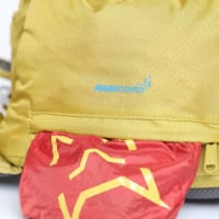
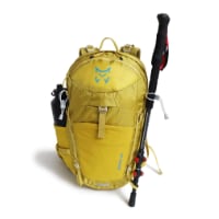
Technical backpack for day trips with backpack cover and internal compartment for the hydration bladder. Ideal daypack for excursions where we need a medium capacity backpack. The back with Air Flow System creates large air channels that will keep our back as cool as possible.

€83,-
Enjoy.

P.S.: You might be interested in reading the guide about the Olvidado (aka Viejo Camino) uploaded by @peregrina2000 in the camino resources area of this forum. She and her fellow walking partner on that camino (sorry, I don't recall who was) uploaded tracks of the route to wikiloc that could be useful for you too.
 
I certainly have read and downloaded Susanna and Laurie's guide and I refer every time I arrive at new pueblo. Indeed, I wouldn't have dared venture onto this camino without it.

I have no arrived at Quintanilla de Rebollar, staying at very plush Posada Real el Prado (59€). Only short 8k walk from Espinosa de los Monteros this morning as heat forecast. In Espinosa stayed at La Casa Encanto, (62€ including breakfast - hotel is unmarked, enquire in Bar Muna/Mina).

So far signposting has been good. Plenty of 'official' signposts in Pais Vasco; these stopped once in Castillo-Leon but have reappeared since Espinosa, often referring to it as 'Camino Olvidado'. As warned, some arrows had been painted over between Burcena and Becedo; pathetic, really, as it merely draws attention to them! As it was late I followed the road from Burcena to Arceo which probably added 2km to a long day - Zalla to Irus. In Zalla stayed at Hotel Ibarra Zalla (54€ including 5% pilgrim discount - very friendly and good buffet breakfast for 8€). In Irus I camped out next to church.

Only time I've really lost the arrows so far was above Irus, climbing pass of Cabrio. Having fought a battle with gorse and brambles and lost badly - and bloodily - two weeks previously, I wasn't going to risk it again so I scrambled down to main road. The bar in Bercedo was open but certainly wasn't selling 'Tronco' or, indeed any freshly-made snacks so know breakfast for me. On the other hand, the bar at Nava de Ordunte was very open and has WiFi.

What else? Hotel prices I'm paying are higher than those quoted in Susanna and Laurie's guide, largely because it's now high season. And this can be a very lonely camino; I got quite angry and then depressed yesterday, even thought of quitting but better today - more people around and less dilapidated, semi-deserted villages.

More later!
 
New Original Camino Gear Designed Especially with The Modern Peregrino In Mind!
Ramblanista, wow, you are on the Olvidado! I was on the camino when you posted this, and have just now seen the thread. I am wondering how things are going. I hope you enjoy it. Susanna and I were together till Aguilar de Campoo, but from then on I walked alone (as did Susanna, when she came back several months later). And I really hope you were able to spend some time in and enjoy Fasgar. It was the highlight of my Olvidado, and by now the town should be swelling to its summer population (winter population, 8). Please give Rosi a HUGE hug from me.
 
I wasn't supposed to be here, I'd intended to be following the GR 123 west from Balmaseda to link up with the GR 71 and GR74 to get to Potes as part of a project to devise my own camino along the Cordillera Cantabria and end up at O Cebreiro. I started in Irun two weeks ago, spent three and a half days on the Norte before heading inland after Deba. I sort of followed the GR 121 and GR 121 but a combination of the heat, a lack of maps and a backpack that's fine for thruhiking but not climbing mountains made it increasingly difficult and unenjoyable so when I found myself only 10km from the Viejo I decided to do so.
Our paths crossed in Sodupe this morning and I'm now in a hotel in Zalla - about 9km from Balmaseda, planning next few stages and downloading maps from Wikiloc. So far, so good; route has been well-marked with official signposts and ubiquitous yellow arrows. It's been nice to get back to level ground; I know there's plenty of ups and downs to come but believe you me, they won't as up or down as some the days I've walked in the Montes Vascos!
I'll try and post updates on my blog www.ramblanista.blogspot.uk and/or on here but my full report might not be available till mid-August. I'll keep my eye on the forum daily so if you've any questions please fire away.

Sian
Good afternoon dear Friend of the CaminoBrotherhood,
I plan to walk the Viejo Camino next year, coming from Alicante/Burgos (Camino de la Lana), so I will be very fan of your story on this Viejo Camino.
Good Evening,
 
It was an interesting summer. I set out from Irun with the intention of following a network of caminos and gran recorridos along the Cordillera Cantabrica to O Cebreiro but it didn't quite work out like that.

My last post was made at the Posada Real el Prado in Quintanilla de Rebollar. I can't recommend this hotel highly enough; it's not cheap but it's well worth treating yourself. The hotelera, Olga, is a fellow pilgrim and has walked several caminos; she has some books about the Viejo Camino/Camino Olvidado which I spent a very pleasant evening perusing. Dinner was abundant and delicious, lots of home made produce; the next morning I opted for a 'small' breakfast but I was offered a large platter of fruit and home-made jam. A very friendly place to relax - and as a pilgrim I got my cold beers on the house.

There is a bar in the village but I think it's more of a social club, it wasn't open on a Friday evening.

Pleasant walk along the valley then a bracing climb to 'El Collado' where I made the mistake of following the yellow arrows to the right instead of making for the unpaved road about 100m to the left. The arrows led me along a vague and thinning path that would probably be impassable in anything other than the driest weather. Eventually the path petered out into gorse and brambles and for the second time on my trip my legs where shredded and lacerated by thorns as I made my way through the dense foliage down to the track.

At Pedrosa de Valdeporres I encountered a fellow hiker/pilgrim, the only one I would meet on the route. She was doing a three or four day exploratory walk and looking for a casa rural. She wasn't impressed by the lack of intrastructure and we both agreed that the heat was making walking difficult. I should probably have stayed in Pedrosa but I'd booked a room further along the trail so I carried on, across the viaduct after which I lost the trail so followed a path then track to the right which took me to the main road to Soncillo which I followed all the way. At San Martin de la Ollas I came across an arrow indicating the off-road route but I ignored it as it would have involved losing height and I was getting knackered. In any case, the road isn't too busy, it's a relatively easy gradient and the views back to the east were fantastic.

I passed through Soncillo and wished I'd stayed there, too. Susanna and Laurie's guide lists one hotel but there was another, can't remember the name but it was about 30Euros. Instead I folled the nacional to Quintanaentello where I stayed in the Hotel Rural La Prader (48 Euros, okay but overpriced compared to most of the other hotels in which I stayed).

The next day's stage to Arija was a pleasant mix of tracks and minor roads, not too much along the main road. The bar at Herbosa was open; it was a Sunday morning and half the village seemed to be in attendance; not sure it's always open).

In Arija I camped at the campsite - 8 Euros, good facilities, bar with cheapish food; pleasant, relatively quiet in early July.

The next stage in Susanna and Laurie's guide is 31,2 km from Arija to Olea but I decided to make a slight deviation and break the journey in Reinosa, about 1,5 km from Villafria. The plan was to take a minor road from Reinosa to rejoin the camino at Juliobriga, which I did. From Arija to Villafria is entirely along a road; there are beautiful views across the reservoir and towards the mountains but although the road isn't too busy, hiking it all day was a bit of a pain. There is the possibility of leaving the road and following a gran recorrido, I'll look into this and post my findings on here.

I do recommend staying in Reinosa, especially if you get a room at the Hotel Golobar. Don't let its location on the industrial estate put you off, at 25Euros for a spacious en-suite it was probably the best-value in which I stayed, in six weeks of walking. The owner and staff are very friendly, the owner offered me the use of his computer to research the next stage of the walk. Good restaurant too. It's 800m from the centre of town but it's well-placed to get back to the camino via an underpass to the village of Bolmir. And, of course, plenty of services in Reinosa, including a station on the Palencia-Santander railway line.

I got fed up with on the road from Arija to Reinosa, not so much from the asphalt or the traffic but from feeling 'out of place' as cars and lorries passed me by. I'm not normally averse to tarmac but here it felt that I was just walking along a road, not following a camino. And with every kilometre the eastern peaks of the Picos de Europa got closer and closer, tempting and tantalising me.

I set out the next morning with the intention of hiking to Olea where I was going to stay in Casa Miguel. I rejoined the camino at Juliobriga then followed the track up into the forest. I was so enamoured with the forest track that contoured the southern slopes of Pena Cutral that I somehow missed the camino and came out on the western ridge overlooking the valley. Now the mountains loomed ever closer and I couldn't take my eyes off them; when the forest track came to an end I made a sharp left and followed a trail that led me back up to the top of the hill from where I located a track down to Cervatos. This was great walking, and more like hiking than pilgrimage (I know the distinction is vague but the six-week hike was an attempt to think about the differences between hiking and pilgrimage; it's a theme of my PhD research) and by the time I made it down to Cervatos I'd made my decision - I needed to climb mountains. I followed the nacional back to Reinosa and the Hotel Golobar where the owner and staff were surprised to see me. The following day I headed north into the Parque Natural Saja.

As it happens, bad weather in the mountains led me back to the Camino del Norte for a few days but I ended up taking a bus from Oviedo to Leon and doing the Camino San Salvador which was the highlight of the whole six-week hike. Details at http://ramblanista.blogspot.co.uk/ when I can get round to writing them up.

I felt guilty about leaving the Olvidado, I had intended to follow it all the way to Villafranca. The lure of the Picos was probably the decisive factor but the uncertainties of the Olvidado did play a part. It's not so much the solitude, the occasional lack of waymarking and accommodation or the amount of road-walking, rather a combination of all three; I was concerned that when waymarking became inconsistent I'd end up spending much more time on roads than tracks or paths. Plus, there were a couple of stages of 30km or more which wouldn't normally be a problem but I was walking in the middle of a fierce heatwave and I wanted the option of walking shorter days should the heat defeat me.

Will I go back and finish it off? I hope so, though I don't know when. During the summer of 2016 or 2017 I shall be carrying out fieldwork for my PhD which, for research purposes, will require me to walk along busy caminos - it will have to include the Frances - and lonely ones. I thought about incorporating part of the Olvidado into this route but it may not be feasible and in any case I think it's the sort of camino that should be walked from begining to end.

We'll see. In the meantime I would highly recommend this camino for anyone who enjoys getting away from the main drag and is happy to spend day after day walking alone.
 
Very light, comfortable and compressible poncho. Specially designed for protection against water for any activity.

Our Atmospheric H30 poncho offers lightness and waterproofness. Easily compressible and made with our Waterproof fabric, its heat-sealed interior seams guarantee its waterproofness. Includes carrying bag.

€60,-

As it happens I took a photo for future reference:
 

Attachments

  • 2015-07-10 18.53.47.jpg
    2015-07-10 18.53.47.jpg
    2.2 MB · Views: 12
Hi, Ramblanista,
It's been more than a year since I was on the Olvidado, but looks like things are pretty much the same. We were lucky to have very nice weather. I think I got the same heat wave you did when I was on the Camino Catalan. 38-40 degrees are NOT ideal for walking any camino!

I'll have to go back and look at my notes to try to locate you better, but it sounds like you didn't make it to Fasgar and over the mountains to Campo de Santiago? That is definitely one of the highlights, so you will have to go back. Buen camino, Laurie

I got as far as Cervatos before turning back to Reinosa and then heading north into the mountains. I do hope to go back, in which case I might do the 'Viejo' Camino outlined elsewhere on one of the Olvidado threads from Pamplona to Vitoria-Gasteiz to the GR99 Ruta Natural del Ebro to join the Olvidado at Aguilar de Campoo.

A big issue for me when walking away from the main caminos in Spain is the paucity of IGN maps; even if you can find them they're not fantastic, certainly not compared to the French IGN or the Catalunyan equivalent. If I could get hold of a set of these to do the Olvidado I'd be a lot happier.

As this was my fiftieth birthday treat to myself I stayed mostly in hotels and pensions, next time I'd be more confident about wild-camping which would help in some of the longer stages.
 
Technical backpack for day trips with backpack cover and internal compartment for the hydration bladder. Ideal daypack for excursions where we need a medium capacity backpack. The back with Air Flow System creates large air channels that will keep our back as cool as possible.

€83,-
Hi, Ramblanista, I too celebrated my 50th birthday with my first Camino Frances, which has led to 15 more, one a year since then. This is dangerous! But wishing you a happy 50th.

When I walked the Olvidado, I had a GPS with me. I am NOT a gadget person or a tech person, but it seemed like a sensible thing to do. I was walking with Susanna for the first part, though, so I never learned to use it. Thinking back, I would say there was really only one time (after Olea, as I remember), when we had to rely on it, and this was because there are two alternatives after Olea and we weren't sure which one we were on. (There was another badly marked section after Nava de Ordunte, but we were accompanied by Adolfo so we didn't get lost -- but I wouldn't want to try that section without a GPS, and it sounds like you got lost before Bercedo -- I am not surprised). Aside from that, we managed fine with the arrows. Then when Susanna stopped walking in Aguilar, I had to try to learn how to use the darn thing and never did get too proficient at it. But there was definitely one time, up in the hills after Cervera de Pisuerga, when I had to pull it out and figure out which way to go. Since that was kind of a remote spot and the marking wasn't clear at all, I'd say it was worth its weight in gold.

So, long way of saying that if you have a GPS and have wikilocs tracks on it, you will be fine. I suppose that does take some of the fun and adventure out of it, but it's a good tradeoff IMO.

I take it you are not a fan of the GPS either? Laurie

Thanks for birthday wishes. My six week #Transcantabrica hike this summer was just the first half of the 'celebrations'; I'm off to Mexico and Central America for five weeks at Xmas to climb volcanoes.

I took the advice given by yourself and Susanna and elsewhere about GPS and download Wikilocs maps of most of northern Spain though not with the Olvidado marked on it. I'm a geography tutor so I really should be au fait with GPS but I simply couldn't get the hang of it and only referred to it once of twice. A lot of time I went on gut instinct - which, from my experiences of the Ruta del Ebro last year, I can usually trust, a large-scale map and occasional visits to the maps on Peter Robins 'Walking Pilgrim' website. Since April roaming charges for UK mobiles in Spain are much reduced so I could afford to use the internet regularly. And, of course, I had your guide which was extremely helpful. I suspect my desire for a map is a bit like a child's need for a blanket; it's reassuring and physical. And even when I know where I'm going I like to see where I am and identify the landscape around me.

As a rule the arrows are more-than-sufficient - better in Basque Country than Castille/Leon - and I'm normally good at spotting them a long way off. Even where they'd been painted over near Barcena and Arceos they were easy to find, probably easier! My problem was that when I lost them my immediate response was to find the nearest road and follow that. Had I had a map I'd have been a little more adventurous.

I only did my first camino (Frances) three years ago, now I'm addicted to the damn things and studying them as part of a PhD! The Salvador was fantastic as were the Liebana and Vadiniense so I suspect I will be back on the Olvidado to complete it through the mountains at some point in the not too distant future.
 
Hi, Ramblanista, I too celebrated my 50th birthday with my first Camino Frances, which has led to 15 more, one a year since then. This is dangerous! But wishing you a happy 50th.

When I walked the Olvidado, I had a GPS with me. I am NOT a gadget person or a tech person, but it seemed like a sensible thing to do. I was walking with Susanna for the first part, though, so I never learned to use it. Thinking back, I would say there was really only one time (after Olea, as I remember), when we had to rely on it, and this was because there are two alternatives after Olea and we weren't sure which one we were on. (There was another badly marked section after Nava de Ordunte, but we were accompanied by Adolfo so we didn't get lost -- but I wouldn't want to try that section without a GPS, and it sounds like you got lost before Bercedo -- I am not surprised). Aside from that, we managed fine with the arrows. Then when Susanna stopped walking in Aguilar, I had to try to learn how to use the darn thing and never did get too proficient at it. But there was definitely one time, up in the hills after Cervera de Pisuerga, when I had to pull it out and figure out which way to go. Since that was kind of a remote spot and the marking wasn't clear at all, I'd say it was worth its weight in gold.

So, long way of saying that if you have a GPS and have wikilocs tracks on it, you will be fine. I suppose that does take some of the fun and adventure out of it, but it's a good tradeoff IMO.

I take it you are not a fan of the GPS either? Laurie
Yes I agree with you, in such routes GPS is a must have, I have just bought a Garmin Oregon 650T and all Camino Olvidado tracks from wikiloc are now loaded. Those from you, from Suzanna and from Myfair (to continue by the Camino de Invierno). I need to find decent tracks for la Ruta de la Lana and all good and ready for 2016. Just need to loose one stone (that I mostly lost this year in my Levante+Sanabres but immediately put weight back to UK !)
Laurie there is loads of good information from you, I am transposing your two guides (Olvidado from Aguilar de Campoo that I will join from Burgos at the end of la Lana), and Invierno in my GPS as well : the villages you mention become way points to have routes (computed via the way points) and tracks (loaded from your stuff in wikiloc). they sometimes differ a lot when the Camino is somewhere in the wild. And the last work will be to store all the places where accommodation is made possible.
Have a nice day...
 
St James' Way - Self-guided 4-7 day Walking Packages, Reading to Southampton, 110 kms

❓How to ask a question

How to post a new question on the Camino Forum.

Forum Rules

Forum Rules

Camino Updates on YouTube

Camino Conversations

Most downloaded Resources

This site is run by Ivar at

in Santiago de Compostela.
This site participates in the Amazon Affiliate program, designed to provide a means for Ivar to earn fees by linking to Amazon
Official Camino Passport (Credential) | 2024 Camino Guides
Back
Top