• For 2024 Pilgrims: €50,- donation = 1 year with no ads on the forum + 90% off any 2024 Guide. More here.
    (Discount code sent to you by Private Message after your donation)
  • ⚠️ Emergency contact in Spain - Dial 112 and AlertCops app. More on this here.

Search 69,459 Camino Questions

Quality of Waymarking

intrepidtraveler

Active Member
Time of past OR future Camino
Caminos Madrid, Frances and Finisterre (2015)
Camino Norte-2017; Camino Ingles from A Coruna - 2017
In preparation for the Norte this May I picked up a copy of "Guide to the Northern Caminos."

For each stage the authors give a rating with respect to the degree of difficulty of the terrain and the quality of the waymarks.

Based on their ratings it seems that the way marking leaves a lot to be desired. For those who have walked this route in recent years, what was your experience in this department?

Thanks for taking the time to reply.
 
A guide to speaking Spanish on the Camino - enrich your pilgrim experience.
We had no problem. We used the same guide and I did have access to gps tracks on maps.me - and used it a few times when we were in doubt.
 
We had no problem. We used the same guide and I did have access to gps tracks on maps.me - and used it a few times when we were in doubt.


Very well marked. Improving all the time. Signs alone will get you there. You are on coast a lot of the time. Ocean on your left hard to miss
 
Join our full-service guided tour of the Basque Country and let us pamper you!
The CSJ guides are very good (Ruta de la Costa 1 & 2) fairly light to carry and clear directions. (Note their guide to the Camino del Norte is an introduction only). We found waymarking good on the whole
 
I walked Norte in 2015 (from Santander to Ribadeo). I would say that I am generally good at finding my way. I felt that, speaking very generally, waymarking along the Norte was less reliable than along CF (where I think there is too much(!):)). What I mean is that several times we found ourselves unsure which road to take if we relied entirely on yellow arrows.
My experience of other routes is different. I found the Primitivo to be exceptionally well waymarked. I never had to search for an arrow, without there being too many, and if I found there was not one when I felt I needed one it generally meant I had gone wrong and needed to go back to the last arrow. Similar experience on Portuguese last year. Baztan route a bit thin on waymarking in France, but not in Spain.

I am not sure I would say "a lot to be desired" on the Norte, but could have been better two years ago.

I am encouraged by @as gaillimh that things may be improving.
Very well marked. Improving all the time. Signs alone will get you there. You are on coast a lot of the time. Ocean on your left hard to miss
But, er, I think the ocean was usually on my right!!;):D:p
 
But, er, I think the ocean was usually on my right!!;):D:p
Walking across the meseta on the CF last autumn with a young Hungarian man. A little after dawn on an overcast day. He pointed up ahead at a pink glow in the sky: "Look, the sun is rising over there!" I pointed out that where I come from the sun rises in the east and if we were walking towards the sunrise our navigation was pretty poor :)
 
Join our full-service guided tour of the Basque Country and let us pamper you!
In preparation for the Norte this May I picked up a copy of "Guide to the Northern Caminos."

For each stage the authors give a rating with respect to the degree of difficulty of the terrain and the quality of the waymarks.

Based on their ratings it seems that the way marking leaves a lot to be desired. For those who have walked this route in recent years, what was your experience in this department?

Thanks for taking the time to reply.

Well marked, never had to wonder, at least the section I walked, from San Sebastian to Llanes.
 
Very well marked. Improving all the time. Signs alone will get you there. You are on coast a lot of the time. Ocean on your left hard to miss
If you are walking the Norte to SdC, the ocean is on your right. If it is on your left you are going the wrong way!!
 
We had no problem. We used the same guide and I did have access to gps tracks on maps.me - and used it a few times when we were in doubt.

Thanks, everyone for your input. Kanga, or anyone else who knows the answer - once you've downloaded the maps.me app, where/how do you go about getting the gps map(s) for the various caminos?
 
3rd Edition. More content, training & pack guides avoid common mistakes, bed bugs etc
I'm a real amateur when it come to using GPS files but here goes. Use your phone to go to the resources section in the forum and download the file you want (there is one labeled "GPS (kms) of all Spanish caminos in one file") and once it is downloaded it should show "open in maps.me". It works for KML/KMZ files.

You can do the same thing by downloading kms files from anywhere.

If you want to use a GPX file you may have to use wikilocs. I have both apps.
 
Thanks, everyone for your input. Kanga, or anyone else who knows the answer - once you've downloaded the maps.me app, where/how do you go about getting the gps map(s) for the various caminos?
Are you aware that the maps and the gps tracks are two entirely separate sets of data? I use the Android version but I assume the iPhone one is similar. You use the maps.me app itself to download maps of the area you are interested in. You can then follow @Kanga's advice and find KML/KMZ tracks from the forum or elsewhere. These are not themselves maps: a set of coordinates which in effect draw a line on the map for you to show you the route. If you have the appropriate maps installed just selecting the KML/KMZ file in your phone's "Download" folder should pop-up a box for you to open it in maps.me.
 
Thanks for the info - I will start now playing around with maps.me and see what I can figure out. Technology is great for me when it is simple to use, intuitively obvious and reliable. Otherwise it starts to feel like an exercise in frustration.o_O
 
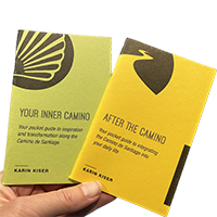
Ideal pocket guides for during & after your Camino. Each weighs only 1.4 oz (40g)!
NORTE: Ocean on right

PORTUGESE: ocean on left.

Frances: What ocean?

The Camino Frances runs as long as the Camino del Norte goes. But you won't see no ocean until Muxia or Finisterre, because this way is miles inside the continent. Anyway, the Cantabric sea is on the right (same as Camino del Norte)
 
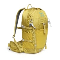
Technical backpack for day trips with backpack cover and internal compartment for the hydration bladder. Ideal daypack for excursions where we need a medium capacity backpack. The back with Air Flow System creates large air channels that will keep our back as cool as possible.

€83,-
I'm a real amateur when it come to using GPS files but here goes. Use your phone to go to the resources section in the forum and download the file you want (there is one labeled "GPS (kms) of all Spanish caminos in one file") and once it is downloaded it should show "open in maps.me". It works for KML/KMZ files.

You can do the same thing by downloading kms files from anywhere.

If you want to use a GPX file you may have to use wikilocs. I have both apps.

Oh Kanga, thank you!

I'm planning my first solo Camino on the Norte this next August and irections have been a concern for me. I can get all caught up in my thoughts and forget to pay attention. I lose my way so easily. It's been a worry for me. I followed your directions and now have a way to get myself back on track. Again , thanks!
 
Waymarking was good as everyone seems to have said.

We also had offline map with the Buen Camino App that was great if worried off track as it has the yellow route and the blue dot. Also good for planning rest stops for coffee etc as it had good information on bars
 
I got lost the first morning out of Irun, looking at the book instead of keeping eyes peeled for arrows. Fortunately a policeman spotted me. It's always in towns that peregrinos can get muddled. If that's the Cicerone book then be wary, we all grew to loathe it on last year's Norte. Come to think of it, two of us got lost in the dunes one day. Funny old world:rolleyes:
 
€2,-/day will present your project to thousands of visitors each day. All interested in the Camino de Santiago.
In preparation for the Norte this May I picked up a copy of "Guide to the Northern Caminos."

For each stage the authors give a rating with respect to the degree of difficulty of the terrain and the quality of the waymarks.

Based on their ratings it seems that the way marking leaves a lot to be desired. For those who have walked this route in recent years, what was your experience in this department?

Thanks for taking the time to reply.
I walked the Norte solo in August last year (2016). I did have the guide book but the App Buen Camino was fantastic. The waymarking is pretty good but when you get to Galicia it is second to none. There were a couple of times in Asturias that I could have got a little lost but the app kept me on track especially as I often wouldn't see anyone.

Good luck. You will love it.
 
In preparation for the Norte this May I picked up a copy of "Guide to the Northern Caminos."

For each stage the authors give a rating with respect to the degree of difficulty of the terrain and the quality of the waymarks.

Based on their ratings it seems that the way marking leaves a lot to be desired. For those who have walked this route in recent years, what was your experience in this department?

Thanks for taking the time to reply.

As a solo woman, I walked the Norte from Bilbao to Santiago in Sept/Oct 2016. Reading the detailed description of the route in the guide book leads one to believe that the way marking must be bad. Quite the opposite - I found the way marking to be very good. A few days into the route, I did download the Buen Camino App - $5.99. Once you download the maps, you do not need cell service or WiFi. Your phone's GPS shows right where you are on the route - it was very comforting when you have walked for a while without seeing any arrows. And, yes, the ocean should be on your right! It is a beautiful route. Buen Camino
 
Very well marked. Improving all the time. Signs alone will get you there. You are on coast a lot of the time. Ocean on your left hard to miss
Sorry to correct you but if you are walking with the ocean on your left then you are going in the wrong direction,Irun to Santiago travelling West the ocean is on your right. Michael.
 
Ideal sleeping bag liner whether we want to add a thermal plus to our bag, or if we want to use it alone to sleep in shelters or hostels. Thanks to its mummy shape, it adapts perfectly to our body.

€46,-

Most read last week in this forum

I walked the Camino Francés in Octobee 2022, from Villafranca del Bierzo to Santiago de Compostela, and loved it. I would like to walk the Camino del Norte as I'm drawn to the coast, culture and...
Hello everyone. I know that pre-booking accommodation has been discussed many, many times, so apologies but I wanted to be quite specific. We are walking from Irún to Bilbao in the first week of...
Hello! I am visiting Northern Spain for the first time this June and would am planning on hiking a small segment of the Camino. I've done a little research and decided to hike between Zarautz and...

❓How to ask a question

How to post a new question on the Camino Forum.

Forum Rules

Forum Rules

Camino Updates on YouTube

Camino Conversations

Most downloaded Resources

This site is run by Ivar at

in Santiago de Compostela.
This site participates in the Amazon Affiliate program, designed to provide a means for Ivar to earn fees by linking to Amazon
Official Camino Passport (Credential) | 2024 Camino Guides
Back
Top