• ⚠️ Emergency contact in Spain - Dial 112 and AlertCops app. More on this here.
  • Remove ads on the forum by becoming a donating member. More here.

Search 74,075 Camino Questions

LIVE from the Camino 3 days on the Asturias/Viejo - Pamplona to Salvatierra

WestKirsty

Active Member
Time of past OR future Camino
Next up: Viejo/Olvidado
It's Camino time again! A friend and I both have a long weekend in Spain and wanted to do some walking. The Camino Viejo/Asturias was brought to my attention in another thread so we thought, why not start that route!

We're in Pamplona just now, at the Jesus y María Albergue. It's busy, but not full. The old town is jumping though, as it's a long weekend and good weather! Tomorrow morning we'll set off on a route likely different from the others here :)

Thank you to those who posted the virtual thread! We've used the information and links there to plan our route. We will likely follow the RocJumper tracks on Wikiloc and the blog notes. We've also got the official route GPS tracks loaded on the phones but will also see how our legs feel and try to get off the roads and onto some of the GR routes along the way.

I know this route won't appeal to the masses but thought perhaps those who worked on the virtual thread might be interested in what it's like on the ground, so I'd be happy to post here if it's of interest. We've got just 3 days so will walk to Salvatierra, where the route joins the Vasco.

Here we go!
 
A selection of Camino Jewellery
3rd Edition. More content, training & pack guides avoid common mistakes, bed bugs etc
It's Camino time again! A friend and I both have a long weekend in Spain and wanted to do some walking. The Camino Viejo/Asturias was brought to my attention in another thread so we thought, why not start that route!

We're in Pamplona just now, at the Jesus y María Albergue. It's busy, but not full. The old town is jumping though, as it's a long weekend and good weather! Tomorrow morning we'll set off on a route likely different from the others here :)

Thank you to those who posted the virtual thread! We've used the information and links there to plan our route. We will likely follow the RocJumper tracks on Wikiloc and the blog notes. We've also got the official route GPS tracks loaded on the phones but will also see how our legs feel and try to get off the roads and onto some of the GR routes along the way.

I know this route won't appeal to the masses but thought perhaps those who worked on the virtual thread might be interested in what it's like on the ground, so I'd be happy to post here if it's of interest. We've got just 3 days so will walk to Salvatierra, where the route joins the Vasco.

Here we go!
Please, what is the "virtual thread"?
 
Pamplona to Irurzun - 28km

A good first day out, although we were only on the official route for a few short portions of the day. We left Pamplona heading Northwest, while so many others headed further south on the Frances. The route passes through mostly residential neighborhoods until joining the EuroVelo 1 route at the edge of the city.


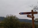
We spotted our first yellow arrow while walking along side an army base of some sort. It seemed abandoned (no humans walking about) but there were lots of tanks, Humvees etc.

Shortly after the base we consulted our various maps again and decided to stay on the EuroVelo/GR route when we got to Berrioplano, instead of turning south to follow the official route which looked to be alongside the main highway through the valley. It was a good choice! It was good to get away from urban sounds for a bit and into the lovely countryside.

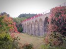
There was another section where we were able to find a hill trail instead of the shoulder of the road, and then connected to the Camino Natural de Plazaoa - which again got us a bit further from the road. There were some cute villages, a viaduct and beautiful scenery! There were also lots of water fountains, though not all were working. We actually rejoined the official Camino along this stretch and were able to follow the arrows for a little while.

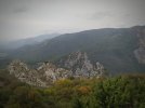
However, we were going to be too early into Irurzun to check in to our hotel so opted for one more diversion - cutting off at Aizkorbe and heading up to the "Balcony of Vultures". It was a steep climb for a little while but we were so glad we did it! There is a little stone balcony overlooking the impressive rock walls and I counted at least 30 vultures flying overhead.

So, while we didn't follow the yellow arrows, we were pleased with the day. I wasn't keen on being so close to such a major road so using these side trails worked a treat! The official trail is 22-23km. Without the detour up to the balcony, we would have walked 24-25km, so not much difference.

I should note though, that if anyone is planning this way soon, there was some work being done on these trails though being a holiday weekend, no workers or machines were out today. If they were working, I'm not sure if we'd get past. Hopefully the works won't take long :)

So it was a fun one! We didn't find any bars on route once we left Pamplona, so best to have food packed.

We've got the Wikiloc track of the day saved and I'll add it to this thread when I get home - I can't seem to copy the link on my phone !

Let's see what tomorrow brings!
 

Attachments

  • IMG_20221030_082637.jpg
    IMG_20221030_082637.jpg
    4.1 MB · Views: 58
  • IMG_20221030_161255.jpg
    IMG_20221030_161255.jpg
    3.5 MB · Views: 44
  • IMG_20221030_161324.jpg
    IMG_20221030_161324.jpg
    4.3 MB · Views: 54
3rd Edition. More content, training & pack guides avoid common mistakes, bed bugs etc
So, while we didn't follow the yellow arrows,

I would like to walk the Olvidado/Camino Viejo from Pamplona next summer (is it the Olvidado/Camino Viejo you are walking to Salvatierra??)

Will you follow more of the official way tomorrow? I am interested in if the route is well marked and if there is accomodation!

There is so little information about it, less than the Olvidado from Bilbao.
 
Irutzun to Alsasua - 35km

Day 2 was anither great day on the trail! @Bad Pilgrim , to answers your questions, yes I think we are walking the Viejo, which will eventually join up with the Olvidado. I think it's also the same route as the Camino de las Asturias but that route branches off and heads to Oviedo at some point. When I get back I'll investigate all this more. But at any rate, the Wikiloc routes we've been using to help guide us have said Viejo/Asturias so I think they're the same for the first part.

And yes, we did follow more of an official route today as we were following arrows much of the way. Again, we had downloaded GPS tracks from an association website but those went alongside the Autopista for almost the whole route. We were following a Wikiloc track and noticed quite new looking arrows for almost the entire way. So I'm not sure if the association has re-routed the way with the new arrows but at any rate, it was a good walk today along very mixed paths - forests, farmland, industry etc.

In the morning I had wanted to stop in at a little Ermita for Santiago. As we approached we noticed loads of people about, what looked like a market being set up outside but then also lots of sound and lighting equipment. It turns out a film is being made there! It will be called "La Ermita" and is to come out next year. I have no idea what it's about but I want to see it! The crew were busy setting up and completely ignored us so we wandered around a bit. I peaked inside but it was filled with film equipment.

For the first 20km or so there wasn't much by way of bars etc. but at a village called Lacunza we stopped for a rest. A very cute place with several bars open, a small supermarket etc. It was a good little stop. From there the route was quite urban, we passed a hostel/restaurant etc so lots of facilities along this stretch.

Then it was back into the forest for the final push into Alsasua. What a great little place! We got a hotel room across the railway for 44 for the 2 of us - clean, fridge in the room and a microwave in a communal space.

I'll write up more information about accommodation and facilites we've come across along with links to routes and websites when I get home and back to my laptop.

So far, it's been great!
 
I'm really interested in this, thanks for all the information. I would need three days to walk the distance you have covered but it sounds like there are some places along the way so it might be possible.
 
Get a spanish phone number with Airalo. eSim, so no physical SIM card. Easy to use app to add more funds if needed.
Alsasua to Salvatierra - 25km (with short diversion)

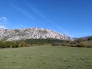
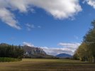
And the last day on a long weekend Camino. We left Alsasua following arrows/the road across a highway and near the train station. It was a foggy start to the day so we didn't get views of the surrounding mountains until mid-morning, then what views!

We lost the arrows for a bit today but saw some from time to time. The tracks we downloaded from the website criss-crossed the highway 3 different times, while a recent walker's tracks on Wikiloc only required one highway crossing (on an overpass...it was safe) so we followed their trail.
It was nice - a mix again of forest trail, country roads, farm land and some more industrial areas.

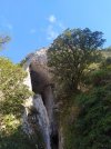
The surprise of the day came after the village of Eguino. We met a day hiker and walked with him for a bit on a lovely grassy section. He told us that if we had the time it would be worth a short diversion to see a cave nearby - la cueva de la leze. It was indeed close, just a 5 minute walk to a campground where many hiking and rock climbing routes start. And a huge cavern with some waterfalls inside - very impressive. There was also a nice picnic area there so it made for a great little diversion. If anyone walks along this way I do recommend the side trip. It added about a km to the day.

Yellow arrows became more consistent once we crossed from Navarra into País Vasco. And we joined the Camino Vasco between Zalduondo and Salvatierra.

In total we walked 88km, including a few scenic detours. I enjoyed it more than I thought I would! As mentioned above, I'll put together more of the navigation, accommodation and other facility details together in another post here in the coming days.

Overall, it was a good route! Mixed trails, some signage and facilities along the way. I've done the first few days on the Olvidado out of Bilbao and definitely prefer this way, this far.
IMG_20221101_113444.jpg
IMG_20221101_104058.jpgIMG_20221101_121957.jpg
I'll write back with more soon!
 
Alsasua to Salvatierra - 25km (with short diversion)

And the last day on a long weekend Camino. We left Alsasua following arrows/the road across a highway and near the train station. It was a foggy start to the day so we didn't get views of the surrounding mountains until mid-morning, then what views!

We lost the arrows for a bit today but saw some from time to time. The tracks we downloaded from the website criss-crossed the highway 3 different times, while a recent walker's tracks on Wikiloc only required one highway crossing (on an overpass...it was safe) so we followed their trail.
It was nice - a mix again of forest trail, country roads, farm land and some more industrial areas.

The surprise of the day came after the village of Eguino. We met a day hiker and walked with him for a bit on a lovely grassy section. He told us that if we had the time it would be worth a short diversion to see a cave nearby - la cueva de la leze. It was indeed close, just a 5 minute walk to a campground where many hiking and rock climbing routes start. And a huge cavern with some waterfalls inside - very impressive. There was also a nice picnic area there so it made for a great little diversion. If anyone walks along this way I do recommend the side trip. It added about a km to the day.

Yellow arrows became more consistent once we crossed from Navarra into País Vasco. And we joined the Camino Vasco between Zalduondo and Salvatierra.

In total we walked 88km, including a few scenic detours. I enjoyed it more than I thought I would! As mentioned above, I'll put together more of the navigation, accommodation and other facility details together in another post here in the coming days.

Overall, it was a good route! Mixed trails, some signage and facilities along the way. I've done the first few days on the Olvidado out of Bilbao and definitely prefer this way, this far.
View attachment 136012
View attachment 136013View attachment 136014
I'll write back with more soon!

I have been hesitating to start the Olvidado from Bilbao or Pamplona this summer. I shall be conventiently in Pamplona, but since there is more info about Bilbao I thought I would have to transfer to Bilbao to start the Olvidado from there. Your posts have convinced me that Pamplona is a possible start after all! Thanks!
 
Hi again! Back home but wanting to be back on the trail. Here's the summary I mentioned above and I'd be happy to try and answer any specific questions on the first few days of these trails :)

The route & useful websites:
My interest in this route stems from a recommendation on this forum and subsequently reading through the virtual camino thread. The links on there were helpful and led to other useful sites. I’ve repeated some of the links here, just so they’re in one place. Might be helpful!

From what I’ve read, the Camino Viejo and Camino de Las Asturias are the same route until just after La Puebla de Arganzón. These websites have information about the routes:

Camino de Las Asturias:
The Friends of the Camino of Alava website: Camino de las Asturias - Etapas (alavacaminodesantiago.org)

The Federal Association of Friends of the camino website: Federación Española de Asociaciones de Amigos del Camino de Santiago (caminosantiago.org)

Camino Viejo:
This website is in Spanish but is quite useful for this route as it also mentions accommodation options (I would definitely call ahead as I don’t know that date of this information): Ruta Pamplonesa del Camino Olvidado, el Viejo Camino de Santiago (viejocaminoolvidado.com)

There is also a link on that page to a very detailed description: 4.-Camino-description-VIEJO-public-13.pdf (viejocaminoolvidado.com) (I think this was done by someone on this forum? All credit goes to them!)


My friend and I downloaded the GPS tracks from the first link about the Asturias. However, when we saw the route mapped out, it was alongside the Autopista for most of the way and we weren’t keen on that. We ended up using the Wikiloc tracks from the blog and tracks of Roc Jumper: Camino Viejo · Camino Olvidado · Camino de las Asturias 05 Vitoria - Puebla de Arganzón 18,8 km +250 m -302 m | RocJumper

Lots of information on their blog as well for the first 6 days.


Signage (days 1-6):
Leaving Pamplona we say a few yellow arrows painted on signs etc. However, not far out of the city, when we got to Berrioplano we started to take some different routes to get off tarmac and away from the highway.

When following the RocJumper tracks, particularly on day 2, we followed lots of newish looking arrows - blue placards with the yellow arrow pointing the way. These were well spaced. We also routinely saw white stickers with a blue/yellow camino shell and then an arrow on the bottom. These seemed oddly spaced and near towns.

So there is signage along the way, though with the routes that we took it was inconsistent. I would highly recommend having Wikiloc and tracks to follow. We also noticed that few people seemed to know there was a Camino route this way. We got some strange looks when we asked for stamps - they may well have thought we were seriously lost on the Frances :)


Stages:

Day 1: Pamplona to Irurtzan


This was the route we took: Wikiloc | Camino viejo etapa 1 Pamplona - Irurtzun Trail

This was a mixed day of walking - countryside, near roads, some forest paths. There were some hills but nothing too strenuous until our end diversion up to the Balcony of Vultures. This part of the trail is certainly not necessary, but if you like hiking and great views, I do recommend it!

There were a number of water fountains on route, though not all were working. At any rate, there were enough for our needs for the day. However, no bars or other facilities on route so if you follow our tracks, I would pack a picnic. Some nice picnic spots on route though!

In Irurtzan there were 2 hotels - Hostal Macháin (cheaper but was full when we called) and the more expensive Hotel Plazaola (70 euros for 2 people - clean and comfortable, but I would suggest overpriced).

There are also a number of bars in town, particularly around the main plaza. I also saw a Coviron Supermarket.


Day 2: Irurtzan to Alsasua

This was a long day. Here’s the route we took: Wikiloc | Camino viejo etapa 2 Irurtzun - Alsasua Trail

This was the RocJumper route and we were following the newer arrows for almost the whole day.

Not many facilities until Lacunza, where we stopped for lunch. Very cute village with several bars and a panaderia.

Shortly after we walked past this hotel/restaurant in Arbizu: Hotel Restaurante Izar-Ondo :: Arbizu Sakana Turismo Navarra (hotelrestauranteizarondo.com) so if you wanted a shorter day, that might be an option.

In Alsasua we stayed at Hotel Izelai (44 euros for 2 people, fridge in room, microwave and coffee/vending machines in a shared space). There were other hotels here as well as it’s quite a sizable place. Lots of bars and supermarkets etc.

Day 3: Alsasua to Salvatierra

Here are our tracks for the day: Wikiloc | Camino viejo etapa 3 Alsasua - Salvatierra Trail

Again, we mostly followed the RocJumper tracks and saw arrows intermittently throughout the day. Plenty of water fountains as well.

You’ll see our diversion after Egino to La Cueva de la Leze - a great area for a picnic and the formation is very impressive! It was relatively easy going that day and you start to leave the valley and those wonderful mountains.

After a village called Albeiz you need to cross some train tracks. Take care here! You use the official crossings for most of it, but there’s one other track you need to cross by jumping off the platform and over. I don’t like things like this, but we were following arrows at this point - the arrows made me do it ;)

We also spotted the orange arrows of the Camino Ignancio at this point as the trails merge for a short while. The yellow painted arrows were back here as well - from where you cross the highway all the way to Salvatierra.

For those familiar with the Camino Vasco, you actually join the alternative path out of Zalduondo. And then you’re on the Vasco! Information on accommodation can be found on Gronze for the next few stages.


So there it is! I have another long weekend in December so I may try and do a few stages on one of these routes, depending on accommodation options. The Asturias route looks like there might be trouble ahead (in terms of finding places to sleep) but the Viejo may have more options - though I can see one or two places without accommodation listed.

Happy trails!
 
The focus is on reducing the risk of failure through being well prepared. 2nd ed.
: Ruta Pamplonesa del Camino Olvidado, el Viejo Camino de Santiago (viejocaminoolvidado.com)

There is also a link on that page to a very detailed description: 4.-Camino-description-VIEJO-public-13.pdf (viejocaminoolvidado.com) (I think this was done by someone on this forum? All credit goes to them!)
All credit goes to them
Indeed it is @caminka

This is super information, @WestKirsty!
I'll add a link to your info the bottom of the planning thread.
 
Perfect memento/gift in a presentation box. Engraving available, 25 character max.
It says @caminka is the author. It is packed with information! Just what I needed! Unfortunately it doesn't say what year it is from (I could have missed it.)
It was updated in 2013 after I walked the route in 2012. Absolutely check the facilities before you go, but my other historic obsessions should be ok. :-)
 
Hi again! Back home but wanting to be back on the trail. Here's the summary I mentioned above and I'd be happy to try and answer any specific questions on the first few days of these trails :)

The route & useful websites:
My interest in this route stems from a recommendation on this forum and subsequently reading through the virtual camino thread. The links on there were helpful and led to other useful sites. I’ve repeated some of the links here, just so they’re in one place. Might be helpful!

From what I’ve read, the Camino Viejo and Camino de Las Asturias are the same route until just after La Puebla de Arganzón. These websites have information about the routes:

Camino de Las Asturias:
The Friends of the Camino of Alava website: Camino de las Asturias - Etapas (alavacaminodesantiago.org)

The Federal Association of Friends of the camino website: Federación Española de Asociaciones de Amigos del Camino de Santiago (caminosantiago.org)

Camino Viejo:
This website is in Spanish but is quite useful for this route as it also mentions accommodation options (I would definitely call ahead as I don’t know that date of this information): Ruta Pamplonesa del Camino Olvidado, el Viejo Camino de Santiago (viejocaminoolvidado.com)

There is also a link on that page to a very detailed description: 4.-Camino-description-VIEJO-public-13.pdf (viejocaminoolvidado.com) (I think this was done by someone on this forum? All credit goes to them!)


My friend and I downloaded the GPS tracks from the first link about the Asturias. However, when we saw the route mapped out, it was alongside the Autopista for most of the way and we weren’t keen on that. We ended up using the Wikiloc tracks from the blog and tracks of Roc Jumper: Camino Viejo · Camino Olvidado · Camino de las Asturias 05 Vitoria - Puebla de Arganzón 18,8 km +250 m -302 m | RocJumper

Lots of information on their blog as well for the first 6 days.


Signage (days 1-6):
Leaving Pamplona we say a few yellow arrows painted on signs etc. However, not far out of the city, when we got to Berrioplano we started to take some different routes to get off tarmac and away from the highway.

When following the RocJumper tracks, particularly on day 2, we followed lots of newish looking arrows - blue placards with the yellow arrow pointing the way. These were well spaced. We also routinely saw white stickers with a blue/yellow camino shell and then an arrow on the bottom. These seemed oddly spaced and near towns.

So there is signage along the way, though with the routes that we took it was inconsistent. I would highly recommend having Wikiloc and tracks to follow. We also noticed that few people seemed to know there was a Camino route this way. We got some strange looks when we asked for stamps - they may well have thought we were seriously lost on the Frances :)


Stages:

Day 1: Pamplona to Irurtzan


This was the route we took: Wikiloc | Camino viejo etapa 1 Pamplona - Irurtzun Trail

This was a mixed day of walking - countryside, near roads, some forest paths. There were some hills but nothing too strenuous until our end diversion up to the Balcony of Vultures. This part of the trail is certainly not necessary, but if you like hiking and great views, I do recommend it!

There were a number of water fountains on route, though not all were working. At any rate, there were enough for our needs for the day. However, no bars or other facilities on route so if you follow our tracks, I would pack a picnic. Some nice picnic spots on route though!

In Irurtzan there were 2 hotels - Hostal Macháin (cheaper but was full when we called) and the more expensive Hotel Plazaola (70 euros for 2 people - clean and comfortable, but I would suggest overpriced).

There are also a number of bars in town, particularly around the main plaza. I also saw a Coviron Supermarket.


Day 2: Irurtzan to Alsasua

This was a long day. Here’s the route we took: Wikiloc | Camino viejo etapa 2 Irurtzun - Alsasua Trail

This was the RocJumper route and we were following the newer arrows for almost the whole day.

Not many facilities until Lacunza, where we stopped for lunch. Very cute village with several bars and a panaderia.

Shortly after we walked past this hotel/restaurant in Arbizu: Hotel Restaurante Izar-Ondo :: Arbizu Sakana Turismo Navarra (hotelrestauranteizarondo.com) so if you wanted a shorter day, that might be an option.

In Alsasua we stayed at Hotel Izelai (44 euros for 2 people, fridge in room, microwave and coffee/vending machines in a shared space). There were other hotels here as well as it’s quite a sizable place. Lots of bars and supermarkets etc.

Day 3: Alsasua to Salvatierra

Here are our tracks for the day: Wikiloc | Camino viejo etapa 3 Alsasua - Salvatierra Trail

Again, we mostly followed the RocJumper tracks and saw arrows intermittently throughout the day. Plenty of water fountains as well.

You’ll see our diversion after Egino to La Cueva de la Leze - a great area for a picnic and the formation is very impressive! It was relatively easy going that day and you start to leave the valley and those wonderful mountains.

After a village called Albeiz you need to cross some train tracks. Take care here! You use the official crossings for most of it, but there’s one other track you need to cross by jumping off the platform and over. I don’t like things like this, but we were following arrows at this point - the arrows made me do it ;)

We also spotted the orange arrows of the Camino Ignancio at this point as the trails merge for a short while. The yellow painted arrows were back here as well - from where you cross the highway all the way to Salvatierra.

For those familiar with the Camino Vasco, you actually join the alternative path out of Zalduondo. And then you’re on the Vasco! Information on accommodation can be found on Gronze for the next few stages.


So there it is! I have another long weekend in December so I may try and do a few stages on one of these routes, depending on accommodation options. The Asturias route looks like there might be trouble ahead (in terms of finding places to sleep) but the Viejo may have more options - though I can see one or two places without accommodation listed.

Happy trails!
It was updated in 2013 after I walked the route in 2012. Absolutely check the facilities before you go, but my other historic obsessions should be ok. :)
thanks for all useful informations.
I was thinking of walk French from SJPD to Pamplona. Then Olvidado until Cacabelos. Or until it meets Vadiniense.
And than see which one walk depending on where I find the cheapest return flight
(I doubt I have time to get to Santiago this time as well)
End of this month June.

Just I worried about the accomodations(and price)
I thought to carry a light tent as plan B.
But I would prefer not. Cause I use it very little and this light is new and never used.
You will need yo check with accommodations or tourist offices. If possible, in advance, so you can plan accordingly.
With this, it can be done without a tent, but sometimes there is no (budget) albergue option.
 
The 2025 edition of the Lightfoot Guide to the via Podiensis is now available

❓How to ask a question

How to post a new question on the Camino Forum.

Most read last week in this forum

I am on the viejo at the moment and took a detour to walk through the tunnel on Thursday. I know this was discussed in the virtual planning thread but mine was a less adventurous route as I didn't...

Featured threads

❓How to ask a question

How to post a new question on the Camino Forum.

Featured threads

Forum Rules

Forum Rules

Camino Updates on YouTube

Camino Conversations

Most downloaded Resources

This site is run by Ivar at

in Santiago de Compostela.
This site participates in the Amazon Affiliate program, designed to provide a means for Ivar to earn fees by linking to Amazon
Official Camino Passport (Credential) | 2024 Camino Guides
Back
Top