• For 2024 Pilgrims: €50,- donation = 1 year with no ads on the forum + 90% off any 2024 Guide. More here.
    (Discount code sent to you by Private Message after your donation)
  • ⚠️ Emergency contact in Spain - Dial 112 and AlertCops app. More on this here.

Search 69,459 Camino Questions

Best Map book Camino Portugese from Porto to Santiago

Paul Roby

New Member
Time of past OR future Camino
2016 France :-)
2019 Portuguese Never happened :-(
Hi, we plan to walk the camino portugese from Porto to Santiago in April 2019 and I would like to know which resource in best and what is the value.
There is 'A Camino Portuguese Guide', 'Maps only the the Camino Portuguese' and 'A Pilgrim's Guide to the Camino Portugués: Lisbon - Porto - Santiago'
I'm sure there are many others so what is the best?
 
Last edited:
The 9th edition the Lightfoot Guide will let you complete the journey your way.
I used the John Brierly guide "A pilgrim's guide to the Camino Portuguese: Lisbon-Porto-Santiago", it's fairly accurate, although I'd have bough just the maps if I had the chance as thet are lighter to carry. The book gives you plenty of other info on the route though. The comprehensive and relevant list of albergues have a look here: http://www.vialusitana.org/caminho-portugues/albergues/
 
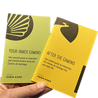
Ideal pocket guides for during & after your Camino. Each weighs only 1.4 oz (40g)!
The best resource is Luis Freixo's Blog as its the best and is free see http://www.caminador.es/. You can view his maps of each stage of every Portuguese Camino (and there are rather alot of caminos to do including another new one thanks to Luis la Via Mariana via Arbo to add to the list from Braga! ) in alot of formats like Google Maps, Wikiloc or pdf which I prefer to use as you can download to your Smartphone and use offline so you don't need internet or drain your battery.
 
The best resource is Luis Freixo's Blog as its the best and is free see http://www.caminador.es/. You can view his maps of each stage of every Portuguese Camino (and there are rather alot of caminos to do including another new one thanks to Luis la Via Mariana via Arbo to add to the list from Braga! ) in alot of formats like Google Maps, Wikiloc or pdf which I prefer to use as you can download to your Smartphone and use offline so you don't need internet or drain your battery.
 
The best resource is Luis Freixo's Blog as its the best and is free see http://www.caminador.es/. You can view his maps of each stage of every Portuguese Camino (and there are rather alot of caminos to do including another new one thanks to Luis la Via Mariana via Arbo to add to the list from Braga! ) in alot of formats like Google Maps, Wikiloc or pdf which I prefer to use as you can download to your Smartphone and use offline so you don't need internet or drain your battery.
But from what I can see, it does not offer all the maps in English
 
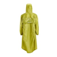
Very light, comfortable and compressible poncho. Specially designed for protection against water for any activity.

Our Atmospheric H30 poncho offers lightness and waterproofness. Easily compressible and made with our Waterproof fabric, its heat-sealed interior seams guarantee its waterproofness. Includes carrying bag.

€60,-
Do you really need english explanations for using a map? I think, most signs used in maps are self-explaninig or international.

I used both the Brierley guide-book in 2013/2014 and his maps in 2017. In my opinion, his "maps" offer one problem: they are rather sketches than proper maps, i. e. they do not really reflect the distances. Sometimes 1 cm is half a mile, sometimes it is about 2 km. So it is nearly impossible to deduct from his maps how long you still have to walk. And the "maps"-edition (unlike the guide-book does not show the connection from Vila do Conde to Rates. So I could only walk that because I had done it before.

The information about accomodation included in the "maps" was up-to-date and proved very useful. It is a very handy booklet which makes you independent from your smartphone and will even survive hard rain.

BC
Alexandra
 
Yes that's right a map is a map ! He has all formats too so for example you can open Google Maps & see where gou are (and the marked Camino) while walking !
 
The best resource is Luis Freixo's Blog as its the best and is free see http://www.caminador.es/. You can view his maps of each stage of every Portuguese Camino (and there are rather alot of caminos to do including another new one thanks to Luis la Via Mariana via Arbo to add to the list from Braga! ) in alot of formats like Google Maps, Wikiloc or pdf which I prefer to use as you can download to your Smartphone and use offline so you don't need internet or drain your battery.
I went back and looked at it and I'm not sure it is the best resource. For example, just looking at the first couple of days of my walk, it doesn't show Vila Cha where I slept the first night in an albergue (it should be between Labruge and Vila do Conde), and it shows the camino connection from Vila do Conde to the Central linking at Rates when, in fact, following the arrows, it linked at Arcos. And that's just the first two days. After that, I stopped looking. I found other guidebooks and apps more complete and accurate for what I walked. Not to denigrate the effort that went into this, but I would not hold it up currently as the sine qua non of resources.

http://www.caminador.es/wp-content/uploads/2009/06/02-PLANO-GUIA-2013-2.png

If you go into the PDFs, they do provide a lot of detail, but the information appears to be about ten years old.
 
Last edited:
Join our full-service guided tour and let us convert you into a Pampered Pilgrim!
I used the Brierley guide when walking from Lisbon. No problems with that.
The next times I walked the Portuguese caminho I just followed the yellow marks and prepared myself by looking on google maps what was the next place to stay the night so was informed about the distance to walk.
I bought a Portuguese guidebooklet last year -will be a problem for you if you do not speak Portuguese but it gives all stages and distances in numbers.But I speak Portuguese so it is easy to say for me.
This year I will follow the waymarkers again and use google maps.
 
I went back and looked at it and I'm not sure it is the best resource. For example, just looking at the first couple of days of my walk, it doesn't show Vila Cha where I slept the first night in an albergue (it should be between Labruge and Vila do Conde), and it shows the camino connection from Vila do Conde to the Central linking at Rates when, in fact, following the arrows, it linked at Arcos. And that's just the first two days. After that, I stopped looking. I found other guidebooks and apps more complete and accurate for what I walked. Not to denigrate the effort that went into this, but I would not hold it up currently as the sine qua non of resources.

http://www.caminador.es/wp-content/uploads/2009/06/02-PLANO-GUIA-2013-2.png

If you go into the PDFs, they do provide a lot of detail, but the information appears to be about ten years old.

David,

You need to go back to the Home page of his Blog and start from there http://www.caminador.es/

The map you've shown is a redundant superseded map from 2013.

Here's the actual page you need to go to http://www.caminador.es/?page_id=19...54JY-nFivbpxyrhne-uwNkMtsjP2u2dR5eJ3O5-KjeI5k

And for the map of the stage http://www.caminador.es/wp-content/...PGEinTYa7RKdSpCmgo5JUEYiYwv_nxy0lAIZtW5p9F3Oc

Luis has much more detailed information on each stage as well as on all of the caminos which originate from Portugal in multi formats including Google Maps. No other resource comes close to this level of information and it's all free to access. All this and more from the man who founded the shoreline route (as well as as the Mariana Way which you should walk in the future !). He even orginally painted the very arrows you followed from Porto as far as to Redondela So yes I'm afraid I have to disagree with you. In fact most subsequent resources have used his info including Brierley etc
I stand corrected. In my defense, however, I will say that I did go to the home page of his blog and the out of date information I got, I got from clicking on what appeared to be the right links. So it appears that, as knowledgeable and important as he is, he is not always scrupulous about removing old content when replacing with the new.

I will no longer deny that he is the best, most detailed, most accomplished, and most up to date source of information. But I would caution people visiting his site to be careful of what they are looking at to be sure it is not older information that has remained there, if they are just going to the home page and browsing rather than following a direct link that someone has provided to the information they need
 
The 9th edition the Lightfoot Guide will let you complete the journey your way.

Most read last week in this forum

Bom dia dear pilgrims, I plan on returning to Portugal this summer, after walking the Salvador + Primitivo. I have a few questions: - What is the easiest way to get from SdC to Coimbra? I assume...
My final question since I have asked sooo many. Grabbing a light lunch that I can get on the go, hoping to grab it, and find a square or a bench to enjoy it, then get back to walking. Not really...
We are flying into Lisbon, then taking a train to Tomar for a couple nights, which looks pretty easy. What is less clear is the best way from Tomar to Porto. Have you done this? What do you...
Arriving in Valença around noon and I need to get to my hostel in Tui. I would like to conserve my energy and time, so can I take a taxi from Valença Bus station to take me to my hostel in Tui...
Dear all, I have done Camino Frances, Norte and Primitivo and would like to ask about Portuges. I have some soul-searching to do and would love to walk a part of it, unfortunately only a part...
Hello everyone! My wife and I are doing our first Camino in Sept and I was very curious about the stretch from Tui to Pontevedra. We have been to Spain multiple times and love the small towns...

❓How to ask a question

How to post a new question on the Camino Forum.

Forum Rules

Forum Rules

Camino Updates on YouTube

Camino Conversations

Most downloaded Resources

This site is run by Ivar at

in Santiago de Compostela.
This site participates in the Amazon Affiliate program, designed to provide a means for Ivar to earn fees by linking to Amazon
Official Camino Passport (Credential) | 2024 Camino Guides
Back
Top