Vacajoe
Traded in my work boots for hiking ones
- Time of past OR future Camino
- Frances, Portuguese, Aragon, Norte, SJWayUK, Nive
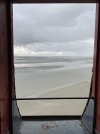
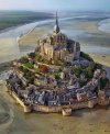
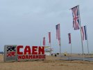
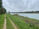
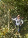
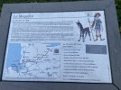
This overlooked route is one that English pilgrims would have followed after crossing the channel to France. About 120 miles long, it’s a beautiful (and relatively flat!) walk across Normandy from one beach to another! The path starts at a D-Day beach and ends with a traverse across the tidal beach to MSM itself - definitely a thrilling end to a pilgrimage! If you had the energy, you could continue on to SdC from MSM, but we will end at journey there.
We have 11 days planned and I’ll update daily with a few remarks about the completed stage since there is very little in English about this route.
We have 11 days planned and I’ll update daily with a few remarks about the completed stage since there is very little in English about this route.


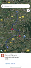
 . QAlso, the stated stages land you in areas that may not have accommodations. For example, we had to walk 30 minutes past Evrecy off-route to reach the nearest gite. Very odd that this is a stage end-point.
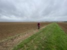

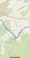
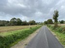
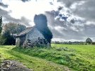
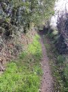
 . Even odder, the route makes some very questionable choices (see below for one example), resulting in extra walking for no known reason. If it went by an important monument or church or unique landscape, then I would understand, but there was nothing different than what we had been doing. I don’t get it.


.jpeg")


 . The gps tracks followed the waymarks for most of the day, too, which was unusual.


 .
.


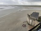
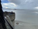
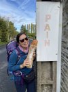
 . Officially it’s called, Maison du Pêlerin and is located at the very end of the lower street after all the shops and restaurants. MSM is magical at night after all the tourists leave - highly recommend being able to stay on the Mont.