• For 2024 Pilgrims: €50,- donation = 1 year with no ads on the forum + 90% off any 2024 Guide. More here.
    (Discount code sent to you by Private Message after your donation)
  • ⚠️ Emergency contact in Spain - Dial 112 and AlertCops app. More on this here.

Search 69,459 Camino Questions

Coastal camino v. Central

Susan B Johnson

PuraVida
Time of past OR future Camino
June (2016)
I was just reading about 2 different routes through Portugal. Do they have different starting points or is it one route that forks at some point?

I've been advised by my physical therapist to walk the route with the fewest inclines and the most stable surface. How does the coastal v. inland route compare when it comes to even terrain and inclines?

Thanks!
 
Very light, comfortable and compressible poncho. Specially designed for protection against water for any activity.

Our Atmospheric H30 poncho offers lightness and waterproofness. Easily compressible and made with our Waterproof fabric, its heat-sealed interior seams guarantee its waterproofness. Includes carrying bag.

€60,-
Susan there exists more than 2 Portuguese routes but the most important ones are the Central route and the Coastal route starting from Porto. Directly from the Sé cathedral they fork but walking the coast later you could be possible to change to the Central route, in Vila do Conde or in Caminha at the Spanish border
Both start at the same point, the Sé cathedral in Porto.
if you are advised to walk the walk with the fewest inclines, choose the coastal walk all along to Vigo in Spain. After Vigo you will hit the central route which leads you direct to Santiago.
you will hit some inclined terrain from Redondela but that is not much.
The Central route has some inclined terrain, especially between Ponte de Lima and Rubiães and a fairly steep hill downwards before Redondela ( btw from the Coastal route you will approach Redondela from a different side with no steep hills)
 
Last edited:
You can see the altitude of every stage in various websites, for example on Gronze.com, if you select a stage and then click on "Ver perfil de la etapa". I have done port of the inland rule and I don't remember any particular incline
 
The one from Galicia (the round) and the one from Castilla & Leon. Individually numbered and made by the same people that make the ones you see on your walk.
I was just reading about 2 different routes through Portugal. Do they have different starting points or is it one route that forks at some point?

I've been advised by my physical therapist to walk the route with the fewest inclines and the most stable surface. How does the coastal v. inland route compare when it comes to even terrain and inclines?

Thanks!
Are you planning to walk through Portugal, eg from Lisbon, or just from Porto? Either way, there are many routes to choose from, almost to the point of distraction.

North of Porto, the route through Braga and the Central route will have more undulating terrain than the Coastal and Senda Littoral. And there is a least one short, steep climb on the Central route that I think everyone would find challenging.

As for stable surfaces, most cobblestone and other paved surfaces are quite firm, but you might find that they are ankle twisting nightmares to walk on. I did. I am told that the two coastal alternatives have more boardwalk, which might be better for you.
 
Get yourself a guidebook for the Camino Portugues. They're a great resource and have routes, starting points, elevation charts etc. If you're worried about weight, just use it for research and don't bring it.
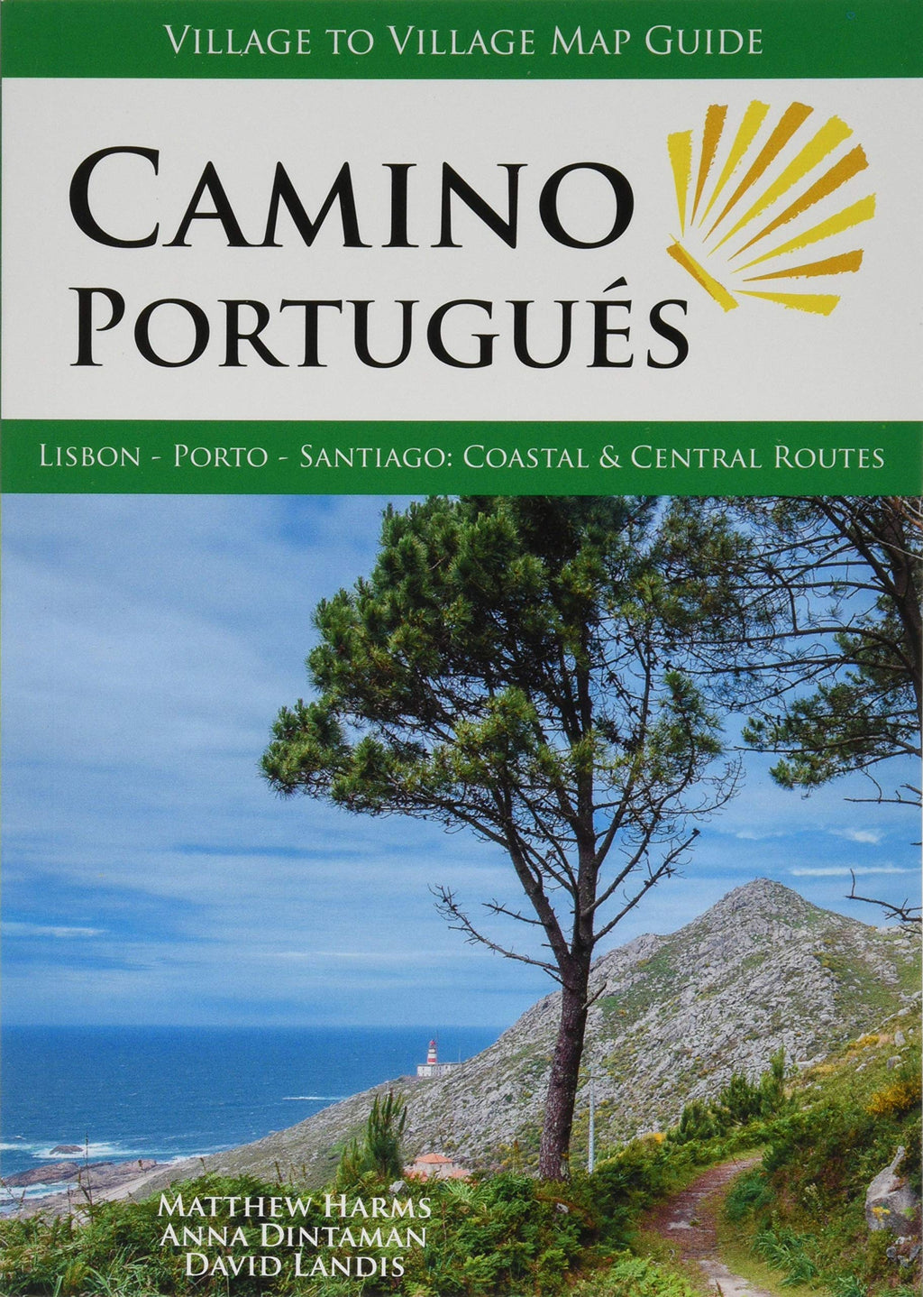
You can purchase one on the forum. They sell the Brierley full guidebook and the maps only as well as the village to village one and even comes with a free set of pilgrim's credentials included. That's a heck of a bargain.

 
Ideal pocket guides for during & after your Camino. Each weighs only 1.4 oz (40g)!
Last year I walked the central from Lisbon, then did one day on the coastal from Porto, then switched back to the central. My one day after Porto along the coast ranks in my top 5 days ever on the camino. I would have stayed on the coast but it was December and very rainy... I figured weather wise I would be more protected away from the sea. That one day however was beautiful with dappled clouds and comfortable temperature.

Next time, if I walk in like May I'll stick to the beach.
 
Hi Susan!
I walked the Coastal route from Porto in 2021 i t was a good choice and i loved it!
I also chose it because it was relatively flat.
I can't remember any stage where the surface was bad like some of the paths on the Frances for example which are rock strewn or difficult..


Albertinho's post is a pretty good description.

Out of Porto if the river Douro is on your left your going the right way out to the sea.
Along the coast the way is predominantly flat and there is a network of boardwalks to follow as part of the path. You also walk along wide ,promenades,sidewalks and roadside walking after turning inland.
I found them great to walk on!
All the best have a wonderful walk
Woody
 

Attachments

  • DAY TWO BOARDWALK.mp4
    2.9 MB
Hi Susan!
I walked the Coastal route from Porto in 2021 i t was a good choice and i loved it!
I also chose it because it was relatively flat.
I can't remember any stage where the surface was bad like some of the paths on the Frances for example which are rock strewn or difficult..


Albertinho's post is a pretty good description.

Out of Porto if the river Douro is on your left your going the right way out to the sea.
Along the coast the way is predominantly flat and there is a network of boardwalks to follow as part of the path. You also walk along wide ,promenades,sidewalks and roadside walking after turning inland.
I found them great to walk on!
All the best have a wonderful walk
Woody

Hello Susan

Absolutely agree with Woody's quote and comments.

One thing is when you get to Vigo, following the yellow arrows takes you uphill and downhill and uphill and downhill etc past various churches.

Do yourself a favor and use your mapping / gps app such as Google maps for example, and chart a direct course to wherever you are staying.

We stayed at the B&B Hotel and enjoyed our stay there and would stay there again.
 
A selection of Camino Jewellery
Hello Susan

Absolutely agree with Woody's quote and comments.

One thing is when you get to Vigo, following the yellow arrows takes you uphill and downhill and uphill and downhill etc past various churches.

Do yourself a favor and use your mapping / gps app such as Google maps for example, and chart a direct course to wherever you are staying.

We stayed at the B&B Hotel and enjoyed our stay there and would stay there again.
Once walking from Baiona , you enter Nivran /Ramalhosa
there is an albergue where we applied for a stamp
the hospitaleiro pointed us to “ GREEN” waymarkers. Following them we came out at the coastline and followed the coastline all the way to Vigo.And you enter Vigo at the downhill part of town. Vigo is build on terraces .
Also out of Vigo you follow the lower part of town along the railway and estuary direction Redondela. very nice walk
 
There are lots of different routes through Portugal, as you can see from the number of different Camino Portugues sub-forums. :)

When people talk about the Central vs Coastal routes, they are talking about routes between Porto and Santiago. There are actually three main routes from Porto to Santiago, with a couple of lengthy variants.

The three main routes, from east to west, are the Central, the Coastal, and the Senda Litoral. The Central more or less goes north from Porto through Barcelos, Ponte de Lima, Valença and crosses the border at Tui. The Coastal also heads north out of Porto but veers west and reaches the coast at Vila do Conde, then heads north sometimes along the coast, sometimes somewhat inland. The Senda Litoral is the one that really follows the seashore, heading out of Porto along the river and then up along the beaches. The three all join together at Redondela in Spain.

The first variant I mentioned is one that passes through Braga, to the east of the normal Central route. I don't believe it gets much traffic and isn't in many of the guidebooks or apps, but it exists. The second variant is the Variante Espiritual (Spiritual Variant) which occurs after the three have joined together. It departs from the main route shortly after Pontevedra and rejoins it at Padron.

I believe the Coastal/Senda routes are a little easier in terms of inclines than the Central, although neither of these is terribly difficult in terms of inclines compared to many other Camino routes.
 
When people talk about the Central vs Coastal routes, they are talking about routes between Porto and Santiago. There are actually three main routes from Porto to Santiago, with a couple of lengthy variants.
This seems to have become accepted usage on this forum, to the detriment of understanding that there are central and coastal routes south of Porto as well.
 
New Original Camino Gear Designed Especially with The Modern Peregrino In Mind!
This seems to have become accepted usage on this forum, to the detriment of understanding that there are central and coastal routes south of Porto as well.
That is correct . The Central comes from Lisbon
the Costal from Cascais but does not hit the coast .
From Porto there is the Central which is 240 kms to Santiago
The Coastal to Vila do Conde to the Central in São Pedro de Rates and via Tui is 260 kms
The full Coastal via the ferry watertaxi or swimming in Caminha to A Guarda and by Baiona and Vigo is 280 kms

There are several variations like the cut from Caminha to Valença and the relatively new as far as I know not waymarked one from Viana do Castelo to Ponte de Lima.
( you will miss Casa da Fernanda by walking that one btw 🫢)

About the Caminho para Braga
it starts in Porto and follows the route out of Porto on the Central route .
in Maia it veers to the north east to Vila Nova de Famalição and Braga
North of Braga you can choose to go to Ponte de Lima in north western direction or in north eastern direction , to the Interior caminho
There are subforums here on the forum like the Geira and the Torres.
Last year at the Pilgrims Office we had an overview in the computer about the main routes as mentioned above and we had to calculate sometimes the kms they walked when there were more “ uncommon “ routes ( anyway for the crowds ) Especially I remember a guy who came from Mallorca or another guy coming from Metz in France.
I do not know how they do it now since this year the registration tool the website of the Pilgrims Office has changed and the Compostelas are printed now and as I understood the Certificate of Distance too.
 
Last edited:

❓How to ask a question

How to post a new question on the Camino Forum.

Forum Rules

Forum Rules

Camino Updates on YouTube

Camino Conversations

Most downloaded Resources

This site is run by Ivar at

in Santiago de Compostela.
This site participates in the Amazon Affiliate program, designed to provide a means for Ivar to earn fees by linking to Amazon
Official Camino Passport (Credential) | 2024 Camino Guides
Back
Top