• Update 2: We should be back as normal now. Sorry again! Ivar
  • For 2024 Pilgrims: €50,- donation = 1 year with no ads on the forum + 90% off any 2024 Guide. More here.
    (Discount code sent to you by Private Message after your donation)
  • ⚠️ Emergency contact in Spain - Dial 112 and AlertCops app. More on this here.
  • Get your Camino Frances Guidebook here.

Search 69,459 Camino Questions

Elevation Map from SJPDP to Santiago

Time of past OR future Camino
Future Camino Frances April 2022
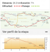
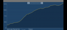
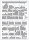
I began my Camino in SJPDP in April 2022 and received a map showing the elevation changes and towns/villages along the way broken up in 32-33 stages. Is there a website where I can find this map online?
 
Ideal pocket guides for during & after your Camino. Each weighs only 1.4 oz (40g)!
Gronze shows an elevation profile for every stage. You do have to expand it by clicking the plus sign next to "ver perfil de la etapa"

Screenshot_20220901-064212~3.png


Gronze is only in Spanish, but if you use the Chrome browser it will automatically translate to English or the language of your choice.
 
Very light, comfortable and compressible poncho. Specially designed for protection against water for any activity.

Our Atmospheric H30 poncho offers lightness and waterproofness. Easily compressible and made with our Waterproof fabric, its heat-sealed interior seams guarantee its waterproofness. Includes carrying bag.

€60,-
The 9th edition the Lightfoot Guide will let you complete the journey your way.
I try not to look at the elevation it too closely...might make me change my mind ;) . I do like to know how many "hills" there will be (especially at the end) and I like to know if I am going up or down most of the day. Otherwise, try not to think about it too much.

I am more interested in whether there will be life-giving coffee early in the day and water re-supply on the day's route...
 
20220902_134217-1-jpg.131994
 

Attachments

  • 20220902_134217[1].jpg
    20220902_134217[1].jpg
    1.3 MB · Views: 423
The one from Galicia (the round) and the one from Castilla & Leon. Individually numbered and made by the same people that make the ones you see on your walk.
The 2024 Camino guides will be coming out little by little. Here is a collection of the ones that are out so far.
€2,-/day will present your project to thousands of visitors each day. All interested in the Camino de Santiago.
Draw your own profile! Using a 200 meter vertical scale to a 1000 meter horizontal scale is ridiculous! If one of my staff gave such a profile, he/she would be looking for a new job. Compare 200 meters vertical to 200 meters horizontal if you want to see how steep the hill is that you will be walking. Look at page 28. climb to O'Ciebeiro --you will climb approx 700 meters vertically in approx 14 kilometers horizontally. That is a mere 5% grade! Horses pulled artillery up that hill!
 
Draw your own profile! Using a 200 meter vertical scale to a 1000 meter horizontal scale is ridiculous! If one of my staff gave such a profile, he/she would be looking for a new job. Compare 200 meters vertical to 200 meters horizontal if you want to see how steep the hill is that you will be walking. Look at page 28. climb to O'Ciebeiro --you will climb approx 700 meters vertically in approx 14 kilometers horizontally. That is a mere 5% grade! Horses pulled artillery up that hill!
What you point out is true, and the reminder is good. However, I would not call it ridiculous in a guide book, considering the logistics of fitting maps on the page in a way that one can easily see the hills. On the other hand, if your staff are organizing artillery to go uphill, they should certainly plot it out differently.
 
Draw your own profile! Using a 200 meter vertical scale to a 1000 meter horizontal scale is ridiculous! If one of my staff gave such a profile, he/she would be looking for a new job. Compare 200 meters vertical to 200 meters horizontal if you want to see how steep the hill is that you will be walking. Look at page 28. climb to O'Ciebeiro --you will climb approx 700 meters vertically in approx 14 kilometers horizontally. That is a mere 5% grade! Horses pulled artillery up that hill!
I've done that. The profile is close to worthless. A 20% incline looks like it is nothing at all but you won't think that walking it.

Edit: Get a GPS track and use the profile tool at https://gpsvisualizer.com to play around with scale.
 
Technical backpack for day trips with backpack cover and internal compartment for the hydration bladder. Ideal daypack for excursions where we need a medium capacity backpack. The back with Air Flow System creates large air channels that will keep our back as cool as possible.

€83,-
New Original Camino Gear Designed Especially with The Modern Peregrino In Mind!
The first edition came out in 2003 and has become the go-to-guide for many pilgrims over the years. It is shipping with a Pilgrim Passport (Credential) from the cathedral in Santiago de Compostela.
I wouldn't imagine that the hills themselves have changed.
Louis XIV, king of France (or perhaps Rios, the spanish ambassador), said on november, 16th 1700 "Il n'y a plus de Pyrénées !" ("There are no more Pyrénées !").
Fortunately, this was from a diplomatic point of view. Geographically, Roncevaux is always there !
 
Draw your own profile! Using a 200 meter vertical scale to a 1000 meter horizontal scale is ridiculous! If one of my staff gave such a profile, he/she would be looking for a new job. Compare 200 meters vertical to 200 meters horizontal if you want to see how steep the hill is that you will be walking. Look at page 28. climb to O'Ciebeiro --you will climb approx 700 meters vertically in approx 14 kilometers horizontally. That is a mere 5% grade! Horses pulled artillery up that hill!
That makes me curious as to your profession - as a civil engineer I've used a 1/5 exaggeration on an overview for highway centrelines and pipelines. Use what makes it fit on the page :)
 
A selection of Camino Jewellery
Compare 200 meters vertical to 200 meters horizontal if you want to see how steep the hill is that you will be walking.
For kicks I once created an elevation profile for the SJPdP to SdC camino using the same units for both the horizontal and vertical axes. If I remember correctly it was about 1600 pixels by 3 pixels with each pixel representing 500 meters.
 
I've done that. The profile is close to worthless. A 20% incline looks like it is nothing at all but you won't think that walking it.

Edit: Get a GPS track and use the profile tool at https://gpsvisualizer.com to play around with scale.
20% is not very steep. 2 meter rise over 10 met
That makes me curious as to your profession - as a civil engineer I've used a 1/5 exaggeration on an overview for highway centrelines and pipelines. Use what makes it fit on the page :)
Also a Civilized Engineer. And I'm sure you know that lawyers and politicians determine what gets funded and THEY do NOT comprehend profiles that use exaggerated scales. Lawyers, Politicians, and civilians don't usually rebiew the actual engineering drawings. We do real scale profiles for the public.
 
A selection of Camino Jewellery
20% is not very steep. 2 meter rise over 10 met

Also a Civilized Engineer. And I'm sure you know that lawyers and politicians determine what gets funded and THEY do NOT comprehend profiles that use exaggerated scales. Lawyers, Politicians, and civilians don't usually rebiew the actual engineering drawings. We do real scale profiles for the public.
Interesting point of view, thank you.
 
20% is not very steep. 2 meter rise over 10 met

Also a Civilized Engineer. And I'm sure you know that lawyers and politicians determine what gets funded and THEY do NOT comprehend profiles that use exaggerated scales. Lawyers, Politicians, and civilians don't usually rebiew the actual engineering drawings. We do real scale profiles for the public.
Maybe, but that wouldn’t do for a guidebook or website. Most people should understand the horizontal/ vertical scales. If they don’t, they shouldn’t be allowed out on their own.
 
The 2024 Camino guides will be coming out little by little. Here is a collection of the ones that are out so far.
Most people want to know if there is a significant hill ahead. If the hill turns out to be less difficult than expected from the scale distortion, they are generally quite happy. Better that way than the other way around.
lawyers and politicians determine what gets funded and THEY do NOT comprehend profiles that use exaggerated scales.
I think if we sent some lawyers and politicians up to Orisson, most of them would agree that it is a steep hill for walking.
 
Most people want to know if there is a significant hill ahead. If the hill turns out to be less difficult than expected from the scale distortion, they are generally quite happy. Better that way than the other way around.

I think if we sent some lawyers and politicians up to Orisson, most of them would agree that it is a steep hill for walking.
Not that steep. Pretty flat compared to the Primitivo or Norte.
 
Not that steep. Pretty flat compared to the Primitivo or Norte.
Nobody is suggesting it is the steepest hill in the world, or in Spain, etc. We are getting into a childish argument here. It is silly to suggest that it is insignificant as a hill, especially on the first day of a Camino for inexperience hikers. Enough said!
 
Very light, comfortable and compressible poncho. Specially designed for protection against water for any activity.

Our Atmospheric H30 poncho offers lightness and waterproofness. Easily compressible and made with our Waterproof fabric, its heat-sealed interior seams guarantee its waterproofness. Includes carrying bag.

€60,-
Nobody is suggesting it is the steepest hill in the world, or in Spain, etc. We are getting into a childish argument here. It is silly to suggest that it is insignificant as a hill, especially on the first day of a Camino for inexperience hikers. Enough said!
True...But if YOU have walked from SJPDP to Roncevalle you have heard the very strong lack of confidence voiced by MANY new Pilgrims They are SCARED!!! And what scares them? The profiles in the guide books! If they would draw their own profiles, it would give them more confidence on what lies ahead of them. Be honest and tell them what it is--a hill and nothing more!
 
True...But if YOU have walked from SJPDP to Roncevalle you have heard the very strong lack of confidence voiced by MANY new Pilgrims They are SCARED!!! And what scares them? The profiles in the guide books! If they would draw their own profiles, it would give them more confidence on what lies ahead of them. Be honest and tell them what it is--a hill and nothing more!
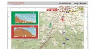
You have a certain point - the elevation profile of the trail from SJPP to Roncesvalles across the Lepoeder pass ("Route Napoleon") looks scary because people, me included, tend to project the profile that they see on paper into reality, as if the sketch is a a true rendition of the actual shape of the hill or mountain. Here are two elevation profiles of the same "Route Napoleon mountain" to illustrate what this part of the discussion is about:
R.N.jpg

The first sketch is from the popular Brierley guide. IMHO, it does illustrate the nature of the terrain: a non-hostile big lump that promises a long drawn-out slog over the pass with a shorter descent to Roncesvalles. I don't think that this scares people. What scares some of them is the talk about it being so terribly steep, the hardest thing I've ever done (or you'll ever be doing) and similar. This gives people the impression as if the whole trail is very steep; the talk about gradients may even reinforce this impression and is probably not helpful for numerous newcomers. Is it even useful in this context? You don't walk straight up a mountain. You walk on a trail that bends and turns and sometimes - only once on the Route N. - it goes in zig-zag-lines, and all of this with a lower gradient which requires more time to walk than a straight line but is also less strenuous.

What matters for mountain and hill walkers is how close the contour lines are to each other on the map and whether the trail cuts straight through them or diagonally. Of course, the common wisdom says that you don't need a proper map for the Camino and you don't need to know what it can tell you provided you know how to read it. The Spanish Camino Association offers such a map on their website. It is not widely known. It shows clearly that there are very few steep sections, about three in total, one at the beginning, one in the middle (zig-zags) and one close to the pass, and all three of them are short.
Topographic map.jpg
Link to complete map:
 
Last edited:
To all newcomers arriving in this thread , be aware that the first day will be difficult for most but not so hard as to be taking the ring to mordor as some outliers may say or indeed to be easy as some of the egos may tell you either.

Preparing those with zero experience of the Route Napoleon for a tricky / strenuous climb for the day will hold them in good stead. Lets remember that the elevation isn't a trick to make it appear daunting, nor will stretching it out or shrinking it ( like old world maps used to do ) make it easier
 
3rd Edition. More content, training & pack guides avoid common mistakes, bed bugs etc
Most people want to know if there is a significant hill ahead. If the hill turns out to be less difficult than expected from the scale distortion, they are generally quite happy. Better that way than the other way around.

I think if we sent some lawyers and politicians up to Orisson, most of them would agree that it is a steep hill for walking.
I do love your optimism 😉
 
To all newcomers arriving in this thread , be aware that the first day will be difficult for most but not so hard as to be taking the ring to mordor as some outliers may say or indeed to be easy as some of the egos may tell you either.

Preparing those with zero experience of the Route Napoleon for a tricky / strenuous climb for the day will hold them in good stead. Lets remember that the elevation isn't a trick to make it appear daunting, nor will stretching it out or shrinking it ( like old world maps used to do ) make it easier
You have a certain point - the elevation profile of the trail from SJPP to Roncesvalles across the Lepoeder pass ("Route Napoleon") looks scary because people, me included, tend to project the profile that they see on paper into reality, as if the sketch is a a true rendition of the actual shape of the hill or mountain. Here are two elevation profiles of the same "Route Napoleon mountain" to illustrate what this part of the discussion is about:
View attachment 132072

The first sketch is from the popular Brierley guide. IMHO, it does illustrate the nature of the terrain: a non-hostile big lump that promises a long drawn-out slog over the pass with a shorter descent to Roncesvalles. I don't think that this scares people. What scares some of them is the talk about it being so terribly steep, the hardest thing I've ever done (or you'll ever be doing) and similar. This gives people the impression as if the whole trail is very steep; the talk about gradients may even reinforce this impression and is probably not helpful for numerous newcomers. Is it even useful in this context? You don't walk straight up a mountain. You walk on a trail that bends and turns and sometimes - only once on the Route N. - it goes in zig-zag-lines, and all of this with a lower gradient which requires more time to walk than a straight line but is also less strenuous.

What matters for mountain and hill walkers is how close the contour lines are to each other on the map and whether the trail cuts straight through them or diagonally. Of course, the common wisdom says that you don't need a proper map for the Camino and you don't need to know what it can tell you provided you know how to read it. The Spanish Camino Association offers such a map on their website. It is not widely known. It shows clearly that there are very few steep sections, about three in total, one at the beginning, one in the middle (zig-zags) and one close to the pass, and all three of them are short.
View attachment 132073
Link to complete map:
Stunningly beautiful cartography, thank you.
 

Most read last week in this forum

La Voz de Galicia has reported the death of a 65 year old pilgrim from the United States this afternoon near Castromaior. The likely cause appears to be a heart attack. The pilgrim was walking the...
This is my first posting but as I look at the Camino, I worry about 'lack of solitude' given the number of people on the trail. I am looking to do the France route....as I want to have the...
The Burguete bomberos had another busy day yesterday. Picking up two pilgrims with symptoms of hypothermia and exhaustion near the Lepoeder pass and another near the Croix de Thibault who was...
Between Villafranca Montes de Oca and San Juan de Ortega there was a great resting place with benches, totem poles andvarious wooden art. A place of good vibes. It is now completely demolished...
Left Saint Jean this morning at 7am. Got to Roncesvalles just before 1:30. Weather was clear and beautiful! I didn't pre book, and was able to get a bed. I did hear they were all full by 4pm...
Hi there - we are two 'older' women from Australia who will be walking the Camino in September and October 2025 - we are tempted by the companies that pre book accomodation and bag transfers but...

❓How to ask a question

How to post a new question on the Camino Forum.

Forum Rules

Forum Rules

Camino Updates on YouTube

Camino Conversations

Most downloaded Resources

This site is run by Ivar at

in Santiago de Compostela.
This site participates in the Amazon Affiliate program, designed to provide a means for Ivar to earn fees by linking to Amazon
Official Camino Passport (Credential) | 2024 Camino Guides
Back
Top