• For 2024 Pilgrims: €50,- donation = 1 year with no ads on the forum + 90% off any 2024 Guide. More here.
    (Discount code sent to you by Private Message after your donation)

Search 69,459 Camino Questions

Elevation Tracking

jgiesbrecht

Active Member
Time of past OR future Camino
Camino Frances, Fisterra, Muxia Sept-Oct 2020
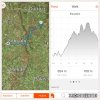
I have been keeping an eye on different apps, seeing what I would like to use next spring when I walk the CF. I have a fitbit, so have used that app for a while. I have also checked out mapmywalk, and only slightly browsed polarsteps and walkmeter. With fb it's just flights of stairs....I'd like to have a bit more in depth tracking, but not willing to pay either. Obviously step apps are a dime a dozen, but what apps have you used for elevation tracking?
 
The 9th edition the Lightfoot Guide will let you complete the journey your way.
3rd Edition. More content, training & pack guides avoid common mistakes, bed bugs etc
You will require a good quality digital thermometer, a kettle and some source of heat.

At sea level, water boils at 100 °C (212 °F). For every 500-foot (150 m) increase in elevation, water's boiling point is lowered by approximately 0.5 °C (0.9 °F). At 8,000 feet (2,400 m) in elevation, water boils at just 92 °C (198 °F).

At regular intervals stop, boil your kettle and record the temperature.

Yes, you will get some strange looks along the way but think of the new friendships to be made as you sit back, sip your cups of tea and enjoy the view together . . . .

I once read the journal of a Victorian explorer who did just this and spent 10 years of his life in search of the perfect cup of tea.
 
I have been using Gaia app. Tracks all you want plus stats at the end of the day, + tracks and live maps, it even makes tea after a long day
 
Join our full-service guided tour of the Basque Country and let us pamper you!
I second GAIA GPS. The few times that I have calibrated, it's been very accurate. Also, they keep expanding their maps of US national parks and wilderness areas. They went to a subscription model a few years ago. I have one. Not sure if there is a free version. However, I've heard a lot about Strava and seems to be a favorite of runners. I may use that (along with GAIA) for my next camino.

edit: One other thing about GAIA. It is rock solid. I have used several other tracking apps (paid and free) and none were as stable as GAIA. They would crash and/or stop tracking for huge sections.
 
I use the OsmAnd+ offline mapping and navigation app which I installed on my 8" Android tablet. I love it. It is feature rich. One can command it to record one's track. The track records show elevation, total climb, total descent, speed, etc., and can be exported to other devices or shared with other people. The app is extremely economical, does not need internet connectivity after one has downloaded the maps, and the maps, which are open-source, are free and show the Caminos and other hiking trails as well as lodging places, cafés, ATMs, laundromats, etc. etc.


I have no economic interest in OsmAnd, am simply a very satisfied user.
 
Last edited:
Wikiloc and Gaia are my favorites. Wikiloc was developed in Spain and has a large number of Spanish tracks on its site, so in addition to seeing your own elevation stats, you can see others’ for any deviations you might be considering.
 
The one from Galicia (the round) and the one from Castilla & Leon. Individually numbered and made by the same people that make the ones you see on your walk.
I use AlpineQuest.
Best €10 I spent on navigation/mapping/tracking app.
Comes with all the hiking trails laid out
 
I have been using Gaia app. Tracks all you want plus stats at the end of the day, + tracks and live maps, it even makes tea after a long day
IGN Mapas de España is also awesome and it is free, it has tracks for ALL the caminos, maybe it has way too much info for the app addicted pilgrim...
 
New Original Camino Gear Designed Especially with The Modern Peregrino In Mind!
IGN Mapas de España is also awesome and it is free, it has tracks for ALL the caminos, maybe it has way too much info for the app addicted pilgrim...
I just downloaded this app. But rather than having tracks for ALL the caminos, it seemed to come with no tracks at all, just the base map (very nice though that base map may be). Maybe the tracks came from elsewhere and were just openable in the app?
 
I just downloaded this app. But rather than having tracks for ALL the caminos, it seemed to come with no tracks at all, just the base map (very nice though that base map may be). Maybe the tracks came from elsewhere and were just openable in the app?
Just look around for "caminos de Santiago" and it will lead you to a menu w all the caminos it will also read gpx or kml tracks
 
Click on the black diamond with the right turning arrow, 1st choice
 
The 2024 Camino guides will be coming out little by little. Here is a collection of the ones that are out so far.
IGN Mapas de España is also awesome and it is free, it has tracks for ALL the caminos, maybe it has way too much info for the app addicted pilgrim...

I just downloaded this app. But rather than having tracks for ALL the caminos, it seemed to come with no tracks at all, just the base map (very nice though that base map may be). Maybe the tracks came from elsewhere and were just openable in the app?
I discovered that this app actually gets its tracks from elsewhere. It can be used to display any track. I liked the idea of having detailed topo maps but it looked too complicated for casual use. The BASIC instructions ran to ninety or so pages in Spanish. It looked like there were many features that professionals would love though.

On my just finished camino I used Wikiloc to keep me on track and OSMand to navigate within the destination towns (because the Wikiloc tracks might end at a different place than where you want to go).
 
David Tallan:

The same publisher offers another app that focusses on the Camino.

Search for "Cno. Santiago by Centro Nacional de Información Geográfica".
 

Most read last week in this forum

I’m leaving soon for CP and again attempted to use what’s app without success. I was trying to call a hotel in Spain, it just rings but nothing else. A few years ago I tried using in within Spain...
I realize every ounce matters when carrying backpack and not shipping luggage ahead. However, I know that the Spaniards are big into meat and potatoes, and not so much produce. I am thinking of...
Hola, I gearing up to start my 1st CdS and have seen people recommended sleeping bag liners to protect against bed bugs. Do these help or is it a myth? Should I add the extra weight of bringing one?
I’ve been stressing about charging my devices, so just want to make sure. I have this 4port Powered USB hub which I’m connecting to an adapter to fit European (at least Spain, since I know it...
Michael @wisepilgrim had mentioned a new feature that he was developing for Wise Pilgrim, and it looks like it is now in operation. You can check the app and see in real time how many beds are...
Well…… about $400 usd in socks and liners later and about 160 miles. I live in California near the Sierra mountains so we have some good trails and heat- I wanted to find my perfect combination...

❓How to ask a question

How to post a new question on the Camino Forum.

Similar threads

Forum Rules

Forum Rules

Camino Updates on YouTube

Camino Conversations

Most downloaded Resources

This site is run by Ivar at

in Santiago de Compostela.
This site participates in the Amazon Affiliate program, designed to provide a means for Ivar to earn fees by linking to Amazon
Official Camino Passport (Credential) | 2024 Camino Guides
Back
Top