• For 2024 Pilgrims: €50,- donation = 1 year with no ads on the forum + 90% off any 2024 Guide. More here.
    (Discount code sent to you by Private Message after your donation)
  • ⚠️ Emergency contact in Spain - Dial 112 and AlertCops app. More on this here.

Search 69,459 Camino Questions

From Gibraltar thru Ronda to Seville

jim wilking

New Member
Time of past OR future Camino
Frances and Portuguese last two years
VDLP (2017)
Will be starting my Camino in Gibraltar around April 21st with a route thru Ronda. The Asociacion Graditana Jacotea web site shows a basic route from town to town but no specific info as to the actual path. Some very detailed topo maps available on-line give a pretty good picture and my only real concern is the location of the Camino between El Colmenar and Ronda. I wonder if anyone knows if this information will be available in La Linea and, if so, where? Is there a cathedral in La Linea where the Camino begins and will I be able to pick up a Credential or will I have to wait for that until I get to Seville? Is the route thru Ronda considered an alternate "Via Serrana" to the Via Serrana that route thru Cadiz? Comments appreciated.
 
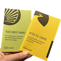
Ideal pocket guides for during & after your Camino. Each weighs only 1.4 oz (40g)!
Will be starting my Camino in Gibraltar around April 21st with a route thru Ronda. The Asociacion Graditana Jacotea web site shows a basic route from town to town but no specific info as to the actual path. Some very detailed topo maps available on-line give a pretty good picture and my only real concern is the location of the Camino between El Colmenar and Ronda. I wonder if anyone knows if this information will be available in La Linea and, if so, where? Is there a cathedral in La Linea where the Camino begins and will I be able to pick up a Credential or will I have to wait for that until I get to Seville? Is the route thru Ronda considered an alternate "Via Serrana" to the Via Serrana that route thru Cadiz? Comments appreciated.

Hi Jim,
Here is what you need for this camino:
http://www.asociaciongaditanajacobea.org/via_serrana.htm (click on the little square on the left of ''Via Serrana'' at the top of the map and you'll have all the stages). The way starts from the Church of St James in La Linea.
I walked it last year in May and had a grand time. Don't worry, the marking is very good and you can find cheap accommodation all along the way.
Enjoy!
Jean-Marc
 
Last edited:
New Original Camino Gear Designed Especially with The Modern Peregrino In Mind!
I'm doing the Via Serrana this summer as a precursor to the Via de la Plata and as part of a Mediterranean to Atlantic walk. Starting June 3, the website mentioned by Canuck is very good.
 
Just when I think I have a good understanding of all the caminos out there, another one emerges to put on the list of neverending caminos!

Walking through Ronda must be very nice. Jean-Marc could you comment a little on the terrain? This isn't the route that goes through Aracena, is it? I remember doing day walks in that area a few years ago and seeing arrows, but with no idea as to which camino it was.

Thanks for the info, everyone. Not sure if we want to open up a new sub-forum for this or not, hmmm, @Kanga, what do you think?

EDIT: Just answered my own question. The route that goes through Aracena is the Camino del Sur, which starts in Huelva. https://www.caminodesantiago.me/community/threads/camino-del-sur.21587/
 
Hi Jim,
Here is what you need for this camino:
http://www.asociaciongaditanajacobea.org/via_serrana.htm (click on the little square on the left of ''Via Serrana'' at the top of the map and you'll have all the stages). The way starts from the Church of St James in La Linea.
I walked it last year in May and had a grand time. Don't worry, the marking is very good and you can find cheap accommodation all along the way.
Enjoy!
Jean-Marc

Thanks Jean-Marc for your information. I searched for St James in La Linea to no avail. Would there be another name that it would go by? There was a list of about 15 churches of various denominations but none by that name. Since I will be arriving by bus from Malaga it would be good (and more comfortable) to have a specific destination. Good to hear the camino marking is good.
Jim
 
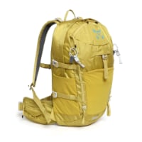
Technical backpack for day trips with backpack cover and internal compartment for the hydration bladder. Ideal daypack for excursions where we need a medium capacity backpack. The back with Air Flow System creates large air channels that will keep our back as cool as possible.

€83,-
Jim,

This should be the address that you want for the Santiago parish in La Linea--
Parroquia De Santiago Apostol,
Calle Jardines, 65,
11300 La Línea de la Concepción, Cádiz.

Here is a simple Google map link marking the walking route from the bus station to the parish.

Good luck and Buen camino!
 
Last edited:
Many thanks to all who provided suggestions on my original post. I have a few comments on the Ronda route from Gibraltar to Seville as I have now completed my camino. This route is a bit on the lonely side. Never saw another pilgrim. Nice country and friendly and helpful people. Excellent lodging but no alburgues. I should preface my comments by saying I relied on what info I could glean from the Via Serrana web site but with my limited knowledge of Spanish there may have been some info on the web site that might have mitigated some of my problems.

About 7 K's north of Jimena la Fronter the highway takes a 90-degree right turn to the east and the marked camino leaves the highway continuing directly north up a road that eventually deadends at a village on the river. About one K up this road (north) the camino makes a right hand turn off the road (east) directly into a private property with a locked gate and a formidable wall. The fun begins. I continued up the road looking for access to maybe turn east and intersect the camino since the camino had to eventually turn north. I found a small gate tied off with some rope and was contemplating opening the gate when a dog at a residence on the west side of the road started barking. I walked over and fortunately an English expat was out and about and described how I could get to El Colmenar. Go thru the gate and follow the trail to another gate (wooden pallet), continue on path until you reach what appeared to be some kind of hydroelectric system that runs up the hill at about a 30-degree angle - two large maybe 5' diameter steel pipes. At the top of this system is a small fenced-in area that you have to climb around to access the road. Once you're on the road you will pass an abandoned house on your left (this white house can actually be seen from the expat's home - it's at about 2 o'clock if you're facing north assuming the road you're on is running north/south). Some cows had taken up residence in the house when I was there and the oranges on the tree in the front yard were quite tasty. A little way pass the house is an improved dirt road. Take a right turn and a few K's later a yellow arrow will magically appear indicating you are back on the camino and headed in the right direction around the east side of the mountain. Or, if you want a little adventure, take a left at that intersection like I did and spend about 3 hours trying to find a way through on the west side of the mountain. The left turn takes you to a dead end. There were a couple of occupied homes at the end of the road and a resident told me there was a way through on that side of the mountain but I sure couldn't find it. Cork trees, thorny underbrush, a 4' high stone wall with a 6' high wire fence alongside it and a whole bunch of billy goats was all I found. It obviously wasn't a good day to be wearing shorts when I looked at my legs at the end of the day. So I backtracked to the intersection and and took the right turn option. Very long day.

Leaving El Colmenar you will see on the web site there is no indication of the camino route for the first 3 K's or so and this is rough country since you are right down in the river gorge. I started out following the arrows back across the bridge but when the arrows directed me to the right of the trail into town, that came down into town through an open pasture (on the north side of the switchbacks of the highway), I decided my 79-year old legs had already had as much fun as they needed and I walked right back into town and purchased a ticket to take the train to Ronda. My mama didn't raise no fool. I didn't have the time or the desire to spend another day likde the day before. In retrospect I should have just purchased a ticket to the next station (Jimena de Libar) because from there the country kind of opens up and if you lost the camino the roads would still lead you into Ronda.

The other area that I encountered a problem was about half way between Coripe and Montellano on the way to El Coronil. The camino had been rerouted with markings showing a left turn off the original route. This leads to a 5-way intersection in the middle of an open area. Not a clue which road to take except don't take the one you walked in on and don't take the one marked "Privado". I took the one that headed off to the SW. Wrong! Never saw another yellow arrow until I got to El Coronil even though I had to have crossed over the camino at some point because I ended up on the highway headed north out of Montellano. Either go straight up to the farmhouse at the intersection (looked like it might deadend there) or take a right turn which has a better chance of returning you to the original camino. I went left because the country opened up in that direction and I had a landmark in front of me that I knew was in the correct direction to get to El Coronil.

I hope this info is of some benefit to someone. One thing for sure is the Ronda route sure made me appreciate the camino between Seville and Salamanca.

Buen Camino to all - Jim W.
 
I'm doing the Via Serrana this summer as a precursor to the Via de la Plata and as part of a Mediterranean to Atlantic walk. Starting June 3, the website mentioned by Canuck is very good.
Hi, I wondered if you were enjoying this one? - I'm hoping to start in Tarifa and then do the Vía Serrana this October. Buen camino.
 
The focus is on reducing the risk of failure through being well prepared. 2nd ed.
Hi, I wondered if you were enjoying this one? - I'm hoping to start in Tarifa and then do the Vía Serrana this October. Buen camino.
Hi, Alan,

Is Via Serrana going to the west, to Portugal? I made some research for walking from Tarifa and to connect to Rota Vicentina (and up to Lisboa) but don't remember Via Serrana...
 
@jim wilking , Thanks for your comments regarding Camino via Serrana, I am / was planning to do El Camino Starting in La Linea de la Concepcion and finishing in Santiago de Compostela.
I have been searching information on the web regarding Camino via Serrana .
The information is either very sketchy or very complicated with very little useful information, eg,, travel 250meters and turn right after 50 meter take the fork on the left, 100 meters do a sharp right, 160 meters don't follow the road to your left go past the closed gate when you get to a T intersection do not go left or right continue straight ......
I am trying to obtain purchase a detail map ,
I may just travel from La Linea de la Concepcion to Jimena de la Frontera then take public transport to Ronda.
How is the route from Ronda to Seville ??

Thanks for your input
 
3rd Edition. More content, training & pack guides avoid common mistakes, bed bugs etc
@jim wilking , Thanks for your comments regarding Camino via Serrana, I am / was planning to do El Camino Starting in La Linea de la Concepcion and finishing in Santiago de Compostela.
I have been searching information on the web regarding Camino via Serrana .
The information is either very sketchy or very complicated with very little useful information, eg,, travel 250meters and turn right after 50 meter take the fork on the left, 100 meters do a sharp right, 160 meters don't follow the road to your left go past the closed gate when you get to a T intersection do not go left or right continue straight ......
I am trying to obtain purchase a detail map ,
I may just travel from La Linea de la Concepcion to Jimena de la Frontera then take public transport to Ronda.
How is the route from Ronda to Seville ??

Thanks for your input
Hi, Condor,
You are in luck! I believe our regular fall walker @alansykes has just started this route. Watch for his posts, because he usually writes in as he goes. And he usually posts his GPS tracks, which is an added bonus. Though I am not much of a tech-y person, I also walk solitary routes and wouldn't go without them. Alone plus solitary route = need for GPS in my mind.


[
@jim wilking , Thanks for your comments regarding Camino via Serrana, I am / was planning to do El Camino Starting in La Linea de la Concepcion and finishing in Santiago de Compostela.
I have been searching information on the web regarding Camino via Serrana .
The information is either very sketchy or very complicated with very little useful information, eg,, travel 250meters and turn right after 50 meter take the fork on the left, 100 meters do a sharp right, 160 meters don't follow the road to your left go past the closed gate when you get to a T intersection do not go left or right continue straight ......
I am trying to obtain purchase a detail map ,
I may just travel from La Linea de la Concepcion to Jimena de la Frontera then take public transport to Ronda.
How is the route from Ronda to Seville ??

Thanks for your input
El Condor
Yes, a good map seems to be hard to find. I took some screen shots of the route shown on the web site
http://www.asociaciongaditanajacobea.org/via_serrana.htm and printed them off for use on the trail but they were not really the answer because they were pretty old maps and roads and inhabited areas seemed to have changed quite a bit. You read some of the comments I received from my original post and it really gets confusing because there seems to be more than one pathway. Some comments indicated the path was well-marked and the one I took was well-marked in places but it was quite obvious to me that no one had recently been on the camino that I was on with the wall and locked gate being just one example. There were also references to GR7 that I had no idea what that was in reference to. And one commenter indicated his route took him thru Ubrique which you'll see on the map is well west of the river and the route indicated in the web site above keeps you basically east of the river all the way to Ronda. So all very confusing.
I am currently trying to learn to use Google Earth. The information available there is unbelievable if you can figure out how to navigate thru the web site. I have also been considering going back and doing it all again with a little more time to spend. Finding a way thru the first 3 K's or so out of El Colmenar is really the only obstacle I would need to overcome. I should be able to figure that out using Google Earth.
A word of caution on leaving Ronda. It's a long day to Olvera. I missed the camino markings coming out of Ronda and it made for a long day. Olvera is that mountain way out on the horizon that looks like it has snow on the top of it. But instead of snow there are many white painted buildings. And you do have to climb that mountain at the end of your day.
From Ronda to Seville is just a nice walk and fairly well marked except for the one confusing area mentioned in my last post.
Good luck and let us all know how it went. You didn't mention your schedule so I hope this response is not too late. Have been traveling a bit and didn't answer this in a timely manner.
Cheers, Jim W.
 
Last edited by a moderator:
El Condor
Yes, a good map seems to be hard to find. I took some screen shots of the route shown on the web site
http://www.asociaciongaditanajacobea.org/via_serrana.htm and printed them off for use on the trail but they were not really the answer because they were pretty old maps and roads and inhabited areas seemed to have changed quite a bit. You read some of the comments I received from my original post and it really gets confusing because there seems to be more than one pathway. Some comments indicated the path was well-marked and the one I took was well-marked in places but it was quite obvious to me that no one had recently been on the camino that I was on with the wall and locked gate being just one example. There were also references to GR7 that I had no idea what that was in reference to. And one commenter indicated his route took him thru Ubrique which you'll see on the map is well west of the river and the route indicated in the web site above keeps you basically east of the river all the way to Ronda. So all very confusing.
I am currently trying to learn to use Google Earth. The information available there is unbelievable if you can figure out how to navigate thru the web site. I have also been considering going back and doing it all again with a little more time to spend. Finding a way thru the first 3 K's or so out of El Colmenar is really the only obstacle I would need to overcome. I should be able to figure that out using Google Earth.
A word of caution on leaving Ronda. It's a long day to Olvera. I missed the camino markings coming out of Ronda and it made for a long day. Olvera is that mountain way out on the horizon that looks like it has snow on the top of it. But instead of snow there are many white painted buildings. And you do have to climb that mountain at the end of your day.
From Ronda to Seville is just a nice walk and fairly well marked except for the one confusing area mentioned in my last post.
Good luck and let us all know how it went. You didn't mention your schedule so I hope this response is not too late. Have been traveling a bit and didn't answer this in a timely manner.
Cheers, Jim W.

Thanks for this post. I don't speak Spanish, will I get away without it on this route?
 
Ideal sleeping bag liner whether we want to add a thermal plus to our bag, or if we want to use it alone to sleep in shelters or hostels. Thanks to its mummy shape, it adapts perfectly to our body.

€46,-
Yes. My Spanish is very limited but you muddle thru OK. One suggestion I would have if you follow the route that I tried to follow. If you don't get lost on the mountain like I did you should get to El Colmenar in good time. Before you drop down off the hill to El Colemenar look for the path that leads you to the north. It has to cross over the path you take down the hill (thru the pasture) somewhere up there on top. If you could start up that path and see that it is reasonably marked it would give you some confidence there is an actual path there. It should only be about 3 K's to the river where the yellow path shows up on the web site. That's what I will do if I try that camino again.
 
I've only walked Tarifa to Ronda on the GR7 via Ubrique which as Google Earth (tm) will show is the 'long way round'. Great walk though.

There is a classic 'gate' just outside Jimena that consists of 5 strands of barbed wire wound between two posts. Climbing over the adjacent chestnut poles is an easy resolution.
 
Yes. My Spanish is very limited but you muddle thru OK. One suggestion I would have if you follow the route that I tried to follow. If you don't get lost on the mountain like I did you should get to El Colmenar in good time. Before you drop down off the hill to El Colemenar look for the path that leads you to the north. It has to cross over the path you take down the hill (thru the pasture) somewhere up there on top. If you could start up that path and see that it is reasonably marked it would give you some confidence there is an actual path there. It should only be about 3 K's to the river where the yellow path shows up on the web site. That's what I will do if I try that camino again.

This insight is invaluable to me Jim. Thanks you.
 
3rd Edition. More content, training & pack guides avoid common mistakes, bed bugs etc
@jim wilking , Thanks for your and everyone else reply, greatly appreciated.
The reason I am starting from La Linea de la Concepcion is because I want to start my Camino from the front door of the house where I was born.
Although I have lived in Australia for 54 years my Spanish still pretty good ( and I speak with the Andalusian accent )
I have just purchased an apps called "Komoot" and although it may not take me exactly on the Camino route it will help if I lose my bearings .

Regarding I accommodation , I have decided to take a 2 men tent, I have converted a Childs running stroller into a Hiking trolley ( with 16inch wheels and a few parts from my golf baggy ) ( Hence I can carry extra water and food supplies. Once I reach Sevilla I may forward the excess equipment to Santiago and travel only with my back pack )

Thanks and

Buen Camino
 
I'm doing the Via Serrana this summer as a precursor to the Via de la Plata and as part of a Mediterranean to Atlantic walk. Starting June 3, the website mentioned by Canuck is very good.
Did you wind up doing this walk? We're thinking of doing the same in Fall 2023. We've walked to Finisterre, so we are thinking Via Serrana, Via de la Plata, Camino Sanabrés, and then Camino Inglés backwards. We're figuring 9 weeks including an average of one rest day per week. Thoughts?
 
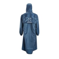
Very light, comfortable and compressible poncho. Specially designed for protection against water for any activity.

Our Atmospheric H30 poncho offers lightness and waterproofness. Easily compressible and made with our Waterproof fabric, its heat-sealed interior seams guarantee its waterproofness. Includes carrying bag.

€60,-
That's awesome thanks!!! I'm a couple months out from starting and I was looking for more maps to look at.. Also can you give a quick guide on how made that map? Thanks
 

❓How to ask a question

How to post a new question on the Camino Forum.

Similar threads

Forum Rules

Forum Rules

Camino Updates on YouTube

Camino Conversations

Most downloaded Resources

This site is run by Ivar at

in Santiago de Compostela.
This site participates in the Amazon Affiliate program, designed to provide a means for Ivar to earn fees by linking to Amazon
Official Camino Passport (Credential) | 2024 Camino Guides
Back
Top