• For 2024 Pilgrims: €50,- donation = 1 year with no ads on the forum + 90% off any 2024 Guide. More here.
    (Discount code sent to you by Private Message after your donation)

Search 69,459 Camino Questions

GPS meltdown

peregrina2000

Moderator
Staff member
I thought I would start a new thread, though this is not my first GPS meltdown thread. I was on the phone with Garmin support for one hour and ten minutes and my problem is not solved. I was trying to avoid abusing the tecchies here, but I am worse off now than before I called. I have a Garmin Dakota.

The problem that triggered my call is the same problem that I had last year two days before I started my camino. I opened the track manager and could not find any of my tracks on my gps, even though on basecamp when I connected the device to my computer, I could see that they were all there on the memory card. I got advice, and voila, those tracks appeared again on my garmin. Unfortunately I didn’t write the instructions down.

The same thing has happened now, though thankfully I am several months from departure not a few days. Garmin support was very kind and patient, but unable to help me get the trackks showing on my device. Though we could see that the tracks were there on the memory card — they showed up both on basecamp, and also in “file explorer”(??? Pushing the windows icon and the”e” key at the same time— but when they showed up on the file explorer, I didn’t see the names of the tracks like “Mozarabe 10, Granada to Pinos Puente”, like I see in basecamp, but rather just saw the tracks numbered 1 to 151.

All that has happened after our hour long conversation is that, at her direction, I have deleted all of the tracks from my memory card and will start over. But something else that she told me has left me totally confused, and she even wrote it in a follow-up email so I know I heard her right. Here is what she wrote to me:

As I mentioned, your device has a track limit of 200 saved tracks at a total of 10,000 points. Since you need to add around 40 tracks that have 500 points a piece, this will far exceed the maximum track points your device can read. Regardless of where the files are kept (on the microSD card or on the device memory), the device will only read up to this limitation.

Now, this makes no sense to me at all. What is the point of the memory card if it can’t keep a lot of tracks available for the device to read? And when she says the device will only “read” up to this limitation, what does that mean? That after reading 10,000 points the device stops reading? If she means that the device can only “store” up to that number of points, I understand that, but that’s not what she said. And I have never gotten any indication that by storing lots of tracks on my memory card, the device was overloaded or something. Last year I had way more than 10,000 points stored on my memory card (since I had all of the Mozárabe, as well as some older caminos that I hadn’t bothered to erase) and I had no problem. On my very first year of using the garmin, I didn’t understand the difference between the memory card and the device itself, and I did find that the device had erased some tracks,presumably because I was over the limit. But again, that is a storage problem, not a reading problem.

SO... I don’t even know what questions to ask, but any advice would be most welcome! Buen camino, Laurie
 
Join our full-service guided tour of the Basque Country and let us pamper you!
If your using a phone or tablet the I suggest you try Locus Maps. You can download all of Spain's IGN maps for free. Its the best map system IMO and I use it a lot without problems.
 
IANAT (I am not a techie), but I have a few thoughts:

First, you might get a better explanation if you call back and speak to another agent - The question that I would want to ask is "Are you saying that there's a limit to the number of tracks that the device can manage, regardless of storage capacity? What is that limit imposed by? By the device operating system / software?"

Second, shame on Garmin if there's a constraint in the device software that prevents it from managing the number of tracks that can be stored on a memory card.

Third, perhaps you could try storing your tracks on two separate memory cards and see if that offers a work around. MicroSD cards are a few Dollars / Euros each.
 
Last edited by a moderator:
New Original Camino Gear Designed Especially with The Modern Peregrino In Mind!
I do not know your specific device, so I can only try to provide a more general explanation.

There is a distinction between external storage capacity and internal computing capacity. The internal computing capacity is limited by Random Access Memory, processor architecture and software design unless some Virtual Memory scheme is implemented (e.g. Demand Paging).

Typically a program (an app) will read it’s data from an external storage into internal registers in order to operate on the data, and there is a limit on the amount of data that can be held by the internal registers. That may be what is meant when it is said that the device will only read up to some limitation.

So even if your external storage (SD card) can hold a large amount of data, the application/the internal registers can only handle a limited portion at a time.

One explanation I can think of that could make the application malfunction due to ‘reading too many points’ is that the individual track files somehow got messed up so the application can’t tell where the files start and end. That could also explain why you were advised to delete the track files and start over. But this is of course speculation.
 
Typically a program (an app) will read it’s data from an external storage into internal registers in order to operate on the data, and there is a limit on the amount of data that can be held by the internal registers. That may be what is meant when it is said that the device will only read up to some limitation.

So even if your external storage (SD card) can hold a large amount of data, the application/the internal registers can only handle a limited portion at a time.

So, if I am understanding you correctly, your "at a time" suggests that you think that the device should be able to read any individual track on the memory card so long as it is under the device's limit? That certainly has been my experience in the past, but that is definitely not what the Garmin person told me. Last year I used the GPS on the Mozárabe, and I had the tracks on the memory card. I had not bothered to delete the tracks from several previous years for the Ebro, Castellano-Aragonés, and Levante, so there were lots and lots of points on that memory card. But I just can´t figure out how it is even technologically possible that the device could be made in such a way that it would somehow pick 20,000 points from all the points stored on a memory card and say -- these are the points I am going to read.

I am totally confused. But, as a follow up, I have transferred all of the Olvidado tracks and a few more to the very large capacity memory card, and when I turn on the device they are all there under "current tracks." So it looks just like other years, but I am nervous. Guess I´ll just check the device periodically to see if the tracks are still there and keep my fingers crossed that they will still be there when I get to Spain!

Thanks for the help.
 
So, if I am understanding you correctly, your "at a time" suggests that you think that the device should be able to read any individual track on the memory card so long as it is under the device's limit? That certainly has been my experience in the past, but that is definitely not what the Garmin person told me.

Yes, that would be my (informed?) guess. But as the Garmin person told you otherwise, I could be wrong, but it seems logical.

But I just can´t figure out how it is even technologically possible that the device could be made in such a way that it would somehow pick 20,000 points from all the points stored on a memory card and say -- these are the points I am going to read.

The points that are picked/read form external memory would be those belonging to a specific file representing a specific track. So when you tell the device ‘show me the Olvidado track’ (or whichever command you give), the device (or actually the operating system) only reads the data (points) in that specific file.
 
The one from Galicia (the round) and the one from Castilla & Leon. Individually numbered and made by the same people that make the ones you see on your walk.
But, as a follow up, I have transferred all of the Olvidado tracks and a few more to the very large capacity memory card, and when I turn on the device they are all there under "current tracks." So it looks just like other years, but I am nervous. Guess I´ll just check the device periodically to see if the tracks are still there and keep my fingers crossed that they will still be there when I get to Spain!

That the new files now work could suggest, that the ‘old’ files that you deleted somehow got corrupted, perhaps during loading. I don’t think you need to be nervous. Once the files are loaded correctly, they should stay there and remain in working order.

Buen Camino :)
 
Laurie,

Interesting topic.. for a techie like me. :)
My first and last dedicated gps device was a Garmin eTrex in 2004. Never had big enough tracks to hit any limits, not that I did find any.

Based on your notes on Camino Mozarabe, I decided to open the file for my Camino Mozarabe kml file.

51887

Not an exact science but I estimated around 2100 track points (+- 200). Looking at the Garmin forum the limits seems to be vague depending on models. The number of points should be same even when it is converted from kml to gpx. Not sure about your Dakota but many says the limit per track is only 1000. And many says it will load only up to the maximum number of points (say 10000) and ignore anything more regardless of how many tracks/points you have in memory (base/card).

In any case, I think this is an old model (a decade ago?), so limits abound. It may help to delete unnecessary tracks from memory.

Modern smartphone with gps vs older Garmin are like modern cars vs those in the 50s, just look at the first iPhone and the current model. The biggest jump in power and abilities started for models around 5 years ago.

I have no issues with multiple offline maps on MAPS.ME app (Android/iPhone) with offline map of the whole of Spain plus a couple of Camino Tracks (kml support) on my phone I carried for my Caminos.

That said, I like tech, even older ones. Besides, there are advantages in using a more rugged dedicated device than a fragile smartphone. A downside is the 20 seconds or more to fix the location, something a smartphone is able to do in 2 seconds using cell tower signals.

If I were to use this myself I would:

  1. Only load the relevant track(s). Remove the old tracks. The limits seem to be system-wide as they say. You may be hitting one of the limits which you did not before.
  2. If it is just a simple track (without POIs) I will trim down the points with GPSBabel before loading it into the Garmin.

Prerecorded tracks usually have more points than necessary and some are not optimized. One wouldn't know how many points were used just by looking just be looking at the map overlay. But the file size is a good indicator (my Camino Mozarabe kml is around 90k for the 2100 points estimate).
 
Oh, Evan,
You are way way above my pay grade on this. I do know, however, that since I download all my tracks from wikilocs, that all are converted to 500 points. There is an option when downloading that asks you whether you want the actual number or whether you want it reduced to 500. And since I typically download only stage by stage, 25-40 kms, the 500 points is totally sufficient.

I KNOW that I should move to my phone, learn how to use maps.me and put wikilocs tracks there, but I am a real tech-phobe (you probably remember that from some of my other threads ;)). If I can get through this year with the old Garmin, I will make 2020 the year of the new technology.
 
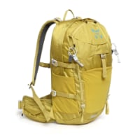
Technical backpack for day trips with backpack cover and internal compartment for the hydration bladder. Ideal daypack for excursions where we need a medium capacity backpack. The back with Air Flow System creates large air channels that will keep our back as cool as possible.

€83,-
If I can get through this year with the old Garmin, I will make 2020 the year of the new technology.

Well Laurie, Wikilocs already have their app for both iPhone and Android so you can search and download directly from the phone app. Your conversion to tech in 2020 will be a breeze. :D:D;)
 
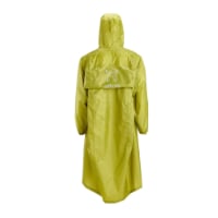
Very light, comfortable and compressible poncho. Specially designed for protection against water for any activity.

Our Atmospheric H30 poncho offers lightness and waterproofness. Easily compressible and made with our Waterproof fabric, its heat-sealed interior seams guarantee its waterproofness. Includes carrying bag.

€60,-
Laurie have you considered going to a Garmin GPS Watch? Try the Garmin Fenix X Plus. A bit pricey but has a lot of features for hiking and easy to use not much tech overload. All the world Topo maps are pre loaded and you still have access to all your tracks.
 
Oh, Evan,
You are way way above my pay grade on this. I do know, however, that since I download all my tracks from wikilocs, that all are converted to 500 points. There is an option when downloading that asks you whether you want the actual number or whether you want it reduced to 500. And since I typically download only stage by stage, 25-40 kms, the 500 points is totally sufficient.

I KNOW that I should move to my phone, learn how to use maps.me and put wikilocs tracks there, but I am a real tech-phobe (you probably remember that from some of my other threads ;)). If I can get through this year with the old Garmin, I will make 2020 the year of the new technology.

I have the same problem with my older Garmin Nuvi 750 that I originally bought to use in a car. Then all my cars started coming with an interface, built into the entertainment system, to connect my iPhone phone. That totally eliminates the need for the separate Garmin. My Garmin Nuvi is stilling in a drawer someplace collecting dust. I cannot give it away... Let me know if you want it...

However, I had the same data point limitation. I suspect, and without getting technical, that it is the circuitry in the phone can only take so big of a bite (a mouthful) of data. Beyond that, it does not compute...

Also, I suspect that this design flaw or technical shortcoming is the root of your problems with the number of waypoints, etc. This is a common flaw in most older computerized products. The processors and built in memory space was far more expensive back in the day, when these devices were produced. Over time, processors and memory got VERY cheap.

According to Moore Law, this generational progression occurs every 18 months. It has done so, fairly consistently over the past 35 years, that personal computing products have been available. This relates to continual improvement in design and manufacturing capabilities to produce smaller, faster, and cheaper processor chips and related circuits...but I digress...

For example, consider that the Apollo 11 moon mission 50 years ago this year, used a total computing power that was about what is in an Apple watch or similar... and certainly FAR less power than in any smartphone...

Today, your smart phone, Android or Apple will run circles around any dedicated GPS, with the correct app installed, and the appropriate data tracks loaded. The SOLE exception is if you find yourself somewhere on earth without near enough cellular service towers to provide consistent service.

It is the satellite navigation feature that makes dedicated GPS units invaluable anywhere on earth. Fortunately, on virtually any Camino route I am aware of, cellular service is always available. There ARE a few dead spots here and there. We have all experienced them. But they do not hinder navigation or lead you astray. The yellow arrows fill in those blanks quite nicely...

So, the bottom line... Dedicated, satellite-based GPS units excel in very remote areas, on the ocean, a remote battlefield, or in the mountains where there is no cellular service. They can literally be lifesavers. Also, true in this paradigm, waypoints can be few and far between if they point you in the correct direction to your destination.

On the other hand, modern smartphones excel at navigation where there are many waypoints and frequent points of interest or places to mark. They are ubiquitous and handy. I refer to them as the Swiss Army Knife of electronics. There are so many apps available for so many things, and the phones are able to do so many varied things, that they have become invaluable. About the only thing my iPhone cannot do is open a beer bottle cap...

Hope this helps.
 
The focus is on reducing the risk of failure through being well prepared. 2nd ed.
I just KNEW that someone would have the solution. Actually, I DO carry a bottle opener on my tiny Gerber Dime Travel multitool.

My reference was for alliteration...

That said, THANK YOU for the assist. I knew I could count on you guys...
 
The 2024 Camino guides will be coming out little by little. Here is a collection of the ones that are out so far.
The app TrailSmart. If you have internet connection and are willing to use data the tracks are free, otherwise you can download the Frances for $20 and use the tracks offline (no internet required). They also have the Finisterre, Portuguese and Primitivo tracks. Inexpensive and very useful. Although you'll have to get accustomed to their interface as there is a lot there beyond the tracks and map including information of the albergues, etc.
 
Ideal pocket guides for during & after your Camino. Each weighs only 1.4 oz (40g)!
Well, thanks to everyone, I have learned a lot, the most interesting being that it would probably be much easier to use my phone than my Garmin. And that even a tech dolt like me could do it! I am tempted to try it out. I have an old iphone, though, which is currently showing less than 1GB available. So I am going to hazard a guess that I would need a new phone to be able to get all the stuff, including the topo maps, on my phone. So maybe the camino gods want me to continue with the ancient technology I have for another year.
 
I thought I would start a new thread, though this is not my first GPS meltdown thread. I was on the phone with Garmin support for one hour and ten minutes and my problem is not solved. I was trying to avoid abusing the tecchies here, but I am worse off now than before I called. I have a Garmin Dakota.

The problem that triggered my call is the same problem that I had last year two days before I started my camino. I opened the track manager and could not find any of my tracks on my gps, even though on basecamp when I connected the device to my computer, I could see that they were all there on the memory card. I got advice, and voila, those tracks appeared again on my garmin. Unfortunately I didn’t write the instructions down.

The same thing has happened now, though thankfully I am several months from departure not a few days. Garmin support was very kind and patient, but unable to help me get the trackks showing on my device. Though we could see that the tracks were there on the memory card — they showed up both on basecamp, and also in “file explorer”(??? Pushing the windows icon and the”e” key at the same time— but when they showed up on the file explorer, I didn’t see the names of the tracks like “Mozarabe 10, Granada to Pinos Puente”, like I see in basecamp, but rather just saw the tracks numbered 1 to 151.

All that has happened after our hour long conversation is that, at her direction, I have deleted all of the tracks from my memory card and will start over. But something else that she told me has left me totally confused, and she even wrote it in a follow-up email so I know I heard her right. Here is what she wrote to me:

As I mentioned, your device has a track limit of 200 saved tracks at a total of 10,000 points. Since you need to add around 40 tracks that have 500 points a piece, this will far exceed the maximum track points your device can read. Regardless of where the files are kept (on the microSD card or on the device memory), the device will only read up to this limitation.

Now, this makes no sense to me at all. What is the point of the memory card if it can’t keep a lot of tracks available for the device to read? And when she says the device will only “read” up to this limitation, what does that mean? That after reading 10,000 points the device stops reading? If she means that the device can only “store” up to that number of points, I understand that, but that’s not what she said. And I have never gotten any indication that by storing lots of tracks on my memory card, the device was overloaded or something. Last year I had way more than 10,000 points stored on my memory card (since I had all of the Mozárabe, as well as some older caminos that I hadn’t bothered to erase) and I had no problem. On my very first year of using the garmin, I didn’t understand the difference between the memory card and the device itself, and I did find that the device had erased some tracks,presumably because I was over the limit. But again, that is a storage problem, not a reading problem.

SO... I don’t even know what questions to ask, but any advice would be most welcome! Buen camino, Laurie
If you carry a phone, then use the GPS in your phone with a mapping app (I use GaiaGPS). App costs abt $20. One less thing to carry.
 
I thought I would start a new thread, though this is not my first GPS meltdown thread. I was on the phone with Garmin support for one hour and ten minutes and my problem is not solved. I was trying to avoid abusing the tecchies here, but I am worse off now than before I called. I have a Garmin Dakota.

The problem that triggered my call is the same problem that I had last year two days before I started my camino. I opened the track manager and could not find any of my tracks on my gps, even though on basecamp when I connected the device to my computer, I could see that they were all there on the memory card. I got advice, and voila, those tracks appeared again on my garmin. Unfortunately I didn’t write the instructions down.

The same thing has happened now, though thankfully I am several months from departure not a few days. Garmin support was very kind and patient, but unable to help me get the trackks showing on my device. Though we could see that the tracks were there on the memory card — they showed up both on basecamp, and also in “file explorer”(??? Pushing the windows icon and the”e” key at the same time— but when they showed up on the file explorer, I didn’t see the names of the tracks like “Mozarabe 10, Granada to Pinos Puente”, like I see in basecamp, but rather just saw the tracks numbered 1 to 151.

All that has happened after our hour long conversation is that, at her direction, I have deleted all of the tracks from my memory card and will start over. But something else that she told me has left me totally confused, and she even wrote it in a follow-up email so I know I heard her right. Here is what she wrote to me:

As I mentioned, your device has a track limit of 200 saved tracks at a total of 10,000 points. Since you need to add around 40 tracks that have 500 points a piece, this will far exceed the maximum track points your device can read. Regardless of where the files are kept (on the microSD card or on the device memory), the device will only read up to this limitation.

Now, this makes no sense to me at all. What is the point of the memory card if it can’t keep a lot of tracks available for the device to read? And when she says the device will only “read” up to this limitation, what does that mean? That after reading 10,000 points the device stops reading? If she means that the device can only “store” up to that number of points, I understand that, but that’s not what she said. And I have never gotten any indication that by storing lots of tracks on my memory card, the device was overloaded or something. Last year I had way more than 10,000 points stored on my memory card (since I had all of the Mozárabe, as well as some older caminos that I hadn’t bothered to erase) and I had no problem. On my very first year of using the garmin, I didn’t understand the difference between the memory card and the device itself, and I did find that the device had erased some tracks,presumably because I was over the limit. But again, that is a storage problem, not a reading problem.

SO... I don’t even know what questions to ask, but any advice would be most welcome! Buen camino, Laurie
While I like a good gadget I do not think I would bother to carry a device and charger for the Frances. The route is so easy to follow one could almost do it blindfolded!!
 
Down bag (90/10 duvet) of 700 fills with 180 g (6.34 ounces) of filling. Mummy-shaped structure, ideal when you are looking for lightness with great heating performance.

€149,-
Well, thanks to everyone, I have learned a lot, the most interesting being that it would probably be much easier to use my phone than my Garmin. And that even a tech dolt like me could do it! I am tempted to try it out. I have an old iphone, though, which is currently showing less than 1GB available. So I am going to hazard a guess that I would need a new phone to be able to get all the stuff, including the topo maps, on my phone. So maybe the camino gods want me to continue with the ancient technology I have for another year.

If you have ANY smart phone running the Apple iOS or a version of the Android operating system (OS) you should be good to go. Older phones using earlier cellular technologies do not have the ability to handle these apps.

As a general statement, if your cell phone has a color, touch-sensitive screen and you can type a text message on a tiny keyboard, your cell phone should be useable as described in this thread. I am only using this to establish the relative generation of the cell phone.

The other requirement is that your cell phone uses a cellular 'data' connection for downloading information, e-mail, apps, or accessing the internet. If you can do these things, you likely have enough resource to handle some of the GPS-like apps available.

Again, if in doubt...ask a younger person who may be more 'up' on the technology. I am not proud. I sometimes stroll into my local Best Buy electronics store and simply ask one of the young sales clerks for an explanation on something I don't understand. It is easier than going into the local cell phone store...they always want to sell me something.

To verify, ask a young 'un...;) Children or grand kids . nephews are good resources for this. if like me, you do not have these, use the electronic store gambit that I use.

Hope this helps...
 
€2,-/day will present your project to thousands of visitors each day. All interested in the Camino de Santiago.
When you upgrade your phone @peregrina2000 consider seeing if there is a local geocaching group. These groups hide caches of trinkets and your job is to find them and add or swap your trinket. Go with someone experienced and start asking GPS questions.
 
Ideal sleeping bag liner whether we want to add a thermal plus to our bag, or if we want to use it alone to sleep in shelters or hostels. Thanks to its mummy shape, it adapts perfectly to our body.

€46,-
"Thank God for the yellow arrows"!!
Please, whatever happens, do not remove the yellow arrows!

In my experience yellow arrows are generally good from Roncesvalles to Compostela (CF)

My experience on other routes, for example Via Francigena (VF) seeing signage in any form is so rare it can be an excuse for a celebration.
 
This might be off-the-mark because I've only skim-read the thread, so apologies if so. It does indeed seem a very poor limitation of this GPS that it can't handle so many points. I've encountered similar hard limits with MP3 players which had the capacity for thousands of albums but a hard limit of how many it was prepared to index.

Anyway, my point was that GPS trails are a vector which can be smoothed and simplified, often without losing much. There is some software out there that will simplify your GPS trails into half as many points. A quick Google turned up this, for instance:

If you could shrink your trails you wouldn't bump up against the limit.
 
You can do that on the Frances. How about the many other caminos where you are likely to be alone and where there are not enough yellow arrows?!
I have walked 5 different Caminos. The only camino that I had some problems with was from Le Puy. The reason for that is that in France a lot of times there are just little strips on posts that are easy to miss if you are not paying attention. I did miss some of those as the walk was so beautiful and I was completely out of my head in terms of concentration. There was none! I love it when my mind goes blank like that. But I rarely ever had any problems with the other Caminos I have walked.
 
The 2024 Camino guides will be coming out little by little. Here is a collection of the ones that are out so far.
That works for the most well known Caminos, but @peregrina2000 walks the lesser trod paths. 🙂
Check out what I wrote to Pelerine. I can only go by my experience. I think and I have a feeling you may agree that as you start to walk more and more you develop a 6th sense a lot for what is the right path. It doesn't always work and of course we can all get lost once in a while but for me it is all part of the walk. I guess I am pretty Spartan about everything on my Caminos. I don't take a lot and think a whole lot less is a whole lot more when I am on the Camino. I will admit on the Norte last year I had the wise pilgrim app that has a good mapping system that I checked out a few times to find some alternate adventures. Some of them were really nice and some of them not so much! Have a good day Trecile and maybe I will see you one day at a cafe somewhere. Next stop Via De La Plata. in 6 to 12 months. I think if I just keep going north I will be ok for most of it hahaha
 
Hi Laurie, can you tell me what wikiloc track you want to use? If the amount of waypoints is the problem, I can try to lower this amount and send it to you. With less waypoints it is usually no problem to find your way, the only thing is that the track is not exactly following the the road, but hits here and there the road you need to take. You then still know where to go.
A manual to put maps.me and a track into your Iphone you can find here.
 
Last edited:
While GPS tracks may not be needed for following well-marked trails, for anyone planning to use the Wikloc app to help when walking connecting trails between two caminos or to get to alternate accomodation, etc., here are some things we have found helpful:
  • No other apps needed: all you need is the wikiloc app itself. You do not need to transfer the tracks to another app to use them.
  • No wifi or cell needed: the GPS part of the app works without needing a wifi or cell connection.
  • Battery: we keep our phone in airplane and low power mode when using wikiloc out on the trail. It lasts all day.
Once you have the Wikiloc app on your phone, the following steps will make a track available for offline use:
  1. Open the desired track on the phone when you are in a place where you have wifi available.
  2. Scroll to the bottom of the screen and click on "Save Trail". This downloads the track to your phone and it is now available for offline use.
To use the track on the trail:
  1. Open Wikiloc and click on Profile at the bottom of the screen.
  2. Select the trail you want from the "Saved Trails" list.
  3. Click on "Follow Trail." The blue dot will give you your precise location without needing access to cell or wifi.
 
3rd Edition. More content, training & pack guides avoid common mistakes, bed bugs etc
I thought I would start a new thread, though this is not my first GPS meltdown thread. I was on the phone with Garmin support for one hour and ten minutes and my problem is not solved. I was trying to avoid abusing the tecchies here, but I am worse off now than before I called. I have a Garmin Dakota.

The problem that triggered my call is the same problem that I had last year two days before I started my camino. I opened the track manager and could not find any of my tracks on my gps, even though on basecamp when I connected the device to my computer, I could see that they were all there on the memory card. I got advice, and voila, those tracks appeared again on my garmin. Unfortunately I didn’t write the instructions down.

The same thing has happened now, though thankfully I am several months from departure not a few days. Garmin support was very kind and patient, but unable to help me get the trackks showing on my device. Though we could see that the tracks were there on the memory card — they showed up both on basecamp, and also in “file explorer”(??? Pushing the windows icon and the”e” key at the same time— but when they showed up on the file explorer, I didn’t see the names of the tracks like “Mozarabe 10, Granada to Pinos Puente”, like I see in basecamp, but rather just saw the tracks numbered 1 to 151.

All that has happened after our hour long conversation is that, at her direction, I have deleted all of the tracks from my memory card and will start over. But something else that she told me has left me totally confused, and she even wrote it in a follow-up email so I know I heard her right. Here is what she wrote to me:

As I mentioned, your device has a track limit of 200 saved tracks at a total of 10,000 points. Since you need to add around 40 tracks that have 500 points a piece, this will far exceed the maximum track points your device can read. Regardless of where the files are kept (on the microSD card or on the device memory), the device will only read up to this limitation.

Now, this makes no sense to me at all. What is the point of the memory card if it can’t keep a lot of tracks available for the device to read? And when she says the device will only “read” up to this limitation, what does that mean? That after reading 10,000 points the device stops reading? If she means that the device can only “store” up to that number of points, I understand that, but that’s not what she said. And I have never gotten any indication that by storing lots of tracks on my memory card, the device was overloaded or something. Last year I had way more than 10,000 points stored on my memory card (since I had all of the Mozárabe, as well as some older caminos that I hadn’t bothered to erase) and I had no problem. On my very first year of using the garmin, I didn’t understand the difference between the memory card and the device itself, and I did find that the device had erased some tracks,presumably because I was over the limit. But again, that is a storage problem, not a reading problem.

SO... I don’t even know what questions to ask, but any advice would be most welcome! Buen camino, Laurie


Somehow pilgrims got to their destination with no maps let alone gps. Still, it’s kinda nice having an idea where your next bunk bed is located. Maps. Me works fine and doesn’t require data. Triangulation to down loaded maps and waypoints is accurate within meters.
 
Just a general observation I want to make: it is funny/peculiar how a simple (?) technical question Laurie asked has brought answers which do nothing to contribute to the solution of her technical problem. Poor Laurie! Why did you ask the question? Couldn’t you have thought of buying a map and simply following the arrows? How on earth did you become a moderator?
Which is an oportunity for me to thank you for all the info you have fed to this community when we are lost, beautiful alternatives to yellow arrows sending us along busy roads (eg on the Norte). Oh dear, I have transgressed (?) writing what has nothing to do with this thread. I apologise and will shut up for good now....
 
Get a spanish phone number with Airalo. eSim, so no physical SIM card. Easy to use app to add more funds if needed.
When we last discussed this, I had not been able to determine how Garmin dealt with the track/trackpoint limit. It is not one that I had met nor expected to meet. My best understanding is that once the limit is reached, older tracks are moved to the archive to make way for new tracks as they are recorded. I am still not certain how they handle tracks that are downloaded.

What I have found is that on the Garmin eTrek 30, which has a very similar operating system to yours, you can move a track back from the archive to being active by going to the archives, opening a track and then setting it as a favourite. On my GPS the sequence is:
  1. From the main menu, select Track Manager
  2. Select Archived Tracks
  3. Select the track you want to make active
  4. Select Make Favorite
How might this help? If you archive your existing selection of tracks, you can then selectively return them to active status using this approach. The sequence for archiving a track in the active store is:
  1. Select Track Manager from the main menu
  2. Scroll down the track that you wish to archive and select it
  3. Scroll down to Archive and select that option
  4. That track will no longer be listed with the active tracks but will be listed under Archived Tracks
This can all be done on the device, and seems to operate smoothly, but I would suggest you try it out beforehand on something you can afford to lose to ensure that it is working in the same way on your device.

In summary:
  1. move enough of your existing active tracks to the archive to make room for any new tracks.
  2. move these to the archive as well
  3. selectively move one or more tracks to active status from the archive as you need them
  4. return them to the archive when they are no longer required.
Note that I haven't found any limits on the archive, but then I don't ever recall having quite as many tracks on it as you might have.
 
Just a general observation I want to make: it is funny/peculiar how a simple (?) technical question Laurie asked has brought answers which do nothing to contribute to the solution of her technical problem. Poor Laurie! Why did you ask the question? Couldn’t you have thought of buying a map and simply following the arrows? How on earth did you become a moderator?
Which is an oportunity for me to thank you for all the info you have fed to this community when we are lost, beautiful alternatives to yellow arrows sending us along busy roads (eg on the Norte). Oh dear, I have transgressed (?) writing what has nothing to do with this thread. I apologise and will shut up for good now....
Yes Pelerine,
Well said.
Laurie is indeed a trailblazer for the Camino paths
You know the ..."To boldly go where no one has gone before" quote.

She is the guidebook!!

We are off to the Invierno in June ...and without Lauries 2019 download we wouldn't even think about doing it.
Same as when we walked the Salvidor last year ...so much effort in the download i from Laurie, Ender, Rebekah and another lady.

We've walked many Mountains....and Caminos but are very good at getting lost too although in our younger years this never bothered us and we were always able to get out of a jam...somehow!
And we never planned too much back then.

Now, it's different with advancing age and so many more walking the various caminos and I'm not ashamed to say that we couldn't ...or wouldn't walk this Invierno without Lauries help......

And the information posted by other forum members who post here

Also forum members sending in any changes or new information gained on their walks greatly helps to keep the yearly downloads updated

So thank you all and best wishes
Annette
 
I too am very grateful for Laurie's GPS tracks. My second camino was in Catalonia, inspired by Laurie's account, and I would not have had the confidence to walk without her Wikilocs track. I only ever really needed them once, but they were brilliant to have with me.

Slightly off topic, a few years ago there were regular news items in the UK, when people required rescuing in areas like the Lake District. They had gone out into the hills with only a phone to guide them, and been totally lost when the cloud came down and they realised they had no phone signal. And on the Le Puy route last summer, there were a number of places where there was no phone signal. There are places where a phone is no use.
 
Ideal pocket guides for during & after your Camino. Each weighs only 1.4 oz (40g)!
Here's a bit of information that, unfortunately, won't help Laurie with her Garmin, but that might be of use to those of you thinking of using your smartphones as a GPS and worrying about areas without cell reception:

Happily, even when there is no signal available for making phone calls, a smartphone continues to function as a GPS. This article explains how a smartphone communicates with GPS satellites to get your location without wifi or cell, just the same as a conventional handheld GPS like a Garmin. http://www.adventurealan.com/iphone-gps-map-backpacking/
 
Sorry this has gotten a bit off-topic.Thanks for the support :) I have developed a pretty thick skin when it comes to GPS comments. I know that every time I ask a GPS question, it is likely to provoke some of these comments. I get it, I know that there are people who are vehemently opposed to using them, and I know that medieval pilgrims didn’t use them. If anyone ever asked me, I would say you absolutely don’t need a GPS on the Francés, Vdlp, Norte (unless you want to do some of the stunning coastal alternatives, which you will not be able to find without a GPS), Portugués. But some people have them and use them on those caminos, really none of my business.

I too have tried to develop a sixth sense and I don’t rely on my GPS unless necessary, but I have to say that there have been several times out alone on remote caminos when I would have really been in a pickle without it. On the Castellano-Aragonés, which I remember oh so well, I would have been totally unable to find my way. I was walking in what was essentially a bowl of undulating ridges. No roads, no tractor paths, no people or buildings of any sort. Lots of scrub plants. I was, I estimated, about 6-8 kms from Tarazona. If I had not had my GPS, I can’t even imagine how long it would have taken me to find a road. But with the GPS I climbed out in one direction, went down and around, and voilá found my way into town.

On the Olvidado, about 4 km off road at an old abandoned mine site, there were no arrows, lots of paths, nothing to indicate which way to go. My GPS saved me from having to go back to the road. Of course I am not sure what I would have done back at the road, because the Camino did leave from the abandoned mine site and was not along the road. But I never would have found it without the GPS. Saying it’s just part of the camino might have been some people’s reaction to these and other incidents I’ve had, but I am not willing to walk alone and cross my fingers that I don’t get hopelessly lost. And another important point is that very few local people have any idea where these paths are. If you ask them how to get to the next town you know is on the Camino, they will send you on the road, no doubt about it.

Anyway, I don’t mean to belabor this point, and I am sorry because I know I sound defensive. As I said, I certainly respect anyone who walks without one, and you are of course entitled to have strong opinions about them. But I hope you understand why I will continue to use them, and unfortunately, since I am such a tech idiot, I will continue to ask questions about them! Buen camino, Laurie
 
When we last discussed this, I had not been able to determine how Garmin dealt with the track/trackpoint limit.

Oh that made me giggle — Doug is one of the most patient tech support people I have ever “met.” Thank you so much for all your help. I have deleted all tracks except those for the upcoming Vasco mountain alternatives and Olvidado. That should be fine. But I promise that next year I am going to have a new phone and learn how to use it!

For some of Doug’s limitless patience —


I think I’d say Doug is the Dave Bugg of GPS.
 
Last edited:
A guide to speaking Spanish on the Camino - enrich your pilgrim experience.
But I promise that next year I am going to have a new phone and learn how to use it!
Walking the S:t Olavsleden in 2018, I carried my ETrek 30 loaded with Open Street Maps map sets of Sweden and Norway and tracks from the S:t Olavsleden web site, and a Samsung Android with the OSMAnd+ app, various country maps in Europe, etc.

The phone's larger screen size was always a small advantage, but anytime I used the phone in track logging mode, it turned into a power hungry demon. Noting that track logging is one of my key reasons for carrying a GPS, I will still be carrying my Garmin for this purpose. I typically got at least two days from one set of batteries, often three for shorter days.

With track logging turned off, using the phone just for checking location was time consuming as it needed to re-synch with the GPS satellites. This might have been an internal setting, as I don't get this effect when I am using the OSMAnd+ app on my new phone here at home.

I also use the Garmin epix as a sports watch. It has plenty of nice features, but completely unsuitable for the sort of multi-day walking I do here without carrying something like a solar charger and battery bank, and I am trying to avoid that.

No doubt the phone apps will improve, as will the functionality provided by dedicated GPS devices and sports watches. At this stage and for my purposes, phones still have some way to go before they replace even a somewhat older dedicated GPS.
 
With track logging turned off, using the phone just for checking location was time consuming as it needed to re-synch with the GPS satellites. This might have been an internal setting, as I don't get this effect when I am using the OSMAnd+ app on my new phone here at home.
You probably know this already Doug but (1) in case you don't and (2) in case others don't --- as I understand things the phone attempts to use cellular tower signals to get a rough idea of where it is to speed up calculations with the GPS satellite data. Perhaps the phone used in Sweden was in airplane mode or it wasn't in range of cell towers.

Or maybe you mean slow because you had to boot the phone, login and start the app.
 
Get a spanish phone number with Airalo. eSim, so no physical SIM card. Easy to use app to add more funds if needed.
A big thumbs up for OSMAnd+, really useful, cost-effective and relatively intuitive GPS program. Simple to add downloaded camino tracks and the Open Street Maps have great layers of information about lodging, transport, shops, ATMs etc. I also use 'MapMyWalk' which is so handy (and not at all power hungry) for making daily trails. I also like it when the 'posh bird in my pocket' tells me when I have completed another km and what my split pace was - helps me maintain a generally stable pace throughout the day. Three cheers for these clever programs and aids which don't add a single gramme to the weight of my mobile phone :)📱👍
 
You probably know this already Doug but (1) in case you don't and (2) in case others don't --- as I understand things the phone attempts to use cellular tower signals to get a rough idea of where it is to speed up calculations with the GPS satellite data. Perhaps the phone used in Sweden was in airplane mode or it wasn't in range of cell towers.

Or maybe you mean slow because you had to boot the phone, login and start the app.
That's a good question and I can only speculate about whether it was Samsung's configuration, the setup of OSMAnd+ or something else. The phone was not in airplane mode, and did have location services enabled. If OSMAnd+ was recording a track, it would open up already tracking satellites and quickly adjust the map to show my current location. If not, when it opened, it wasn't sync'd with any satellites, and went through the process of acquiring them. The time it took for that varied, and in the overall scheme of things, probably didn't take all that long. But it was noticeable.
 
Laurie, I've been playing around with Wikioc's new "Premium" features for a few weeks and just noticed that one of them is for simplifying sending routes to a Garmin. The exact wording is:
Send to your Garmin
Download trails from Wikiloc to your Garmin in the easiest way possible!
Feature available for compatible Garmin devices.
I can't try it out because I no longer have a Garmin, but I wonder if this could be of help to you. The implication seems to be that you can now send tracks directly to a Garmin. I suppose the key word here is "compatible" Garmin, though.
 
Ideal pocket guides for during & after your Camino. Each weighs only 1.4 oz (40g)!

Most read last week in this forum

Greetings all. I was scheduled to start in Porto in a few days. Went for a 20 km hike yesterday (my longest thus far) and almost didn’t make it. By the time I got home, I could hardly walk...
I have a confession. I am terrified of - and yes now feel free to laugh - the top bed in bunks with no railing/fence (something to stop you falling out). I've managed to get away with it except...
This is the latest fad for Camino stay out of the wind and woods 🤗.
One way or another, you need to see this movie! We were lucky enough this evening to attend the 'World Premiere' that was followed by a Q&A Session with: Writer / Director / Producer - Bill...
Did it make a difference in your short term, long term and lifetime? Did it change your soul..or chain it forevermore to some dusty track in Spain Are you in the ever present because of it, or...
Yes, pardon me. So I've just read this cool article about the closing of the Puerta del Perdón in the Monastery of Santo Toribio for the holy year (and it is a very beautiful peurta for sure). It...

❓How to ask a question

How to post a new question on the Camino Forum.

Similar threads

Forum Rules

Forum Rules

Camino Updates on YouTube

Camino Conversations

Most downloaded Resources

This site is run by Ivar at

in Santiago de Compostela.
This site participates in the Amazon Affiliate program, designed to provide a means for Ivar to earn fees by linking to Amazon
Official Camino Passport (Credential) | 2024 Camino Guides
Back
Top