• For 2024 Pilgrims: €50,- donation = 1 year with no ads on the forum + 90% off any 2024 Guide. More here.
    (Discount code sent to you by Private Message after your donation)
  • ⚠️ Emergency contact in Spain - Dial 112 and AlertCops app. More on this here.

Search 69,459 Camino Questions

Gradient of climb out of Betanzos?

Jo Rutter

New Member
Time of past OR future Camino
Camino Inglés (2015)
Hi all,
I've done a forum search for this answer, and not come up with anything specific yet , so I'm hoping someone more skilled at interpreting those elevation charts of the camino stages can help me.
As the weather is still intermittently wet and gloomy here in England, I've been training on a treadmill on rainy days. I've been setting it at a gradient of 10% to simulate uphill walking, but would like to set it to the actual gradient if I could, just so I can get an idea of what I'm in for! Can anyone advise? I don't mean the gradient of the entire rise from Betanzos to Bruma, just the gradient of the first (worst) main hill that reportedly takes about 45 minutes to climb. 'Steep' means different things to different people ;-)

Thanks -
Jo
 
The focus is on reducing the risk of failure through being well prepared. 2nd ed.
I've done this route 3 times now, and I would guess the hard part - after Bar Julia - is about 1 in 3 gradient. It is STEEP.:(
I've driven up hills in the Lake District of 1 in 3, (Wrynose Pass etc), but this is steeper.
 
New Original Camino Gear Designed Especially with The Modern Peregrino In Mind!
Approximate formula:

100m height difference on a distance of 1000m = 10% gradient

Complicated formula:

100 * height difference / root of (distance^2 - height difference ^2) = gradient

Have fun calculating! SY
 
The worst kilometer on the climb out of Betanzos (between kilometers 8 and 10 on Ivar's profile) is around 11% average (if I'm not wrong) while the worst kilometer on the climb between Vilacoba and Vizoño (between kilometers 22 and 24 on Ivar's profile) is around 16% average, once again, if I'm not wrong.
 
Last edited by a moderator:
Join our full-service guided tour and let us convert you into a Pampered Pilgrim!
Jo - I have a method that could provide this info, but you will need to do some work. Go to the RideWithGPS site and select Plan. You will need a starting point, and it recognized Mino, Spain for me. When it asks if you want that as your starting point, say no, and then find where on the map you want to start graphing and click.

If you select OSM Outdoors from the Map dropdown in the top right corner; it displays the Camino route as a dotted red line. I tried to locate Bar Julia, but it turned out my search had found one near Barcelona. I'm guessing we're talking about the stretch between Km's 9-10 on the profile that Ivar pointed to, but the grade at Km 22 looks about the same.

Basically, you want to plot the route so RWGPS will show you the elevation profile at the bottom with a calculated %. Although OSM shows the Camino route, it is not part of the Google package that RWGPS licenses, so you cannot automatically follow (snap to) it. Zoom in on the segment you want to plot while looking at OSM, and use the Draw Lines function. The more waypoints you provide, obviously the greater accuracy. Since you only want a small section, start and end where you wish.

===>>> IF - any of you can give me the town names around the desired segment I will do this. There is a learning curve in RWGPS.

I saw Betanzos on the maps, but not Bruma.

Charles
 
Noting that there will be some variation due to the nature of GPS tracks, it took me about 45 min from leaving the albergue at Bentanzos to cross the road marked in OSM as A-6. This had an average gradient of under 4%, and was around an average 10% for the 1.2 km between the N-V1 and A-6. The maximum gradient according to Google Earth for that section is about 19%.

The steepest slope if you use Google Earth was a stretch of 2km just after Bar Julia, at an average of about 11% but a maximum slope around 25%.
 
New Original Camino Gear Designed Especially with The Modern Peregrino In Mind!
I actually found this etapa less hard than the walk out of Pontedeume...
http://caminodesantiago.consumer.es/etapa-de-pontedeume-a-betanzos
Might be because the walk to Bruma is on unpaved roads. Yes it is very steep but less hard for the feet...
And the cold beer in Bruma is very welcome indeed!
I also felt this was the more difficult walk. When I transferred my GPS track for the leg Pontedeume to Bentanzos to Google Earth, I found not only was I slower that day, it was just a little steeper on some of the climbs.
 
IF - any of you can give me the town names around the desired segment I will do this.

If the maps are the same than those of Google Maps:
  • for the climb out of Betanzos, choose Praza Galicia (Galicia Square) in Betanzos as starting point and the most Southern part of Rúa Couto as ending point (or alternative, choose the point where the 'prolongation' of Rúa Couto cross the Railway). Verify the route goes through Rúa Rollo and not through Avenida Jesús García Naveira.
  • for the (hardest part of the) second climb, look for Vilacova, Abegondo, La Coruña and Vizoño, Abegondo.
 
Thanks for the info Castilian -

I used the OSM Outdoors map as it displays the Camino route. You can select from multiple map (and satellite) backgrounds in the upper right corner.

Unlike at Mino, I was able to snap to the Camino here, eliminating the need to draw lots of very short lines.

http://ridewithgps.com/routes/7032293

Based on this, the first climb is 3/4 of a mile at a fairly steady 8-12 %.

http://ridewithgps.com/routes/7032263

The hardest part is the 1/4 mile zig-zag in the woods, varying from 16-19%, with some 15% at each end of this.

Mousing over either the map or the elevation profile will display the corresponding point on the other.

I've cycled up some 20-25% grades in the Lake District, but (thankfully) wasn't near any 30% ones.

Charles
 
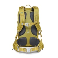
Technical backpack for day trips with backpack cover and internal compartment for the hydration bladder. Ideal daypack for excursions where we need a medium capacity backpack. The back with Air Flow System creates large air channels that will keep our back as cool as possible.

€83,-
This is 9/10 of a mile after Julia, and it has just quickly increased from 10 to 15%, and you can see that it is still steeper ahead.

This is also where the camera car decided to turn around.

nine-tenths of a mile after Julia.jpg
 
Muchas gracias, everyone, this is all extremely helpful! I was much alarmed by Ivar's map, until I realised the huge difference in the horizontal and vertical scales. It looks like it's doable after all - not really any steeper than some of the climbs I've done on the Wainwright Coast-to-Coast path in England. Charles, Castilian, and DougFitz, I'm especially grateful for your very detailed breaking down of the path into segments - to know that you've only got about 1/4 mile (say) of 19% grade at a time makes it seem much more manageable. And the photo helps immensely to visualise it. I'm going to try that tracking site myself. Thanks for the warning about the stage out of Pontedeuma, Sabine. Forewarned is forearmed, as they say. I'll certainly be grateful for cold beers after all of these climbs!
 
hola, Jo -

Here is Pontedeume to Betanzos.

http://ridewithgps.com/routes/7033071

Sabine's link made the initial climb look longer and tougher than it actually seems to be (said from the perspective of not having to walk it ;-) - about one mile total, with the middle two tenths at around 13% - never at 14 or over.

Some more visualization for you - at .3, .4, .5, .6, and .7 miles from the traffic roundabout. You can see it leveling off at the top of the last image.

Pontedeume at .3 mile.jpg Pontedeume at .4 mile.jpg Pontedeume at .5 mile.jpg Pontedeume at .6 mile.jpg Pontedeume at .7 mile.jpg

I've found that RWGPS does seem to track to the Ingles, especially if you zoom in closely enough so it doesn't get distracted by nearby roads, which might be what happened earlier. One tip - click between intersections, not at or near them. If you give it a chance to do other than what you want, it likely will.

It also wants to always select the shortest route, so work zoomed in with frequent control points and verify what it plots - it not what you wanted, you can frequently just drag the line over, but before this you need to remove control points from the segment you're moving, and I suggest adding them just outside that section, to control the scope of the change.
If you want to try a what-if scenario after creating (and Saving) a route, you can Save As New from the original and then modify selected segments.

It has a few quirks, but I've come to love it for letting me lay out a route very quickly and accurately.

The site is designed for cycling, but it works equally well for walks, although you may need to Draw Lines in some cases.

Carlos
 
Get a spanish phone number with Airalo. eSim, so no physical SIM card. Easy to use app to add more funds if needed.
Sabine's link made the initial climb look longer and tougher than it actually seems to be (said from the perspective of not having to walk it ;-) - about one mile total, with the middle two tenths at around 13% - never at 14 or over.
Using my GPS track and exporting it to Google Earth gives a slightly different perspective. It was 1.75 km with a climb of 160 m, an average slope of about 9% and a maximum slope of 19%.
 
A selection of Camino Jewellery
The Gronze profiles are less daunting as they seem to be more spread out :)
We too found the climb out of Pontedeume more difficult than the climb after Casa Julia. The one out of Betanzos we don't remember as a climb. Hope that is true this year too ;).
We think that by staying in Cabanas and starting from there we might find it easier than the 'cold' start - and then straight uphill - from the river side in Pontedeume itself.
 
I go along with you Tia. I found the cold start from Pontedueme hard going as did two 20 something year old Italian girls struggling up at the same time. It didn't help that in the early dawn we missing the road arrow off to the right and walked up to the main road and then back down to the turn to continue more up! I was lucky that when I walked up to Bruma the bar after Bar Julia was open. Oh how lovely were those two Caz Limons chased by that ice-cream! :):):)
 
Sadly we hear that the bar at Vizono has closed down (retired) - we stopped there too. If anything changes then I hope that folk post about it.
 
Join our full-service guided tour of the Basque Country and let us pamper you!
I must say I find it rather difficult to understand this obsession with gradients, and the calculations thereof. I mean, we're going to walk it, aren't we, regardless of whether it's 10% or however many metres rise per kilometre.
When the steep bits come, then just get into bottom gear and trudge on.
I can average about 5kph on the flat, but am really really slow climbing hills - locals on crutches sail past me.:)
 
Very light, comfortable and compressible poncho. Specially designed for protection against water for any activity.

Our Atmospheric H30 poncho offers lightness and waterproofness. Easily compressible and made with our Waterproof fabric, its heat-sealed interior seams guarantee its waterproofness. Includes carrying bag.

€60,-
Jo - I have a method that could provide this info, but you will need to do some work. Go to the RideWithGPS site and select Plan. You will need a starting point, and it recognized Mino, Spain for me. When it asks if you want that as your starting point, say no, and then find where on the map you want to start graphing and click.

If you select OSM Outdoors from the Map dropdown in the top right corner; it displays the Camino route as a dotted red line. I tried to locate Bar Julia, but it turned out my search had found one near Barcelona. I'm guessing we're talking about the stretch between Km's 9-10 on the profile that Ivar pointed to, but the grade at Km 22 looks about the same.

Basically, you want to plot the route so RWGPS will show you the elevation profile at the bottom with a calculated %. Although OSM shows the Camino route, it is not part of the Google package that RWGPS licenses, so you cannot automatically follow (snap to) it. Zoom in on the segment you want to plot while looking at OSM, and use the Draw Lines function. The more waypoints you provide, obviously the greater accuracy. Since you only want a small section, start and end where you wish.

===>>> IF - any of you can give me the town names around the desired segment I will do this. There is a learning curve in RWGPS.

I saw Betanzos on the maps, but not Bruma.

Charles
O Meson do Vento is close by Hospital de Bruma !
 
Muchas gracias, everyone, this is all extremely helpful! I was much alarmed by Ivar's map, until I realised the huge difference in the horizontal and vertical scales. It looks like it's doable after all - not really any steeper than some of the climbs I've done on the Wainwright Coast-to-Coast path in England. Charles, Castilian, and DougFitz, I'm especially grateful for your very detailed breaking down of the path into segments - to know that you've only got about 1/4 mile (say) of 19% grade at a time makes it seem much more manageable. And the photo helps immensely to visualise it. I'm going to try that tracking site myself. Thanks for the warning about the stage out of Pontedeuma, Sabine. Forewarned is forearmed, as they say. I'll certainly be grateful for cold beers after all of these climbs!
It does not look like doable.. It is doable. Many went before you !
Great walk !
Buen camino
 
Last edited:
I actually found this etapa less hard than the walk out of Pontedeume...
http://caminodesantiago.consumer.es/etapa-de-pontedeume-a-betanzos
Might be because the walk to Bruma is on unpaved roads. Yes it is very steep but less hard for the feet...
And the cold beer in Bruma is very welcome indeed!
I am so looking forward to that "cold beer" or two after reading this thread. I guess I was working under the assumption that the Ingles was mostly flat, but then I'll be training my legs on the climb to Somport in June.
 
Join our full-service guided tour of the Basque Country and let us pamper you!
O Meson do Vento is close by Hospital de Bruma !

I had been looking for "Bruma" as the name on the map, and only later noticed that there was a Montes and Hospital "de Bruma".
A large part of the difficulty is that there seems to be a different place name every 300 meters in Galicia.
 
Using my GPS track and exporting it to Google Earth gives a slightly different perspective. It was 1.75 km with a climb of 160 m, an average slope of about 9% and a maximum slope of 19%.

Would you know just where the 19% was - nothing I saw in street-view looked that steep.
 
I had been looking for "Bruma" as the name on the map, and only later noticed that there was a Montes and Hospital "de Bruma".
A large part of the difficulty is that there seems to be a different place name every 300 meters in Galicia.
That is true. Special on the camino Ingles it is so because it is a very rural area with only a few people living there around.
If you come to the south for example you meet bigger towns and villages.
Probably has to do with better connections to the ocean from there
the Camino Inglès part from Betanzos looks more agricultural and woods
 
Ideal pocket guides for during & after your Camino. Each weighs only 1.4 oz (40g)!
Would you know just where the 19% was - nothing I saw in street-view looked that steep.
It's in the section between the albergue and the top of the climb! I'm sorry, but there is a point where I'm not going to do a metre by metre analysis of my GPS tracks!
 
Last edited:

Fantastic! (And I see what Sabine means about coming out of Pontedeuma). Thanks so much!
I must say I find it rather difficult to understand this obsession with gradients, and the calculations thereof. I mean, we're going to walk it, aren't we, regardless of whether it's 10% or however many metres rise per kilometre.
When the steep bits come, then just get into bottom gear and trudge on.
I can average about 5kph on the flat, but am really really slow climbing hills - locals on crutches sail past me.:)

Travellingman, you are so right! The reason I wanted to know the gradient in the first place was so that I could set up a treadmill to practice the climbs. I live in a very flat part of the world, and the weather isn't very good for outdoor training anyway at the moment. I'm not sure my treadmill will do 19%, but this is all good info for my training programme, and I'm hugely grateful for it!
 
I must say I find it rather difficult to understand this obsession with gradients, and the calculations thereof.
There are so many wonderful tools available today that do these calculations for us that it is difficult to resist the temptation to use them. I think cyclists get more interested than walkers because they find it more difficult to negotiate steeper slopes without dismounting. So having done the CI, used a GPS and knowing how to use a couple of the currently available tools, I am happy to share the results. Believe me, I let the tools do the calculations, and hope very much that the developers who coded them have the arithmetic correct!
 
St James' Way - Self-guided 4-7 day Walking Packages, Reading to Southampton, 110 kms
Aaaugh! Numbers! Calculations! Humbug!
There are really freakin' steep bits on this camino, but there are bars and drinks machines at strategic points. That's all you need to really know.
Numbers are no help.
In the context of the original post, it made sense to provide a number. It was not about walking the camino, but about setting up a treadmill. I have no idea whether these devices can be set with slopes the equivalent of the steepest sections of the CI or any other route, but I am happy to provide the information.
 
In the context of the original post, it made sense to provide a number. It was not about walking the camino, but about setting up a treadmill. I have no idea whether these devices can be set with slopes the equivalent of the steepest sections of the CI or any other route, but I am happy to provide the information.

With all due respect to my friend Doug, and the other posters on this thread, I am with Rebekah on this one. Knowing how steep the slope was would not have prevented me re-tearing my achilles tendon just before the top of the hill, or helped me as I hobbled and cried my way up that steep slope the other side of Bar Julia. Probably if I had some more of the technological equipment I too would want to use it, but I travel only with a debit card and a happy heart.

Be brave. Life is joyous.

Alan
 
Ideal pocket guides for during & after your Camino. Each weighs only 1.4 oz (40g)!
In the context of the original post, it made sense to provide a number. It was not about walking the camino, but about setting up a treadmill. I have no idea whether these devices can be set with slopes the equivalent of the steepest sections of the CI or any other route, but I am happy to provide the information.

And it DID enable me to set up my treadmill to best advantage, so thank you! I'm sorry if others have been negative about your helpful and informative answer to my original question. I had no intention of provoking a philosophical discussion about the merits of researching the route! I think I had better be careful about what I ask here in future.
 
Knowing how steep the slope was would not have prevented me re-tearing my achilles tendon just before the top of the hill, or helped me as I hobbled and cried my way up that steep slope the other side of Bar Julia.
Absolutely! I never thought the information was being provided in that context.

Probably if I had some more of the technological equipment I too would want to use it, but I travel only with a debit card and a happy heart.
I now have this image of @Jo Rutter trudging past Bar Julia towing her treadmill behind on a little cart, or even worse, with it strapped to her back, so that she can get a bit of extra exercise in at nights if the day's walks have not been steep enough for her liking!
 
Left one question . How do you cope with going "downwards " on your treadmill ?

You can train yourself going upwards on the treadmill machine at the sportsgym up till about 12% inclination ? The machines I am training with are not able to imitate going downwards . Going downwards was more than a challenge .
In the south of Galicia coming from Portugal we met some nasty hills .
Only by zig zagging all the time it was doable .
Keep in mind with your backpack on , your "center of gravity " you normaly are used to , is at a different spot so this makes it even more difficult.
 
A selection of Camino Jewellery
Left one question . How do you cope with going "downwards " on your treadmill ?

You can train yourself going upwards on the treadmill machine at the sportsgym up till about 12% inclination ? The machines I am training with are not able to imitate going downwards . Going downwards was more than a challenge .
In the south of Galicia coming from Portugal we met some nasty hills .
Only by zig zagging all the time it was doable .
Keep in mind with your backpack on , your "center of gravity " you normaly are used to , is at a different spot so this makes it even more difficult.
Good point! Maybe take off the backpack and roll myself (and it) down? Seriously, I hope my poles will be my friends for this!
 
You will be ok Jo...! I'm the most centre of gravity challenged person in the world ( think stumbling on a carpet, missing the last step on stair ) and I survived the Caminos without falling. I did though get blue toenails ( and said goodbye to two toenails afterwards....;) ).

And I'm also in awe with everyone here who posts all these wonderful numbers / charts and % ....I'm also mathematically challenged so I'm reading it all in a fine bewilderment! Good going.
 
Last edited:
Would you know just where the 19% was - nothing I saw in street-view looked that steep.
Charles, I believe you bike the Camino and therefore will not have been on some of the sections covered by walkers. There is no way that street view can show some parts of the Camino.
 
Ideal sleeping bag liner whether we want to add a thermal plus to our bag, or if we want to use it alone to sleep in shelters or hostels. Thanks to its mummy shape, it adapts perfectly to our body.

€46,-
I am so looking forward to that "cold beer" or two after reading this thread. I guess I was working under the assumption that the Ingles was mostly flat, but then I'll be training my legs on the climb to Somport in June.
the only flat long distance walk 540 kms is here in the Netherlands called the Pieterpad (path of Peter). Almost no inclination at all except for 2 or 3 times about 100 to 300 meters
 
Last edited:
Charles, I believe you bike the Camino and therefore will not have been on some of the sections covered by walkers. There is no way that street view can show some parts of the Camino.

Tia - My first Camino was road biking, we were two couples. I plan to do it again on a MTB, using much of the path, but leaving it in places for multiple reasons. I have no plans to do the CI, and was just trying to provide info in response to Jo's question.

Street view shows those segments driven by the Google camera cars, and this includes a fair amount of the CF way - I was surprised at how many dirt/gravel roads they drive in some regions of Spain. I posted a sequence of five images from the climb out of Pontedeume (which is on a paved street), and while it is steep, none of the sections looked like 19% to me - so I was just trying to figure out where that section was. dougfitz declined to provide that info, so I'll just leave it at that.

Different applications of technology can yield varying results. As travellingman suggests, it's all moot in the long run.
 
New Original Camino Gear Designed Especially with The Modern Peregrino In Mind!
Aaaugh! Numbers! Calculations! Humbug!
There are really freakin' steep bits on this camino, but there are bars and drinks machines at strategic points. That's all you need to really know.
Numbers are no help.

Thank you. When I showed my wife your post she sent me a simple message:

Let go. Let Camino.

We are so looking forward to June. And to the bars at the top of the climbs!
 
Thank you. When I showed my wife your post she sent me a simple message:

Let go. Let Camino.

We are so looking forward to June. And to the bars at the top of the climbs!
The bar is at the beginning of the steep hill (Bar Julia ) so after a beer or two better call a taxi or Antonio of hostal O Meson Novo:D
 
The bar in Vizoño, at the top of the hill after Casa Julia, is reported as shut as the owners have retired :(. Take plenty of water from Betanzos in case Casa Julia is not open when you pass. We did hear that there is now a bar in Cos, can anyone confirm this, also in Leiro maybe which would be a help even if just off the Camino.
 
Very light, comfortable and compressible poncho. Specially designed for protection against water for any activity.

Our Atmospheric H30 poncho offers lightness and waterproofness. Easily compressible and made with our Waterproof fabric, its heat-sealed interior seams guarantee its waterproofness. Includes carrying bag.

€60,-
From my diary [Pilgrimage IV]...... "It was a very pleasant, off-road camino and well signposted. I estimated that I would reach Bar Julia [where one can phone ahead for a lift] by mid-day. Around 09:00 I phoned Meson Novo and asked if I might have a lift later, from Bar Julia. "Not sure about that," I was told. "It may not be possible." I said OK. I'd call again later when I actually got to Bar Julia.

That would have been fine - but there was a complication. I didn't see bar Julia. Before I knew it, I was a good kilometre past it. There were no tables or chairs or sun-shades outside it - apparently just a name over a door. Anyhow - having passed it, I could see the road stretching back behind me, and knew I must have somehow not seen it. Now one thing I don't enjoy doing is walking back the way I've come - I'd sooner just plod on. I plodded on.

I came to the next church, knowing I was approaching a long, long climb. It was open - now that's very unusual. A man came out with a broom. "Don't go inside!" he said. "I've just washed the floor." I climbed the steps so I could see inside. "STOP!" he yelled. But I was close enough for a photo without going any further. I had to admit it was a beautiful church - but I wasn't sure where the congregation would come from! "Are there toilets here?" I asked. "No - nothing here!" he said. I walked behind the church where Johnny Walker's guide says they are - and, sure enough, there they were - but not suitable for a guy who might want to spend 6d there. Foolishly I didn't check the ladies.

So began the long climb - 350 metre elevation over 3 kms.. But it was all right. No problems - I just took my time. At the summit I walked on to Vizono having read in the guide that there was a bar/cafe there. I needed a break, a coffee, a snack. But after walking off route to the "bar" I discovered that the owner retired last year, and just shut the place down...... "

Don't worry about the climb. I'm a fairly unfit 75 year-old!
 
The bar in Vizoño, at the top of the hill after Casa Julia, is reported as shut as the owners have retired :(. Take plenty of water from Betanzos in case Casa Julia is not open when you pass. We did hear that there is now a bar in Cos, can anyone confirm this, also in Leiro maybe which would be a help even if just off the Camino.
The one at Leiro is slightly further the the sign would lead you to believe, However when we reached it Tia it was closed 10.00am and it wasn't a Sunday we saw nothing as we walked through Cos but a sign for an albergue so couldn't be sure about a Bar.
 
St James' Way - Self-guided 4-7 day Walking Packages, Reading to Southampton, 110 kms
"let go. Let camino."
Thanks. I was just kidding, OK?

I got the joke. I just added the "let go" because my wife is telling me to stop trying to plan and account for everything, and we thought your response was the best one!

Buen Camino!
 
The treadmill at incline is an excellent training method whether you are talking about Camino or everyday fitness for your other sports or just plain life. All of us use it at my rowing club to increase thigh strength and core fitness. My usual gym routine is two hours am and two hours pm everyday and that training is not for a Camino. Whether you are doing a Camino or not, aiming for good fitness is a good thing. I'm not sure what your machine is - I have a Life Fitness at home (a home gym) and also this is the kind we use at my row club. It goes to an incline of 11. Half my workouts are floor mat and stretching, some weights and the machines. The treadmill on incline is a good habit. I usually do my first few miles on flat, increase gradually to 11 (the highest setting). I will within this time increase and decrease inclines to a more interval training approach. To further increase your core muscle (abs) and thigh strength you can (if confident enough) step back three or four steps so that you are further behind on the treadmill at incline, then take strong steps forward. I've done this for years and years. I don't think it's a matter of getting fit just for a Camino . You will then paddle board standing up with ease at home plus have the best beach body in town! There isn't any such thing as being too strong. Buen Camino. Pat
 
dougfitz declined to provide that info
Note that this statement is essentially untrue - I had provided sufficient information to satisfy the OP. But apparently had not met the fanatical demands for detail @Charles Hansen seems to need. If it helps him, here is the Google Earth screen shot of my GPS track coming out of Bentanzos clearly showing the point at which that application has calculated the slope at 19.4%. I hope this is an end to the matter.

upload_2015-2-24_7-51-8.png
 
Last edited:
Ideal sleeping bag liner whether we want to add a thermal plus to our bag, or if we want to use it alone to sleep in shelters or hostels. Thanks to its mummy shape, it adapts perfectly to our body.

€46,-
Note that this statement is essentially untrue - I had provided sufficient information to satisfy the OP. But apparently had not met the fanatical demands for detail @Charles Hansen seems to need. If it helps him, here is the Google Earth screen shot of my GPS track coming out of Bentanzos clearly showing the point at which that application has calculated the slope at 19.4%. I hope this is an end to the matter.

View attachment 16596
That was a nasty slope. I thought not far from this point on the pictureimage.jpg
 
Last edited:
The treadmill at incline is an excellent training method whether you are talking about Camino or everyday fitness for your other sports or just plain life. All of us use it at my rowing club to increase thigh strength and core fitness. My usual gym routine is two hours am and two hours pm everyday and that training is not for a Camino. Whether you are doing a Camino or not, aiming for good fitness is a good thing. I'm not sure what your machine is - I have a Life Fitness at home (a home gym) and also this is the kind we use at my row club. It goes to an incline of 11. Half my workouts are floor mat and stretching, some weights and the machines. The treadmill on incline is a good habit. I usually do my first few miles on flat, increase gradually to 11 (the highest setting). I will within this time increase and decrease inclines to a more interval training approach. To further increase your core muscle (abs) and thigh strength you can (if confident enough) step back three or four steps so that you are further behind on the treadmill at incline, then take strong steps forward. I've done this for years and years. I don't think it's a matter of getting fit just for a Camino . You will then paddle board standing up with ease at home plus have the best beach body in town! There isn't any such thing as being too strong. Buen Camino. Pat

Well, I'm not doing anything like 4 hours a day! More like three hours in the gym a week. And unfortunately I will never have the best beach body at 65 :-( But I have set the gym treadmill at 15% (its max) and aim (after warming up) to do a kilometer at my usual walking speed of 5kph. Later I will try doing this with my empty backpack, and then with my pack weighted. I'll report back in a few weeks, but so far this regime (with other cardio, weights and stretches) seems to suit me, as you say, for life, not just for camino.
 
Hi All, is there only one real steep section on the CI? I might cope with that, but not if the entire camino is steep. My knees are crocked!! Thanks
 
Get a spanish phone number with Airalo. eSim, so no physical SIM card. Easy to use app to add more funds if needed.
The Gronze site gives a good outline of the gradients with distances between places too. We don't really remember the climb out of Betanzos, but the one out of Pontedeume was long and steep as said above. It is not a level Camino as most days have at least one good hill. Do you have Johnnie's guide? it gives good directions and some indication of the hills.
 
I remember both hills, and I think the one in Pontedeume is steeper, perhaps a bit shorter, but certainly very steep, very stimulating first thing in the morning!
 
New Original Camino Gear Designed Especially with The Modern Peregrino In Mind!
Just do it, one step at a time. If you are out of air or your buttocks hurts from walking uphill, sit down and have a break. Think about the cold beer at the end. Or do a strecht. And do not forget how good it feels to be right there on the hill and being able to do it. Appreciate the moment. And the pain. Feel life bursting through you!
Buen Camino
 
Hi Ekelund, your words are very encouraging - thank you. I am more worried about decants actually, they hurt more. I am now considering the walk from Tui to SDC, it looks flatter, but I haven't written off CI. I have time to decide, I'm not walking until June. Thanks everyone for your help.
 
I remember both hills, and I think the one in Pontedeume is steeper, perhaps a bit shorter, but certainly very steep, very stimulating first thing in the morning!

It felt like this for me too. Probably because the Pontedueme hill was the first sharp climb on the Ingles and also a bit of a shock to the system being right at the start of the day. By Betanzos, the climb is like second time round and not such a shock.
 
Down bag (90/10 duvet) of 700 fills with 180 g (6.34 ounces) of filling. Mummy-shaped structure, ideal when you are looking for lightness with great heating performance.

€149,-
Hi Ekelund, your words are very encouraging - thank you. I am more worried about decants actually, they hurt more. I am now considering the walk from Tui to SDC, it looks flatter, but I haven't written off CI. I have time to decide, I'm not walking until June. Thanks everyone for your help.
On the Caminho Português are steep hills downwards .do not underestimate them.
We went down with poles, zigzagging. ! No good for the knees !
 
Technical backpack for day trips with backpack cover and internal compartment for the hydration bladder. Ideal daypack for excursions where we need a medium capacity backpack. The back with Air Flow System creates large air channels that will keep our back as cool as possible.

€83,-
Hi all,
As the weather is still intermittently wet and gloomy here in England, I've been training on a treadmill on rainy days. I've been setting it at a gradient of 10% to simulate uphill walking, but would like to set it to the actual gradient if I could, just so I can get an idea of what I'm in for! Can anyone advise? I don't mean the gradient of the entire rise from Betanzos to Bruma, just the gradient of the first (worst) main hill that reportedly takes about 45 minutes to climb. 'Steep' means different things to different people ;-)

Thanks -
Jo

Update! I did this climb from Bar Julia this morning in the light rain, and it was absolutely magical, and MUCH less difficult than I imagined. In fact, it was my favourite part of the CI so far. Thanks to everyone for their advice, and if you are reading this and haven't yet walked this section don't be afraid, and don't let anything put you off - it's very special. Two more days now for me . . .
Jo
 
Hi all,
I've done a forum search for this answer, and not come up with anything specific yet , so I'm hoping someone more skilled at interpreting those elevation charts of the camino stages can help me.
As the weather is still intermittently wet and gloomy here in England, I've been training on a treadmill on rainy days. I've been setting it at a gradient of 10% to simulate uphill walking, but would like to set it to the actual gradient if I could, just so I can get an idea of what I'm in for! Can anyone advise? I don't mean the gradient of the entire rise from Betanzos to Bruma, just the gradient of the first (worst) main hill that reportedly takes about 45 minutes to climb. 'Steep' means different things to different people ;-)

Thanks -
Jo

we just did this last month. It is very steep from Betanzos to Mino, took us over an hour. I'm not sure of the gradient, but it was uphill all the way.
 
Very light, comfortable and compressible poncho. Specially designed for protection against water for any activity.

Our Atmospheric H30 poncho offers lightness and waterproofness. Easily compressible and made with our Waterproof fabric, its heat-sealed interior seams guarantee its waterproofness. Includes carrying bag.

€60,-
Nothing to worry about. If you ever walk up from Combarro to Armenteira on the Variante Espiritual of the Camino Portugués you'll see what a real ascent is! The same goes for the climb up from Belesar on the Camino de Invierno.
 

Most read last week in this forum

So, I managed to lose my lovely Tilley hat. Left behind I think, in a shop in Cambre. Going back for it not an option as the place is closed today, Sunday. Am I destined to arrive in Santiago...
Beautiful walking weather on the Camino Ingles today
On one of the FB forums, someone asked about detouring to Fragas do Eume, just outside of Pontedeume, and it looks amazing. Since I'm splitting up Ferrol - Pontedeume into two days (taking the...

❓How to ask a question

How to post a new question on the Camino Forum.

Similar threads

Forum Rules

Forum Rules

Camino Updates on YouTube

Camino Conversations

Most downloaded Resources

This site is run by Ivar at

in Santiago de Compostela.
This site participates in the Amazon Affiliate program, designed to provide a means for Ivar to earn fees by linking to Amazon
Official Camino Passport (Credential) | 2024 Camino Guides
Back
Top