• For 2024 Pilgrims: €50,- donation = 1 year with no ads on the forum + 90% off any 2024 Guide. More here.
    (Discount code sent to you by Private Message after your donation)

Search 69,459 Camino Questions

Guidance on cycling the Camino

PádraigSiúlóir

New Member
Time of past OR future Camino
2011, 2012, 2013, "2016"
Hello all,
I’m planning to cycle The Camino starting from St. Jean Pied de Port in the first fortnight of May. I want to stay on the original route as much as possible. I’ve completed The Camino twice already on foot and do not want to have to lift and haul my bike and gear over rocks or through mud which was at times difficult enough to do on foot, though well worth it, when carrying only ten kilograms approx. I also want to avoid as much asphalt as possible. Can anybody suggest a good guide or map that takes my preferences into consideration with indications where one should leave the trail to avoid exposed rock and also where one can re-join the trail.
Regards and thanks.
Pádraig
 
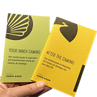
Ideal pocket guides for during & after your Camino. Each weighs only 1.4 oz (40g)!
This (http://www.csj.org.uk/planning-your-pilgrimage/faq/#cycling-the-camino) might be of some use to you, as is their cyclists' guide. Remember that the original route, as used for centuries, was the road between centres on the way to Santiago-- over the centuries, it became paved and much of the original route can now be found under the pavement of national roads. Much of the Camino Francese as walkers know it is on tracks and sideroads parallel to this original route. So if you end up having to do some on highways, take comfort that you are following their footsteps.
 
This (http://www.csj.org.uk/planning-your-pilgrimage/faq/#cycling-the-camino) might be of some use to you, as is their cyclists' guide. Remember that the original route, as used for centuries, was the road between centres on the way to Santiago-- over the centuries, it became paved and much of the original route can now be found under the pavement of national roads. Much of the Camino Francese as walkers know it is on tracks and sideroads parallel to this original route. So if you end up having to do some on highways, take comfort that you are following their footsteps.
Thanks for your reply.
I've ordered a copy of the guide so hopefully it will have what I want otherwise I will do what I'm sure countless cyclists before me have done, study what maps are available and hope for the best.
Regards and thanks.
Pádraig
 
The focus is on reducing the risk of failure through being well prepared. 2nd ed.
Hello all,
I’m planning to cycle The Camino starting from St. Jean Pied de Port in the first fortnight of May. I want to stay on the original route as much as possible. I’ve completed The Camino twice already on foot and do not want to have to lift and haul my bike and gear over rocks or through mud which was at times difficult enough to do on foot, though well worth it, when carrying only ten kilograms approx. I also want to avoid as much asphalt as possible. Can anybody suggest a good guide or map that takes my preferences into consideration with indications where one should leave the trail to avoid exposed rock and also where one can re-join the trail.
Regards and thanks.
Pádraig
Hola Padraig, It will be interesting to see if you are able to find trails otherthan the Camino, I use a road bike on the original Camino which as another post notes are now National roads ( but quite traffic free mostly) Anyhow the only suggestion I can make is to follow my movie and copy the towns and villages then perhaps you could check Google maps (walking/cycling option) for the trails you are seeking.
. When did you walk previously I am sure you will be aware of May weather in SJPdP.
Hello all,
I’m planning to cycle The Camino starting from St. Jean Pied de Port in the first fortnight of May. I want to stay on the original route as much as possible. I’ve completed The Camino twice already on foot and do not want to have to lift and haul my bike and gear over rocks or through mud which was at times difficult enough to do on foot, though well worth it, when carrying only ten kilograms approx. I also want to avoid as much asphalt as possible. Can anybody suggest a good guide or map that takes my preferences into consideration with indications where one should leave the trail to avoid exposed rock and also where one can re-join the trail.
Regards and thanks.
Pádraig
 
Hola Padraig. I did the Camino Frances via cycle in Sept 2015 starting from Pamplona. Unfortunately, IMHO, there really is not a cycle guide that really explains where you can follow the walkers camino and where you have to get onto the sealed roads. I did manage to get to the top of the Alto del Perdon - following the walkers. Now I road my mountain bike/hybrid - which has suspension on the front forks and this was really of assistance. As this was my first day it was a real tough intro. From the Alto I took the road (N1111) all the way to Puente La Reina - it would have been possible to rejoin the camino at Uterga. Day 2 I again tried to follow - made it to the Old Roman Bridge a few KM west of Cirauqui, from there it was follow the road to Los Arcos. (The lack of real data on the walking surface overroad my desire to follow). Day 3 I stayed on the road until Viana and from there until Burgos I followed the pilgrims. But it was really, really tough going from Atapuerca to Orbaneja. From Burgos to Rabanal you can follow the walkers without to much trouble. I will write about the last 260 km later if you need it.
Have a look back at some of the post from "newfydog" (he has ridden the whole way and is a really experienced cyclist). I am happy for you to PM me if you want more info. Cheers for now!
 
Look at bici:map. We used their guides for the Ruta de la Plata and the Camino del Cid and found them to be very good. They show the walking route, suggested bike alternatives and road routes. Bernard will send directly to you if you can't find in a bookshop.
 
The one from Galicia (the round) and the one from Castilla & Leon. Individually numbered and made by the same people that make the ones you see on your walk.
Thanks lads for your help and advice. I'm now using a combination of notes from my previous walks, "The Cycling Pilgrim 2013" which I got from The Confraternity of Saint James and a very helpful map, "Camino de Santiago 2009 cloned from route 386849", that I got from Bikemap.net. (Well worth a look at).
Again thanks and best regards,
Pádraig
 
Hello all,
I’m planning to cycle The Camino starting from St. Jean Pied de Port in the first fortnight of May. I want to stay on the original route as much as possible. I’ve completed The Camino twice already on foot and do not want to have to lift and haul my bike and gear over rocks or through mud which was at times difficult enough to do on foot, though well worth it, when carrying only ten kilograms approx. I also want to avoid as much asphalt as possible. Can anybody suggest a good guide or map that takes my preferences into consideration with indications where one should leave the trail to avoid exposed rock and also where one can re-join the trail.
Regards and thanks.
Pádraig
 
In 2014 I cycled from France to Santiago, i had walked this route several times and was interested in the routes used before the bridge was built at Puente la Reina.
To miss the rocks and mud after Pamplona I would suggest, that after reaching Zizur Mayor take the Na 7015.
When you see a sign for GARES (Pueate la Reina) take that to miss mud and rocks.(Shorter option)
Or keep on the NA 7015 through Ubani and Arraiza then very steep down hill to Belascoain and a very old bridge. once over take the NA 7110 Pueate la Reina. (Historical route along the river side )
You will find that P.L. Reina is back over the Royal bridge and will understand the avoiding of such a long detour for walkers was most welcome. I used a 16 inch wheel folding bike (Mezzo 9) with a very light load and a very heavy rider
 
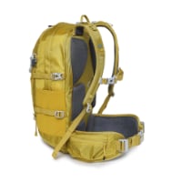
Technical backpack for day trips with backpack cover and internal compartment for the hydration bladder. Ideal daypack for excursions where we need a medium capacity backpack. The back with Air Flow System creates large air channels that will keep our back as cool as possible.

€83,-
I wo
Hola Padraig. I did the Camino Frances via cycle in Sept 2015 starting from Pamplona. Unfortunately, IMHO, there really is not a cycle guide that really explains where you can follow the walkers camino and where you have to get onto the sealed roads. I did manage to get to the top of the Alto del Perdon - following the walkers. Now I road my mountain bike/hybrid - which has suspension on the front forks and this was really of assistance. As this was my first day it was a real tough intro. From the Alto I took the road (N1111) all the way to Puente La Reina - it would have been possible to rejoin the camino at Uterga. Day 2 I again tried to follow - made it to the Old Roman Bridge a few KM west of Cirauqui, from there it was follow the road to Los Arcos. (The lack of real data on the walking surface overroad my desire to follow). Day 3 I stayed on the road until Viana and from there until Burgos I followed the pilgrims. But it was really, really tough going from Atapuerca to Orbaneja. From Burgos to Rabanal you can follow the walkers without to much trouble. I will write about the last 260 km later if you need it.
Have a look back at some of the post from "newfydog" (he has ridden the whole way and is a really experienced cyclist). I am happy for you to PM me if you want more info. Cheers for now!
 
I would love any info you can share about last 260km from leon

Thanks
Hi Hilary - from Leon its really not an issue. There is the 10-15 km of major roads - through the industrial area. Just follow the yellow arrows. I think I was a bit tired as I ended up missing the turn off to Villa de Mazarife and continued on to Hospital de Orbigo. I arrived early in the afternoon so could have made it Astorga. From Hospital to Astorga I followed the walkers trail/ through Astroga it was easy to follow the arrows West. I think I followed the trail until Santa Catalina and then took the rural sealed road that runs parallel up to Rabanal. From Rabanal I would strongly recommend you take the sealed road - the trail is not bike friendly. In fact I think I went on road through Molinaseca/Ponferrada to Cacabelos and then rejoined the trail to Villafranca de Bierzo. I don't recall really following the walking trail much at all for the remainder of the Camino, but I did divert off the N-VI (major secondary road) onto a rural road at Herrerias to Laguna de Castilla and O' Cebreiro and then to Triacastela. As I went to Samos (to see the monasterio) I am not aware of what the Camino is like between Triacastela and Perros. Basically from Sarria its up to you to either ride the road that is the Camino (its not specifically named in the Michelin Guide) , or follow the route marked as the LU-633 through Portomarin to Palas de Rei and from there onto the N-547 which the Camino virtually parallels. After Arzua the N-547 may be quieter as a new autoroute/motorway is planned, but about 10-12 km East of Santiago you come to a big round-about, here you have to get back onto the Camino as bikes are not permitted on the Motorway. You should not get lost - you will see all the walking pilgrims. This road leads you to the Monte do Gozo and then into down-town Santiago. If you feel lost - get off the road and ride the footpath - it will have those yellow arrows and then look for a sign that in Spanish/Galician says " Ciudad de Culture" which will lead you into the old city and the Cathedral. One thing I will say for Spanish motorists - car and bus and truck drivers - they are a lot more bike tollerant than ours back home. Maybe they ride bikes on their weekends!! I recommend you get a copy of the Michelin guide " Camino de Santiago" as it has all those minor small roads marked and in most cases route marked - its a soft cover so can go into your pocket. Hope this helps.
 
New Original Camino Gear Designed Especially with The Modern Peregrino In Mind!

Most read last week in this forum

I Willl start biking from SJPD on 9.may with Ebike. I have a list of bike friendly albergs is there somebody who have experience with charging batery in such alberg. Do i need afdition 220v...
Ivan. I believe I can rent two bikes through you between Burgos and Leon. Can you let me know if this is possible? I plan to arrive in Burgos on 11 May and start cycling the next day. Thanks
Plan to cycle between Burgos and Leon over three or four days. Are there any interesting detours between these two cities that would take up a 4th day?

❓How to ask a question

How to post a new question on the Camino Forum.

Similar threads

Forum Rules

Forum Rules

Camino Updates on YouTube

Camino Conversations

Most downloaded Resources

This site is run by Ivar at

in Santiago de Compostela.
This site participates in the Amazon Affiliate program, designed to provide a means for Ivar to earn fees by linking to Amazon
Official Camino Passport (Credential) | 2024 Camino Guides
Back
Top