• For 2024 Pilgrims: €50,- donation = 1 year with no ads on the forum + 90% off any 2024 Guide. More here.
    (Discount code sent to you by Private Message after your donation)

Search 69,459 Camino Questions

Help! Wikiloc Tracks, Maps, and Frustration with Technology

Time of past OR future Camino
Yearly and Various 2014-2019
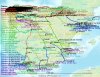
Via Monastica 2022
A question from someone who's technically more-than-challenged.
I'm walking from Santo Domingo de Silos to Burgos, making a detour to Santa Maria de Lara.
I have the file of Alan Sykes's Wikiloc track downloaded to my Android, with Orux map viewer software also downloaded. It works very well, if I'm online.
But I don't expect to be able to connect while I'm walking and when I'm offline I can't move from one area of the track to another or change the scale of the map. What to do?
The track is a little complicated and it's a long day. The last thing I want to do is get lost.
(Oh, and I have no access to a printer, so can't print screenshots...)
Honestly?....all I wish I had is an old-fashioned detailed topo map. Is there a place in Burgos to buy such a thing?
 
A selection of Camino Jewellery
Bingo, Margaret, you're a gem, as usual, thanks so much. There's an IGN point of sale at 34 Calle Vitoria, open 9-2, M-F, in case anyone else is interested.
Still curious to hear if there's a way to get this technology to work...........
If worse comes to worse I've made screenshots and saved them as PDF files so I can view them on my phone. But that seems pretty...not sure what the word is...well, it's not the point, anyway.
 
The focus is on reducing the risk of failure through being well prepared. 2nd ed.
A question from someone who's technically more-than-challenged.
I'm walking from Santo Domingo de Silos to Burgos, making a detour to Santa Maria de Lara.
I have the file of Alan Sykes's Wikiloc track downloaded to my Android, with Orux map viewer software also downloaded. It works very well, if I'm online.
But I don't expect to be able to connect while I'm walking and when I'm offline I can't move from one area of the track to another or change the scale of the map. What to do?
The track is a little complicated and it's a long day. The last thing I want to do is get lost.
(Oh, and I have no access to a printer, so can't print screenshots...)
Honestly?....all I wish I had is an old-fashioned detailed topo map. Is there a place in Burgos to buy such a thing?

Now, if you're changing your route to go with the San Olav from Covarrubias, does this complicate your life?

I am another technologically challenged old fogie, and I bumble through my untraveled caminos with a Garmin GPS. It doesn't have wifi and works fine (at least when I can figure it out, but that's my problem, not the Garmin's). So I would think that your phone GPS should be enough to get you there. I have debated chucking the GPS and just using my phone, but I have just enough knowledge now to think I am better off sticking with the known unknowns rather than launching into the unknown unknowns, to paraphrase someone I would rather forget. ;)
 
Now, if you're changing your route to go with the San Olav from Covarrubias, does this complicate your life?
Ha ha...NO!
The technology complicates my life.:eek:
Well, the devil you know...so I relate to your decision to use the Garnin.
Thing is I have not much familiarity with either. Last time I used a GPS was in 1994, before they got all smart and fancy. And I've never tried to use the phone's GPS. Steep learning curve time.

I would love to use Alan's GPS track offline with my phone, but with Oryx it looks like I can't.
Any ideas, anyone?

You need to PM Alan, I think he comes back here from time to time, even though he is probably busy with his flock. Because I think he used his phone offline, though I am not sure.
 
The one from Galicia (the round) and the one from Castilla & Leon. Individually numbered and made by the same people that make the ones you see on your walk.
Will do, thanks very much, Laurie.
And I'd welcome the '2 cents' of anyone else who's had experience with this!
 
Here's my 1 cent's worth. I've been struggling with this issue also because I really want to have an offline map on my phone with the camino I'm on clearly marked so I will know when I'm more or less on the right route. I'm going to be walking the Camino del Norte/Camino Primitive/Finisterre in June/July this year. So far, I've got to what is, I think, a good offline map app (maps.me available for android and apple devices). It uses open street maps and you can download all of Spain at street level. There's a link here GPS (kmz) tracks of all Spanish camino's in one file thanks to forum member Thomas1962, and I've downloaded and opened it in maps.me. However, the 'breadcrumbs' don't really stand out at street level from the other stuff on the map, and I'd like to find a way to make the trail bright and bold so it really stands out, so far without success. But what I have on my phone now is a lot better than nothing or, imo, lugging around paper maps, as long as the technology gods don't mess with my phone! I don't know whether Alan's wikiloc track can be layered on maps.me but I think as long as it's in either kml or kmz code it could be, but then again, I'm a tech idiot.

Hope this helps some and good luck with both the technology and the camino.
Dick
 
A question from someone who's technically more-than-challenged.
I'm walking from Santo Domingo de Silos to Burgos, making a detour to Santa Maria de Lara.
I have the file of Alan Sykes's Wikiloc track downloaded to my Android, with Orux map viewer software also downloaded. It works very well, if I'm online.
But I don't expect to be able to connect while I'm walking and when I'm offline I can't move from one area of the track to another or change the scale of the map. What to do?
Hi. I see that you have an Android phone, as I do. Can I recommend that you look at the OSMAnd mapping app on the Google Play Store. This uses Open-Street-Mapping (OSM) and allows for full downloading of very detailed maps onto your Android, so being off-line doesn't matter. The download function, within the app, allows you to select which country and, importantly the district within the country, that you wish to download, so you only need to download the areas you are walking through. The maps are vector based which means, without being too technical, that it is possible to zoom in to whatever level of detail you require down to individual house levels. The GPX files you already have can be added and show on the map. If necessary the same app will do routing from point to point for you, in a similar way to car-based GPS units, even for walking tracks. It is an excellent app, the best I have tried (out of many) and I use it all the time. It is always on my phone and already loaded with several GPX files for our Lisbon-Santiago Camino in April/May. If I can help further send me a message through this board.
 
New Original Camino Gear Designed Especially with The Modern Peregrino In Mind!
Can I recommend that you look at the OSMAnd mapping app on the Google Play Store. This uses Open-Street-Mapping (OSM) and allows for full downloading of very detailed maps onto your Android, so being off-line doesn't matter.
I've used this a little on a tablet at home. It seems to have quite a few features but I haven't figured them out yet. In its most basic mode it shows you a map and where you are located on that map and that is all I've needed so far. You can download it and a few maps for free. For example, I've got the state of Massachusetts on it. OpenStreetMap maps will often show trails where Google Maps don't.
 
OSMAnd mapping app on the Google Play

Best android GPS App I used on my travels was LOCUS MAP
Great ideas! And.....
:D
OsmAnd is apparently not compatible with my device ( 2-year-old Samsung).
And Google Play only shows Locus add-ons, not the actual app.
Back to square 1.:confused:
I'll try again from Spain.
 
Technical backpack for day trips with backpack cover and internal compartment for the hydration bladder. Ideal daypack for excursions where we need a medium capacity backpack. The back with Air Flow System creates large air channels that will keep our back as cool as possible.

€83,-
Can anybody help me with this Wikiloc program I downloaded to my phone?
There are no tutorials. Nothing. I can't find a search button.
I can find trails on my big MAC but how do I get them to the iPhone?
Help?
 
Hi @Anniesantiago, you will find instructions in one of the mails I sent you.
From front page choose 'navigate'
Choose your options, ie 'worldwide', activity 'hiking'
Scroll to the bottom of navigate page and and type in what you are searching for in the tab 'search text or wikiloc ID'
Then choose 'apply filter'

I played with it last night and I THINK I figured it out. I saved several maps of the route. Hopefully I can retrieve them and save them. I guess I'll need a data card SIM?
 
St James' Way - Self-guided 4-7 day Walking Packages, Reading to Southampton, 110 kms
I played with it last night and I THINK I figured it out. I saved several maps of the route. Hopefully I can retrieve them and save them. I guess I'll need a data card SIM?

GPS doesn't need a data connection, but without it wikiloc will probably show your route but it won't show the background map. I hope someone else will correct me if I am wrong.
 
Well I cannot download resources to my android tablet. HELP
 
I just downloaded the OsmAnd app on your recommendation.

But what kinds of maps should I download (which covers SJPDP to Santiago)?

And how to get the trail on these maps?

If you have time, I would appreciate help.
Im lost need a navigator ...
 
€2,-/day will present your project to thousands of visitors each day. All interested in the Camino de Santiago.
I just downloaded the OsmAnd app on your recommendation.
I did mention the app in this forum a year ago. I didn't quite recommend it (more of a mention) but, okay, I'll go with it.

And how to get the trail on these maps?
I have not yet loaded a gpx file for use with OSMand but it looks like this is the way to do it (on android phones at least): http://www.flannaghan.com/2014/04/17/android-nav

But what kinds of maps should I download (which covers SJPDP to Santiago)?
To download your maps: Open OSMand. Select the menu button (the stack of three horizontal lines.) Next pick Download maps. Select Europe. Select France. Select Aquitaine. Select Standard map.

Once the map is downloaded you will want to see it. Backtrack to the OSMand main screen. Select the menu button. Select Search. There is where the interface messes up. Play around on your own later but just do this for now, in the type-in box enter 43.16353,-1.23585 (the coordinates of the Pilgrims' Office in SJPdP.) Now click the SHOW ON MAP text below the type-in box. There you go. Explore.

When you no longer need the map you can delete it the following way to regain memory: Select the menu button. Select Download maps. Select Europe. Select France. Select Aquitaine. Next to the text "Standard map" is a menu indicator (three dots in a vertical line.) Use the menu item Remove and then answer Yes to verification message.

I don't have enough memory on my phone right now to test these out but for the CF in Spain I think you need the regions Basque Country, Castile and Leon, Galicia and Rioja. Right now I only have Aquitaine and Galicia loaded and I will probably get rid of Aquitaine soon.

Now more generally:

I've mentioned the OSMand app before on this forum and I've seen the maps.me app mentioned so I downloaded that also. I use both. OSMand has features I like but the interface is terrible. maps.me is easier to use, for example they say that to show a kml track attach it to an email and then hold you finger down on the attachment and then pick maps.me as the viewing application.

OSMand reads track files in gpx format. maps.me reads track files in kml format. You can convert from one format to another using an online tool at http://www.gpsvisualizer.com/convert_input

Both apps use OpenStreetMap databases although they package different areas into their files and the way they display the data is different. I've been meaning for some time to write up a comparison.
 
Last edited:
Ok, I downloaded both OsmAnd and Maps.me app.
When I opened and downloaded the track file; https://www.caminodesantiago.me/com...racks-of-all-spanish-caminos-in-one-file.341/
that file could be open in maps.me (but not found for OsmAnd).

While looking at the el Camino track route in maps.me, I found it difficult to find the villages on the route.
Roncevalles or Larrasoana I didn't find on the map. (I will recheck again.)
 
Ok, I downloaded both OsmAnd and Maps.me app.
When I opened and downloaded the track file; https://www.caminodesantiago.me/com...racks-of-all-spanish-caminos-in-one-file.341/
that file could be open in maps.me (but not found for OsmAnd).

OSMand reads track files in gpx format. maps.me reads track files in kml format. You can convert from one format to another using an online tool at http://www.gpsvisualizer.com/convert_input

You have to convert the kmz file you downloaded into a gpx file for OSMAnd to be able to read it. A kmz file is a compressed kml file. The tool at http://www.gpsvisualizer.com/convert_input can convert the kmz file directly to a gpx file.

The kmz/kml/gpx data files downloaded from the forum themselves do not have many named points or tracks. The towns thus have to be named in the area data files you downloaded from the maps.me and OSMand sites. The attached picture shows the tracks and towns named. As you can see you have ALL the caminos in the kmz file. The file may be just too bad for OSMAnd to handle.

http://trekopedia.com/?page_id=3182 used to have smaller sections of the CF in kml files on their site and these would include points of interest line albergues, fountains, etc. Something happened recently and the files aren't accessible any longer (but maybe they will come back.) Or maybe it WILL work for you but not for me because of my ancient browser.
 

Attachments

  • 20170311141045-13011-map.jpg
    20170311141045-13011-map.jpg
    210.7 KB · Views: 4
Last edited:
New Original Camino Gear Designed Especially with The Modern Peregrino In Mind!

Most read last week in this forum

Last year on my camino I was a bit annoyed when someone back home told me to enjoy my vacation. I bristled. Why did that word annoy me so much? I was on a pilgrimage! Anyway, I'm about to embark...
I'm looking for the best app to use whilst walking on the Camino. Usually I just rely on my Apple watch but I'm leaving that at home, so need an app use that I can pause at rest stops etc...
Everyone talks about the wonderful café con leche, but what if tea is more to your liking? Can you even get tea along the Camino (Frances)? I don’t drink coffee but my morning cup of tea is...
Hey all. I haven't been on the forum for quite sometime (years probably). I walked the Camino Frances in 2016 and to say it was life changing for me is an understatement. On day 3, at the café at...
I am just back from a few weeks on the Via the la Plata. Since 2015 I have been nearly every year in Spain walking caminoroutes I loved the café con leches. This year I did not like them as much...
Forgive me if already in a thread somewhere, but any search for the above brings up basically every post ever written! Did anyone get to see the premiere? Dying to know what it's like as the...

❓How to ask a question

How to post a new question on the Camino Forum.

Similar threads

Forum Rules

Forum Rules

Camino Updates on YouTube

Camino Conversations

Most downloaded Resources

This site is run by Ivar at

in Santiago de Compostela.
This site participates in the Amazon Affiliate program, designed to provide a means for Ivar to earn fees by linking to Amazon
Official Camino Passport (Credential) | 2024 Camino Guides
Back
Top