• For 2024 Pilgrims: €50,- donation = 1 year with no ads on the forum + 90% off any 2024 Guide. More here.
    (Discount code sent to you by Private Message after your donation)

Search 69,459 Camino Questions

Helping Albertagirl with Maps!

Albertagirl

Veteran Member
Time of past OR future Camino
Frances; Aragones; VdlP; Madrid-Invierno; Levante
NOTE From Mod — You may have seen @AJ’s thread on planning the Camino Levante. A number of issues involving maps.me, google maps, facebook, etc have come up. I thought that it would be more helpful to @Albertagirl if we had one dedicated thread where she could work through these issues and still keep the flow of the Levante thread going.

So, here goes, let see if it helps! Buen camino, Laurie

Thank you so much, Jean Luis. I stayed there many years ago, but I remember that the Peruvian-Spanish couple were extremely nice. Unless things have changed, thougn, I would NOT eat dinner there.
@peregrina2000
I wonder if you could tell me the location of Corral de Pablanch. I have been unable to find this hotel on either maps.me or Google Maps.
 
Last edited by a moderator:
New Original Camino Gear Designed Especially with The Modern Peregrino In Mind!
@peregrina2000
I wonder if you could tell me the location of Corral de Pablanch. I have been unable to find this hotel on either maps.me or Google Maps.
Just use Google search. There is a Facebook page with the map I've attached. There are some other search results but they take a bit more effort and a bit of Spanish, so I haven't looked any further.
 

Attachments

  • Capture.JPG
    Capture.JPG
    88 KB · Views: 37
Thank you so much, Jean Luis. I stayed there many years ago, but I remember that the Peruvian-Spanish couple were extremely nice. Unless things have changed, thougn, I would NOT eat dinner there.
I had lunch there with a group of friends, and it was very correct,.....but it was some 30 years ago.....everything changes.

I wonder if you could tell me the location of Corral de Pablanch. I have been unable to find this hotel on either maps.me or Google Maps.
Here you have
Corral de Pablanch (Google Maps).png Corral de Pablanch (Google Earth).png
Google Maps shows deviations, for cars, but if you can climb the stairs the route of Google Earth is more direct.
 
The 2024 Camino guides will be coming out little by little. Here is a collection of the ones that are out so far.
Just use Google search. There is a Facebook page with the map I've attached. There are some other search results but they take a bit more effort and a bit of Spanish, so I haven't looked any further.
I am not on Facebook and there is no way that I will sign up, which I would need to do in order to gain access to their information. This is not an option for me.
 
I had lunch there with a group of friends, and it was very correct,.....but it was some 30 years ago.....everything changes.


Here you have
View attachment 82761 View attachment 82762
Google Maps shows deviations, for cars, but if you can climb the stairs the route of Google Earth is more direct.
I don't know what is happening, but my attempted search of Google maps, knowing where the hotel shows up on your version of Google Maps, has shown no signs of it. I am still struggling with Google Earth, since I cannot find it as a search, but it might show up on Street View. I am not very good at this sort of search, but I am very determined.
 
3rd Edition. More content, training & pack guides avoid common mistakes, bed bugs etc
Last edited:
I don't know what is happening, but my attempted search of Google maps, knowing where the hotel shows up on your version of Google Maps, has shown no signs of it. I am still struggling with Google Earth, since I cannot find it as a search, but it might show up on Street View. I am not very good at this sort of search, but I am very determined.

Albertagirl, as you’ve been seeing, googlemaps has locations of virtually all businesses and places of interest, easy to locate by typing in the name and city/town. This is one of those rare occasions where Google Maps does not have any indication of a known business, in this case “El Corral de Pablanch.” It may be because it was closed for a while, but in any event, you’re not going to find it identified on googlemaps. Using the street address, you can find its location, but using the title of the business will not yield any results.
 

Attachments

  • BAE85FA4-62E7-4B33-9D7F-E378264098A1.png
    BAE85FA4-62E7-4B33-9D7F-E378264098A1.png
    3.7 MB · Views: 6
  • 70277B88-C7DE-4C93-906B-7A325CDD63EF.png
    70277B88-C7DE-4C93-906B-7A325CDD63EF.png
    3.7 MB · Views: 6
Some musings about my use of these apps...

I have no idea how the Google maps information is collected and updated. Since they typically have information about hours open, etc., I expect that the business itself has a role in maintaining the information up-to-date. (For all we know - which is next to nothing - the Corral proprietors don't like Google and are not providing updates, but they accept Facebook.) There are errors and omissions in this type of huge and dynamic database of information. Similarly, maps.me gets its information from a myriad of sources that might even include Google.

When I was "leading" the virtual Sanabres thread, I found it very demanding and had to slow down the pace. It took me ages to go back and forth between regular Google search results and those webpages, Google Earth (satellite and street), Google maps, maps.me on my phone, alternative Wikilocs tracks, and the various spreadsheets/guides for the route. On the forum thread, we were discussing a lot of detail that I would not normally worry about in Spain. For example, I always carry some nuts, chocolate, etc., so that if I can't find a store or place to eat, I will not starve. So, I do not normally scout out my eating spots or grocery stores in advance. That is too much work!

I have Google Earth installed on my computer, with tracks of most of the caminos shown. I did this myself a couple of years ago, and I have difficulty remembering how I did it. 😧 However, it is absolutely worth doing! Do you have that set up with the tracks, @Albertagirl?
 
St James' Way - Self-guided 4-7 day Walking Packages, Reading to Southampton, 110 kms
I'm using the overlays on my OSMand map and it's not predictable. Sometimes it shows more than Googlemap sometimes less. A websearch that accesses multiple layers of information is the only way to go. Unlike the d days when you pulled out the Yellow Pages, thete isn't a single central source of information.
 
The place has information at

There is a tab there to get a map. That tells you that they are at
38°52'49.9"N 0°45'28.9"W

A shorter version of that is
38.880531, -0.758040

You can enter either as a location to search for in maps.me. I've done that and there is a match with Google maps. It does not pinpoint exactly with a building though. Maybe Laurie can tell you where in relation the building is to the pin.

An address was given at

The address given was (I modified some):

Carretera Navalón, 7
46640
Mogente / Moixent ( VALENCIA )
In front of the furniture shop/factory COIM Muebles


See also
..
 
I had lunch there with a group of friends, and it was very correct,.....but it was some 30 years ago.....everything changes.


Here you have
View attachment 82761 View attachment 82762
Google Maps shows deviations, for cars, but if you can climb the stairs the route of Google Earth is more direct.
Are you sure? Don't think I'd fancy staying here:

1599755731973.png

1599755939625.png
 
Very light, comfortable and compressible poncho. Specially designed for protection against water for any activity.

Our Atmospheric H30 poncho offers lightness and waterproofness. Easily compressible and made with our Waterproof fabric, its heat-sealed interior seams guarantee its waterproofness. Includes carrying bag.

€60,-
I had mentioned that already, but find when I go there it doesn't lead to anyplace that makes sense. Edit - brilliant, Jeff....

@Albertagirl, here is another resource that you may find helpful:
You can search with either an address or a lattitude/longitude. Then in addition to giving you the WTW location, it will take you to a place where you're offered a choice of navigation apps, so it's possible to check out several options from one place (see attached screenshot). It's quite intuitive.

Screenshot_20200910-231523_Android System.jpg
 
Co-ordinates

38°52'48.26"N 0°45'26.15"W
Just use Google search. There is a Facebook page with the map I've attached. There are some other search results but they take a bit more effort and a bit of Spanish, so I haven't looked any further.
Interestingly the address on the Facebook page leads you to a very impressive edifice in central Valencia

1599757660267.png

But then we all know how trustworthy FB is ;)
 
A selection of Camino Jewellery
I had mentioned that already, but find when I go there it doesn't lead to anyplace that makes sense. Edit - brilliant, Jeff....

@Albertagirl, here is another resource that you may find helpful:
You can search with either an address or a lattitude/longitude. Then in addition to giving you the WTW location, it will take you to a place where you're offered a choice of navigation apps, so it's possible to check out several options from one place (see attached photo). It's quite intuitive.

View attachment 82787
My belove'd What3Words!

The reference for the sign at the entrance is "///shakily.blamed.lameness" in English and "///pomo.superarlo.gruñidos" in Spanish . . . I think I'll stick to English!
 
Last edited:
Based on Jeff's driveway information I got coordinates to the driveway.

38.879708,-0.756726

Enter that into maps.me and then save it as a favorite with the name of the place.
 
Co-ordinates

38°52'48.26"N 0°45'26.15"W

Interestingly the address on the Facebook page leads you to a very impressive edifice in central Valencia

View attachment 82788

But then we all know how trustworthy FB is ;)
In the course of my searching, I followed a link and ended up at the same location in central Valencia. I didn't try that link again.
 
Join the Camino Cleanup in May from Ponferrada to Sarria. Registration closes Mar 22.
So, thank you to everyone. I think that I wasn't quite as stupid as I was crediting myself with being. I found somewhere (?) an address for Corral de Pablanch: Carretera Navalón, 7. It took me a while, but eventually I found Carretera Navalón. Then, while I was searching up and down this street, the address appeared, unattached to any building, but on the east side of the road. So I concluded that I could probably get there by walking out of town on Carretera Navalón and looking to the right for a lane with a sign. This is exactly what @Jeff Crawley has shown me on post #13. And I have ceased to beat myself over the head for my incompetence, since my general rule is: "If I can do it, however I do it, is good enough for me" with regards to technological matters. I am grateful for everyone's help, and shall keep in mind the location app offered by @VNwalking, which may be simple enough for me to use. Thanks again to all, and I shall keep this thread bookmarked for further location challenges.
 
Last edited:
This is making me laugh, which is a good thing to do when faced with confusion.
You can search with either an address or a lattitude/longitude. Then in addition to giving you the WTW location
What is WTW - "Wherever That Was" ? I don't do lat/longs.
And I have ceased to beat myself over the head for my incompetence, since my general rule is: "If I can do it, however I do it, is good enough for me" with regards to technological matters.
As I have said to @peregrina2000 , those who constantly declare/bemoan their technological incompetence are, for some reason, unable to accept that they are in the boat with 90% of the population. We are in this together! Some things I figure out, other things you figure out. It is not usually a matter of talent - it is usually a matter of patience, time and persistence.
 
This is making me laugh, which is a good thing to do when faced with confusion.

What is WTW - "Wherever That Was" ? I don't do lat/longs.

As I have said to @peregrina2000 , those who constantly declare/bemoan their technological incompetence are, for some reason, unable to accept that they are in the boat with 90% of the population. We are in this together! Some things I figure out, other things you figure out. It is not usually a matter of talent - it is usually a matter of patience, time and persistence.
///What3Words - the answer to everybody who's not happy with map co-ordinates.

Increasingly being used by the emergency services in the UK to pin point lost souls. You get a map on your phone and as you wander about each square you pass through has a three word reference (you can do it in different languages too).

You tell somebody you're in ///events.drank.puppets and they'll be able to find you (guess where?)
 
Ideal sleeping bag liner whether we want to add a thermal plus to our bag, or if we want to use it alone to sleep in shelters or hostels. Thanks to its mummy shape, it adapts perfectly to our body.

€46,-
So, thank you to everyone. I think that I wasn't quite as stupid as I was crediting myself with being. I found somewhere (?) an address for Corral de Pablanch: Carretera Navalón, 7. It took me a while, but eventually I found Carretera Navalón. Then, while I was searching up and down this street, the address appeared, unattached to any building, but on the east side of the road. So I concluded that I could probably get there by walking out of town on Carretera Navalón and looking to the right for a lane with a sign. This is exactly what @Jeff Crawley has shown me on post #13. And I have ceased to beat myself over the head for my incompetence, since my general rule is: "If I can do it, however I do it, is good enough for me" with regards to technological matters. I am grateful for everyone's help, and shall keep in mind the location app offered by @VNwalking, which may be simple enough for me to use. Thanks again to all, and I shall keep this thread bookmarked for further location challenges.
It's not you, it's them . . .

When I did my last full CF I logged each hostal/hotel in the location Booking.com told me they were.
I then sought them out in StreetView - some were a couple of blocks away!
Glad you got there in the end but doesn't look like there's much in the area.
 
When I did my last full CF I logged each hostal/hotel in the location Booking.com told me they were.
I then sought them out in StreetView - some were a couple of blocks away!
Getting into town I would use Wikiloc and OsmAnd. Once there I would turn on cellular data and Google Maps and compare albergue locations between the apps. Google was also used to find food, drink and attractions in town that may have been pretty much on the way to the albergue but maybe out of sight a block or two off camino.
 
The one from Galicia (the round) and the one from Castilla & Leon. Individually numbered and made by the same people that make the ones you see on your walk.
Please identfy Wikiloc and OsmAnd. Are these location apps which I could download from the Iphone App Store and would they be useful to me on an Iphone5s, without purchasing other hardware? Could a person with my level of competence(?) even figure out how to use them? Consider me as on the low end of @C clearly's 90% of the population who consider ourselves to be technologically incompetent.
 
I consider myself to be somewhere in the middle of the 90% - at the higher end for my age and for a few specific skills, but at the lower end for other skills. That is what characterizes the entire 90%.

Wikiloc is a website site where you can go on your computer (or phone, of course, but that often seems harder) to look at the GPS tracks that people from all over the world have uploaded. You can search for trails (e.g. "camino levante" or "albacete") and see who made the tracks, distances, sometimes they have additional information. You can do this on your computer without an account or any special app. Then if you want to download a particular KML file, you need to sign up for a free account. You can do it with a name and email of your choice.

You can also do this on your phone, and I think there are fancier paid versions and apps, but I just stick with the free account, browse on my computer, download files to my computer, and then email them to myself for my phone. That way I collect some alternative routes to have on my phone.

OsmAnd is some kind of GPS/location app that I expect is wonderful. However, I have not investigated it, and have chosen not to take on the learning curve for it. (I am not incapable. I have decided that I have enough tools already, to meet my needs.) Given what you have said, I wouldn't suggest that you take on another specialized app.

For me, what I find to be adequate is:
  1. comfort in simply Google searching for information
  2. basic navigation around Google Maps, including the Search and the "Directions to" features
  3. having Google Earth on my computer, with the tracks of "all caminos in Spain", and being able to toggle satellite view and street view, zoom in and out, "walk around" in street view, search places, and measure distances between places
  4. finding and downloading tracks from Wikilocs and elsewhere, and sending them to my phone for viewing on maps.me
  5. bookmarking places on maps.me on my phone
[A Zoom tutorial would be hugely popular!]
 
having Google Earth on my computer, with the tracks of "all caminos in Spain", and being able to toggle satellite view and street view, zoom in and out, "walk around" in street view, search places, and measure distances between places
@C clearly
I have Google Earth on my Iphone and, as usual, am trying to teach myself how to use it, but I do not have the tracks of "all caminos in Spain" on this app. I do have on maps.me the tracks of the caminos downloaded from the Resources section of this forum, given by the Dutch pilgrims' association to the forum for free download. This is what I usually use. Now that I am using Google Maps more, the camino tracks would also be useful there. How do I get them onto Google Earth and Google Maps? I shall also have a go at Wikilocs. I had heard of it on this forum, but thought that it was only used by those who have specialized hardware, like a Garmin gps. As maps.me has a gps function to show me where I am, I don't wish to buy more hardware. I don't think that I shall ever be comfortable with using this technology, but so long as I am functional, that will have to be enough. I agree that your suggested functions make sense to me and fulfill the usual needed purposes. Like you, I often email items to my phone, but usually texts of camino information, which I move to Kindle when transferring it. How would I get information to Google Earth/Maps or to maps.me, without the link that my phone offers when I am transferring text? Thanks again for your help. You appear to me to be on about the level of technological competence to which I aspire. The total techies are so far beyond me that I don't even understand what they say, or post, most of the time, if it is about technological issues. I really appreciate your help.
 
A selection of Camino Jewellery
I should have said, W3W. what3words being the name of the app Jeff and I like so much.

As Jeff says, it's easy to use...and fun.
(If I'm not there, Jeff, look for me at
///cheesy.window.uptown)
Looks like I am helping.worldwide.waitresses in my living room. 🤪
 
You appear to me to be on about the level of technological competence to which I aspire.
I like that! 😁
tracks... How do I get them onto Google Earth and Google Maps?
As far as I know they cannot be put on Google Maps. However they can go on Google Earth, somehow, since I did it. I will need to start googling again for help and youtube videos to figure that out again.
I don't wish to buy more hardware.
Absolutely none needed.
How would I get information to Google Earth/Maps or to maps.me
Do you currently have your tracks on maps.me? How did you get them there? Normally, I simply send the tracks attached to an email. Then I go to my phone, open the email, save the file (or just download and it saves somewhere all by itself). Then I go to maps.me and, like magic, the tracks are there.

There are always tiny quirks in the method for each phone (and sometimes each phase of the moon) but we should be able to get past that, with that patience and persistence I mentioned!
 
Technical backpack for day trips with backpack cover and internal compartment for the hydration bladder. Ideal daypack for excursions where we need a medium capacity backpack. The back with Air Flow System creates large air channels that will keep our back as cool as possible.

€83,-
I work from my computer, and attempt to get everything onto my phone that I will, or might, need when on camino. For my last camino (Madrid-Frances-Invierno-Santiago) I entered onto the contact list on my Iphone all the phone numbers and addresses, emails, prices, etc. of every place that I thought I might choose to stay during my camino, alphabetically arranged by the town, so I could compare them easily. This was very time-consuming, and also quite useful. The Madrid and Frances were easy, and the Invierno challenging, Like the Levante, the real challenge was just finding a place to stay every night that was not an excessive distance from the previous night. I got the tracks on maps.me by looking up the post in the Resources section and choosing the app that would give me all the camino tracks for my iphone. I think that I had to download it from Resources directly to my phone. I can't remember how I got it to recognize the appropriate format.

So I have gone back to the appropriate location in Resources on my phone and downloaded the caminos in Spain onto Google Earth. I have had some problems with this download, as the routes have disappeared from my phone several times, so I am not yet confident that the download is stable. I live in hope, and have spent most of the rest of the day fiddling with this. It is not a bad way to spend time in a pandemic, when I should be preparing for an imminent departure on camino.
 
hi,,,my favourite app for the various camino routes is Windy Maps (also called Mapys.cz).its a free app and nearly every camino route is already on the app !! so then if you want to use without having phone service you can then download wherever you want and then can be used with only gps activated ,,its so simple and can be used anywhere in the world ,, for walking ,cycling tracks anywhere !! oh and of course it then shows exactly where you are !! and i also use it as my app to find my way when im driving ,,, And have i said ,,its free !!
 
Some musings about my use of these apps...

I have no idea how the Google maps information is collected and updated. Since they typically have information about hours open, etc.
Google Maps is maintained by us! People who use Maps can suggest changes. If you can prove (to Googles satisfaction) that you own a business mentioned on Maps then you have some powers of veto on some of the information and you can reply to comments.

Generally, suggested changes are moderated by other Maps users. As you make more suggested changes you earn "points" and can get to higher levels of trust from 1 to 10. There are very few 10's in the world. I am an 8 which is the top 1%.

You can tell what level of trust someone is by counting the "points" of the star next to their name (if they have a star) when they make a comment about a business on Maps.

If we know that this business exists and is still open then we could add it to Maps.

Does anyone want to do this?
 
Ideal sleeping bag liner whether we want to add a thermal plus to our bag, or if we want to use it alone to sleep in shelters or hostels. Thanks to its mummy shape, it adapts perfectly to our body.

€46,-
I am an 8 which is the top 1%.
Wow. And great that you take the time to have erroneous information on the web corrected!

I don't think I've earned any points anywhere but when I get impatient with the to and fro on the forum - and that is rare since I have of course the patience of a lamb - I occasionally send an email to the right address. I emailed Google when the Google information about Orisson was still saying that they are "permanently closed" while they were already accepting bookings again and I emailed a small business owner whose phone number had the wrong country code on his Facebook page and he had not noticed. In both cases, the wrong information displayed online was corrected fairly quickly.
 
Okay, some thoughts about adding information to Google Maps.

Firstly, it is extremely difficult to add GPS related routes to G Maps like some have done with Google Earth. This is because G Maps is used for routing (finding a path between two points) and Google needs much more information than a GPS track in order to do routing. For this reason, I will not cover adding GPS routes. If you are very technical then you can probably find this information, eventually!

For other information such as adding a business, adding hours of business, contact information and most other stuff it is much easier but can sometimes take a while before it shows up on Maps (because it gets moderated and checked). Sometimes this can be speeded up if your trust level is high enough and provided supporting information is provided.

In order to make any changes/suggestions to Maps you must first be signed into G Maps.

If you use Chrome on a PC and sign into Chrome then you are probably also signed into GMaps via Chrome.

If you use an Android phone and are signed into your phone then you are probably also signed into G Maps when you use it on that phone.

If you use an Apple phone then I don't know how you sign into G Maps on that phone (because I don't use Apple products) but it must be possible to do that.

More to follow, including a way to highlight places you want to stay at and a sort of work around for Camino routes if anyone is interested??
 
@Albertagirl I agree that you do not need OsmAnd if you have Maps.me. They do much the thing for the basic user. OsmAnd does more but probably nothing you need or want. The user interface to OsmAnd can drive me nuts (though personally I use this app more often then Maps.me).

Though both apps get their data from the Open Street Map project they display differently and I prefer the OsmAnd display. Here are the displays for Zabaldiki at about the same scale for Google Maps and the Maps.me and OsmAnd apps.

Screenshot_20200911-072035.pngScreenshot_20200910-190333.pngScreenshot_20200910-190326.png
 
The focus is on reducing the risk of failure through being well prepared. 2nd ed.
I am currently using version 10.50.0 of Google Maps on my Nokia Android phone. I am part of Googles Beta test team for G Maps and so it is possible that my version of G Maps is different from yours so keep that in mind if what you are seeing on your phone doesn't match something that I describe.

If anyone wants information about G Maps "Local Guides" program (the people like me who make frequent changes to G Maps) then check out https://support.google.com/local-guides/answer/6225851

When you open G Maps on an Android phone there is a small icon on the top right corner of the screen. If you are logged into G Maps, that will be your icon photo.

If you are not logged in then it will be some other icon and if you touch it, you will be able to log in.

All the things that I describe require you to be logged in before you can do them.
 
Are you sure? Don't think I'd fancy staying here:
Jeff you are right, I didn't magnify enough the image of Google Earth, Pablanch is on the other side, left, of the route to Navalón.
IMG_20200911_134833.jpg IMG_20200911_134849.jpg

here is the corrected route to this Casa Rural
Corral de Pablanch (Google Earth).png

Found it! (Well done @Rick of Rick and Peg)
So @Albertagirl only needs to loook on left side of the street untill she see the indication to Corral de Pablanch

Interestingly the address on the Facebook page leads you to a very impressive edifice in central Valencia
may be this edifice is just the same longitud East as Pablanch is longitud West.
 
Here is my screenshot from G Maps that matches the one done by @Rick of Rick and Peg It shows an icon that is not on Rick's screenshot.

This icon is on my screen because I loved staying at the albergue in Zabaldika and so I added it to a "list" on G Maps.

This list feature may be of interest to @Albertagirl and anyone else planning a Camino as it visually highlights places of interest that you set up.

Screenshot_20200912-000140~2.png
 
St James' Way - Self-guided 4-7 day Walking Packages, Reading to Southampton, 110 kms
.I think adding any information nowadays to the Google Maps based on what we knew about any place before the pandemic may be in many cases misleading for those searching for recent info. The state of many businesses change from day to day, and if we don't have the last minute info, I suggest refrain from adding any new "old" data to Google or OSM (open street maps) in order not to create confusion.

(that's from level 6 contributor 😉)
 
For other information such as adding a business, adding hours of business, contact information and most other stuff it is much easier but can sometimes take a while before it shows up on Maps (because it gets moderated and checked).

Very intereting fo me.
In my city there was a business which is now more than 10 years closed, and the owner is dead, but it is still indicated on Google Maps.
My problem is that the contact telephone for this business is wrong, and is exactly mine, so I frequently receive calls from people who have seen the old information and want to contact the business.
How can I get it canceled, or at least corrected?
 
It seems like Corral de Pablanch became surrounded by the industrial park on one side and a (probably loud) highway and the construction of the high-speed rail on another side. I couldn't find any actual review of that place since peregrina2000 was there in 2013. If someone wants to add it to Google Maps, I recommend calling them first. In 2019 they were probably renovating the place - look at that SOMETHING in their driveway, but is the place in operation in the covid era? That needs to be checked.
 
Ideal sleeping bag liner whether we want to add a thermal plus to our bag, or if we want to use it alone to sleep in shelters or hostels. Thanks to its mummy shape, it adapts perfectly to our body.

€46,-
.I think adding any information nowadays to the Google Maps based on what we knew about any place before the pandemic may be in many cases misleading for those searching for recent info. The state of many businesses change from day to day, and if we don't have the last minute info, I suggest refrain from adding any new "old" data to Google or OSM (open street maps) in order not to create confusion.

(that's from level 6 contributor 😉)
Except that G Maps is very good at advising people to check for Covid 19 changes and adding a business that currently isn't on G Maps is a very useful thing to do. Anyway, I don't have the information about this business and Google generally doesn't accept Facebook links as the only proof of existence and so I won't add it.

Your suggestion to phone the business first before adding them is an excellent one!
 
Last edited:
Very intereting fo me.
In my city there was a business which is now more than 10 years closed, and the owner is dead, but it is still indicated on Google Maps.
.....
How can I get it canceled, or at least corrected?
In G Maps on an Android phone, search for the business.
Touch the name of the business - this will show you the additional information like the phone number.
Slide the screen up until you see the prompt "Suggest an edit" - touch this link.
One of the options you are then given is to "Close or remove" the business - take this option.
G Maps will then ask you for additional information that they use to verify that you are telling the truth.

The best information, in my opinion, is to go to the place where that business was and take a photo of the premises with a smart phone that records the date and the geographic position of the photo. Also provide any other links to information that supports that the business is closed such as a government website or newspaper article or death notices.

Then wait. G Maps will not reply but if there is sufficient supporting information then the business will be removed along with your phone number.
 
It seems like Corral de Pablanch became surrounded by the industrial park on one side and a (probably loud) highway and the construction of the high-speed rail on another side. I couldn't find any actual review of that place since peregrina2000 was there in 2013. If someone wants to add it to Google Maps, I recommend calling them first. In 2019 they were probably renovating the place - look at that SOMETHING in their driveway, but is the place in operation in the covid era? That needs to be checked.

@arthur1218
I began the search to find this location after reading the following post by @JLWV from the Levante thread, post#210:
About MOIXENT - Corral de Pablanch, after two mails (one returned for wrong direction, although got on the web), and three phone calls, I got a positive answer from the boss, Marco Antonio Garcia, Yes the casa rural is open ! The phone numbers listed as 647 787 335 and 962 260 049 are correct, but he says it is better to call to 744 602 053.
@peregrina2000 had also given it a good review from staying there on a previous camino.
 
A selection of Camino Jewellery
I got a positive answer from the boss, Marco Antonio Garcia, Yes the casa rural is open
That's fantastic news! Then we can upload the updated info to google, and maybe this way even send some customers this way! And when you visit the place, you can add the fresh photos of the casa rural.
What was really surprising for me, that was lack of any sign on the road telling the drivers to take a turn into that driveway. Maybe it has changed lately. The last google maps photos are from 2019.
I hope you'll visit the place soon, Albertagirl!
 
I must say, I first met this thread with dread, it being started by @peregrina2000 without my knowledge. Entirely my own responsibility, of course, for littering the Levante thread with my challenges in using maps and finding locations. I now think of it as a conversation, between the pilgrim, the map, all the information on, or missing from, the app and what information others can help me fill in I see myself as a kind of intellectual bulldog: once I have my teeth into something, I don't let go. I have gone from frustration to fascination, to success (with help): in the small matter of finding an individual lodging place and verifying that it is currently in service and in the larger issue of having appropriate tools to hand to find information about lodging myself. This is not a small issue, as I prepare to walk the 1300 km Camino de Levante alone. And it was fun. Thanks to all.
 
I now think of it as a conversation, between the pilgrim, the map, all the information on, or missing from, the app and what information others can help me fill in
That is a good description of the process. Some of those "conversations" are quite frustrating and never fully resolved, but we gradually move forward with a better, more factual picture.
 
New Original Camino Gear Designed Especially with The Modern Peregrino In Mind!
@Doughnut NZ
I can see this casa rural marked when I click on the link, but it does not appear on my Iphone. I just see, in the same location, an outline of buildings which are marked Casa Rural Corral de Pablanch on the screen which you posted a link to, but no marker on my Iphone. Will this appear later on my phone than on your screen? I also appreciate all the information which appears on the left of the screen and am hoping to get online access to that as well.
 
3rd Edition. More content, training & pack guides avoid common mistakes, bed bugs etc
@Doughnut NZ
I can see this casa rural marked when I click on the link, but it does not appear on my Iphone. I just see, in the same location, an outline of buildings which are marked Casa Rural Corral de Pablanch on the screen which you posted a link to, but no marker on my Iphone. Will this appear later on my phone than on your screen? I also appreciate all the information which appears on the left of the screen and am hoping to get online access to that as well.
It will take around 24 hours for the information to be completed.
 
It will take around 24 hours for the information to be completed.
Thank you,
You will see that my self-identification as a bulldog is earned. I just could not see how something could appear on one Google maps screen and not on others. I wonder what the propietors of this casa rural will think if their business suddenly increases, thanks to @JLWV 's persistance in trying to reach them and your willingness to make the changes that would help to make their business visible on the market. I like to think that our complicated world goes round, in part, because people of good will are ready to give their time and skills to help out. Good work!
I think that @arthur1218 kicked off the change, I just helped it along the way.
 
The focus is on reducing the risk of failure through being well prepared. 2nd ed.
I like that! 😁

Do you currently have your tracks on maps.me? How did you get them there? Normally, I simply send the tracks attached to an email. Then I go to my phone, open the email, save the file (or just download and it saves somewhere all by itself). Then I go to maps.me and, like magic, the tracks are there.
You can get all the tracks in your phone directly if you navigate with your phone to this webpage of the Dutch Confraternity: https://www.santiago.nl/downloads
On top you find a google translate button and a complete manual in English.
 
Way to go, all of you. This is what it looks like tonight.
Both Buen Camino and Gronze are building Levante info sheets. Buen Camino has a good map system built in. These two are my go to information sources. Enjoy when they’re ready.

F090685F-3B4B-499D-A4A1-B54714E24522.png
 
Very light, comfortable and compressible poncho. Specially designed for protection against water for any activity.

Our Atmospheric H30 poncho offers lightness and waterproofness. Easily compressible and made with our Waterproof fabric, its heat-sealed interior seams guarantee its waterproofness. Includes carrying bag.

€60,-
The forum is a magic collective!
Wonderful.
Hopefully this updated info on GM will percolate to Gronze and Buen Camino.
 
@Albertagirl - my level of understanding is letting me down today. I tried to add a track to my phone. It isn't working. Now I remember that I have a new phone since I last downloaded new tracks. So I am perplexed, and realize that I need to devote a few hours to figuring out what to do. I never really had a solid grasp of how the files are managed on my phone before, so every time I take a few months off, I have to relearn. And every phone is different in tiny but crucial ways! :mad:
 
So I am perplexed, and realize that I need to devote a few hours to figuring out what to do.
You want to examine your phone's built-in file manager app or one that you installed. You can use it to find where *.gpx or *.km* are located. If you click on one that is listed you would probably by asked what app you want to open it with and possibly email is suggested or maybe you are presented with a share menu. Connecting the phone to a PC or Mac may also allow you to copy the file to the bigger system in which case you may copy it to the same location on your newer phone. There are too many variables for me to give specific advice but I'm hoping this may be useful nonetheless.
 
Get a spanish phone number with Airalo. eSim, so no physical SIM card. Easy to use app to add more funds if needed.
@Albertagirl - my level of understanding is letting me down today. I tried to add a track to my phone. It isn't working. Now I remember that I have a new phone since I last downloaded new tracks. So I am perplexed, and realize that I need to devote a few hours to figuring out what to do. I never really had a solid grasp of how the files are managed on my phone before, so every time I take a few months off, I have to relearn. And every phone is different in tiny but crucial ways! :mad:
I had two problems when I tried to add the camino routes from the Dutch pilgrims' files to my iphone a few days ago. . The first is that I wanted the routes on Google Maps, but I was informed that they could not be installed on Google Maps, but only on Google Earth where, in my opinion, they are less useful than are the same maps that I installed to maps.me several years ago. The second problem is that, once I had been told that I could only install them to Google Earth, I did so, and tried to see how that worked out shortly afterwards, but they disappeared and seemed to be unstable. As a last resort, I downloaded the camino routes again, then went away and did not touch the app for some time. They were then apparently stable, but appear to have disappeared from Google Earth again. This is not of concern to me, as I do not find them particularly useful on Google Earth. The camino routes which I downloaded to maps.me on a previous iphone several years ago are still in place, as they were transferred with the other information when I replaced the phone. They remain useful, except that I am not sure if they are completely up to date. There is a note on the website from which I recently tried to download the camino routes to Google Earth which states that corrections were introduced to the routes, to keep future downloads up to date. If these future downloads are flawed, I am wondering if that has affected any material which had previously been downloaded, Did you just now try to download onto maps,me and did that fail? I know you have said that you download things to your computer then transfer them to a mobile device, where they make themselves at home. Alas, I cannot help you sort this out, as I am sure that you are much better in managing such things than I am. Good luck. Scream a litter louder and the specialists on the forum will hurry forth to help. Good luck.
 
You want to examine your phone's built-in file manager app or one that you installed. You can use it to find where *.gpx or *.km* are located. If you click on one that is listed you would probably by asked what app you want to open it with
I bypassed google altogether this way.
All my downloaded map files (usually they come from wikiloc) now automatically open with OSMand.
I'm assuming you could do the same with Maps.me.
 
Much as I hate to face it, a pandemic is a good time to wrestle this matter to the ground. One of these years I will decide that I have had enough and it is time for this little old lady to appeal to her children to take care of her computer and phone. (My husband is not a suitable support in this endeavour.) However, I am not there yet, and figure that as long as I can wander around a foreign country with a backpack, I should be able to take care of it myself!

An early success today is that I re-figured out how to add KML files to Google Earth on my computer. I love having them there - it is where I study the minutiae of the route. I have never used Google Earth on my phone.

You want to examine your phone's built-in file manager app
I have an Android - just a warning to Albertagirl that I think (not sure?) that this file fiddling is difficult or impossible on an i-phone.

I am inspecting the files on my phone, viewing them on Explorer on my computer. My KML files are in Downloads, mostly "loose" although one collection for VDLP is in a folder. I don't know how the folder got there, but I intend to try to create more folders without affecting things. I am experimenting painfully by moving single files at a time and checking everything before I go further. I am also trying to organize my Bookmarks.

This should keep me occupied for a while! I figure that I can mess around, since I will likely have time to delete everything, re-install maps.me, and start from scratch - before I will be walking in Spain again.
 
A selection of Camino Jewellery
This should keep me occupied for a while!
It's worth every second.
A few years ago I organized the folders on my phone so that I have a separate camino downloads folder - with subfolders for maps and guides, and even a few subfolders in these for separate caminos, when there are a lot of files. Now the only time I have to go looking for needles in haystacks is when I neglect to file something where it belongs - which still happens, sadly. All the systems in the world will not protect me from my own carelessness. 🤪
 
I had two problems when I tried to add the camino routes from the Dutch pilgrims' files to my iphone a few days ago. . The first is that I wanted the routes on Google Maps, but I was informed that they could not be installed on Google Maps, but only on Google Earth where, in my opinion, they are less useful than are the same maps that I installed to maps.me several years ago.
.......
Okay, okay, okay. I said that it was a bit technical but people seem to want technical so here goes...
You can't add routes directly to G Maps but there is an indirect way. It is possible to do it on a phone but the limited screen space and limited input modes make this more complicated and so I will explain how to do it on a Windows PC. I also use Chrome on my PC and within Chrome I am signed in (to Google) so all that follows assumes this. If you are using something else then your experience will vary (sometimes widely).

Firstly download the .kml file that you want to use and put it somewhere where you can find it again.

If you are using the file from the (very nice) Dutch site then the first issue that you will face is that their file contains a bunch of Spanish Caminos and is 6.4Mb. The issue is: The tool that I am going to use can only deal with files up to 5.0Mb in size. I downloaded their file and edited it to delete some of the Caminos to make it smaller and my edited version can now be found here: https://drive.google.com/file/d/1CKL794V0Vw25X_h6yfshMbdntdVhzg7j/view?usp=sharing Download this file to your PC.

If you are technically minded and want to do your own editing then please feel free. It is not complicated provided that when deleting things you ensure that you delete everything between two matching tags. The files are in a form of XML so if you are used to editing XML then you will be quite at home. You can use any decent text editor. I use Notepad++. I left all the <Symbol> stuff alone and deleted <Placemark> to </Placemark>, including the <Placemark> and </Placemark> tags themselves.

Now, in Chrome, open a new tab and type mymaps and click on the Google Maps - My Maps link (or https://www.google.com/mymaps).

Click the red button that says "+ Create A New Map"

A map will open that is centred on where you are. Have a bit of a look around before taking the next step and notice that there is a box that has the words Untitled map towards the top of it. At some stage we will change that name to something more meaningful. Towards the bottom of that same box is a "drop down" that currently says "Base map". If you want to, later on to change the base map layer to show contours or an aerial view if that is what you prefer.

For now though, I want you to concentrate on the blue link towards the centre of the box that says "Import". This is just above the Yellow bit.

Click on Import. You then have a choice. Either drag your kml file over to the new window that has opened or click on the new blue link that says "select a file from your device" and select either your edited kml file or the one that I provided for you.

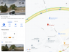
Once it finishes loading then you should be presented with a map centred on Spain that has some Camino routes drawn on it in differing colours.

Now is a good time to give your new map a more useful title. Click on the text that says "Untitled map" and a new window should open with "Untitled map highlighted in blue. Type in a more meaningful (to you) name and then in the area just below this type in a description. I suggest that the description should mention that the maps comes from the Dutch source and the date that it was downloaded (i.e. today). This will help you in future when you decide that it is time to update the map. Then click "Save".

Your new map should now re-appear with a new, more meaningful name and description towards the top of the box. Just below this you should notice that it says "All changes saved in Drive".

Now is the time to change the base map if you want to but, of course, you don't have to change the base map. If you want to then scroll down to the bottom and then click on the drop down and choose a different base map. Perhaps just experiment with this feature to see what is available and what you prefer to see.

That basically is that. You have just created a route(s) that can be seen when using Google Maps.

To prove this, on the PC open a new Chrome tab and inside it open Google Maps.
Inside Google Maps click on the Hamburger menu icon on the left and then choose "Your places" from the drop down menu.
Within "Your places" window click on the Maps tab (towards the top right).
Your new map should now be at the top of that list. Click on it.

You are now using Google Maps showing the new routes that you have added.

Of course, the next thing that you are going to ask is: How do I then view this on my iPhone?

Well, I don't have an iPhone and so I can't tell you exactly but on my Android phone I open the Maps app, at the bottom of the screen I touch "Saved". Then scroll to the bottom of that screen and touch "Maps" (in blue). Choose the same meaningful name and Voila! I can see the Camino routes on my phone.

Over to you. Let the questions begin
 
Thanks, @Doughnut NZ
I needed a laugh, and I am currently in hysterics. Perhaps @C clearly has the know how to follow your instructions, but I don't and never will. This is not deliberate ignorance, but simply the way my life has gone. I am content with using maps.me for things for which I need a mapping function, The only reason that I wanted to improve my access to online information with regards to the Levante is that I was noticing that maps.me does not indicate adequate accommodation in the smaller villages. @peregrina2000 referred me to Google Maps, which does show considerably more spaces to sleep and gives useful information about them. So my current challenge has been, for the moment, met. I am way behind on working my way through all the locations and catching up with the rest of those on the virtual Levante camino, so that is what I am working on now. As I proceed, I find that there are more things that I can find in the existing apps, so I am learning what I can in my own limited way, focusing on what I, as a walking pilgrim, need to help my everyday life. I am quite content with how things are going now, and grateful for all who have assisted me in this.
 
Get a spanish phone number with Airalo. eSim, so no physical SIM card. Easy to use app to add more funds if needed.
I needed a laugh, and I am currently in hysterics. Perhaps @C clearly has the know how to follow your instructions, but I don't and never will.
Your laughter made me laugh. I thought DoughnutNZ's explanation was excellent and clear, and I have bookmarked it to come back to - but I need to be rested at the time, and be ready to solve that specific problem. For a few days I am focusing on file management until I get my maps.me files organized on my phone.

By the way, @Albertagirl, have you gotten into the habit of searching YouTube for instructional/help videos? They can be excellent aids for everything from phone management to sewing and appliance repair.

You may notice that I have tagged this thread with "maps gps & tracks". This tagging is a work-in-progress, but the idea is to gather threads with such tips. If you go to this page, you can search for that tag. But you won't find much yet because I haven't yet have quickly searched to gather and tag some good threads. If DoughnutNZ and Rick or others know of particularly good threads, just send me the links and I can tag them to create a collection.
 
Last edited:
I am more in the albertagirl camp. When someone says
Firstly download the .kml file that you want to use and put it somewhere where you can find it again.

I say two things — first, I don’t use kml, but rather gpx, so I wonder if the steps will be different. Assuming these steps will work for .gpx, I then say — what does “put it somewhere where you can find it again“ mean? How do I do that? It assumes I know how to save these files, which I have tried to do unsuccessfully in the past.

I say this not to discourage these discussions, but to point out that the level of expertise and comfort is so different from one person to the other. There are some of us who do not understand what others find simple and clear. I know the tech gurus on the forum have a lot of patience, which I have greatly benefitted from, so @Albertagirl, asking whatever questions are embedded in your “laugh out loud” is something you should feel free to do.
 
I then say — what does “put it somewhere where you can find it again“ mean?
Oddly, that is a sentence that really resonated with me! (Remember, "file management" is on my mind today.) You said you have been unsuccessful in the past - maybe you saved them but did not realize where they got saved. That is often a problem, that needs to be thought about before the saving takes place.
 
Ideal pocket guides for during & after your Camino. Each weighs only 1.4 oz (40g)!
If you are using the file from the (very nice) Dutch site then the first issue that you will face is that their file contains a bunch of Spanish Caminos and is 6.4Mb. The issue is: The tool that I am going to use can only deal with files up to 5.0Mb in size. I downloaded their file and edited it to delete some of the Caminos to make it smaller and my edited version can now be found here: https://drive.google.com/file/d/1CKL794V0Vw25X_h6yfshMbdntdVhzg7j/view?usp=sharing Download this file to your PC.
This is the way I work with these files to, and it is the way they are even made. :p
If you want to work on these files yourselves but are afraid to change anything in the code yourself, it is also possible to open them in google earth on your computer. If you the extract the file in the left column, you will see the different camino's which are part of this file. Just click on any and delete a part, and save again (preferably under a different name....) This should work as well.
If anyone would like a specific part out of the big file, please let me know. I will be happy to customize it. 😌
 
I am more in the albertagirl camp. When someone says


I say two things — first, I don’t use kml, but rather gpx, so I wonder if the steps will be different. Assuming these steps will work for .gpx, I then say — what does “put it somewhere where you can find it again“ mean? How do I do that? It assumes I know how to save these files, which I have tried to do unsuccessfully in the past.

I say this not to discourage these discussions, but to point out that the level of expertise and comfort is so different from one person to the other. There are some of us who do not understand what others find simple and clear. I know the tech gurus on the forum have a lot of patience, which I have greatly benefitted from, so @Albertagirl, asking whatever questions are embedded in your “laugh out loud” is something you should feel free to do.
Yes, .gpx files also work with mymaps in the way I described. I left that file type out for simplicity.
 
That is often a problem, that needs to be thought about before the saving takes place.
Different web browsers on different operating systems save files in different "default" places. However, in all cases it is possible to find out where that default place is. Without knowing which browser and which operating system each person is using I can't provide tailored instructions.

In most browser/operating system combinations there is an option to save files in a place of your own choice. If you want to choose your own place then that is normally simpler for you provided you remember where you put it.
 
Technical backpack for day trips with backpack cover and internal compartment for the hydration bladder. Ideal daypack for excursions where we need a medium capacity backpack. The back with Air Flow System creates large air channels that will keep our back as cool as possible.

€83,-
I am more in the albertagirl camp. When someone says


.... what does “put it somewhere where you can find it again“ mean? How do I do that? It assumes I know how to save these files, which I have tried to do unsuccessfully in the past.

I say this not to discourage these discussions, but to point out that the level of expertise and comfort is so different from one person to the other. There are some of us who do not understand what others find simple and clear.
I understand that there are many levels of expertise within the forum and this is further complicated by the different technology that each of us uses.

That is why I was very specific about what technology I was using at the start of my post.

If someone uses the technology that I described, then, by default when they click on the link on the Dutch website (or my supplied link of a smaller file) the Chrome browser will offer to save the file within the Downloads folder on your PC.

Before clicking the save button, read the filename on the screen, then when you need to find the file again later you will know that it is in the Downloads folder and you will know it's filename.
 
To make things even simpler, I have shared the smaller map that I created from the edited one on the Dutch website.

It can be found here: https://goo.gl/maps/qZXHNJzxSS2DNWwr7

Simply click on this link and choose to open the file in G Maps and you will see a subset of Spanish Camino routes that includes the Levante and the Frances plus some others.

I am not yet sure if you can save this file onto your own phone or if you need to click the link every time you want to use it. I will investigate and report back.
 
Last edited:
Hi there,
@Doughnut NZ great instructions. I will try out the editing in text file. Haven’t ever dared before.
I have built my own Camino maps in google maps my maps. That is not maps.me.......
They are available in the iPhone version of google maps. Choose saved data at the bottom of the screen and then scroll right to find maps. The good maps you will have made with the aforementionned great instructions on your computer will be listed there (You need to be signed in to google). Click on the one you want and it will show up in your google maps display on the iphone. Just did it for the first time. Works well. You may need to iterate back to your computer to make things look better for your iPhone.
enjoy.
 
3rd Edition. More content, training & pack guides avoid common mistakes, bed bugs etc
I have added the accommodation way markers from the Dutch site. They seem quite good but I did notice that some were a little offset from where G Maps had the accommodation placed. No more than a couple of metres but keep this in mind. I have only added those that are in a .klm or .gpx file. If someone else would like to put the ones that are in .pdf files into either .klm or .gpx then I will add those as well.

A couple were way out though and so I have attempted to fix those. There is also at least one A Bolbereta that Google Maps is showing as being permanently closed. G Maps is showing a new ALBERGUE CASA SABELA on the same spot and this Albergue is taking bookings on Bookings.Com and has an active Facebook page. So I take no responsibility for the accommodation way points although the Dutch web site suggests that @SYates is the coordinator.
 
Last edited:
I couldn't get my recent KML tracks to appear on my new phone. A bit of googling revealed that apparently some Samsung file managers can't handle KMLs.

Capture3.JPG
I had a Samsung phone before, but maybe the file manager was different or maybe I got lucky and some other quirk made it all work. So I have now installed Total Commander, opened the downloaded files, and the tracks instantly appeared. That's very satisfying, but now I still need to find out how to achieve "total command" of all my files.
 
The one from Galicia (the round) and the one from Castilla & Leon. Individually numbered and made by the same people that make the ones you see on your walk.
Hi there,
... I will try out the editing in text file. Haven’t ever dared before.
The trick is to use a text editor that at least understands XML. Notepad++ is good for that. There are also specialist XML editors out there but I have never had the time to evaluate them and Notepad++ does everything that I need so I can't comment on the other editors. My advice though is NOT to use simplistic editors like Notepad that don't understand XML as they wont maintain the structure of the XML such as nice indents and tag pairing and so it becomes very easy to get lost and make a syntax error with the XML that may be hard to find later. Also, do NOT use a word processor as they will add formatting that will confuse the XML.
 
I am in awe.
@DoughnutNZ, thanks for taking the time to share all that. Bookmarked!

When I tried to open this is said I needed permission. What's with that - is it a glitch of my sysem, or...?
I made it public originally but maybe when I edited it it reverted to me only. I will have another look at it.

Okay try this link: https://www.google.com/maps/d/edit?mid=1IGoOibNBNcyKeBofrAFzAUSSBMLxbtRS&usp=sharing

I will stop editing it so it can stabilise. @C clearly
 
The 2024 Camino guides will be coming out little by little. Here is a collection of the ones that are out so far.
I'm getting a bit lost in this thread. Some of what I'm going to say may have been covered earlier in different, and possibly better, ways. But if you don't want to download or learn a different app these instructions will help you add points of interest (POI) data to maps.me to supplement your camino. [@Doughnut NZ's cautions on editing are good but it is possible to edit a file in kml format with a simple text editor if you are careful.]

Let's say that you use maps.me and you have a kml or kmz track of the camino but it doesn't show any (or enough) lodging. And maybe you wish it showed the locations of ermitas (or bars) that people have recommended. This problem can be fixed easily if you can find the latitude and longitude coordinates of the points of interest. What you do is create one or more kml files with the points of interest. The harder part is getting the coordinates, creating the files is easy.

Use the text in the code box below to create a text file, say MyCaminoPOI.txt. Edit the value between the <name></name> tags to something meaningful to you (e.g., MyCamino POIs). Then edit the material between each of the <Placemark></Placemark> pairs. Add more <Placemark> data as needed. Actually, you do not even have to have the <description></description> lines. Note that the kml coordinates (longitude & latitude) are the reverse of what you normally see (latitude & longitude). Also, the values are in decimal format. Further note that longitudes west of the prime meridian have a minus sign in front.

When done editing, save the file and then copy it with the ".txt" suffix replaced with ".kml". Email that kml file (and others that you might create) to yourself as attachments. On your smartphone open the email and click the attachment(s). You will be prompted to enter the application to open the attachment. Use maps.me and it will add the kml file to its list of known files.

Then, when in maps.me, pick the icon at the bottom with the two stars. You will be presented with a list of klm and kmz files that includes the ones you made youself and ones with tracks that you may have downloaded. You can choose "Hide all" and then select just the ones that you need for your camino. Get back to the map by picking the left pointing arrow at the top of the page. Then, on the map, move to the location of your camino (if you are on the camino then pick the icon for showing your current position otherwise navigate the map with your fingers). You should see the marker for the points you entered into your kml files in addition to the track and its waypoints from your downloaded file(s). So, now when you walk the way you can see where that pretty ermita is that @perigrina2000 told you about and take the side trip to it when close.

I actually tested all this out before doing this writeup.

By the way, something similar can be done with the OsmAnd+ app but the format of the gpx file it needs is different from that of the kml file.

Code:
<?xml version="1.0" encoding="UTF-8"?>
<kml xmlns="http://earth.google.com/kml/2.0">
	<Document>
		<name>GPS Visualizer data</name>

		<Folder>
			<name>Waypoints</name>

			<Placemark>
				<name>Astate</name>
				<description>Mountain top </description>
				<Point>
					<coordinates>-1.2593079,43.0774774</coordinates>
				</Point>
			</Placemark>

			<Placemark>
				<name>Beillurti</name>
				<description>Yet another mountain top</description>
				<Point>
					<coordinates>-1.2707233,43.0823359</coordinates>
				</Point>
			</Placemark>

		</Folder>
	</Document>
</kml>
 
Down bag (90/10 duvet) of 700 fills with 180 g (6.34 ounces) of filling. Mummy-shaped structure, ideal when you are looking for lightness with great heating performance.

€149,-
If you are using the file from the (very nice) Dutch site then the first issue that you will face is that their file contains a bunch of Spanish Caminos and is 6.4Mb. The issue is: The tool that I am going to use can only deal with files up to 5.0Mb in size. I downloaded their file and edited it to delete some of the Caminos to make it smaller and my edited version can now be found here: https://drive.google.com/file/d/1CKL794V0Vw25X_h6yfshMbdntdVhzg7j/view?usp=sharing Download this file to your PC.
I'm curious. Which Caminos did you delete? Then I can search for them, and create another kml file with just them, and import them into my map on another layer. :)
 
Oh.
Rick.
Deer in the headlights here. 🤪 :eek:
Let's say that you use maps.me and you have a kml or kmz track of the camino but it doesn't show any (or enough) lodging.
I solve this by cross-checking manually...just opening another tab and looking at another map.
It requires no knowledge of coding or even much tech skill, besides knowing that I can have two tabs open simultaneously.

But anyone with skills will have fun with this!
 
I am more in the albertagirl camp. When someone says


I say two things — first, I don’t use kml, but rather gpx, so I wonder if the steps will be different. Assuming these steps will work for .gpx, I then say — what does “put it somewhere where you can find it again“ mean? How do I do that? It assumes I know how to save these files, which I have tried to do unsuccessfully in the past.
When I clicked on the link to the file, Chrome couldn't open it and instead dowloaded it and put it automatically in my "downloads" folder. Since my downloads folder seems to be ordered with the most recent files on top, I found it quite readily. I can just leave it there (which I did). When I went to import it to my Google map, I went to my "downloads" folder to select it. Or, I could have made a folder using Windows Explorer (for example, "Map files" and moved it to that folder. I might do that if I were more organized and could count on myself to remember (a) that I had made a "Map files" folder and (b) where I had made the folder.
 
Technical backpack for day trips with backpack cover and internal compartment for the hydration bladder. Ideal daypack for excursions where we need a medium capacity backpack. The back with Air Flow System creates large air channels that will keep our back as cool as possible.

€83,-
Simple. I use OSMand to follow or lay down tracks, and cross check by looking at Googlemaps - the POIs shown are not always the same. Am I missing something?
 
I'm curious. Which Caminos did you delete? Then I can search for them, and create another kml file with just them, and import them into my map on another layer. :)
Sorry, I didn't keep a note. I was more thinking that the file I created was an example rather than a resource to keep and use. It was only later that I realised that it had ongoing value and started adding to it.

If I get time tomorrow I will do a diff in Notepad++ and that will give me the names of the deleted Camino's.
 
Technical backpack for day trips with backpack cover and internal compartment for the hydration bladder. Ideal daypack for excursions where we need a medium capacity backpack. The back with Air Flow System creates large air channels that will keep our back as cool as possible.

€83,-
I'm getting a bit lost in this thread. Some of what I'm going to say may have been covered earlier in different, and possibly better, ways. But if you don't want to download or learn a different app these instructions will help you add points of interest (POI) data to maps.me to supplement your camino. [@Doughnut NZ's cautions on editing are good but it is possible to edit a file in kml format with a simple text editor if you are careful.]

Let's say that you use maps.me and you have a kml or kmz track of the camino but it doesn't show any (or enough) lodging. And maybe you wish it showed the locations of ermitas (or bars) that people have recommended. This problem can be fixed easily if you can find the latitude and longitude coordinates of the points of interest. What you do is create one or more kml files with the points of interest. The harder part is getting the coordinates, creating the files is easy.

Use the text in the code box below to create a text file, say MyCaminoPOI.txt. Edit the value between the <name></name> tags to something meaningful to you (e.g., MyCamino POIs). Then edit the material between each of the <Placemark></Placemark> pairs. Add more <Placemark> data as needed. Actually, you do not even have to have the <description></description> lines. Note that the kml coordinates (longitude & latitude) are the reverse of what you normally see (latitude & longitude). Also, the values are in decimal format. Further note that longitudes west of the prime meridian have a minus sign in front.

When done editing, save the file and then copy it with the ".txt" suffix replaced with ".kml". Email that kml file (and others that you might create) to yourself as attachments. On your smartphone open the email and click the attachment(s). You will be prompted to enter the application to open the attachment. Use maps.me and it will add the kml file to its list of known files.

Then, when in maps.me, pick the icon at the bottom with the two stars. You will be presented with a list of klm and kmz files that includes the ones you made youself and ones with tracks that you may have downloaded. You can choose "Hide all" and then select just the ones that you need for your camino. Get back to the map by picking the left pointing arrow at the top of the page. Then, on the map, move to the location of your camino (if you are on the camino then pick the icon for showing your current position otherwise navigate the map with your fingers). You should see the marker for the points you entered into your kml files in addition to the track and its waypoints from your downloaded file(s). So, now when you walk the way you can see where that pretty ermita is that @perigrina2000 told you about and take the side trip to it when close.

I actually tested all this out before doing this writeup.

By the way, something similar can be done with the OsmAnd+ app but the format of the gpx file it needs is different from that of the kml file.

Code:
<?xml version="1.0" encoding="UTF-8"?>
<kml xmlns="http://earth.google.com/kml/2.0">
    <Document>
        <name>GPS Visualizer data</name>

        <Folder>
            <name>Waypoints</name>

            <Placemark>
                <name>Astate</name>
                <description>Mountain top </description>
                <Point>
                    <coordinates>-1.2593079,43.0774774</coordinates>
                </Point>
            </Placemark>

            <Placemark>
                <name>Beillurti</name>
                <description>Yet another mountain top</description>
                <Point>
                    <coordinates>-1.2707233,43.0823359</coordinates>
                </Point>
            </Placemark>

        </Folder>
    </Document>
</kml>
Oh Ric! I do so like it when you talk dirty to me like this.
 
Questions about maps.me on my Android...

I have about 100 "Lists" (see screenshot). Almost all of them are a single track with a bookmark or two. However, one List "Jacobsweg..." has 125 tracks. That is conveniently organized!

Can anyone tell me...
  1. Should I have a List/folder called "My places" by default, as shown on this page, or was that just an example of how someone created and named a list?
  2. What actually are "Lists" anyway?
  3. Can I combine some of my small Lists (i.e. those with a single track) into different camino collections, putting many tracks together like the Jacobsweg group?
  4. Is there a way to know, from viewing the track on the map, which kml file it is? For example, if I wanted to delete a kml file because the track has been rerouted, how can I find it to delete?
    • First I would need to know the name of the file. How can I know this except by painstakingly going through every file, toggling show/hide, and checking the map to see if it is the one I want?
    • Even if I need the name of the file, I would need to scroll down the unsortable lists, hunting for it, so I can then delete it.
I can view all of the files on my computer with Explorer, sorting and organizing them in folders on my phone. However, in the maps.me app, I cannot sort them. The default sort is in the order they were added (most recent at the top).

It might be argued that I don't really need to do all of this. Am I just being a control freak, wanting to know what is where? But surely I should be able to find and delete a track easily.

Thanks for any help you can give!
 

Attachments

  • Screenshot_20200915-215031_MAPSME.jpg
    Screenshot_20200915-215031_MAPSME.jpg
    313 KB · Views: 2
Edit: If you still want to experiment you can try the stuff in the now last paragraph but I tried something similar on my linux system and it didn't work. I did find something on using Google Earth to combine files but I can't try it out, not even at our library, covid closed.

A PDF file: http://www.sdonecall.com/KMZKMLfiles.pdf

@C clearly, my laptop died so I can't experiment but this is what I would do. Take some kml files that are nearby each other (on the ground) and zip them up. Rename the file by changing the .zip to .kmz and see if all the tracks in the kml files show up. Maybe use Google Earth on a PC. If it works then maybe you don't need lists. If it doesn't work then maybe GE can be used to pack the kml files into a kmz. (There is some more to the kmz format other than compressing kml files but I think that is mainly adding some other files too with icon graphics).
 
Last edited:
A selection of Camino Jewellery
I am not on Facebook and there is no way that I will sign up, which I would need to do in order to gain access to their information. This is not an option for me.
Facebook makes it kind of confusing. But if you ignore their prompts to sign in or sign up, you can generally just use all the information on a FB page. It’s irritating, but it still works. I selected the Facebook page map link and I was able to bring it up without signing in. and I do know people who create Facebook profiles with pseudonyms so they can use the few things that are actually good about Facebook without sharing their personal information.

Some businesses set up a Facebook page because they need an online presence, and it’s very easy to do, compared to some of the other options.
 
Last edited:
It's funny how this thread is going. @Doughnut NZ 's metaphor seems to work for me. I guess I am just too old to 'talk dirty." So long as I don't get too lost - getting lost can be very interesting - and find a bed to sleep in for most (preferably all) nights, I am content. For me, planning for a camino comes together over time. The great benefit of the present situation is that I have lots of time to plan. And I am well aware that God is laughing at all my plans. But I will go on planning and hoping through this pandemic. Ultimately, I agree with Julian of Norwich, who lived through her own pandemic, that "All will be well, and all manner of things will be well." In the meantime, I live in hope. This thread no longer helps me with planniing, having gone on way beyond my capacity. But I have had the priviledge of getting to know some kind people who are most generous with their time. Thanks to all.
 
So. I took @Doughnut NZ KML file and added it to a Google Map. Then I added in the Portuguese Caminos from the Dutch site to the same map. Then I downloaded the "too big" KML file from the Dutch site and removed the Caminos @Doughnut NZ had kept and added the remainder to my Google Map. That left me with a Google Map with many of the routes in Iberia. Then I went digging through my forum bookmarks for favourite albergue/favourite restaurant/favourite bar resources and recommendations and added those places to the map as well.

What I ended up with is here: https://www.google.com/maps/d/edit?mid=1vf4iNGwIJhcsChA-pLk5uanLVshEB806&usp=sharing

If you have a place you'd like added to the map, let me know.
 
Ideal sleeping bag liner whether we want to add a thermal plus to our bag, or if we want to use it alone to sleep in shelters or hostels. Thanks to its mummy shape, it adapts perfectly to our body.

€46,-
So. I took @Doughnut NZ KML file and added it to a Google Map. Then I added in the Portuguese Caminos from the Dutch site to the same map. Then I downloaded the "too big" KML file from the Dutch site and removed the Caminos @Doughnut NZ had kept and added the remainder to my Google Map. That left me with a Google Map with many of the routes in Iberia. Then I went digging through my forum bookmarks for favourite albergue/favourite restaurant/favourite bar resources and recommendations and added those places to the map as well.

What I ended up with is here: https://www.google.com/maps/d/edit?mid=1vf4iNGwIJhcsChA-pLk5uanLVshEB806&usp=sharing

If you have a place you'd like added to the map, let me know.
Thanks David😍, I have been a bit busy doing other stuff these last couple of days and so I wasn't able to do what I said I would do. ☹️
 
This thread no longer helps me with planniing, having gone on way beyond my capacity.
The camino provides! No sooner than you said that, look what David posted: 😌
Click the link...it's a wonder. Muchas gracias!
I now have a shortcut to it in my home screen.

And edit...
If you have a place you'd like added to the map, let me know.
How about a route? Pretty please... 😌
The Viejo/Olvidado is missing.
Here' the Amigos' map of the Olvidado.
The Viejo starts in Pamplona and joins the Olvidado in Aguilar de Campoo. A single map of the whole route is hard to find, but @caminka walked it and wrote a guide - her tracks of each stage are on wikiloc.
 
Last edited:
The camino provides! No sooner than you said that, look what David posted: 😌
Click the link...it's a wonder. Muchas gracias!
I now have a shortcut to it in my home screen.

And edit...

How about a route? Pretty please... 😌
The Viejo/Olvidado is missing.
Here' the Amigos' map of the Olvidado.
The Viejo starts in Pamplona and joins the Olvidado in Aguilar de Campoo. A single map of the whole route is hard to find, but @caminka walked it and wrote a guide - her tracks of each stage are on wikiloc.
The Olvidado should be there, with several variants. It was in the Dutch file. Make sure the "Additional Spanish routes" is checked. For the Viejo, I can add it if someone can get me the kml or gpx file. I'm not sure how to download them from wikiloc. I found this page with kml files of Camino routes from the Spanish National Geographical Institute, but it doesn't seem to include the Viejo, unless I am somehow failing to notice it there.
 
Last edited:
A selection of Camino Jewellery

Most read last week in this forum

Hola. While I am familiar with air travel restrictions on knives, I want to read your answers on carrying a small folding knife (Gerber Gear US1, (2.6 inch /6.6 cm blade)) in trains and buses in...
Hello. Having done the Portugese Central from Porto a few years ago, we will be doing the Frances from Leon this April. Searching the forums for footwear suggestions, we (wife and I) decided on...
I couldn't find any posts about this topic on the forum (first time that's ever happened) so I thought I'd ask... It always seemed to me that wringing hand-washed clothes never works very well...
Hi All, I am completing the Camino Ingles in April. I have just bought hiking trainers, as I find walking boots very heavy on my little, old feet. Hpwever, I am worried about conditions, with...
Hello, I will be doing El Camino from Sarria to Santiago this May 13 for the first time. I tend to twist my ankles in uneven surfaces and to easily slip on slippery surfaces. I have some...

❓How to ask a question

How to post a new question on the Camino Forum.

Similar threads

Forum Rules

Forum Rules

Camino Updates on YouTube

Camino Conversations

Most downloaded Resources

This site is run by Ivar at

in Santiago de Compostela.
This site participates in the Amazon Affiliate program, designed to provide a means for Ivar to earn fees by linking to Amazon
Official Camino Passport (Credential) | 2024 Camino Guides
Back
Top