travellover
Member
What do you use to measure the km? GPS? Pedometer? Some other gadget?
| For 2024 Pilgrims: €50,- donation = 1 year with no ads on the forum + 90% off any 2024 Guide. More here. (Discount code sent to you by Private Message after your donation) |
|---|
There are free apps for your smart phone that will keep track of your daily walking distances and time. They also record the route you walked. It is great to have the mapped daily walks when you return home.. Not needed..but fun.
Two that I have used are: MotionX GPS and MapmyWalk.
They are both simple to use and do not require phone or WiFi connection to operate.
The GPS function is separate from the other.
There are some very good threads on the forum discussing this.
I liked Mapmywalk and have used it over the past year for training. The downside is that it uses up a lot of battery. A walk of 4-5 hours has depleted my battery... so I won't use it on the camino. It's not that important to me to be that precise with how far I've walked.
You are going to get a lot of badges!!! I got 40,000 once, and 35,000 six times.I will use my fit bit to track my miles
I found the easiest method to gauge distance walked is to use the simple kilometers per hour basis. It goes like this:
3.0 km/hour - on uphill terrain, steep downhills, and in rainy muddy weather - one km each 20 minutes....
4.0 km/hour - "normal" pace on rolling terrain in reasonably nice weather. This is the baseline - one kilometer each 15 minutes....
5.0 km/hour - at this pace you are walking FAST; not speed-walking mind you, but still covering one kilometer each 12 minutes or so....
Just BTW - I read a book last year by a guy who walked from St. Jean Pied de Port to Santiago de Compostela in 20 days!...
FYI - at 60 years young, I strive for the 4.0 km/hr pace over a day. That allows me to cover a day's walk in 6 to 7 hours. If I hit the road at 07:00, I am usually done by about 14:00, mas o menas...
Enjoy the experience. It is truly profound and ought not be rushed - at least IMHO.
Hi, I use Endomondo on my phone. It does distance and elevation. It doesn't chew the battery if you switch off unnecessary connections. I tried it with "flight mode" and it recorded the walk, then uploaded it once I got home.I thought I didn't care about distances beyond actually arriving each day.....but I've been using Strava just to see what kind of elevations gains we've been doing on practice walks at home and I've discovered looking at the stats at the end of a hike are more than a little bit interesting. We're going to do a 20+km walk at the weekend so I can see how much battery it chews up.
(I, too, started with Map My Walk, but it didn't give any elevation details so I switched to Strava)
I also used Runkeeper for my camino, and it worked well. It uses GPS, but it does not use much battery. It gives a lot of useful information. It also saves a complete record of how much I walked each day and the elevation profile of the walk -- useful if I want to go back and remind myself of particulars.I use an app, 'Runkeeper' to log my walks here at home. It records distance, pace, elevations (even calories used!!). Seems fairly accurate and does not use a lot of battery. Although, like Sixwheeler, when walking over distance, I just pick a target stop ahead and walk until I arrive.
I tried it today, also on airplane setting. My son sighed when I told him it recorded only the time and not the route or distance. I was supposed to know this would be impossible - at least on an iphone. What's your trick? I'm keen to preserve battery if possible.Hi, I use Endomondo on my phone. It does distance and elevation. It doesn't chew the battery if you switch off unnecessary connections. I tried it with "flight mode" and it recorded the walk, then uploaded it once I got home.
The app has been useful for training because it gives interesting stats about average speed, "lap times" (per km) and gives you a nice map that seems to integrate with Google maps. One benefit is you can look up your route for writing a journal or blog.
From the Apple website regarding airplane mode for i-devices: http://support.apple.com/kb/ht1355I tried it today, also on airplane setting. My son sighed when I told him it recorded only the time and not the route or distance. I was supposed to know this would be impossible - at least on an iphone. What's your trick? I'm keen to preserve battery if possible.
The only time I counted strides was on a stretch of road between Ponferrada and Cacabelos where someone had painted stripes on the pavement every hundred meters for a few km. I guess they might have been painted for a 5k run. The only reason I counted was to verify that it is, in fact, a million steps from SJPP to Santiago -- at my average pace of 1300 steps per km, it is 1,040,000 steps. This, of course, assumes that all steps are the same, which they are not due to terrain, etc, so it's probably more like a million and a quarter steps when you factor in sight-seeing around the towns and villages.... I found my stride was really close to 1 meter per step and all I had to do was focus on counting...
Hi. I just went out again for a short walk around the neighbourhood with the endomondo app running on both an Android phone and a Windows Phone 8. Both recorded all the necessary stats with Flight mode selected. I cannot comment on the iphone. I will try it again on a longer out-of town walk.I tried it today, also on airplane setting. My son sighed when I told him it recorded only the time and not the route or distance. I was supposed to know this would be impossible - at least on an iphone. What's your trick? I'm keen to preserve battery if possible.
I don't see why not. I'm really going on suggestions I've read elsewhere about SIM Cards.Funky skier would a French sim work just as well as a Spanish sim ?
Sent from my iPhone using Camino de Santiago Forum mobile app
 ?
?Hi, I use Endomondo on my phone. It does distance and elevation. It doesn't chew the battery if you switch off unnecessary connections. I tried it with "flight mode" and it recorded the walk, then uploaded it once I got home.
The app has been useful for training because it gives interesting stats about average speed, "lap times" (per km) and gives you a nice map that seems to integrate with Google maps. One benefit is you can look up your route for writing a journal or blog.

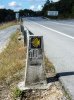
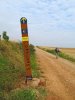
This might be useful for someone not interested in measuring the distance they have personally travelled who is walking the CF. I think there is a more general issue here that some people want to know what distances they have walked, including detours, elegant route variations and end of day shopping. I have used a dedicated GPS on all my pilgrimage walks for that purpose. I have tried using GPS apps on an older smartphone, and between increased battery use and difficulty getting a good satellite fix, gave up. My new Android phone appears to get a fix more quickly, but there is still a power issue.The easiest, cheapest and most foolproof way that I am aware of is to simply consult a sheet with the distance between towns. I have attached a sheet to this post (see below and download) so that you can print it out and bring it with you. This is really all you need. Just follow the yellow arrows and use this sheet. Please not the author's name (not me) for credit.
You did not walk the coastal boardwalk from Matosinhos to Vila do Conde Maggie ? You missed something !I used 'map my walk' on my iPhone 5 on my camino Portuguese this year. I didn't find it drained my battery too much, but I did have an external battery pack, so this wouldn't have been a problem.
I liked to know how far I had walked and how far remained to be travelled. I was also surprised to note that the distances given in the JB guide book consistently understated the distances my gps device measured, by a minimum of 10% and often more. This made a significant difference to the overall length of the walk which according to JB is 615 km and according to my gps I walked 670 km, including a couple of diversions that would not have added up to more than 20 km.
I would be interested to know if this difference in distance was also noted on the Frances route, which I walked last year without the benefit of gps.
I agree that the stats produced at the end of each day's walk are very interesting, showing elevation and pace. I even became quite fond of 'Penelope Pocket' as I called my app voice (well, she lived in my pocket and she sounded quite posh) advising me when I had completed another km.
I know lots of people would balk at the idea of such a gadget, but I really enjoyed it and make no apologies for liking my toys. Let's just enjoy eachother's differences.
View attachment 11367
This might be useful for someone not interested in measuring the distance they have personally travelled who is walking the CF. I think there is a more general issue here that some people want to know what distances they have walked, including detours, elegant route variations and end of day shopping. I have used a dedicated GPS on all my pilgrimage walks for that purpose. I have tried using GPS apps on an older smartphone, and between increased battery use and difficulty getting a good satellite fix, gave up. My new Android phone appears to get a fix more quickly, but there is still a power issue.
BTW, there are several inaccuracies in the other data presented on the sheet @hotelmedicis attached to his post. Don't expect to find a medical centre at Sanbol, but there was a bar and grocery store at Granon when I walked the CF. I suppose this is the difficulty with any information source - there is always the prospect of initial inaccuracy, then things will change over time.
I used Strava last summer on the CF, SJPdP to Santiago, averaging 40km/day with a 56km max in there. The app was loaded on an iPhone 5S. It never let me down. When I got home, I edited all the GPS data into one file and loaded it into a map of northern Spain. Kind of a fun project. But I'm a gadget head.I thought I didn't care about distances beyond actually arriving each day.....but I've been using Strava just to see what kind of elevations gains we've been doing on practice walks at home and I've discovered looking at the stats at the end of a hike are more than a little bit interesting. We're going to do a 20+km walk at the weekend so I can see how much battery it chews up.
(I, too, started with Map My Walk, but it didn't give any elevation details so I switched to Strava)