• For 2024 Pilgrims: €50,- donation = 1 year with no ads on the forum + 90% off any 2024 Guide. More here.
    (Discount code sent to you by Private Message after your donation)
  • ⚠️ Emergency contact in Spain - Dial 112 and AlertCops app. More on this here.

Search 69,459 Camino Questions

Le Puy Plus Norte/Primitivo

Union777

New Member
Time of past OR future Camino
Camino Frances (2017)
Geneva to SJPP (May/June 2018)
I can’t seem to find any threads with information about pairing the Camino from Le Puy and continuing on to do the Camino Norte/Primitivo. I will be beginning my 2nd camino May 5, 2018 in Le Puy and would like to know how I would transition at SJPP to get onto the Norte route. Are these two routes compatible to walk together or would I be putting two physically difficult walks together that may be asking a lot from my body. After walking the CF this year my body was not ready to stop walking so thinking I would be able to put these two cominos together. Can anyone give me their experiences of how to get from SJPP to Iran or ??? Did you find theses two caminos are enjoyable to walk together if you have the time?
 
3rd Edition. More content, training & pack guides avoid common mistakes, bed bugs etc
Hi Union777!

That is easy. You follow the Camino Frances up to Leon. Once in Leon you take Camino del Salvador up to its end (Oviedo). From Oviedo you can take the Camino Primitivo or you can follow the Camino del Norte. Both caminos, Primitivo & Norte, split in front of the cathedral (it is well marked how to take one or the other).

This route is not so difficult to walk. You will find a couple of hard stages, one in the sector between Leon and Oviedo and another in the Primitivo (if you choose the Primitivo), but not anything REALLY difficult (Let´s say not as demanding as SJPdP - Roncesvalles).

Ultreia & Buen Camino!!
 
Thank you Lirsy, that does look straight forward from Leon but I was hoping to start the Norte near Irun so I don’t miss the beginning. I think it may be more complicated but I was hoping someone might know of a way that isn’t too difficult. I’ve already done the CF so was looking forward to new vistas. Thank you again for giving me one possibility!
 
Last edited:
A selection of Camino Jewellery
Mistaken reply deleted.
 
Last edited:
I can’t seem to find any threads with information about pairing the Camino from Le Puy and continuing on to do the Camino Norte/Primitivo. I will be beginning my 2nd camino May 5, 2018 in Le Puy and would like to know how I would transition at SJPP to get onto the Norte route. Are these two routes compatible to walk together or would I be putting two physically difficult walks together that may be asking a lot from my body. After walking the CF this year my body was not ready to stop walking so thinking I would be able to put these two cominos together. Can anyone give me their experiences of how to get from SJPP to Iran or ??? Did you find theses two caminos are enjoyable to walk together if you have the time?

Just take the train from Sppdp to Boyonne. 1 hour later hop on train Irun. Runs every few hours been camino
 
Down bag (90/10 duvet) of 700 fills with 180 g (6.34 ounces) of filling. Mummy-shaped structure, ideal when you are looking for lightness with great heating performance.

€149,-
Thank you to each one of you! You all have given me great options and I feel totally well prepared depending on which version I want to take. I'll keep it all in my Camino file!!
 
St James' Way - Self-guided 4-7 day Walking Packages, Reading to Southampton, 110 kms
You can skip going to Bayonne and go straight to Irun on La Voie de la Nive.

Ah, but then you’d miss ;):

Bayonne
122Bayonne2.jpg

Bidart
132Bidart2.jpg

Guethary
134Guethary2.jpg

St Jean de Luz
137StJeanDeLuz2.jpg
140StJeanDeLuz2.jpg

Socoa
147Socoa2.jpg

And the ferry from Hendaye to Irun
153Hendaye2.jpg

I loved the walk between Bayonne and Irun.
Jill
 
We pedalled from Bayonne to SJPdP, roughly following the Nive valley in June 2017, as part of our UK to SdC tandem cycle pilgrimage. The scenery is green and, in your direction, gently downhill. There is a railway and main road running parallel, but that mostly doesn't spoil the tranquility of the riverside path.

If jsalt's pictures haven't already persuaded you, Bayonne Cathedral has a lovely 'tampon' (sello) and I would recommend the Bar du Marche, near the covered market, for the atmosphere and affordable, traditional french basque food. Also Bayonne has a long history of fine chocolate making. And St Jean de Luz is the place for shellfish platters, fresh from the boat ......

I'm walking the Le Puy route too, but one month before you, stopping at SJPdP, as you start in Le Puy. I have great affection for this part of France already, so I'm hoping to indulge that affection with some good home cooking in the Gite d'Etapes along the way, as well some serene if energetic walking.

Bon chemin/Buen Camino!
Graham
 
In 2015, we walked from Le Puy to SJPDP. Then we caught the bus to Bayonne, then train to St Jean de Luz. We stayed in a hotel right on the Camino at Ciboure. Only had to walk out the door and start walking. From there did Norte, down to Oviedo then my husband and friend walked the Primitivo, while I went down to Frances with another friend. Fantastic walk and experience. You will love it.
The Cele Valley variant is beautiful on the Le Puy route.
 
Very light, comfortable and compressible poncho. Specially designed for protection against water for any activity.

Our Atmospheric H30 poncho offers lightness and waterproofness. Easily compressible and made with our Waterproof fabric, its heat-sealed interior seams guarantee its waterproofness. Includes carrying bag.

€60,-
Hello Union777
In 2015 I walked from Geneva to Le Puy then on to the Norte and ultimately Santiago. I have my Michelin #144 map in front of me and my transition started at St. Palais where I simply followed the D8 heading west. Originally I was going to go south to SJPDP and follow the GR10 to Hendaye but the weather was terrible! This was the middle of June and the rain would simply not let up! I stayed in a gite in St. Palais waiting for a break in the weather and while there a French couple arrived from SJPDP ( they had walked from their home in Normandy to the border and were now walking home!) Anyhow they said not to go on to the GR10 because with all the rain the path could be difficult and dangerous so on their recommendation I started following the road.
Not far out of St. Palais there on the left side of the road was a yellow arrow! Who knew? Somebody obviously. So I followed that and for the next three days made my way west, sometimes on pavement and sometimes on this wiggly path but always with an arrow. Then after Sare and the Col de St. Ignace - there was a sign for the GR10 !
I followed over hill and dale and suddenly out there in the distance was the French motorway the E 70/80 and soon I was walking through a built up area then over the motorway and into Hendaye! The sun was shining and as I stood on the water front overlooking the ocean trying to take a selfy to send home a voice called out in English "would you like me to take your picture for you?" Two fellows with backpacks stepped forward, took my pic and suddenly two more folks walked up asking if this was the Camino del Norte?
Bon chemin/Buen camino
 
Last edited:
I can’t seem to find any threads with information about pairing the Camino from Le Puy and continuing on to do the Camino Norte/Primitivo. I will be beginning my 2nd camino May 5, 2018 in Le Puy and would like to know how I would transition at SJPP to get onto the Norte route. Are these two routes compatible to walk together or would I be putting two physically difficult walks together that may be asking a lot from my body. After walking the CF this year my body was not ready to stop walking so thinking I would be able to put these two cominos together. Can anyone give me their experiences of how to get from SJPP to Iran or ??? Did you find theses two caminos are enjoyable to walk together if you have the time?
Time permits me from reading all of your responses at the moment but I did this with five of my six children a year ago!
We connected the two routes by foot...I wouldn't take back those days for a million dollars. The walk between the two is not to be missed!!!!!
My blog will share where we stayed etc... I think it was early October that we were in SJPP (using the side bar on my blog you can go from there). We also did all of the variants on the Le Puy route making our days a lot longer there than we imagined.
You are in for a wonderful journey!!!!
N
shefollowsshells.blogspot.com
 
The one from Galicia (the round) and the one from Castilla & Leon. Individually numbered and made by the same people that make the ones you see on your walk.
The sections of the GR10 from SJPP to Hendaye is spectacular, but incredibly rugged. It is a ridge route through the Pyrenees.
 
I can’t seem to find any threads with information about pairing the Camino from Le Puy and continuing on to do the Camino Norte/Primitivo. I will be beginning my 2nd camino May 5, 2018 in Le Puy and would like to know how I would transition at SJPP to get onto the Norte route. Are these two routes compatible to walk together or would I be putting two physically difficult walks together that may be asking a lot from my body. After walking the CF this year my body was not ready to stop walking so thinking I would be able to put these two cominos together. Can anyone give me their experiences of how to get from SJPP to Iran or ??? Did you find theses two caminos are enjoyable to walk together if you have the time?
My wife and I intend to do exactly this starting on or about May 10 (so five days behind you). Our idea (well mine really) is to do the GR10 through the Pyrenees. Kel may join me over these few days, or may spend an extra couple of days in St Jean/Bayonne/Irun. I'm looking forward to the challenge of three or four days in the Pyrenees. I would expect that having walked for about a month already, that physically we'll be up for it. It will be the mental/spiritual effort required that will decide what we do.

Anyway, we may cross paths somewhere in France. Bon chemin and all that!
 
The focus is on reducing the risk of failure through being well prepared. 2nd ed.
My wife and I intend to do exactly this starting on or about May 10 (so five days behind you). Our idea (well mine really) is to do the GR10 through the Pyrenees. Kel may join me over these few days, or may spend an extra couple of days in St Jean/Bayonne/Irun. I'm looking forward to the challenge of three or four days in the Pyrenees. I would expect that having walked for about a month already, that physically we'll be up for it. It will be the mental/spiritual effort required that will decide what we do.

Anyway, we may cross paths somewhere in France. Bon chemin and all that!
I hope this will help convince you that your theory is correct.
My first time out over to Roncesvilles I was dying leaving SJPP.
This last time with Le Puy under my belt I kept telling my children, "wait, up ahead you'll start struggling"...we bounced on up and over never having an ounce of trouble. Once we got over to Roncesvilles we came back to SJPP to head North to the Norte.4
Thanks for the encouragement! Really, there's a couple of hard bits out of SJPP up to Orisson, then the downhill into Roncesvalles, but the bulk of the middle section is only hard because of what came before (and what didn't come before in terms of training...)

From the profile of the G10 stages, it doesn't look like there's anything WORSE than that stage in terms of climbing, but there are 3 or 4 days back-to-back and I imagine that there will be far fewer people and resources.
 
I can’t seem to find any threads with information about pairing the Camino from Le Puy and continuing on to do the Camino Norte/Primitivo. I will be beginning my 2nd camino May 5, 2018 in Le Puy and would like to know how I would transition at SJPP to get onto the Norte route. Are these two routes compatible to walk together or would I be putting two physically difficult walks together that may be asking a lot from my body. After walking the CF this year my body was not ready to stop walking so thinking I would be able to put these two cominos together. Can anyone give me their experiences of how to get from SJPP to Iran or ??? Did you find theses two caminos are enjoyable to walk together if you have the time?

Hello Union777,
We might be doing an unorthodox thing, but we're leaving the Via Podiensis (GR65) at Arthez-de-Béarn, and cutting across to Bayonne, via Orthez, Salies de Béarn, Peyrehorade, Urt and then following the coast down to Hendaye and Irun.
It doesn't follow an "official" Camino, but if you're interested, once we have done the GPX tracks, we're happy to share these.
Buen Camino
Andrew
 
3rd Edition. More content, training & pack guides avoid common mistakes, bed bugs etc
I can’t seem to find any threads with information about pairing the Camino from Le Puy and continuing on to do the Camino Norte/Primitivo. I will be beginning my 2nd camino May 5, 2018 in Le Puy and would like to know how I would transition at SJPP to get onto the Norte route. Are these two routes compatible to walk together or would I be putting two physically difficult walks together that may be asking a lot from my body. After walking the CF this year my body was not ready to stop walking so thinking I would be able to put these two cominos together. Can anyone give me their experiences of how to get from SJPP to Iran or ??? Did you find theses two caminos are enjoyable to walk together if you have the time?

those routes are definitely compatible and quite spectacular. I walked this combination last year and loved it.

for the podiensis - norte link, there are several options, most of them outlined in the posts above.

I walked it lake this, following gr-10 most of the way:

https://www.wikiloc.com/hiking-trai...ed-de-port-saint-etienne-de-baigorry-17988679
a short day in preparation for the big day tommorrow. this is gr-10 with a combination of other routes and roads because I wanted to cut out the climb and descent of the mountain (I can't remember the name at the moment).

https://www.wikiloc.com/hiking-trails/camino2016-045-saint-etienne-de-baigorry-bidarray-17989159
a spectacular day, worth every sweat. a steep but good climb of almost 1000m of altitude difference, then following a ridge, and a steep and stony descent for about the same altitude difference. the ridge is by no means flat, there is one very short section where a scramble is necessary, leading down the the lowest saddle where there is the only water on the route - a small source that is usually at least trickling. the view all along spectacular. did you know that pic d'iparla is the highest summit in both basque countries? I didn't. I heard there is an alternative to the steep stony descent, but the first part is unmarked and you probably need to meet someone who knows it. gite d'etape for solo travellers is the one at the far end of the village, but it has a fine view of the half of the day's route. I got a single room. there's a kitchen. don't miss the interesting church.
definitely not recommended in bad weather, rain or snow. in this case, chemin de la nive follows a small road along the valley to the east of the ridge all the way to bidarray. this also saves a day of walking.

https://fr.wikiloc.com/itineraires-randonnee/camino2016-046-bidarray-ainhoa-17989675
the tricky part of the day is the climb to col d'artzatey which should be avoided if wet. part of the route is very eroded (it was being reparied in 2016), there are iron rails, and part is very exposed. I didn't feel uneasy at any time, but some might. if that is that case, there is an alternative chemin de contrebandiers (or sth like that) that follows a forest road to col de méhatché. the rest is beautiful and if you have enough energy, you can even extend the day to sare (but gite d'etape there is quite a way out of the town). gite d'etape ok, with kitchen.

https://fr.wikiloc.com/itineraires-randonnee/camino2016-047-ainhoa-olhette-17990191
the first part to sare no problems at all. then a climb to la rhune, which is mostly ok, just a short section is very stony and probably unpleasant if wet. when crossing the wide saddle, pay attentions to waymarks, as may routes and paths intersect here. the descent is a bit long. manttu baita is no longer a gite d'etape. the new chambres d'hotes - gite d'etape is just before the main road in olhette, trapero baita. there are two small rooms with very wide bunks and a swimming pool. half-pension only.

https://fr.wikiloc.com/itineraires-randonnee/camino2016-048-olhette-irun-17990592
this was a rainy day, so I completely avoided gr-10 and cobbled together sth from local roads, lanes and paths. I am not sure if the lane at 5.8km is public or private, I encountered a fox hunt there, but I had no problems passing by.
gite d'etape in hendaye closed in 2016. youth hostel in irun was also closed for renovation. but albergue de peregrinos in irun is very nice. there is also albergue juvenil at the other end of hondaretta, with a route signposted directly up to ermita de guadalupe.

Thank you so much for the incredible details you shared. I will definitely print this off as I plan my trip!!
 
those routes are definitely compatible and quite spectacular. I walked this combination last year and loved it.

for the podiensis - norte link, there are several options, most of them outlined in the posts above.

I walked it lake this, following gr-10 most of the way:

https://www.wikiloc.com/hiking-trai...ed-de-port-saint-etienne-de-baigorry-17988679
a short day in preparation for the big day tommorrow. this is gr-10 with a combination of other routes and roads because I wanted to cut out the climb and descent of the mountain (I can't remember the name at the moment).

https://www.wikiloc.com/hiking-trails/camino2016-045-saint-etienne-de-baigorry-bidarray-17989159
a spectacular day, worth every sweat. a steep but good climb of almost 1000m of altitude difference, then following a ridge, and a steep and stony descent for about the same altitude difference. the ridge is by no means flat, there is one very short section where a scramble is necessary, leading down the the lowest saddle where there is the only water on the route - a small source that is usually at least trickling. the view all along spectacular. did you know that pic d'iparla is the highest summit in both basque countries? I didn't. I heard there is an alternative to the steep stony descent, but the first part is unmarked and you probably need to meet someone who knows it. gite d'etape for solo travellers is the one at the far end of the village, but it has a fine view of the half of the day's route. I got a single room. there's a kitchen. don't miss the interesting church.
definitely not recommended in bad weather, rain or snow. in this case, chemin de la nive follows a small road along the valley to the east of the ridge all the way to bidarray. this also saves a day of walking.

https://fr.wikiloc.com/itineraires-randonnee/camino2016-046-bidarray-ainhoa-17989675
the tricky part of the day is the climb to col d'artzatey which should be avoided if wet. part of the route is very eroded (it was being reparied in 2016), there are iron rails, and part is very exposed. I didn't feel uneasy at any time, but some might. if that is that case, there is an alternative chemin de contrebandiers (or sth like that) that follows a forest road to col de méhatché. the rest is beautiful and if you have enough energy, you can even extend the day to sare (but gite d'etape there is quite a way out of the town). gite d'etape ok, with kitchen.

https://fr.wikiloc.com/itineraires-randonnee/camino2016-047-ainhoa-olhette-17990191
the first part to sare no problems at all. then a climb to la rhune, which is mostly ok, just a short section is very stony and probably unpleasant if wet. when crossing the wide saddle, pay attentions to waymarks, as may routes and paths intersect here. the descent is a bit long. manttu baita is no longer a gite d'etape. the new chambres d'hotes - gite d'etape is just before the main road in olhette, trapero baita. there are two small rooms with very wide bunks and a swimming pool. half-pension only.

https://fr.wikiloc.com/itineraires-randonnee/camino2016-048-olhette-irun-17990592
this was a rainy day, so I completely avoided gr-10 and cobbled together sth from local roads, lanes and paths. I am not sure if the lane at 5.8km is public or private, I encountered a fox hunt there, but I had no problems passing by.
gite d'etape in hendaye closed in 2016. youth hostel in irun was also closed for renovation. but albergue de peregrinos in irun is very nice. there is also albergue juvenil at the other end of hondaretta, with a route signposted directly up to ermita de guadalupe.
I don't know if I will ever get to walk this way (and I am sure I would not want to encounter a fox hunt!), but I think @caminka deserves a huge shout out of appreciation for all the times she has helped forum members with the details of a lot of pretty obscure routes. I think the first time you helped me, @caminka, was with the Olvidado. So very much appreciated! Buen camino, Laurie
 
Get a spanish phone number with Airalo. eSim, so no physical SIM card. Easy to use app to add more funds if needed.
you are welcome, union777! if you have any more questions, just ask.

I don't know if I will ever get to walk this way (and I am sure I would not want to encounter a fox hunt!), but I think @caminka deserves a huge shout out of appreciation for all the times she has helped forum members with the details of a lot of pretty obscure routes. I think the first time you helped me, @caminka, was with the Olvidado. So very much appreciated! Buen camino, Laurie

you are making me blush, laurie! :oops: I love researching, and discovering less travelled or a little forgotten places, and if there is a pretty romanesque church or a pretty stone bridge or a pretty waterfall or a pretty green lane, I can't wait to be there and see it and enjoy it and feel happy just to be there. and when I am researching and writing my descriptions, and then walking them, it feels like I have been there twice.

the fox hunt was very civilised. there were men in bright orange jackets at regular intervals who looked at me a bit oddly, as if, what is this backpacking lass doing here?, but greeted back and didn't ask questions. the action could be heard higher up the slope.

ps: how do you add the link to the name in a post (so that it gets @ in front)?
 
From the profile of the G10 stages, it doesn't look like there's anything WORSE than that stage in terms of climbing, but there are 3 or 4 days back-to-back and I imagine that there will be far fewer people and resources.

FWIW: I would caution that this is markedly underestimates the GR10. Caminka provides a very accurate discription of the route.
 
FWIW: I would caution that this is markedly underestimates the GR10. Caminka provides a very accurate discription of the route.
Thanks for the words of caution, they are appreciated. From reading Caminka's post it looks as though I need to consider:
  • The weather. It will be high summer so hopefully that will mitigate the risk but not eliminate it.
  • The cumulative effect of successive climbs - I have consistently been mindful of this.
  • Not to be too ambitious. As a regular marathon runner, 40+km walking days are a regular distance for me, and when walking alone I generally average about 6 kms/hr, but combined with the climbs and terrain, that might be a bit too much to expect.
  • Having an out - asking myself in each town and at regular points about leaving the G10 and following the lower path instead.
Once again, I fully appreciate that this is a planned route and that I fully appreciate the effort involved.
 
€2,-/day will present your project to thousands of visitors each day. All interested in the Camino de Santiago.
I enjoyed reading your descriptions @caminka...brought back wonderful memories of my most favorite hiking route. I love the mountains and the solitude and being in the land of my people. I was very much at peace during this 5 day jaunt. Here's my story:
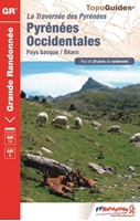
I walked from Geneva to SJPP and then on to Bilbao in 2015. In SJPP I purchased the TopoGuides Pyrenees Occidentales Gr10 book from the shop in SJPP. This would get me from SJPP to Irun in 5 days. It's only 110 kms but plan for shorter km days. The guide is in French but get it anyway. The maps are good, elevation charts always helpful, and includes accommodation lists with phone numbers. You will be walking backwards as described in the book but that's no problem. The cover below is for the 2016 edition (my copy is older so the cover is different). Remember to tear out all those pages you don't need.
0000532_pyrenees-occidentales-gr10_200.jpg

Boutique du pèlerin
32 rue de la citadelle
St Jean Pied de Port
The shopkeeper/owner was experienced with this route (he hikes it even in winter)! He strongly discouraged me from taking this route. He stated it was too steep, and too physically demanding...clearly judging me by my cover (too old, too skinny, I presume). But I had already walked some 1100 kms and was feeling very strong and confident. He was quite insistent but I was not to be deterred. I bought the guide and set-off...and loved every part of this challenging section.
Honestly, how many times in your life will you be able to sit on a mountain top, in the Pyrenees, and see no other human being for hours and hours! The Pottok ponies (the Basque word for "little horse"), and the sheep, and the Griffon vultures will be nearby. Maybe you'll spot some eagles. The views are spectacular! The peace profound! I wish I was a writer and could describe the indescribable feelings of wonder and freedom and love that I experienced in those mountains. I long to return. And I am so grateful that I listened to my heart and followed my desire to hike the mountains of my ancestral home.
Note: This is a very challenging route. I truly felt like part of the herd (the weakest part mind you) as I climbed alongside the mountain goats. Hiking poles are highly recommended.
Buen camino.
 
Last edited:
I enjoyed reading your descriptions @caminka...brought back wonderful memories of my most favorite hiking route. I love the mountains and the solitude and being in the land of my people. I was very much at peace during this 5 day jaunt. Here's my story:
I walked from Geneva to SJPP and then on to Bilbao in 2015. In SJPP I purchased the TopoGuides Pyrenees Occidentales Gr10 book from the shop in SJPP. This would get me from SJPP to Irun in 5 days. It's only 110 kms but plan for shorter km days. The guide is in French but get it anyway. The maps are good, elevation charts always helpful, and includes accommodation lists with phone numbers. You will be walking backwards as described in the book but that's no problem. The cover below is for the 2016 edition (my copy is older so the cover is different). Remember to tear out all those pages you don't need.
0000532_pyrenees-occidentales-gr10_200.jpg

Boutique du pèlerin
32 rue de la citadelle
St Jean Pied de Port
The shopkeeper/owner was experienced with this route (he hikes it even in winter)! He strongly discouraged me from taking this route. He stated it was too steep, and too physically demanding...clearly judging me by my cover (too old, too skinny, I presume). But I had already walked some 1100 kms and was feeling very strong and confident. He was quite insistent but I was not to be deterred. I bought the guide and set-off...and loved every part of this challenging section.
Honestly, how many times in your life will you be able to sit on a mountain top, in the Pyrenees, and see no other human being for hours and hours! The Pottok ponies (the Basque word for "little horse"), and the sheep, and the Griffon vultures will be nearby. Maybe you'll spot some eagles. The views are spectacular! The peace profound! I wish I was a writer and could describe the indescribable feelings of wonder and freedom and love that I experienced in those mountains. I long to return. And I am so grateful that I listened to my heart and followed my desire to hike the mountains of my ancestral home.
Note: This is a very challenging route. I truly felt like part of the herd (the weakest part mind you) as I climbed alongside the mountain goats. Hiking poles are highly recommended.
Buen camino.
Great description kaixo - I think this sums up what I'm looking for with this part of the trip - not withstanding the caution with which it should be undertaken. Could you advise, what time of year did you do this? Were there any other issues that you faced?
 
From reading Caminka's post it looks as though I need to consider:

for the part along crete d'iparla (that is the day on the ridge) you also need to consider water. you will probably meet other day hikers and thru-hikers (of the gr-10, with the huge backpacks), pottocks, sheep and birds - but no facilities. the only source in the middle is signposted about 200m off route, left before you reach the bottom of the saddle.
I took three liters of waters and paced myself. and overpaced myself, not drinking enough on the climb and suffering (very mild) consequences on the way down. a very friendly basque couple from donostia accompanied me on the descent. (I didn't think I looked that bad, but better safe then sorry.) I didn't run out of water, though.

I enjoyed reading your descriptions @caminka...brought back wonderful memories of my most favorite hiking route. I love the mountains and the solitude and being in the land of my people. I was very much at peace during this 5 day jaunt.

:) I love pyrenees but would be hard pressed to choose a favourite route.

Note: This is a very challenging route. I truly felt like part of the herd (the weakest part mind you) as I climbed alongside the mountain goats. Hiking poles are highly recommended.
Buen camino.

hiking poles are a great help on many parts of the gr-10 and particularly on the descents. I walk with my beloved wooden stuff which works very well, too.
 
Last edited:
€2,-/day will present your project to thousands of visitors each day. All interested in the Camino de Santiago.
for the part along crete d'iparla (that is the day on the ridge) you also need to consider water. you will probably meet other day hikers and thru-hikers (of the gr-10, with the huge backpacks), pottocks, sheep and birds - but no facilities. the only source in the middle is signposted about 200m off route, left before you reach the bottom of the saddle.
I took three liters of waters and paced myself. and overpaced myself, not drinking enough on the climb and suffering (very mild) consequences on the way down. a very friendly basque couple from donostia accompanied me on the descent. (I didn't think I looked that bad, but better safe then sorry.) I didn't run out of water, though.
Great tip thanks. I'll have a three liter steamer - I'm always very cautious about hydration.
 
FWIW: I would caution that this is markedly underestimates the GR10. Caminka provides a very accurate discription of the route.

I have been reminded that I walked the Dragonte route from Villafranca del Bierzo up to O'Cebreiro in 2013, and I've had a look at what was involved there and compared it to the Col D'Iparla section of the GR10. The Dragonte is 36 Kms and has 2271 metres of climbing. From St Jean to Bidarray is, according to the GPX maps 35 Kms and has 2000 metres of climbing.

This would appear to me to be fairly similar walking days. Now, I understand that the GR10 might be walking over rougher terrrain, but is there anyone who has done both sections who could provide a comparison? I'd be interested to hear.

BTW, I did the Dragonte route in about 9 and a half hours including stops for coffee (in Villasinde) and lunch (Las Herrerias) arriving in O'Cebreiro at about 4:00. The following day I walked from O'Cebreiro to Sarria.
 

Most read last week in this forum

I walked the Camino Francés in Octobee 2022, from Villafranca del Bierzo to Santiago de Compostela, and loved it. I would like to walk the Camino del Norte as I'm drawn to the coast, culture and...
Hello everyone. I know that pre-booking accommodation has been discussed many, many times, so apologies but I wanted to be quite specific. We are walking from Irún to Bilbao in the first week of...
Considering that we were dipping ourselves in the sea in beautiful Zarautz yesterday evening it is certainly a change in weather today, however, that has not dampened our excitement of the walk...
Hello! I am visiting Northern Spain for the first time this June and would am planning on hiking a small segment of the Camino. I've done a little research and decided to hike between Zarautz and...

❓How to ask a question

How to post a new question on the Camino Forum.

Forum Rules

Forum Rules

Camino Updates on YouTube

Camino Conversations

Most downloaded Resources

This site is run by Ivar at

in Santiago de Compostela.
This site participates in the Amazon Affiliate program, designed to provide a means for Ivar to earn fees by linking to Amazon
Official Camino Passport (Credential) | 2024 Camino Guides
Back
Top