• Get your Camino Frances Guidebook here.
  • For 2024 Pilgrims: €50,- donation = 1 year with no ads on the forum + 90% off any 2024 Guide. More here.
    (Discount code sent to you by Private Message after your donation)
  • ⚠️ Emergency contact in Spain - Dial 112 and AlertCops app. More on this here.

Search 69,459 Camino Questions

Monte Pedroso / Route of Routes Trail

stratophile

Active Member
Hi everyone,

I'm trying to map the path up Monte Pedroso that Johnny Walker describes in his excellent Route of Routes guide. I've been to the top (albeit long ago) but not following his path. I'm familiar with the descent along the
Via Crucis, but not the ascent.

Attached is a screenshot of a map showing what I've got so far, but it doesn't seem to follow the description in the guide.

Could anyone help me get it right?

Much appreciated!
 

Attachments

  • Monte Pedroso Trail.png
    Monte Pedroso Trail.png
    329.1 KB · Views: 5
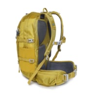
Technical backpack for day trips with backpack cover and internal compartment for the hydration bladder. Ideal daypack for excursions where we need a medium capacity backpack. The back with Air Flow System creates large air channels that will keep our back as cool as possible.

€83,-
Here's an except from the Route of Routes guide describing the portion I am trying to map:
---
KSO this path, initially with a concrete wall and views of the Cathedral of Santiago on your left, and continue on the path through the trees. At the first small junction veer R and shortly come to a clearing. Cross the clearing through the gap in the wall and continue down the path on the other side. Near the bottom follow the path round to the road on your left, to the park gate and a small parking area. At the end of the parking area turn R on the start of a forest path marked with a red arrow on a granite marker. These waymarks continue to the pinnacle. About 100m along this path, veer L (i.e. don’t take the other entrance into the park), as indicated by the red arrow on the stone wall, up a small hill. At the top go L and follow the path round to the R (where you will see a red arrow on the stone to your right). Keep on this path till you come to a yellow and white wooden marker and a car park with a wooden mounted map of “As Sendas do Monte Pedroso”. With the car park in front of you turn sharp right at a small granite stone near ground level and a red and white wooden marker. There is a (faded) red arrow on a stone to the right as you go up this small hill. Shortly, as the path runs alongside the tarmac road, go through the “Area Recreativa Lixo”, and turn L onto the path marked “Merendeiro”. This path winds up and round to a large recreation and BBQ area, before it meets the tarmac road again.

Cross the road and, almost immediately, turn R onto a narrow path, marked by a small red dot on a stone on the ground to your right. This leads onto a wider path marked by a red dot on a tree to the left. Continue on up until you reach a small piece of open ground with 3 path choices ahead. Take the narrow one in the middle, marked by a red arrow on a stone on the ground to your right. Continue on up this path, marked by red arrows and small dots. As you make your final ascent, you will see the Monte Pedroso cruceiro (stone cross) and TV mast straight ahead, and the emerging spectacular views of Santiago on your right. Follow the red markings all the way to the top.
---
 
Transport luggage-passengers.
From airports to SJPP
Luggage from SJPP to Roncevalles
Hola - I am fortunate enough to liveclose to the Roman bridge at the bottom of the ascent to the top of Pedroso. I walked up there yesterday. On the ground there are many paths to the top. At one point I considered deleting the detailed walking notes and simply writing: " the summit of the hill is obvious because of the radio masts which can be seen for miles. Make your way up to these masts by the most convenient route. "

I hope this helps.

John
 
€2,-/day will present your project to thousands of visitors each day. All interested in the Camino de Santiago.

Most read last week in this forum

This is my first posting but as I look at the Camino, I worry about 'lack of solitude' given the number of people on the trail. I am looking to do the France route....as I want to have the...
The Burguete bomberos had another busy day yesterday. Picking up two pilgrims with symptoms of hypothermia and exhaustion near the Lepoeder pass and another near the Croix de Thibault who was...
Between Villafranca Montes de Oca and San Juan de Ortega there was a great resting place with benches, totem poles andvarious wooden art. A place of good vibes. It is now completely demolished...
Left Saint Jean this morning at 7am. Got to Roncesvalles just before 1:30. Weather was clear and beautiful! I didn't pre book, and was able to get a bed. I did hear they were all full by 4pm...
Hi there - we are two 'older' women from Australia who will be walking the Camino in September and October 2025 - we are tempted by the companies that pre book accomodation and bag transfers but...
We have been travelling from Australia via Dubai and have been caught in the kaos in Dubai airport for over 3 days. Sleeping on the floor of the airport and finally Emerites put us up in...

❓How to ask a question

How to post a new question on the Camino Forum.

Similar threads

Forum Rules

Forum Rules

Camino Updates on YouTube

Camino Conversations

Most downloaded Resources

This site is run by Ivar at

in Santiago de Compostela.
This site participates in the Amazon Affiliate program, designed to provide a means for Ivar to earn fees by linking to Amazon
Official Camino Passport (Credential) | 2024 Camino Guides
Back
Top