A bit more of an update with some pictures of the inside. This is a municipal albergue, and it is donativo. The town has bars, restaurants and other services.
Keys to the albergue and sello are in the bar near the albergue, shown in one of the pictures.
The tracks and the APP have not yet been changed to reflect the new routing, but Ender assures me that it is very well marked with arrows. To get to the albergue in Noceda, upon leaving Quintana de los Fuseros there is a well-marked turn to the right (the ”regular” or “old” camino continues straight ahead). About 7 km downhill. After Noceda, the route returns to the “regular” Olvidado and is also well marked.
The location opens up a bit more flexibility.
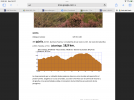
Fasgar to Igüeña is 18.5. For some that will be plenty (one of the Olvidado’s “etapas reinas” is that day over the pass to the Campo de Santiago). Others will want to walk further.
Options to go further than Igüeña are
— 7 km further to Quintana, where the CR El Caruzal rents rooms for pilgrims. That’s a 25 km day. Though the website says it’s a whole house rental, I have confirmation from the owners that they rent rooms to pilgrims. They will also prepare dinner and breakfast.
— 7 km further from Quintana to Noceda (all downhill, not too steep). That makes for a 32 km day.
I’ve attached pictures of the inside of the albergue and the bar where you get the keys.
View attachment 124890View attachment 124891View attachment 124892View attachment 124893View attachment 124894