• For 2024 Pilgrims: €50,- donation = 1 year with no ads on the forum + 90% off any 2024 Guide. More here.
    (Discount code sent to you by Private Message after your donation)
  • ⚠️ Emergency contact in Spain - Dial 112 and AlertCops app. More on this here.

Search 69,459 Camino Questions

Pajares to Buendueños update

Elizabeth2018

Member
Time of past OR future Camino
2018 Madrid, Salvador
Hi all. A bunch of us are in Buendeuños this morning having walked the mountain route from Pajares and Poladura de Tercia. Just before Puente de Fierros there are arrows directing you up a steep grassy path into the mountains. It took us three and a half hours to negotiate this path of about 7 km. It has been raining for the last couple of days and it is slippery and full of mud. Don’t know if anyone from the group maintaining the route has been up there this spring. Tremendous amount of trees are down and the path is eroded in places and perilously close to the edge. With all of this the route is an obstacle course at the moment. We had to climb over, crawl under and slide down in many places. If you are taking this route take good care. And if it is raining you may wish to take the alternative route on the road to Campomanes. If we had known what we were in for we would probably have chosen that option.
 
The one from Galicia (the round) and the one from Castilla & Leon. Individually numbered and made by the same people that make the ones you see on your walk.
That doesn’t sound like much fun. It was snowing when I woke up in Poladura de la Tercia (10 April), and had been snowing all night, so the 3 of us in the albergue walked along the road to Villamarin (about 6kms) to get the one train a day, at 10:21. However, the train didn’t come! Instead, a taxi pulled up, and the driver said that Renfe had sent him. So we piled in. The driver stopped again at Busdongo, the next station, to see if there were any passengers waiting there (there weren’t). The snow was heavy going up to the top of the pass at Puerto de Pajares, but it was clear down the other side. I got out the taxi (which was free!) at Campomanes, and I continued walking from there. The other two went on to Pola de Lena, although I caught up with one of the guys in Mieres. I was actually really glad that I didn’t have to walk down the other side from Puerto de Pajares that day – I don’t think my knees would have liked it much.
Jill
 
Hi all. A bunch of us are in Buendeuños this morning having walked the mountain route from Pajares and Poladura de Tercia. Just before Puente de Fierros there are arrows directing you up a steep grassy path into the mountains. It took us three and a half hours to negotiate this path of about 7 km. It has been raining for the last couple of days and it is slippery and full of mud. Don’t know if anyone from the group maintaining the route has been up there this spring. Tremendous amount of trees are down and the path is eroded in places and perilously close to the edge. With all of this the route is an obstacle course at the moment. We had to climb over, crawl under and slide down in many places. If you are taking this route take good care. And if it is raining you may wish to take the alternative route on the road to Campomanes. If we had known what we were in for we would probably have chosen that option.
Hi, Elizabeth,
I will let Ender know and see what he says about that trail up. In the best of circumstances it is very narrow and clinging to the hillside, so I can imagine that this was quite a feat. But be glad you didn`t take the road to Campomanes because if you had, you would have missed out on Sandra and Bendueños. I have to think that was a fair reward for all your efforts. ;) Buen camino, Laurie
 
Ideal pocket guides for during & after your Camino. Each weighs only 1.4 oz (40g)!
Quick response from Ender. Translated into English, he said:

I will go look at it, but until the rains end, no real repair is possible. I have already spoken with the municipal government of Pola de Lena asking them to take away some fallen trees and clean the camino. They told me they didn't have the resources to do it now, but the next day a local employee called me to say they would get to it soon. I can do some of it myself but I have to be careful because some of this area is in a protected natural area, the natural park of the Ubiñas.


Let's hope those rains end soon. Hope you guys handled the descent to Campomanes -- that is not fun in the best of circumstances. Buen camino, Laurie
 
Hope you guys handled the descent to Campomanes -- that is not fun in the best of circumstances.

The descent from Herias to Campomanes is tricky, especially when wet. But I noticed a forest track between Bendueños and Herias with a signpost (pointing straight on at a right turn of the road) saying Campomanes. I didn't take it, but another pilgrim I met later on did, and he claimed it was alright. This might circumvent the descent later on...
 
Thank you, Laurie @peregrina2000. Ender was with us at Poladura and I surmised he wasn’t likely in the know about how bad the state of the path was because he didn’t mention it. He told the folks assembled that the route after Pajares was easier than the Poladura to Pajares section. We are in Pola de Lena tonight (taking our time to really enjoy the Salvador) and a young man just came in from Pajares to say that Marissa at the albergue told them this morning that they might be wise to take the road through Campomanes to get here That being said you are right about it making it possible for us to stay at Burndueños. We had a great group there last night and it was a most enjoyable stay. Plus now we have a story to tell. It was quite an adventure. @Rainey days that the Canadian Military will probably be ready to hire us after all the obstacles we went through in the mud!

I am just loving this route in spite of the difficulties. Incredible scenery, super albergues and great people — both the peregrinos and the locals.

@jsalt, I remember reading about your adventure in the snow in a post from @OzAnnie while you were up there. I thought of you as I was going through those mountains. You have my utmost respect for taking on this route at that time of year!

Elizabeth
 
3rd Edition. More content, training & pack guides avoid common mistakes, bed bugs etc
The descent from Herias to Campomanes is tricky, especially when wet. But I noticed a forest track between Bendueños and Herias with a signpost (pointing straight on at a right turn of the road) saying Campomanes. I didn't take it, but another pilgrim I met later on did, and he claimed it was alright. This might circumvent the descent later on...

Hi Purky. We saw that little road too but after yesterday decided to go back into Herias and follow the Camino. In retrospect we probably should have taken it as that descent into Campomanes was really slippery in the rain. And I think we linked up with it near the last slope down to Campomanes. The river we walked alongside to Pola de Lena is raging and roaring today with all the water coming down off the mountains. Forecast here is for rain for the next seven days.
 
The descent from Herias to Campomanes is tricky, especially when wet. But I noticed a forest track between Bendueños and Herias with a signpost (pointing straight on at a right turn of the road) saying Campomanes. I didn't take it, but another pilgrim I met later on did, and he claimed it was alright. This might circumvent the descent later on...
Like you, I saw the forest track signpost, but I was reluctant to try it. Good to know that it works! This wikilocs track shows a circuar route from Campomanes to the church at Bendueños and back.
https://www.wikiloc.com/hiking-trails/campomanes-santuario-de-benduenos-9618973
I'm pretty positive that the (longer) route on the right through Herías is the camino, while the left route must be the signposted route. The author of the tracks says there is some road walking, but most on path.
 
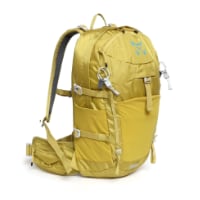
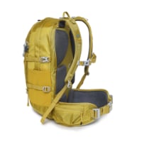
Technical backpack for day trips with backpack cover and internal compartment for the hydration bladder. Ideal daypack for excursions where we need a medium capacity backpack. The back with Air Flow System creates large air channels that will keep our back as cool as possible.

€83,-

Most read last week in this forum

Hello All! I was hoping to do the combined San Salvador/Primitivo in July/August. Is it correct that there still are no transport services available for the S.S.?? I was really counting on having...
Hi! I saw that you wrote about the San Salvador awhile back. I’ll be walking that stretch in June and then onto the Primitivo for the second time. My Altra trail runners did fine on the Primitivo...
According to this article, sent to me by a friend in Oviedo, the old train station in Pola de Gordón will be turned into an albergue, at a cost of more than € 500,000. Lodging for pilgrims isn’t...

❓How to ask a question

How to post a new question on the Camino Forum.

Forum Rules

Forum Rules

Camino Updates on YouTube

Camino Conversations

Most downloaded Resources

This site is run by Ivar at

in Santiago de Compostela.
This site participates in the Amazon Affiliate program, designed to provide a means for Ivar to earn fees by linking to Amazon
Official Camino Passport (Credential) | 2024 Camino Guides
Back
Top