• Get your Camino Frances Guidebook here.
  • For 2024 Pilgrims: €50,- donation = 1 year with no ads on the forum + 90% off any 2024 Guide. More here.
    (Discount code sent to you by Private Message after your donation)
  • ⚠️ Emergency contact in Spain - Dial 112 and AlertCops app. More on this here.

Search 69,459 Camino Questions

SJPP to Orrison incline?

Mysticl

Active Member
Time of past OR future Camino
Frances May (2015) - pending
I was curious, does anyone know the % incline grade on the path to Orrison? Trying to work out an extended training regime to help me over the first couple days, not to mention the Pyranees ... I know it's about 8 km walk all uphill and while at the moment I can manage that distance easily on the flat I am pretty certain at my current fitness level that hill would definitely be too much for me or it would take me all day despite being able to walk that distance on level ground in a couple hours. Luckily I have lots of time to prepare so it would be great to know a more precise grade, that way I can try and find similar hills here to train on at home or at the worst set my treadmill accordingly. I know it's steep but that's a relative term, how steep is steep? Thanks in advance!
 
Down bag (90/10 duvet) of 700 fills with 180 g (6.34 ounces) of filling. Mummy-shaped structure, ideal when you are looking for lightness with great heating performance.

€149,-
My copy of Brierley shows Auberge Orrison at about 650-700m in elevation, and just under 10km from SJPP (at 200m). This would indicate a rise of 500m in a run 10km or a slope of 1:20, or 5% on average.

My personal view is that getting the elevation gain is the critical issue, not necessarily the distance. If you can find a local hill that gets you close to the 500m gain, I would be less worried about it being the same distance provided it isn't too much longer.

Regards,
 
Thanks so much for your reply. Is that 5% the actual grade or the angle? I gather they aren't the same thing ... based on the numbers I gave my hubby which I don't think were accurate in hindsight, he calculated a grade of 11.4% for an angle of 6.5' based on an 8 km walk and an elevation gain of about 914 meters which is considerable more than Brierly indicates. I think your number are more accurate but still not sure if the number you calculated was the angle or the % grade.

I think you're right though finding a hill of about the same elevation is probably what I should be looking for. Thanks again :)
 
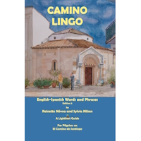
A guide to speaking Spanish on the Camino - enrich your pilgrim experience.
This link might help a wee bit:

http://www.mundicamino.com/ingles/

One can look at each stage by using the navigation numbers on the right under the yellow arrow.

Any use? Should I keep looking for another source?

Keep a smile,
Simeon


The ascent angle would be about 3 degrees if the slope is 5%. There might be some small variation depending on the assumptions made about the elevation gain and distance, but I don't think that is too far out.
 
The first edition came out in 2003 and has become the go-to-guide for many pilgrims over the years. It is shipping with a Pilgrim Passport (Credential) from the cathedral in Santiago de Compostela.
Well I have to confess I like a 5% grade a LOT better than an 11% grade! With that in mind I am going with confirmation bias and adopting the 5% grade as the correct one regardless of what dear Hubby says ... I'm sure he'll understand :)

Simeon thanks for the link. That is a very interesting site. I've bookmarked it :)
 
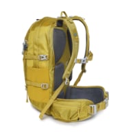
Technical backpack for day trips with backpack cover and internal compartment for the hydration bladder. Ideal daypack for excursions where we need a medium capacity backpack. The back with Air Flow System creates large air channels that will keep our back as cool as possible.

€83,-
According to John Brierley's guide, the height at St Jean is 140 asl and at orisson it is 750 asl, thus height ascent of 610 metres over a distance of 8.00 kms. This gives an AVERAGE gradient of 7.6 %. Near St Jean it is not steep, but certainly where you veer off the road to the left just before Orissson, it is much steeper. David
 
Mysticl said:
Well I have to confess I like a 5% grade a LOT better than an 11% grade! With that in mind I am going with confirmation bias and adopting the 5% grade as the correct one regardless of what dear Hubby says ... I'm sure he'll understand :)

Simeon thanks for the link. That is a very interesting site. I've bookmarked it :)
The averages hide a great deal of variability. Using Google Earth, the stats for the road route from SJPP to Orisson are:

Elevations: at start 162m, at finish 827m. gain 857m, loss 200m.
Slopes: average up 12.0%, down 8.7%,
max up 41.3%, down 38%

The slope increases dramatically from about 4.5km, with a short steep stretch where the road zig-zags and the Camino goes straight ahead at about 6.5km.
 
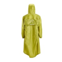
Very light, comfortable and compressible poncho. Specially designed for protection against water for any activity.

Our Atmospheric H30 poncho offers lightness and waterproofness. Easily compressible and made with our Waterproof fabric, its heat-sealed interior seams guarantee its waterproofness. Includes carrying bag.

€60,-
Thanks again Doug, I see the point you mean on my street view google map walkthrough. I am probably a little too concerned about my ability to make it to Orrison but considering my age, my hip, my weight and overall fitness level at present I want to make the most of the time I have between now and my eventual departure. so I don't completely embarrass myself on the first day or worse, hurt myself. Knowing what to expect is half the battle for me and I figure if I train up well enough to handle 2 days of sustained climbing at a moderate to steep incline I should be good to go for the rest of the walk :) I'll plan on an average slope of about 8% that way I'll either be pleasantly surprised or at least adequately prepared if the slope is greater at points along the way. Beyond Roncevalles I am not planning in any way shape or form ;) One day at a time ...
 
[/quote] Great Wood Hill not cutting it for you?[/quote]

Hi Doug! At 128 metres (420 ft) it's not quite the mountains of Galicia!
 
€2,-/day will present your project to thousands of visitors each day. All interested in the Camino de Santiago.
Mysticl said:
I am probably a little too concerned about my ability to make it to Orrison but considering my age, my hip, my weight and overall fitness level at present I want to make the most of the time I have between now and my eventual departure. so I don't completely embarrass myself on the first day or worse, hurt myself.
snip
One day at a time ...
My approach to these really steep slopes is to step short, even to the point of literally putting one foot just in front of the other - a step length of 25cm or so compared to my normal 82cm on the flat. I find it much better to maintain my walking cadence with a short step than taking longer slower steps.

It will also reduce the angles all the lower joints go through, and the pressure on the joints themselves if they are only lifting the body a little way each step. All this goes to reducing the stress on old body parts. When I have coached older walkers on this approach, they have all been able to walk up slopes they they initially found daunting, and were hesitant to tackle. Not just one day at a time - one step at a time and many of them rather than fewer longer steps.

I am also a great advocate of walking poles, provided they are used correctly.
 
That sounds like EXCELLENT advice. I am going to try that! I am likely going to go the pole route as well but still trying to decide on one or two. I was reluctant to add the extra weight but I walk with a stick now and I have found it handy several times just for balance on rough terrain or over logs etc. I also take comfort in the fact that it might help me in the unlikely event some unfriendly critter decides to taste me for lunch.... Probably not, but I take comfort in it anyway ... hehe ... Not sure it is any use on taking strain off my joints though as it's just a stick and I am not likely using it correctly. If I go the pole route I'll try and take your advice to heart and learn how to use them :) No point carrying extra weight if you aren't using them properly!
 
I have trained on a treadmill up to a 15 degree incline for 15 minutes at a time using a speed of 5.5 to 6 kph with a back pack. I have also hit local hills with less height but decent increase. I have had little or no problem on the road or on the treadmill. It seems easier using trekking poles (or sticks as my daughter calls them).

Is that sufficient to ensure a good first day? I intend on going from SJPdP to Roncesville in one day. Thoughts?
 
The 2024 Camino guides will be coming out little by little. Here is a collection of the ones that are out so far.
Occasionally a grade is labeled for cars and trucks. Coming out of Ourense the ascent was labeled as 19%. Parts of the grade to Orisson were as steep, but at least half of it was more gradual. Your training will be good preparation.
 
Shalom Mysticl
Very good planning however somewhat incomplete approaching half-cocked-inclines are good to practice however at the worst you just slow down and rest more often. After Col Lepoeder you have two let us say unpleasant descents, different muscles and worse great demands on your knees! Downhill slippery when wet and rocky in places. Don't forget the downhill bit and practice when you are tired! It makes a big difference.
S
 
bulwurth said:
I have trained on a treadmill up to a 15 degree incline for 15 minutes at a time using a speed of 5.5 to 6 kph with a back pack. I have also hit local hills with less height but decent increase. I have had little or no problem on the road or on the treadmill. It seems easier using trekking poles (or sticks as my daughter calls them).

Is that sufficient to ensure a good first day? I intend on going from SJPdP to Roncesville in one day. Thoughts?

Very similar to the training I did. It proved the PERFECT training routine as I trained and tone the EXACT muscles that were needed to execute the walk uphill incline. Always remember the Camino is NOT a race, so work on endurance-- same load, pace, for longer periods.
 
A selection of Camino Jewellery
Hi Mysticl,
This is an indirect reply to your question and just another point of view.
Your training will serve you well on the camino that's for sure, but it's very different from walking uphill for most of the day.There is more involved in that day 1 walk than just going up a mountainside and that is the question of jet lag. Unless you are planning to rest a day or so somewhere after you land in Europe, you MAY find yourself unusually tired from the time difference and flight (planes are so hard on us) that day 1 could be harder than if you were to do the same thing at home.
I strongly suggest that since you're worried about it, you do not tackle the whole walk from SJPP to Roncesvalles is one day unless you have been practicing walking 27 km over hills and dales. It's harder than many people think and easier than others think. But is there a rush? Stopping at Hunto or Orrisson makes for a pleasant evening around a dinner table with people who will soon feel like friends -and takes a big bite out of the long climb. It is still about 17km from Orrisson to Roncesvalles.
In my experience it's better to go a bit slowly at the beginning and build your strength. (I've been over the Route Napolean as it's called 3 times). But hey - I'm old and slow so my way isn't for everyone of course.
Another alternative of course is to back up a bit on the Le Puy route (around Ostabat or Aroue) and walk along the flattish country for a couple of days to get the jet lag out of your system. You'd be much more ready to tackle the mountain after that. Who knows - depending on when you're going, we might even see you there.
Congratulations on all the hard work you've been doing to get this walk working for you!
Buen Camino
 
We walked to Orisson on 23 April 2012. When we saw the first hill we said 'We haven't done enough training!' It looked about 1 in 2 and at least 10 miles long! We did get to the top but pretty puffed. As we reached the top an Australian guy with an enormous rucksack jumped onto a wall and then into the air with a big whoop of delight. I suppose its all relative really, it is quite steep but there are parts where it drops as well. We did it on a sunny day but not too hot, we did sleep very well that night. The elevations in the Brierley guide are not accurate - he describes it as 'A Practical and Mystical Manual' and in many places it certainly is very mystical. Yes its difficult at times but you wouldn't miss it for the world. Buen Camino

Ron
 

Most read last week in this forum

La Voz de Galicia has reported the death of a 65 year old pilgrim from the United States this afternoon near Castromaior. The likely cause appears to be a heart attack. The pilgrim was walking the...
Just reading this thread https://www.caminodesantiago.me/community/threads/news-from-the-camino.86228/ and the OP mentions people being fined €12000. I knew that you cannot do the Napoleon in...
I’m heading to the Frances shortly and was going to be a bit spontaneous with rooms. I booked the first week just to make sure and was surprised at how tight reservations were. As I started making...
This is my first posting but as I look at the Camino, I worry about 'lack of solitude' given the number of people on the trail. I am looking to do the France route....as I want to have the...
My first SPRINGTIME days on the Camino Francés 🎉 A couple of interesting tidbits. I just left Foncebadón yesterday. See photo. By the way, it's really not busy at all on my "wave". Plenty of...
I was reading somewhere that some of us are doing night walks. As a natural born night owl I would love to do such walk too. Of course I can choose stage by myself (CF). But was wondering if any...

❓How to ask a question

How to post a new question on the Camino Forum.

Forum Rules

Forum Rules

Camino Updates on YouTube

Camino Conversations

Most downloaded Resources

This site is run by Ivar at

in Santiago de Compostela.
This site participates in the Amazon Affiliate program, designed to provide a means for Ivar to earn fees by linking to Amazon
Official Camino Passport (Credential) | 2024 Camino Guides
Back
Top