• Get your Camino Frances Guidebook here.
  • For 2024 Pilgrims: €50,- donation = 1 year with no ads on the forum + 90% off any 2024 Guide. More here.
    (Discount code sent to you by Private Message after your donation)
  • ⚠️ Emergency contact in Spain - Dial 112 and AlertCops app. More on this here.

Search 69,459 Camino Questions

Stage distances into towns and cities Incorrect ???

MickMac

Veteran Member
Time of past OR future Camino
Frances 2013
Frances 2016
Frances 2017
Frances 2018
Frances 2018
Ponferrada-Santiago
July 2019
While walking this summer I noticed the stage distances did not seem take into account the walk through major towns like Pamplona, Logrono, etc.. am I correct ??.
It seems that after you arrive in a city outskirts the walk can be another 4-5 Kilometers sometimes, (with temps reaching 30-40 degrees heat) onto to the stated distance until you reach the old parts of the city and your albergue. Is this just fatigue ????
 
€2,-/day will present your project to thousands of visitors each day. All interested in the Camino de Santiago.
I'm pretty sure that Brierley stages list distances muni to muni, therefore if you go beyond that, your distance will be greater for that day, but less for the next, if you stop at the muni in the next town.
 
€2,-/day will present your project to thousands of visitors each day. All interested in the Camino de Santiago.
Brierley: "For clarity and accuracy each stage begins and ends at the front door of a clearly specified pilgrim hostel or other clearly defined 'end point'."

Sometimes this could be at the far end of town.

[Edited to add the below:]

I don't know how others measure.

Brierley hides the "clearly specified pilgrim hostel." That is to say that the specific end point is not mentioned for any stage n but for stage n+1 you will see it in the text where the blue box labeled "km 0.0" is. It is not always the point marked "1" on the map of the end point for stage n.
 
Last edited:
Last year on the VdlP I was interviewed by a grad student from University of Extremadura doing a pilgrim study. My brother who has done four or five caminos (professional ground pounder, aka soldier, for 20+ years) was sometimes exasperated by the distances given as they sometimes seemed way off. I mentioned this to her and she said there was an aggravating lack of consistency in given distances between towns in Spain, especially small ones. Ideally she said the distance given should be from main plaza to main plaza, but sometimes city limits, the alcadalria, oldest church and other things were substituted.
 
In each guide it should be lined out how they handle distances (hostel to hostel, town center to town center etc.)
Buen Camino, SY
 
3rd Edition. More content, training & pack guides avoid common mistakes, bed bugs etc
That is indeed one of the strengths of the Brierley CF guide - both the daily distances from albergue to albergue and those for the shorter intermediate distances are pretty much spot on - bar the occasional change of route forced by road works
 
On the Primitivo, the hospis at the Mater Christi albergue in Tineo, tough mountaineering guys and local miners, laugh at the distances in the guide books, saying they are reduced in order not to scare away dainty ladies who don't want to break a sweat ;0).
 
Is it just you? Nope, but maybe it's you and me. Having finished the Camino last month, I did have the same experience that you did, and eventually just got used to it. Even more interesting was that guide books by the same author in different languages had different distances from city to city than the English version. Again, just got used to it.

I do remember (and I may even have a picture somewhere) of a road sign having a distance to the next town spray-painted with a black line through it followed by "Liar!!" We all had a good laugh at that one.

Buen Camino!!
 
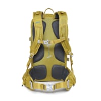
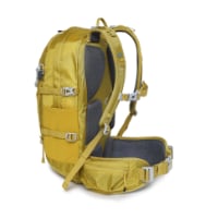
Technical backpack for day trips with backpack cover and internal compartment for the hydration bladder. Ideal daypack for excursions where we need a medium capacity backpack. The back with Air Flow System creates large air channels that will keep our back as cool as possible.

€83,-
Did you also notice that one sign said 8 kilometers to next town then about 1 k on it says 9 kilometers ??. This happens several times along the Camino. Part of the fun on the way.:D
 
AHAHAHAHA, not only that. Last year on Levante I came across this info table in El Toboso.
It says if you speak Spanish the distance between El Toboso an Villa de don Fadrique is 27kms, but if you are speaking English it's just 23,2kms to walk :D:D:D

2015-06-26 11.23.08.jpg
 
AHAHAHAHA, not only that.
It says if you speak Spanish the distance between El Toboso an Villa de don Fadrique is 27kms, but if you are speaking English it's just 23,2kms to walk :D:D:D
View attachment 28700
That's because you can say the same phrases in English with much less words, as seen in the panel. It does not matter how things really are, but how you call them.
Next time I will write down my name in the credential as "Philip". The distances will be then shorter.;)
 
The one from Galicia (the round) and the one from Castilla & Leon. Individually numbered and made by the same people that make the ones you see on your walk.
In addition to that, GPS users should be wary of accepting the raw information provided at the time by their GPS units. I have just been cleaning up the track information from my Camino this year. One of the things this involves is removing the track that is generated when I know that I was stationary. It looks like this will remove about 50 km and leave just under 600 km.

This is not a surprise - the inherent inaccuracies in the GPS signal when it reaches the surface of the earth mean that successive calculations of a stationary position can vary, and make it look like that the GPS is doing a little bit of a wander to stretch its legs while you are sitting with a coffee. People may not realize how much more energetic their GPS is than they are!
 
While walking this summer I noticed the stage distances did not seem take into account the walk through major towns like Pamplona, Logrono, etc.. am I correct ??.
It seems that after you arrive in a city outskirts the walk can be another 4-5 Kilometers sometimes, (with temps reaching 30-40 degrees heat) onto to the stated distance until you reach the old parts of the city and your albergue. Is this just fatigue ????

If I was you, next time I was on the camino I'd bring a ruler.

Make sure it has millimeters and don't forget to have it calibrated with corrections for temperature.

Bring a level ... make sure its horizontal distance and without any vertical elements due to not accounting for up and down hills.

I might suggest bringing a helper ... that way you can bring a longer ruler.

Please publish the results here.

I should tell you about the time that North America was found to be 200 meters further west than had been assumed. It took over 500 years to discover the error and correct it.
 
Last edited by a moderator:
It is a well known and established fact among serious hikers that the last kilometre of the day is always the longest! ;)

On a serious note, perception as @Tincatinker has noted plays a part with some days walking longer or shorter than the map. At the end of the walking day you're tired and having to adjust your vision from rural distance to village/city busyness adds to the weariness.

We used the Village to Village Guide to Walking the Camino and found that the distances were fairly accurate both map wise and on the ground... except for the walk into Triacastela which seemed to go on and on and on...
 
New Original Camino Gear Designed Especially with The Modern Peregrino In Mind!
If I was you, next time I was on the camino I'd bring a ruler.

Make sure it has millimeters and don't forget to have it calibrated with corrections for temperature.

Bring a level ... make sure its horizontal distance and without any vertical elements due to not accounting for up and down hills.

I might suggest bringing a helper ... that way you can bring a longer ruler.

Please publish the results here.

I should tell you about the time that North America was found to be 200 meters further west than had been assumed. It took over 500 years to discover the error and correct it.


"Sarcasm is the lowest form of wit" so you are very very witty
 
That's because you can say the same phrases in English with much less words, as seen in the panel. It does not matter how things really are, but how you call them.
Next time I will write down my name in the credential as "Philip". The distances will be then shorter.;)
Ah, but Felipe/Philip, both names are six letters, so there may be a flaw in your theory. I think it has more to do with shoe sizes worn by English-speakers; for instance my US shoe size is 11, which is 10.5 in the UK, but pity the poor Europeans who wear a size 44 -- they obviously must be walking farther on their stages. :rolleyes:
 
Get a spanish phone number with Airalo. eSim, so no physical SIM card. Easy to use app to add more funds if needed.
but Felipe/Philip, both names are six letters, so there may be a flaw in your theory
No, there is a flaw in your thinking @jmcarp ;). It depends on the unit of measurement. If that is # of letters, yes they are the same. However, the English letters are very very slightly skinnier than the Spanish letters, although that also depends on the font. :p
 
I always thought that the distances between towns, villages , etc. were calculated from the main church in each place.
 
No, there is a flaw in your thinking @jmcarp ;). It depends on the unit of measurement. If that is # of letters, yes they are the same. However, the English letters are very very slightly skinnier than the Spanish letters, although that also depends on the font. :p
Dang, and here I thought I had the answer to the mysteries of the universe. :(
 
New Original Camino Gear Designed Especially with The Modern Peregrino In Mind!
I always thought that the distances between towns, villages , etc. were calculated from the main church in each place.
I think that's the way the governmental or civil authorities calculate the distance for road signs, such as the "Santiago 790 km" sign in Roncesvalles. As far as I know, official road distances here in the US are measured from the location of the county courthouse or city hall. Both English-language guidebooks I have state that the distances for the stages are calculated from and to the main albergue at the end of each stage; presumably the intermediate distances are based on the main albergue in the towns and villages along the way. For instance, Brierley says "For clarity and accuracy each stage begins and ends at the front door of a clearly specified pilgrim hostel." Dintaman and Landis say "All stage routes begin and end at the main or largest albergue in each respective town."
 
I think that's the way the governmental or civil authorities calculate the distance for road signs, such as the "Santiago 790 km" sign in Roncesvalles. As far as I know, official road distances here in the US are measured from the location of the county courthouse or city hall. Both English-language guidebooks I have state that the distances for the stages are calculated from and to the main albergue at the end of each stage; presumably the intermediate distances are based on the main albergue in the towns and villages along the way. For instance, Brierley says "For clarity and accuracy each stage begins and ends at the front door of a clearly specified pilgrim hostel." Dintaman and Landis say "All stage routes begin and end at the main or largest albergue in each respective town."
But I don't think the Spanish government, when posting distance between locations on their road signs use an English language guidebook as their basis
 
But I don't think the Spanish government, when posting distance between locations on their road signs use an English language guidebook as their basis
I didn't mean to imply that the government uses Camino guidebooks to establish distances; I was merely pointing out that the landmarks used by the guidebooks are different than the "official" government distances and that that accounts for at least some of the differences between the stated differences. Because the Camino follows numerous trails and minor roads, it is to be expected that the differences vary -- sometimes significantly, sometimes not.
 
Very light, comfortable and compressible poncho. Specially designed for protection against water for any activity.

Our Atmospheric H30 poncho offers lightness and waterproofness. Easily compressible and made with our Waterproof fabric, its heat-sealed interior seams guarantee its waterproofness. Includes carrying bag.

€60,-
Some guidebooks are simply incorrect unfortunately. Also, in the time it takes for the guides to establish a distance and publish their annual edition, the route could have been changed. In France it's a very common problem; locals will move the signs themselves to route pilgrims further away from their homes (or closer to their businesses!) Even if they notify their local government, it's too late to change the book until the next year.
 
The first edition came out in 2003 and has become the go-to-guide for many pilgrims over the years. It is shipping with a Pilgrim Passport (Credential) from the cathedral in Santiago de Compostela.
I think that's the way the governmental or civil authorities calculate the distance for road signs, such as the "Santiago 790 km" sign in Roncesvalles. As far as I know, official road distances here in the US are measured from the location of the county courthouse or city hall. Both English-language guidebooks I have state that the distances for the stages are calculated from and to the main albergue at the end of each stage; presumably the intermediate distances are based on the main albergue in the towns and villages along the way. For instance, Brierley says "For clarity and accuracy each stage begins and ends at the front door of a clearly specified pilgrim hostel." Dintaman and Landis say "All stage routes begin and end at the main or largest albergue in each respective town."
Interesting how various countries calculate distance. Re:Australia...I was told years ago that measurements were from the General Post Office (GPO) to the next large town's GPO. I imagine that smaller towns were to the small post offices.
 
While walking this summer I noticed the stage distances did not seem take into account the walk through major towns like Pamplona, Logrono, etc.. am I correct ??.
It seems that after you arrive in a city outskirts the walk can be another 4-5 Kilometers sometimes, (with temps reaching 30-40 degrees heat) onto to the stated distance until you reach the old parts of the city and your albergue. Is this just fatigue ????
Would you ever stop giving out :)
 
Ideal sleeping bag liner whether we want to add a thermal plus to our bag, or if we want to use it alone to sleep in shelters or hostels. Thanks to its mummy shape, it adapts perfectly to our body.

€46,-
Did you make it bunny.:cool:
 
Did you make it bunny.:cool:
We made it to Santiago last Friday. Between the three of us the only complaints were two small blisters and maybe one toenail. Great to have met you and your brother.
 
Well done Bunny did your leg hold up and the wee girls knee. ???
 
Technical backpack for day trips with backpack cover and internal compartment for the hydration bladder. Ideal daypack for excursions where we need a medium capacity backpack. The back with Air Flow System creates large air channels that will keep our back as cool as possible.

€83,-
I think distances in the guide books are like traffic signals in Saudi--just a suggestion. I found the guides disagreed with each other, and with GPS, and road signs. On the part of the Camino that required road walking I would occasionally see road sign distances go up rather than down (was that ever discouraging in the pouring rain).
I found (for myself only, not generalizing) this to be yet one more lesson in living in the moment.
 
The official survey is being done.

I wouldn't hold my breath though ... it was muttering something about having lost count somewhere near Viana.

Camino de Santiago 2012 184.jpg

That's bureaucracy ... moving at a snail's pace.
 

Most read last week in this forum

La Voz de Galicia has reported the death of a 65 year old pilgrim from the United States this afternoon near Castromaior. The likely cause appears to be a heart attack. The pilgrim was walking the...
Just reading this thread https://www.caminodesantiago.me/community/threads/news-from-the-camino.86228/ and the OP mentions people being fined €12000. I knew that you cannot do the Napoleon in...
I’m heading to the Frances shortly and was going to be a bit spontaneous with rooms. I booked the first week just to make sure and was surprised at how tight reservations were. As I started making...
This is my first posting but as I look at the Camino, I worry about 'lack of solitude' given the number of people on the trail. I am looking to do the France route....as I want to have the...
My first SPRINGTIME days on the Camino Francés 🎉 A couple of interesting tidbits. I just left Foncebadón yesterday. See photo. By the way, it's really not busy at all on my "wave". Plenty of...
Hello, I would be grateful for some advice from the ones of you who are walking/have recently walked from SJPdP :) 1 - How busy is the first part of the camino right now? I read some reports of a...

❓How to ask a question

How to post a new question on the Camino Forum.

Forum Rules

Forum Rules

Camino Updates on YouTube

Camino Conversations

Most downloaded Resources

This site is run by Ivar at

in Santiago de Compostela.
This site participates in the Amazon Affiliate program, designed to provide a means for Ivar to earn fees by linking to Amazon
Official Camino Passport (Credential) | 2024 Camino Guides
Back
Top