• Get your Camino Frances Guidebook here.
  • For 2024 Pilgrims: €50,- donation = 1 year with no ads on the forum + 90% off any 2024 Guide. More here.
    (Discount code sent to you by Private Message after your donation)
  • ⚠️ Emergency contact in Spain - Dial 112 and AlertCops app. More on this here.

Search 69,459 Camino Questions

Total ascent

The Plodding Pensioner

The Plodding Pensioner
Time of past OR future Camino
Frances(2019)
I used the Dintaman & Landis guide to walk the Frances route this autumn and was very pleased with its content.

I appreciate that most guides will give you a general indication of each stage's starting elevation, maximum elevation and finishing elevation, however, I am wondering if any topographically savvy forum member has ever broken down each stage into total ascent (and total descent). To illustrate, a fictional stage may start at 500' elevation; max out at 600' elevation; and finish at 500' elevation. This would normally be reported as having a total elevation of 100', however, if over the course of this stage you walked through 4 valleys that dropped down to 100' elevation and rose again to 600' elevation, the total elevation walked would have been at least 2000'!

So, I'm wondering if anyone has ever broken down each stage into each small ascent and descend in order to total calculate the total amount of ascending (and descending) elevation covered?
 
Join our full-service guided tour of the Basque Country and let us pamper you!
Good observation and one will be surprised at the difference between the advertised and the actual elevation gain or loss. Although not on the Frances, I had my app going when walking the Baztane this year and found the following.

To get over the Pass of Otsondo we started in Urdax at around 9:15am and only got to the top of the pass (4.5km later) after 2 hours. Another 2 hours got us to Amaiur for 10km in 4 hours. We started at about 90m above MSL with the top of the pass at about 575m above MSL, which is roughly a 485m climb. However, with ups and downs it turned out to be a 583m climb.

To get over the Pass of Belate we started in Ziga at around 9:30am (the owner just shook his head when we explained that we were aiming for Lantz) and only got to the top of the pass (16km later) after 6 hours. Another hour got us to Lantz for 20km in 7 hours. We started at about 303m above MSL with the top of the pass at about 944m above MSL, which is roughly a 641m climb. However, with ups and downs it turned out to be an 1172m climb.
 
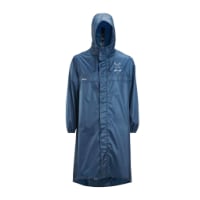
Very light, comfortable and compressible poncho. Specially designed for protection against water for any activity.

Our Atmospheric H30 poncho offers lightness and waterproofness. Easily compressible and made with our Waterproof fabric, its heat-sealed interior seams guarantee its waterproofness. Includes carrying bag.

€60,-
Forum members have told me that elevation gains and losses are notoriously unreliable. GPS reports of the same stretch vary tremendously.

I use wikiloc, like Rick, and the first three tracks that come up for this stage illustrate perfectly.

824 m — https://www.wikiloc.com/hiking-trails/camino-del-baztan-ziga-lantz-17249977

1330 m — https://www.wikiloc.com/hiking-trails/camino-baztanes-et-2-ziga-lantz-17206183

791 m — https://www.wikiloc.com/hiking-trails/5-ziga-lantz-19766143

I have basically given up on getting a reliable estimate, it makes for more surprises en route!
 
Down bag (90/10 duvet) of 700 fills with 180 g (6.34 ounces) of filling. Mummy-shaped structure, ideal when you are looking for lightness with great heating performance.

€149,-
I'm a fan of gpsvisualizer. You can upload a track and and it will give you point by point elevation change in a data table or graph. It's free and powerful. But non-intuitive.
 
The first edition came out in 2003 and has become the go-to-guide for many pilgrims over the years. It is shipping with a Pilgrim Passport (Credential) from the cathedral in Santiago de Compostela.
Walkmeter does an accurate job of not only tracking one's specific route that is walked or run, but also elevation gains and losses, total elevation, and total loss.
 
Good observation and one will be surprised at the difference between the advertised and the actual elevation gain or loss. Although not on the Frances, I had my app going when walking the Baztane this year and found the following.

To get over the Pass of Otsondo we started in Urdax at around 9:15am and only got to the top of the pass (4.5km later) after 2 hours. Another 2 hours got us to Amaiur for 10km in 4 hours. We started at about 90m above MSL with the top of the pass at about 575m above MSL, which is roughly a 485m climb. However, with ups and downs it turned out to be a 583m climb.

To get over the Pass of Belate we started in Ziga at around 9:30am (the owner just shook his head when we explained that we were aiming for Lantz) and only got to the top of the pass (16km later) after 6 hours. Another hour got us to Lantz for 20km in 7 hours. We started at about 303m above MSL with the top of the pass at about 944m above MSL, which is roughly a 641m climb. However, with ups and downs it turned out to be an 1172m climb.

Ouch!

I thought 117m to 525m leaving Ourense was bad.

I doubt Baztane will ever see me: Yikes!
 
Join our full-service guided tour and let us convert you into a Pampered Pilgrim!

Most read last week in this forum

La Voz de Galicia has reported the death of a 65 year old pilgrim from the United States this afternoon near Castromaior. The likely cause appears to be a heart attack. The pilgrim was walking the...
Just reading this thread https://www.caminodesantiago.me/community/threads/news-from-the-camino.86228/ and the OP mentions people being fined €12000. I knew that you cannot do the Napoleon in...
I’m heading to the Frances shortly and was going to be a bit spontaneous with rooms. I booked the first week just to make sure and was surprised at how tight reservations were. As I started making...
This is my first posting but as I look at the Camino, I worry about 'lack of solitude' given the number of people on the trail. I am looking to do the France route....as I want to have the...
My first SPRINGTIME days on the Camino Francés 🎉 A couple of interesting tidbits. I just left Foncebadón yesterday. See photo. By the way, it's really not busy at all on my "wave". Plenty of...
I was reading somewhere that some of us are doing night walks. As a natural born night owl I would love to do such walk too. Of course I can choose stage by myself (CF). But was wondering if any...

❓How to ask a question

How to post a new question on the Camino Forum.

Similar threads

Forum Rules

Forum Rules

Camino Updates on YouTube

Camino Conversations

Most downloaded Resources

This site is run by Ivar at

in Santiago de Compostela.
This site participates in the Amazon Affiliate program, designed to provide a means for Ivar to earn fees by linking to Amazon
Official Camino Passport (Credential) | 2024 Camino Guides
Back
Top