We are going to walk the Lebaniego next spring, and are considering following the Vadiensis through the Picos de Europa to Mansilla de los Mulas. If anyone has walked that path, May I please have a description of the amount of heights and ‘ledge walking’ that may be required? I have a rather severe aversion to heights and don’t want to get caught by surprise. Thanks and Buen Camino!
-
For 2024 Pilgrims: €50,- donation = 1 year with no ads on the forum + 90% off any 2024 Guide. More here.
(Discount code sent to you by Private Message after your donation) -
 ⚠️ Emergency contact in Spain - Dial 112 and AlertCops app. More on this here.
Search 69,459 Camino Questions
You are using an out of date browser. It may not display this or other websites correctly.
You should upgrade or use an alternative browser.
You should upgrade or use an alternative browser.
Walking through the Picos
- Thread starter Steve Mark
- Start date
A selection of Camino Jewellery
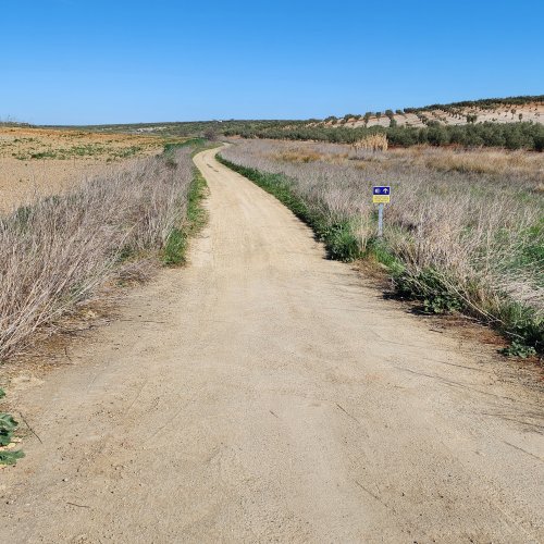
The only mountain stages of the Vadiniense are from Potes to Puente De and Puente De to the Puerto de Pantrave. I don’t remember any ledge walking. The senda da Remoña from Puente De is spectacularly beautiful but for most of the way, if not all, it’s on a path wide enough to drive on.
Oh yes — the stage into Cistierna is also mountainous, but I don’t think there’s anything that would trigger an adverse reaction. The paths are very manageable and again no ledges.
After you leave the Picos, and except for the stage into Cistierna, I remember a lot of asphalt walking on roads.
I walked this route more than ten years ago so I may have forgotten something, but hope others will correct what I have remembered incorrectly.
Gracias Peregrina2000 for your reply. Good information and really appreciated.The only mountain stages of the Vadiniense are from Potes to Puente De and Puente De to the Puerto de Pantrave. I don’t remember any ledge walking. The senda da Remoña from Puente De is spectacularly beautiful but for most of the way, if not all, it’s on a path wide enough to drive on.
Oh yes — the stage into Cistierna is also mountainous, but I don’t think there’s anything that would trigger an adverse reaction. The paths are very manageable and again no ledges.
After you leave the Picos, and except for the stage into Cistierna, I remember a lot of asphalt walking on roads.
I walked this route more than ten years ago so I may have forgotten something, but hope others will correct what I have remembered incorrectly.
Ideal pocket guides for during & after your Camino. Each weighs only 1.4 oz (40g)!
- Time of past OR future Camino
- 2012
You have the option of taking the https://entradas.telefericofuentede.com/ from Fuente De but if you have a height aversion you may, as I have to, sit on the floor of the cabin. Otherwise, as @peregrina2000 says the Senda de Remona is an un-metalled track accessible to 4 wheel drive vehicles and occasionally plagued by them in peak tourist season.We are going to walk the Lebaniego next spring, and are considering following the Vadiensis through the Picos de Europa to Mansilla de los Mulas. If anyone has walked that path, May I please have a description of the amount of heights and ‘ledge walking’ that may be required? I have a rather severe aversion to heights and don’t want to get caught by surprise. Thanks and Buen Camino!
There are no points on the trail that would trigger me but we're all different. You might find this website useful: https://www.rutavadiniense.com/itinerario/ Chrome will translate but I found the photo pages more reassuring than the route descriptions
- Time of past OR future Camino
- 2012
As a postscript to the above, and perhaps because I’m in confessional mode tonight, I walked the Lebaniego and the Vadiniense in a state of ignorant bliss. I had no knowledge of Camino. While I was aware of the fragment of the true cross I walked out of curiosity not reverence. I had 14 days leave, money for airfares and had spotted a line on a map that looked walkable. My curiosity was aroused by a kindly campesina I asked for water. She asked was I Peregrino, did I hacer camino? It took nearly 20 years for me to unpack that one and to walk to Jimmy’s bones
That is exactly what I did!but if you have a height aversion you may, as I have to, sit on the floor of the cabin.
But I just want to make sure that @Steve Mark kniws that the teleférico/cable car ride from Fuente De is not a part of the camino. From Fuente De it’s a short walk to the Sends Da Remoña, which does not go anywhere near the peaks that you get to on the teleférico.
Having said that, if I had the time, I would definitely consider a couple of days in Fuente De for some spectacular day hiking.
A selection of Camino Jewellery
- Time of past OR future Camino
- 2012
I have walked up the canal, up the face of the cliff, that emerges close to the upper cable car station. My companions of the time did remark that I gibbered rather than walked- but I made it
In memory rejoining the Camino from there was an easy diversion from the track down to the Royal hunting lodge (name of which escapes without that diary to hand). Otherwise I’ll need to remind myself of the actual Camino route and see if that was how I got to Leon
It was a long time ago. I think the peseta still reigned
Last edited:
Most read last week in this forum
Hi everybody!
What do you think about my plan to the next summer, in 26 days? Is it a good plan?
Camino Vadiniense:
San Vicente de la Barquera - Cades
Cades - Cicera
Cicera - Potes
Potes -...
Interesting article on the Camino Lebaniego where Cantabria are receiving 1.4m euros towards the Camino. Seems it is part of a Euro 64m project across Spain, France and Portugal.
Edit due to more...
Similar threads
❓How to ask a question
How to post a new question on the Camino Forum.
Similar threads
-
Help - What conditions the the autumn?
- Started by Rushie
- Replies: 3
Most downloaded Resources
-
“All” Albergues on the Camino Frances in one pdf“All” Albergues on the Camino Frances in one pdf
- ivar
- Updated:
-
A selection of favorite albergues on the Camino FrancésFavorite Albergues along the Camino Frances
- Ton van Tilburg
- Updated:
-
Profile maps of all 34 stages of the Camino FrancesProfile maps of all 34 stages of the Camino Frances
- ivar
- Updated:


