- Time of past OR future Camino
- Most years since 2012
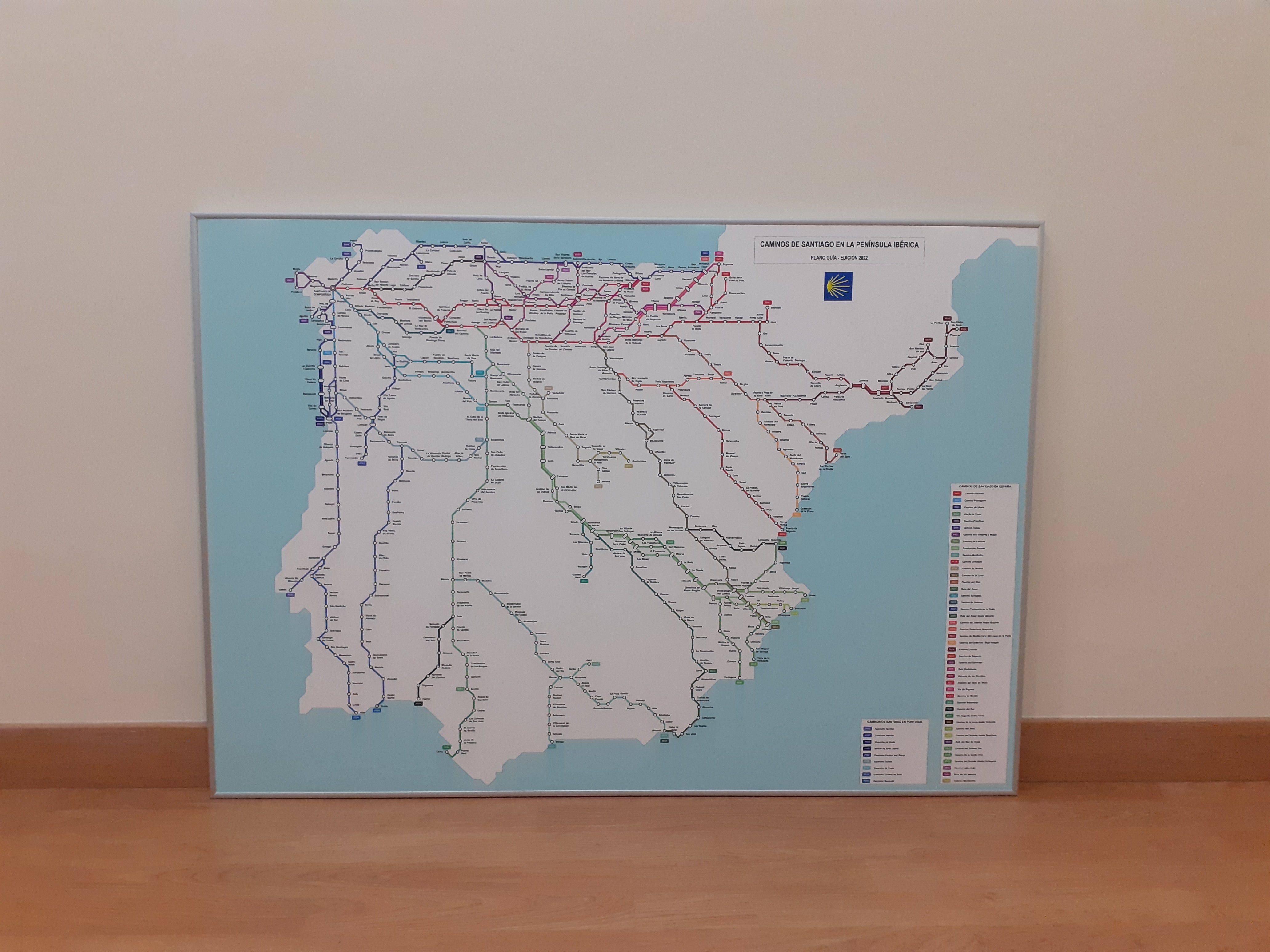
Here is an interesting map of (most of) the Caminos de Santiago, done in the style of a metro map.


| Remove ads on the forum by becoming a donating member. More here. |
|---|

What a great map!Here is an interesting map of (most of) the Caminos de Santiago, done in the style of a metro map.

I’ve emailed the author to ask if he would consider offering a printed version for sale; or failing that a high-resolution download.
Yes! I would like one too!As did I! Would be wonderful to have this available for sale on the Camino Store on this site. I’d buy several!
This is fun !!Here is an interesting map of (most of) the Caminos de Santiago, done in the style of a metro map.

But surely they are the original public transport!I find an irony in walking paths being portrayed as public transport!!!
Fabulous. A work of Art.Here is an interesting map of (most of) the Caminos de Santiago, done in the style of a metro map.

I think it was from a Facebook post linking to the blog on www.caminolanavalencia.es, that I learned about the Metro Map and then saw there are some very interesting articles on the blog section, as well as the very well organized practical information on that route.I invite you to visit the webpage www.caminolanavalencia.es, where you can download a free complete guide of the way from Valencia to Burgos.
Congratulations! I am glad to hear that this guide and webpage are useful for pilgrims, as they were also written by meWelcome to the Forum!
I think it was from a Facebook post linking to the blog on www.caminolanavalencia.es, that I learned about the Metro Map and then saw there are some very interesting articles on the blog section, as well as the very well organized practical information on that route.
We have a section of the forum devoted to the Ruta de la Lana, with a number of threads about the Requena. I walked it route from Valencia in 2022, enjoying it very much, and found that website to be very helpful. I used the KML tracks all the way to Burgos.
The software used was EdrawMax from WondershareFabulous. A work of Art.
So you happen to know what software was used to produce this map?
Hello Vacajoe, the routes included in the map are those homologated by the Federación Española de Asociaciones de Amigos del Camino de Santiago. Of course there are much other routes!Juan Jose: thanks for including the Aragon Route (both old and new!!!) on your map! It’s so easily overlooked these days.

 www.santiagodecompostela.me


