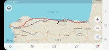
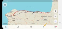
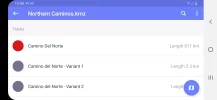
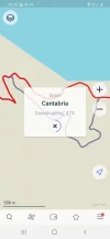
• ⚠️ Emergency contact in Spain - Dial 112 and AlertCops app. More on this here.
  • Remove ads on the forum by becoming a donating member. More here.

Search 74,075 Camino Questions

Your Fav Maps APP!

Status
Not open for further replies.

Renascer

Active Member
Time of past OR future Camino
2021
Hi Everyone! i was just curious about what is your favorite app to navigate through the camino with maps routes etc...offline without using internet? And if you can explain why you prefer that app or if you used more than one app during your camino to get yourself easier and faster to places. Thank you.
 
The one from Galicia (the round) and the one from Castilla & Leon. Individually numbered and made by the same people that make the ones you see on your walk.
I use OruxMaps for loyalty to the app (they were true pioneers), but you have a free version which is possibly 99% identical and includes links to hundreds of Camino de Santiago routes and stages.


you can download stages as you need them in a place where you have internet (they are actually tiny files) and then open it in the IGN app, even with the airplane mode on if you want to save battery.
 
...and ship it to Santiago for storage. You pick it up once in Santiago. Service offered by Casa Ivar (we use DHL for transportation).
I use the Buen Camino app. In addition to offline map of the Camino it has tons of other features. It lists the accommodations in each town along with contact information and booking links. As you are on the Camino it shows the distance to the next town in real time. It has a nifty stage planner that's fun to play around with.

I also like Windy Maps because all the Camino routes are already on it. I don't have to download and import the routes.


Buen Camino has worked great for me, Gronze is also a good resource, but there might be newer apps that have come on the market since my last Camino, fall 2019

As an aside: I had the experience of my phone inexplicably going black on the second day of one of my Caminos. I had my grandson with me so his phone was available for letting family know how we were doing. Thankfully a pilgrim angel gave me her Brierley guidebook so I worked out of that for our 2 weeks there. My advice is to have a back up plan if you have some kind of technical problem.
 
I use OruxMaps for loyalty to the app (they were true pioneers), but you have a free version which is possibly 99% identical and includes links to hundreds of Camino de Santiago routes and stages.


you can download stages as you need them in a place where you have internet (they are actually tiny files) and then open it in the IGN app, even with the airplane mode on if you want to save battery.
Thank you. Do you know if they have the path Map for from vila do conde- rates and the espiritual one too?
 
Ideal sleeping bag liner whether we want to add a thermal plus to our bag, or if we want to use it alone to sleep in shelters or hostels. Thanks to its mummy shape, it adapts perfectly to our body.

€46,-
I use the Buen Camino app. In addition to offline map of the Camino it has tons of other features. It lists the accommodations in each town along with contact information and booking links. As you are on the Camino it shows the distance to the next town in real time. It has a nifty stage planner that's fun to play around with.

I also like Windy Maps because all the Camino routes are already on it. I don't have to download and import the routes.


Thank you so much. The only problem i found with Buen Camino app is that it doesn't give me the choice to put the stage of vila do conde to rates like change route from coastal to central. I was wondering if i could have all my paths in just one app.
 
Wow. I am glad you got help. 🙏
Buen Camino has worked great for me, Gronze is also a good resource, but there might be newer apps that have come on the market since my last Camino, fall 2019

As an aside: I had the experience of my phone inexplicably going black on the second day of one of my Caminos. I had my grandson with me so his phone was available for letting family know how we were doing. Thankfully a pilgrim angel gave me her Brierley guidebook so I worked out of that for our 2 weeks there. My advice is to have a back up plan if you have some kind of technical proble
 
A selection of Camino Jewellery
I use OruxMaps for loyalty to the app (they were true pioneers), but you have a free version which is possibly 99% identical and includes links to hundreds of Camino de Santiago routes and stages.


you can download stages as you need them in a place where you have internet (they are actually tiny files) and then open it in the IGN app, even with the airplane mode on if you want to save battery.
I will check this one too. I wonder if it is good for Portugal too and not just Spain. Thanks
 
Maps.Me for walking,
Google Maps + Google Earth for planning and terrain,
Open Street Map for my Garmin handheld GSPr,
What3Words if I want to meet somebody at an exact spot and not stand outside the wrong entrance to the British Museum for nearly an hour waiting for a daughter (who was at a different entrance),
For the sheer beauty of the maps IGN España,

What? I like cartography!
 
Oh wow! you are talented to use all these. I am hoping to get “one” app right! Lol
Maps.Me for walking,
Google Maps + Google Earth for planning and terrain,
Open Street Map for my Garmin handheld GSPr,
What3Words if I want to meet somebody at an exact spot and not stand outside the wrong entrance to the British Museum for nearly an hour waiting for a daughter (who was at a different entrance),
For the sheer beauty of the maps IGN España,

What? I like cartography!
 
Get a spanish phone number with Airalo. eSim, so no physical SIM card. Easy to use app to add more funds if needed.
Thank you. Do you know if they have the path Map for from vila do conde- rates and the espiritual one too?
There are load of resources (and helpers) on this Forum - play with some of the apps and when you're happy with one I'm sure somebody can find a copy of the exact route you need!
 
Oh wow! you are talented to use all these. I am hoping to get “one” app right! Lol
Not talented, just a retired Civil Engineer with far too much time on his hands and the inablity to leave the UK at present!

Now you've got maps.me make sure you have the map showing the area where you live on your device. Then go for a potter around your street and see how it works. You don't want to arrive in Portugal and find there's something you don't understand!

Have a look at this for some really good information from @Thomas1962 - the man knows his stuff!

smartphone-on-the-camino
 
Thank you so much. The only problem i found with Buen Camino app is that it doesn't give me the choice to put the stage of vila do conde to rates like change route from coastal to central. I was wondering if i could have all my paths in just one app.
Yes, I encountered that on the Portuguese Camino too.
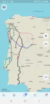
As you can see from this screenshot of Vila do Conde, Windy Maps shows all the Camino routes as a dark blue line.
Screenshot_20210530-070742_Windy Maps.webp

I also use Maps.me occasionally, and downloaded the kml file with all the Portuguese routes.
Screenshot_20210606-210311_MAPSME.webp
 
3rd Edition. More content, training & pack guides avoid common mistakes, bed bugs etc
Not talented, just a retired Civil Engineer with far too much time on his hands and the inablity to leave the UK at present!

Now you've got maps.me make sure you have the map showing the area where you live on your device. Then go for a potter around your street and see how it works. You don't want to arrive in Portugal and find there's something you don't understand!

Have a look at this for some really good information from @Thomas1962 - the man knows his stuff!

smartphone-on-the-camino
Lucky you! with all those skills. All this technology fries my already foggy brain. great idea, I was just browsing the app here to get familiar with, not on a real walk. So i want to see it on the road for sure to learn before i get there. Thank you for sharing that link i will check. I will watch some youtube videos to find out how i save a path i created in maps.me so i use offline the next morning i walk. Imagine! I still could not figure that one out. 🙂
 
Yes, I encountered that on the Portuguese Camino too.
As you can see from this screenshot of Vila do Conde, Windy Maps shows all the Camino routes as a dark blue line.
View attachment 102753

I also use Maps.me occasionally, and downloaded the kml file with all the Portuguese routes.
View attachment 102754
Thanks Trecile yes that is one of the routes i am worried to get lost. Cool this is all new to me. I just downloaded today these apps now i need to figure how to save it to use it offline when im in the camino. What an amazing help this technology is to save our feet(and backs) of extra miles, getting lost finding an alberge later in the day. 😯
 
OsmAnd

- The basic app is free.
- The "+" version of app permits storage of a greater number of maps. It is economical.
- The maps are open-source, are all free, and are generally revised monthly.
- Multiple map styles ("OsmAnd", "Off-road", "Topographical", "Marine", contour lines, etc.).
- Works perfectly both off-line and on-line.
- Feature-rich and tailorable.
- If simplicity is desired, one can de-select features; can re-select later.
- Is both a map-reading app and a navigation app.
- Suitable for multiple uses: driving, walking, cycling, boating, etc.
- Hiking trails and the various Caminos do appear on the map.
- Developers maintain and upgrade app regularly.
- Vast selection of categories of points-of-interest (lodgings/albergues/hostals/hotels, restaurants/cafes, banks & ATMs, museums, churches, shops, sights, amenities, train stations, laundromats, etc.). Displays of categories of POIs are easily selectable/de-selectable.
- Integrated with Wikipedia.
- Active forum for users.
- Track recording is easy.
- App has been in public use for more than 10 years and is a proven product.

OsmAnd started out as an Android app, then the same publisher developed an Apple IOS version. I have licences for both versions. The features in the Apple IOS version are catching up quickly to the Android version.

I have no financial interest whatsoever in OsmAnd.

I like maps, have multiple mapping apps on my devices, and enjoy exploring the various mapping apps. OsmAnd is the one I always come back to.
 
Last edited:
The one from Galicia (the round) and the one from Castilla & Leon. Individually numbered and made by the same people that make the ones you see on your walk.
Thank you so much. The only problem i found with Buen Camino app is that it doesn't give me the choice to put the stage of vila do conde to rates like change route from coastal to central. I was wondering if i could have all my paths in just one app.
I used a variety on my Camino Portugues. I like comparing one to the other. So I had Buen Camino and Wise Pilgrim (I'm not sure if Camino Ninja was out then) but I also used TrailSmart, for which you can download the Portuguese Caminos and which does cover the connecting bit between Vila do Conde and Rates.
 
I used a variety on my Camino Portugues. I like comparing one to the other. So I had Buen Camino and Wise Pilgrim (I'm not sure if Camino Ninja was out then) but I also used TrailSmart, for which you can download the Portuguese Caminos and which does cover the connecting bit between Vila do Conde and Rates.
Jeee it is amazing how many of these apps are out there now! I am enjoying that Maps.me i can design my route easily and the colors/details... i hope they create one that has it all! Directions, albergues, restaurants/cafes and even where are the Closests ATM machine to go get some $$
 
Jeee it is amazing how many of these apps are out there now! I am enjoying that Maps.me i can design my route easily and the colors/details... i hope they create one that has it all! Directions, albergues, restaurants/cafes and even where are the Closests ATM machine to go get some $$
TrailSmart had a fair amount of good stuff (path, accommodations, sights, amenities, etc.) when I downloaded the track. It isn't specific to Caminos as some of the others I used were.
 
...and ship it to Santiago for storage. You pick it up once in Santiago. Service offered by Casa Ivar (we use DHL for transportation).
Jeee it is amazing how many of these apps are out there now! I am enjoying that Maps.me i can design my route easily and the colors/details... i hope they create one that has it all! Directions, albergues, restaurants/cafes and even where are the Closests ATM machine to go get some $$
That's pretty much what dedicated Camino apps like Buen Camino do, and that's why I use them - because everything that I need is integrated into one app. With the exception of that connector in Portugal!
 
Have a look at this for some really good information from @Thomas1962 - the man knows his stuff!

smartphone-on-the-camino
Yes, you should check that link. Quoting from the site:

At santiago.nl (the website of the Dutch Confraternity of Saint James) you will find KMZ and GPX files that show all the pilgrim routes in different countries.

I have their tracks of all the caminos in Spain on my phone, using maps.me, and then add additional variants that I discover for whatever route I am planning to walk next. It is very interesting and helpful to have them all visible at once.

@Thomas1962 is a forum member and has been very helpful.
 
That's pretty much what dedicated Camino apps like Buen Camino do, and that's why I use them - because everything that I need is integrated into one app. With the exception of that connector in Portugal!
Right! We need to talk to that guy! Lol make sure he update for us the people that like to bounce from one way to another!
 
Get a spanish phone number with Airalo. eSim, so no physical SIM card. Easy to use app to add more funds if needed.
TrailSmart had a fair amount of good stuff (path, accommodations, sights, amenities, etc.) when I downloaded the track. It isn't specific to Caminos as some of the others I used were.
It feels like i will be wanting to use few of these things when i am there! I might get curious if i am missing something that another app has. 😊
 
It feels like i will be wanting to use few of these things when i am there! I might get curious if i am missing something that another app has. 😊
They are generally so cheap, in the context of what I am paying for the trip as a whole, flying in from across the ocean and all, and add no weight to my backpack, that I don't mind taking a bunch.
 
On my Caminos Catalan and Aragonese two years ago I used Wikiloc as my primary app. Not being as well walked routes I was concerned that they would not be as well marked. Like other apps when walking you see your selected track and your current position (hopefully on the track) but Wikiloc gives you an audio signal when you veer too far off the track. I found this most helpful in urban and suburban areas as the painted arrows were placed more discreetly. There were a few times when I missed arrows marking a turn in those areas but with Wikiloc I would be headed back within 50 meters or so instead of going 500 meters before I might look at the app and see that I was off course.

I also used OSMand+ for its detail when I wanted to get a broad look of the territory. Maps.me is good for this too. OSMand can do more than Maps.me but is more complicated so for most pilgrims I would recommend Maps.me. Both can load a track over a basemap but don't have Wikiloc's warning feature.

Thirdly I would start up Google Maps when approaching a town. This would be best for showing shops, bars, churches, etc. that might be out of sight even though close to the camino.

OSMand does have a nifty educational feature useful on a camino. You can download locations and texts from Wikipedia and thus have the basemap show a W in a dot over locations of interests (from the English language and/or other languages' sites). When the site is selected you can read a short article about what is there.

I did download some camino specific apps but I didn't use them. I had the navigation I needed in the general apps I already was used to and choices of where to stay on my 2019 caminos was easy to make because generally there was only one within a days walk of any other.

For the sheer beauty of the maps IGN España,
I used this once in a while too to get a feel of the terrain, especially for elevation changes. This does much more than I need. Different from most other apps it does come with an online manual. What they say is the basic manual is 90-100 pages of Spanish.
 
The focus is on reducing the risk of failure through being well prepared. 2nd ed.
@NeiaBrazil I think that it depends on which Camino you are walking and how technical you want to be.

For example, on the Camino Frances you only really need a map in bigger towns and cities to find an albergue or bar/restaurant. For everything else the way is so well marked and there are so many other pilgrims and other helpful people around that you will never get lost and your Camino will be so much better if you walk with your attention on the things around you rather than with your head down and your nose in a phone.

For the bigger towns and cities, Google Maps is hard to beat because it is usually the most up to date and the most accurate. Although, of course, it is not perfect and sometimes gets things wrong. I like to use Google Maps audio feature with a tiny earpiece for detailed walking directions in cities so that I can keep my eyes on the road.

For more remote and less well marked Caminos then I think that @Rick of Rick and Peg advice is the best because, again, you can set your phone to follow a track and get an audio warning if you deviate from the track. This way your attention is on the Camino rather than on your phone. It does take a bit more effort to learn Wikiloc though.

As with all things in life, what is good for one person in one situation may not be ideal for others.

Also, a quick note because some people don't know that you can use Google Maps without an internet connection or they think that it uses lots of data.

It is possible and simple to use Google Maps off-line and it uses very little data when online 😃
 
@NeiaBrazil I think that it depends on which Camino you are walking and how technical you want to be.

For example, on the Camino Frances you only really need a map in bigger towns and cities to find an albergue or bar/restaurant. For everything else the way is so well marked and there are so many other pilgrims and other helpful people around that you will never get lost and your Camino will be so much better if you walk with your attention on the things around you rather than with your head down and your nose in a phone.

For the bigger towns and cities, Google Maps is hard to beat because it is usually the most up to date and the most accurate. Although, of course, it is not perfect and sometimes gets things wrong. I like to use Google Maps audio feature with a tiny earpiece for detailed walking directions in cities so that I can keep my eyes on the road.

For more remote and less well marked Caminos then I think that @Rick of Rick and Peg advice is the best because, again, you can set your phone to follow a track and get an audio warning if you deviate from the track. This way your attention is on the Camino rather than on your phone. It does take a bit more effort to learn Wikiloc though.

As with all things in life, what is good for one person in one situation may not be ideal for others.

Also, a quick note because some people don't know that you can use Google Maps without an internet connection or they think that it uses lots of data.

It is possible and simple to use Google Maps off-line and it uses very little data when
 
I was one of those some people that did not know google maps can be used without internet.
you guys are so helpful. Thank you for sharing.
 
€2,-/day will present your project to thousands of visitors each day. All interested in the Camino de Santiago.
I will check this one too. I wonder if it is good for Portugal too and not just Spain. Thanks
OruxMaps is good for the whole planet, only you would need to download maps for it before going to the Camino (they are quite heavy files). In fact, as far as I know, IGN would be good too for Portugal, only you might need to download the Portugal map file separately (you would have to google that).

This is a place where you can download it

Thank you Amancio
 
...and ship it to Santiago for storage. You pick it up once in Santiago. Service offered by Casa Ivar (we use DHL for transportation).
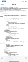
I am impressed how this apps technology is developing. I just found out i am still in the stone era. Lol. Ok i need a pacient soul to teach me how to get this KML file from my iphone to the app maps.me. I want to get a handle of this before i go. Here is what is happenning.
i downloaded one file on my iphone to learn.
It went straight to the phone folder FILES. It says the name of the file and that is an icloud drive.
When i click on it shows a bunch of codes like the picture i attached.
I proceded to the arrow to forward-then did browse which app and chose copy to maps.me but nothing shows up when i open the app. I tried to follow some instructions i saw on YouTube but I am sure i am doing something wrong but have no idea what it is.
 

Attachments

  • 53ACD5E7-FD22-4BE0-8146-29DDD787200A.webp
    53ACD5E7-FD22-4BE0-8146-29DDD787200A.webp
    155.4 KB · Views: 32
The easy way to get Maps.me to load KML and KMZ files and OSMand to load GPX files is to mail them to yourself as attachments (with a useful subject line like "KML for stage 2"). Open the mail and then its attachment. You will likely be asked with what app you want to use to open the file. There are other ways of opening the file but with different devices and file managers it can get complicated to explain.
 
Yes, I encountered that on the Portuguese Camino too.
As you can see from this screenshot of Vila do Conde, Windy Maps shows all the Camino routes as a dark blue line.
View attachment 102753

I also use Maps.me occasionally, and downloaded the kml file with all the Portuguese routes.
View attachment 102754
Oh wow Trecile i was trying with this Windy maps and its sooo cool, it tracks your steps. Fun. Thanks for sharing. 👏
 
3rd Edition. More content, training & pack guides avoid common mistakes, bed bugs etc
The easy way to get Maps.me to load KML and KMZ files and OSMand to load GPX files is to mail them to yourself as attachments (with a useful subject line like "KML for stage 2"). Open the mail and then its attachment. You will likely be asked with what app you want to use to open the file. There are other ways of opening the file but with different devices and file managers it can get complicated to explain.
Thank you so much Rick. I will definitely try this now with my phone since it is the only electronic i will have with me. Lets see if i manage to get anything inside maps.me
 
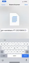
It occurred to me that possibly the KML file you downloaded was not saved with the suffix .kml in the name. KML and GPX files are actually text files in a format called XML (but to simplify lets just say "similar to HTML format"). So if you are missing the suffix in the filename your file manager could be getting confused with what to do with the file and treating it as a text file.

BTW, I often edit GPX tracks with a text editor. Depending on your editor, OS and device you may need to rename the file to use the suffix .txt before editing and then change the name back after editing. You can do this with KML files too. You have to be crazy to try this with KMZ files though.
 
Last edited:
It occurred to me that possibly the KML file you downloaded was not saved with the suffix .kml in the name. KML and GPX files are actually text files in a format called XML (but to simplify lets just say "similar to HTML format"). So if you are missing the suffix in the filename your file manager could be getting confused with what to do with the file and treating it as a text file.

BTW, I often edit GPX tracks with a text editor.
Yes. You maybe right i can try to rename it and add . Kml at the end and see what happens no?
 

Attachments

  • 8554204E-9EB5-4077-8BA3-84F04CA12FE9.webp
    8554204E-9EB5-4077-8BA3-84F04CA12FE9.webp
    52.6 KB · Views: 24
€2,-/day will present your project to thousands of visitors each day. All interested in the Camino de Santiago.
Get a spanish phone number with Airalo. eSim, so no physical SIM card. Easy to use app to add more funds if needed.
I use the Buen Camino app. In addition to offline map of the Camino it has tons of other features. It lists the accommodations in each town along with contact information and booking links. As you are on the Camino it shows the distance to the next town in real time. It has a nifty stage planner that's fun to play around with.

I also like Windy Maps because all the Camino routes are already on it. I don't have to download and import the routes.


I Second Buen Camino! Love love it
 
I use the Buen Camino app. In addition to offline map of the Camino it has tons of other features. It lists the accommodations in each town along with contact information and booking links. As you are on the Camino it shows the distance to the next town in real time. It has a nifty stage planner that's fun to play around with.

I also like Windy Maps because all the Camino routes are already on it. I don't have to download and import the routes.


The focus is on reducing the risk of failure through being well prepared. 2nd ed.
I use OruxMaps for loyalty to the app (they were true pioneers), but you have a free version which is possibly 99% identical and includes links to hundreds of Camino de Santiago routes and stages.


you can download stages as you need them in a place where you have internet (they are actually tiny files) and then open it in the IGN app, even with the airplane mode on if you want to save battery.
I downloaded Mapa de Espana from your link but don't see stages, just a beautifully detailed and very complicated map app. How do I get the stages?
 
Too many maps and too many apps for me haha.
I download the Buen Camino maps. It is really easy. If I am going to vary or I am unsure I like the old fashioned way. Ask directions. In alot of rural areas especially in Portugal I found people would often show me where to go.
 
3rd Edition. More content, training & pack guides avoid common mistakes, bed bugs etc
I used a variety on my Camino Portugues. I like comparing one to the other. So I had Buen Camino and Wise Pilgrim (I'm not sure if Camino Ninja was out then) but I also used TrailSmart, for which you can download the Portuguese Caminos and which does cover the connecting bit between Vila do Conde and Rates.

The Camino Ninja App came out around January 1st 2020.

I tracked the routes in Portugal last year. Most of them multible times. Where needed. It should be the most correct.

Last year people said between 60-80% where using the app in Portugal. This year they say more than 99%, or just everyone. Both albergues and pilgrims say so. And it's quite popular on Camino Francées as well right now.

But I'm not really sure about the question. If he just want a map app or a camino app. Because a camino app usually have more information like crushing kilometers and accommodations as well.

If it is just a map app he is looking for the easiest one is MAPS.ME, in my opinion, and then downloading all the routes from santiago.nl/downloads ...but it is mostly cycling routes, but you can defenitely walk with them if you just want an offline map and do not care about all the rest of the information camino apps offer.
 
Oh well! No way here for this brain to get a file inside maps
Give it try. While you are at it you may want to rename the first part of the name to something you can easily type, remember and search for.
Rick Oh well! 🙂No way here for this brain to get a file inside maps.me
renamed and tried to download and nothing.
then sent to my email like you told me and when i click on it really just give me the choice to “download” not “open with”. See the picture. Clicking download nothing happens. Now this is getting me even more curious! Any idea of what else i should try?
 

Attachments

  • 829FCA52-CDD6-464A-9CCF-EA526A8A0EA5.webp
    829FCA52-CDD6-464A-9CCF-EA526A8A0EA5.webp
    31.1 KB · Views: 15
Any idea of what else i should try?
I'm going to leave it now for an Apple user to carry it forward. I haven't used an Apple product in 30 years except to take photos of people with their own iPhones. I've got nothing against Apple, I just haven't used anything since the MacIntosh.
 
€2,-/day will present your project to thousands of visitors each day. All interested in the Camino de Santiago.
Thank you. Mine is the iphone 11 pro max not sure what i am missing.

Google Chrome?

But, try Camino Ninja App. It’s free.

Download it, select the route and click Map.

It’s a lot easier and the routes are more precise.
 
I like mapy.cz

It's free.

It has a website version ; plus specific downloadable versions for every platform, even Windows Phone ; it shows most waymarked trails, all the major ones, plus roads etc, quite a few bars, cafes, restaurants, plus monuments etc.
 
...and ship it to Santiago for storage. You pick it up once in Santiago. Service offered by Casa Ivar (we use DHL for transportation).
The Camino Ninja App came out around January 1st 2020.

I tracked the routes in Portugal last year. Most of them multible times. Where needed. It should be the most correct.
Does it show the connector routes between the Coastal and Central routes? That's the piece that's missing on the other Camino apps.
 
Maps.Me for walking,
Google Maps + Google Earth for planning and terrain,
Open Street Map for my Garmin handheld GSPr,
What3Words if I want to meet somebody at an exact spot and not stand outside the wrong entrance to the British Museum for nearly an hour waiting for a daughter (who was at a different entrance),
For the sheer beauty of the maps IGN España,

What? I like cartography!

Oh wow! you are talented to use all these. I am hoping to get “one” app right! Lol

Almost the same for me:
- Google Maps for planning
- Maps.me when walking
- Green Tracks (with Open Street Maps files) in addition
 
Does it show the connector routes between the Coastal and Central routes? That's the piece that's missing on the other Camino apps.

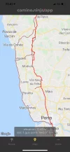
Yes, if you look at the map for the central route it has the senda litoral route marked up as a variant from Porto to Vila do Conde with connectors from Mindelo to Vairão and from Vila do Conde to Arcos / Rates.
 

Attachments

  • IMG_4603.webp
    IMG_4603.webp
    191.5 KB · Views: 13
Ideal sleeping bag liner whether we want to add a thermal plus to our bag, or if we want to use it alone to sleep in shelters or hostels. Thanks to its mummy shape, it adapts perfectly to our body.

€46,-
The Camino Ninja App came out around January 1st 2020.

I tracked the routes in Portugal last year. Most of them multible times. Where needed. It should be the most correct.

Last year people said between 60-80% where using the app in Portugal. This year they say more than 99%, or just everyone. Both albergues and pilgrims say so. And it's quite popular on Camino Francées as well right now.

But I'm not really sure about the question. If he just want a map app or a camino app. Because a camino app usually have more information like crushing kilometers and accommodations as well.

If it is just a map app he is looking for the easiest one is MAPS.ME, in my opinion, and then downloading all the routes from santiago.nl/downloads ...but it is mostly cycling routes, but you can defenitely walk with them if you just want an offline map and do not care about all the rest of the information camino apps offer.
I walked the Portugues in 2018, so it wasn't available for me then.

I think he is looking for a mapping app he can use not just for the different Portuguese Caminos (which, as you say, Camino Ninja covers quite well) but also for the connections between them, in particular, the connection between Vila do Conde and Rates. That I wasn't able to find so easily in my Camino Ninja app when I went to look for it before writing my response. Obviously, my mistake was to look at the Senda route and try to find the connector from Vila do Conde there, instead of looking at the Central route.
 
I think he is looking for a mapping app he can use not just for the different Portuguese Caminos (which, as you say, Camino Ninja covers quite well) but also for the connections between them, in particular, the connection between Vila do Conde and Rates. That I wasn't able to find so easily in my Camino Ninja app when I went to look for it before writing my response.

The connection between Vila do Conde and Rates are shown on the Cental route.
 

Attachments

  • IMG_4603.webp
    IMG_4603.webp
    191.5 KB · Views: 13
You have to install MAPS.ME first from the app store
Yes that is how i did. But still cant download anything to it. So basically what happens when it receives a Kml file? Maybe it is already there inside maps.me and i just dont know how to open or something? Feeling brainless! 😊
Maybe it is because im using safari?
 
The focus is on reducing the risk of failure through being well prepared. 2nd ed.
Yes that is how i did. But still cant download anything to it. So basically what happens when it receives a Kml file? Maybe it is already there inside maps.me and i just dont know how to open or something? Feeling brainless! 😊
Maybe it is because im using safari?
Google Chrome asks you what app you want to open the file with. I think that’s the trick :-)
 
I use the yellow arrows. lol Old school.
As for using the yellow arrows, while approaching Santiago from the south on the Sanabres I saw fresh yellow arrows painted on a building to indicate that the route was straight ahead. On my map on maps.me, the route went to the left and was clear to follow. I thought, "O, somebody is trying to lure me away from the route with those arrows, to go to a bar or albergue." I kept on following the route on maps.me, as it gradually dwindled away and I found myself in an awkward position above a highway. The freshly painted arrows pointed to a new route. It may have been corrected online, on the route for my map, but I had not tried to download it from the forum resources after the initial time, as I didn't think about route changes. Sometimes, yellow arrows may have the more up-to-date information.
 
As for using the yellow arrows, while approaching Santiago from the south on the Sanabres I saw fresh yellow arrows painted on a building to indicate that the route was straight ahead. On my map on maps.me, the route went to the left and was clear to follow. I thought, "O, somebody is trying to lure me away from the route with those arrows, to go to a bar or albergue." I kept on following the route on maps.me, as it gradually dwindled away and I found myself in an awkward position above a highway. The freshly painted arrows pointed to a new route. It may have been corrected online, on the route for my map, but I had not tried to download it from the forum resources after the initial time, as I didn't think about route changes. Sometimes, yellow arrows may have the more up-to-date information.

Almost always follow the arrows!
 
The focus is on reducing the risk of failure through being well prepared. 2nd ed.
Yeah just get it in the App Store. It's free.

But still I think the Camino Ninja App would have saved you all your troubles :)
Oh jee! Thats how much i know about technology dear... i had no clue there was google chrome app. Lol Let me try this then if works! 🤓
 
A selection of Camino Jewellery
@NeiaBrazil, play around with the star icon on the bottom of the Maps.me app. That is where bookmarked tracks and such can be accessed. You might find your downloaded kml file listed there. If so click it. That should show the track but possibly not the basemap underneath it. If no basemap you will be asked if you want to download it.
 
Almost always follow the arrows!
"Almost" being the operative word. While on the Ingles I deliberately went "off piste" to stay at an albergue I had been recommended. Came to a crossroads and there were yellow arrows pointing every which way! Seems the local cycling club likes yellow (and blue and red) arrows too!
 
Yes that is how i did. But still cant download anything to it. So basically what happens when it receives a Kml file? Maybe it is already there inside maps.me and i just dont know how to open or something? Feeling brainless! 😊
Maybe it is because im using safari?
Don't worry, you'll get there! These screen shots were taken from an Android but should be the same as you see (more of less)

When you get a mapping file as an email attachment or a download you should see something like this when you try to open it

1624114733012.webp

Click on maps.me (or your app of choice) and the words "just once" and "always" become darker in colour- you choose the app you want to use (you can always change your mind later)

Maps me should now appear and look like this

1624114858088.webp

This is the star which @Rick of Rick and Peg spoke

1624114927831.webp
Click on it any you'll see the various trails available on your machine

1624115577373.webp

click on the one you want and you get something like this

1624114994752.webp

Click on one of the coloured discs and it should take you to that area on the map. (If you haven't got the detailed map of that area downloaded it will prompt you to do so)

1624115188899.webp 1624115274514.webp

Hope that helps more than hinders you!
 
The focus is on reducing the risk of failure through being well prepared. 2nd ed.
Don't worry, you'll get there! These screen shots were taken from an Android but should be the same as you see (more of less)

When you get a mapping file as an email attachment or a download you should see something like this when you try to open it

View attachment 102886

Click on maps.me (or your app of choice) and the words "just once" and "always" become darker in colour- you choose the app you want to use (you can always change your mind later)

Maps me should now appear and look like this

View attachment 102887

This is the star which @Rick of Rick and Peg spoke

View attachment 102888
Click on it any you'll see the various trails available on your machine

View attachment 102893

click on the one you want and you get something like this

View attachment 102889

Click on one of the coloured discs and it should take you to that area on the map. (If you haven't got the detailed map of that area downloaded it will prompt you to do so)

View attachment 102890 View attachment 102891

Hope that helps more than hinders you!
Oh wow Jeff ! nice reply thank you for your time Let me go slowly slowly and check all the steps to see if i am missing anything. I will post my screens too here so maybe we catch what i am doing wrong. The generosity of this group makes me realize already that this first camino i will embark will be life changing. 💕thank u.
 
Don't worry, you'll get there! These screen shots were taken from an Android but should be the same as you see (more of less)

When you get a mapping file as an email attachment or a download you should see something like this when you try to open it

View attachment 102886

Click on maps.me (or your app of choice) and the words "just once" and "always" become darker in colour- you choose the app you want to use (you can always change your mind later)

Maps me should now appear and look like this

View attachment 102887

This is the star which @Rick of Rick and Peg spoke

View attachment 102888
Click on it any you'll see the various trails available on your machine

View attachment 102893

click on the one you want and you get something like this

View attachment 102889

Click on one of the coloured discs and it should take you to that area on the map. (If you haven't got the detailed map of that area downloaded it will prompt you to do so)

View attachment 102890 View attachment 102891

Hope that helps more than hinders you!
Oh wow! nice reply thank you for your time Let me go slowly slowly and check all the steps to see if i am missing anything. I will post my screens too here so maybe we catch what i am doing wrong. The generosity of this group makes me realize already that this first camino i will embark will be life changing. 💕thank u.
Hi Everyone! i was just curious about what is your favorite app to navigate through the camino with maps routes etc...offline without using internet? And if you can explain why you prefer that app or if you used more than one app during your camino to get yourself easier and faster to places. Thank you.
 
Ok Guys i went slowly and took notes and pictures of my steps so you can see
1-I am now using Google Chrome app instead of Safari and My Phone is Apple 11pro. I am in Florida at the moment not in Portugal. i have two base maps for Portugal already inside the app. In case all this helps or changes anything.
2- I went to https://www.santiago.nl/downloads/
to get the KML to send to my gmail account. See picture below. I got the Portugal oneD7EB0297-46B8-48B4-893C-54F41232F5BD.png
3- After i click on it (Kml one) this appears saying to download it. I click Download.


209CADCD-800A-4EE6-B799-0656AD18DF94.png
4- then it download and says the name of the file and open in...
9B803FBF-1A89-47DB-983F-9001CBF6543A.png
5- i click open in... and goes to this window where i click ( ... more) to go find maps.me


6- then i see the copy maps.me and click on it


6A966324-E9D4-4C3E-B26F-2CFF2FE9D63C.png
7- when i click copy to maps.me go straight to maps.me app open it automatically but nothing shows. Not sure what is happening. Let me know if there is another step i could do. Thank you.
 
Last edited:
Perfect memento/gift in a presentation box. Engraving available, 25 character max.
Hi Everyone! i was just curious about what is your favorite app to navigate through the camino with maps routes etc...offline without using internet? And if you can explain why you prefer that app or if you used more than one app during your camino to get yourself easier and faster to places. Thank you.

For most of the year the low-impact option on the CF is ‘follow the rucksack in front of you’.

For the rest of the year - assuming you’re not colourblind in any way which excludes yellow - it’s: ‘follow the arrows’.

I’m more addicted to various devices than I’d like to be, but even I turn the ‘phone off when it’s not necessary.
 
Here's my thoughts. Use Wikiloc and a track. Walk following rucksacs, arrows, footprints or whatever. If Wikiloc alerts you then look at the track and also where you are. If not using Wikiloc set a timer for 30 to 60 minutes. When the alarm goes off and you have seen a arrow in 10 minutes then ignore the alarm. Otherwise check your position and maybe shout out to those people ahead of you "Hey, we're going the wrong way." Use all remaining time to be in the moment or to contemplate your favorite episode of The Office, whatever brings you most bliss.
 
Last edited:
Get a spanish phone number with Airalo. eSim, so no physical SIM card. Easy to use app to add more funds if needed.
Ok Guys i went slowly and took notes and pictures of my steps so you can see
1-I am now using Google Chrome app instead of Safari and My Phone is Apple 11pro. I am in Florida at the moment not in Portugal. i have two base maps for Portugal already inside the app. In case all this helps or changes anything.
2- I went to https://www.santiago.nl/downloads/
to get the KML to send to my gmail account. See picture below. I got the Portugal oneView attachment 102912
3- After i click on it (Kml one) this appears saying to download it. I click Download.


View attachment 102913
4- then it download and says the name of the file and open in...
View attachment 102914
5- i click open in... and goes to this window where i click ( ... more) to go find maps.me


6- then i see the copy maps.me and click on it


View attachment 102916
7- when i click copy to maps.me go straight to maps.me app open it automatically but nothing shows. Not sure what is happening. Let me know if there is another step i could do. Thank you.
@NeiaBrazil I feel how frustrating this is for you.

I don't have Maps.me on my Android phone and so I loaded it so that I could follow what you did and see if I got the same results.

I got different results, it worked correctly for me.

However, I did notice that when I installed Maps.me I was asked two questions. One question asked for access to my current location and I answered Yes. The other question wanted to give Maps.me access to all files and images on my phone and again I answered Yes.

Apple phones are different but they have similar controls on access by applications on the phone.

When you installed Maps.me what answers did you give for access control?

Once I had Maps.me running and the downloaded files installed I tried to get Maps.me to follow a Camino route/track and I discovered that it couldn't do this. ☹️

I wonder if Maps.me is the correct application for you?

OSMand or Wikiloc (recommended by @Rick of Rick and Peg ) are both able to follow Camino routes. Perhaps one of these might be better for you to use?
That was so nice of you. Thank you for let me know this. Here is what i try now i will delete it, then download it again and be More careful with those answers as i dont remember how i answered them. And if doesnt work i will continue researching, reading and check youtube too and also see if i stop at an apple store for help. Even though i doubt they will know about this specific app. As you see i am not a quitter. Lol. Will give a few more days if not try something else. I just would like to learn it, seems very fun and useful both apps maps.me and windymaps. But when camino comes i will have a backup plan and all will be good. I got intrigued now about these apps! Like i just opened a box of chocolate. Lol
 
Last edited:
Once I had Maps.me running and the downloaded files installed I tried to get Maps.me to follow a Camino route/track and I discovered that it couldn't do this. ☹️
I didn't use any navigational app for our 2015 CF but I have installed on my Android phone the Maps.me app and a basemap of Galicia and two kml or kmz files for Sarria to Santiago and for Tui to Santiago. When I use the bookmarks feature to bring up one or the other both tracks appear over the Galicia basemap (in different colors). I'm sure that if I did this in the stea my current position would be shown on the displayed track as long as I was on the camino.
OSMand or Wikiloc (recommended by @Rick of Rick and Peg ) are both able to follow Camino routes. Perhaps one of these might be better for you to use?
Yeah, maybe it is time to try OSMand or one of the specialized camino apps. I encourage the use of the generalized apps because these use a database by OpenStreetMap and have trails marked on them that Google Maps does not. You can use them for hikes at home.

Wikiloc has three levels of membership. Anyone can use Wikiloc.com to explore tracks uploaded by members. Members (free) can upload snd download tracks. Paid membership gives you a few extra perks, the best of which is a better search capability. Try out the website first.
 
A selection of Camino Jewellery
It is amazing how you guys know about this stuff!!! I can not even say i look like a ten years old kid anymore 😂 as these kids are so smart and quick with tech things!
 
I am optimist as i am reloading now and i see questions i don't remember before.
 
I don't understand what the problem is here. I needed massive help to download the Levante routes to maps.me . I think I know, on a basic level, how it works. But I don't expect the arrow to appear to show a location on a map and on a route, unless I am actually there. I don't have any routes downloaded for Canada, although I have some maps. Right now, the arrow that follows the downloaded route when I am in Spain is sitting on the Calgary map on maps.me on the corner where the apartment block where I live is located. Is everyone sure that lack of the basic knowledge of how maps.me works is not the problem here? I had to download a map of Calgary to see the locator for maps.me and get used to it. But I can't, as far as I know, explore the presence of the locator arrow on a track in Spain unless I am on a track in Spain, and it would not be very useful to me to try to do so. I am ignorant enough to know that I am probably missing something here, but it wouldn't hurt to try this.
 
...and ship it to Santiago for storage. You pick it up once in Santiago. Service offered by Casa Ivar (we use DHL for transportation).
I don't understand what the problem is here. I needed massive help to download the Levante routes to maps.me . I think I know, on a basic level, how it works. But I don't expect the arrow to appear to show a location on a map and on a route, unless I am actually there. I don't have any routes downloaded for Canada, although I have some maps. Right now, the arrow that follows the downloaded route when I am in Spain is sitting on the Calgary map on maps.me on the corner where the apartment block where I live is located. Is everyone sure that lack of the basic knowledge of how maps.me works is not the problem here? I had to download a map of Calgary to see the locator for maps.me and get used to it. But I can't, as far as I know, explore the presence of the locator arrow on a track in Spain unless I am on a track in Spain, and it would not be very useful to me to try to do so. I am ignorant enough to know that I am probably missing something here, but it wouldn't hurt to try this.
I don't think that is the problem. I think (but I'm not sure) that the problem is that when @NeiaBrazil downloads the map that it doesn't open up in Maps.me as anticipated. Nothing to do with being able to see where one is on the map. I've downloaded the KML files for all the Portuguese routes, and when I open my Maps.me app I can search for Portugal, and it will zoom across North America and the Atlantic Ocean and I can see all my downloaded routes. I did notice that it made a difference which file app that I used. It worked with my Google Files app, but not the native Samsung Files app.

Screenshot_20210619-195253_MAPSME.webp
 
HELLO HELLO my friends! Look what i got!!! 👏👍🎵🎼🎶aleluia José! Finally!View attachment 102921
i want to thank everyone that tried to help. I just started to play with this two days ago. I have never used this app before, if you guys didnt tell me about these i would not even know about these apps. Kml files also i had no clue what it was. Just discovered reading here this week.

second- i want to live notes here to help the next pilgrim so they dont break their head if the problem is the same.
i think the combo of a few advices from you made it possible to be able to import Kmls. I believe i had everything wrong from the beginning in how i installed the app.
Here is what i simply did.

1-Deleted the app and Re-installed properly, i answered the questions “yes” now. It automatically asked if i wanted to download my local map which i did.

2-Downloaded before hand the base maps of the countries (Portugal+Spain) i was going to import the KMLs.

3-I used google chrome while searching for the kml to import. Once all this was done I did not even need to send kml to my email. It did open from the webpage and asked which app i wanted to use to open it.

Thats all! I am happy now!
 
Get a spanish phone number with Airalo. eSim, so no physical SIM card. Easy to use app to add more funds if needed.
I don't think that is the problem. I think (but I'm not sure) that the problem is that when @NeiaBrazil downloads the map that it doesn't open up in Maps.me as anticipated. Nothing to do with being able to see where one is on the map. I've downloaded the KML files for all the Portuguese routes, and when I open my Maps.me app I can search for Portugal, and it will zoom across North America and the Atlantic Ocean and I can see all my downloaded routes. I did notice that it made a difference which file app that I used. It worked with my Google Files app, but not the native Samsung Files app.

I think the problem is she’s trying to download and open the KML files with the Safari browser on her iPhone. Google Chrome asks what app you want to open the KML files with but Safari doesn’t.

But the real problem is she’s going for the more complicated technical solution. MAPS.ME works for experienced hikers with technical skills.

Using one of the designated camino apps would most likely be the better advice instead of going for a full blown hiker survival solution.
 
Last edited:
Yeah just get it in the App Store. It's free.

But still I think the Camino Ninja App would have saved you all your troubles :)


I think the problem is she’s trying to download and open the KML files with the Safari browser on her iPhone. Google Chrome asks what app you want to open the KML files with but Google Chrone doesn’t.

But the real problem is she’s going for the more complicated technical solution. MAPS.ME works for experienced hikers with technical skills.

Using one of the designated camino apps would most likely be the better advice instead of going for a full blown hiker survival solution.
Maps.me It is working now. It imports all the kmls no problem.
 
Maps.me It is working now. It imports all the kmls no problem.

Good. Then you should just get a guidebook or a camino app to have the rest of the information.
 
A selection of Camino Jewellery
I
Good. Then you should just get a guidebook or a camino app to have the rest of the information.
I know you were pushing for the “camino ninja app”. Which i can try too no problem. They are ALL new to me. I do have more of a problem with bad judgements than i have with specific apps.
I don't usually like to limit myself and enjoy to be more open minded. I like to learn new things, it is also fun. For your information I already have the guidebook, i have the camino apps and now also a working maps.me and learned a few tricks about it. Wether i will bring or use any of this brand new info when i am there is a whole another question. Learning and educating myself to know my own preferences. I can be there in the moment, enjoying what the camino brings, and not use “any” of the technology at all. In fact i enjoyed learning because i am not so much a person that is always attached to technology. Infact all the hikes i have done i have never used an app. This “could” be the first. But being a person not so constantly attached to technology all the time does not mean i should not learn.
 
Yeah just get it in the App Store. It's free.

But still I think the Camino Ninja App would have saved you all your troubles :)


I think the problem is she’s trying to download and open the KML files with the Safari browser on her iPhone. Google Chrome asks what app you want to open the KML files with but Google Chrone doesn’t.

But the real problem is she’s going for the more complicated technical solution. MAPS.ME works for experienced hikers with technical skills.

Using one of the designated camino apps would most likely be the better advice instead of going for a full blown hiker survival solution.
It was not that complicated and now i can share with others.
 
@NeiaBrazil I think that it depends on which Camino you are walking and how technical you want to be.

For example, on the Camino Frances you only really need a map in bigger towns and cities to find an albergue or bar/restaurant. For everything else the way is so well marked and there are so many other pilgrims and other helpful people around that you will never get lost and your Camino will be so much better if you walk with your attention on the things around you rather than with your head down and your nose in a phone.

For the bigger towns and cities, Google Maps is hard to beat because it is usually the most up to date and the most accurate. Although, of course, it is not perfect and sometimes gets things wrong. I like to use Google Maps audio feature with a tiny earpiece for detailed walking directions in cities so that I can keep my eyes on the road.

For more remote and less well marked Caminos then I think that @Rick of Rick and Peg advice is the best because, again, you can set your phone to follow a track and get an audio warning if you deviate from the track. This way your attention is on the Camino rather than on your phone. It does take a bit more effort to learn Wikiloc though.

As with all things in life, what is good for one person in one situation may not be ideal for others.

Also, a quick note because some people don't know that you can use Google Maps without an internet connection or they think that it uses lots of data.

It is possible and simple to use Google Maps off-line and it uses very little data when online 😃
Really helpful re Google Maps... thank you!
 
The focus is on reducing the risk of failure through being well prepared. 2nd ed.
Maps.me It is working now. It imports all the kmls no problem.
Now do a search for a KML file for a walk somewhere close to you in Florida. Download it and head on out there when you get a chance so you can see what it's like "boots on the ground"

Next week: routes to follow vs the track you left behind you!
 
Perfect memento/gift in a presentation box. Engraving available, 25 character max.
I know you were pushing for the “camino ninja app”. Which i can try too no problem. They are ALL new to me. I do have more of a problem with bad judgements than i have with specific apps.
I don't usually like to limit myself and enjoy to be more open minded. I like to learn new things, it is also fun. For your information I already have the guidebook, i have the camino apps and now also a working maps.me and learned a few tricks about it. Wether i will bring or use any of this brand new info when i am there is a whole another question. Learning and educating myself to know my own preferences. I can be there in the moment, enjoying what the camino brings, and not use “any” of the technology at all. In fact i enjoyed learning because i am not so much a person that is always attached to technology. Infact all the hikes i have done i have never used an app. This “could” be the first. But being a person not so constantly attached to technology all the time does not mean i should not learn.

I'm not trying to push anything. I'm actually trying to give you good advice.

MAPS.ME do not have distances betwen cities, prices for accommodations, etc. The KML files you downloaded are not very updated and do not have the information you probably want.

Guidebooks have not been updated last year and this year because of the pandemic. And a lot of changes happened since then. The biggest guidebook available is even recommending using apps this year.

You have multible apps available with offline information. And most of them free, They all have more updated information than what you have with MAPS.ME and the KML files you downloaded.

Here is a list from the the top of my head that probably all have better information than what you downloaded: Camino Ninja App, Editorial Buen Camino, CaminoTool, Wisely ...and there is probaly 10 or 20 more. And most of them are free.

I can probably make a very long list of reasons why I think my app is the best, but it is really not relevant here and everyone have their own preferences. But there is one vital thing it has right now that other apps do not have. Information about what accommodations are open and not.

That information can also be forund here:

From Porto to the Spanish border:
https://albergueperegrinosporto.pt/theway

From Tui to Santiago:
https://ideas-peregrinas.com/camino/

The information on the lists are also in the Camino Ninja App. And a lot more information you probably also want.

The lists are updated daily. And so is the app. Almost everyone walking in Portugal uses the app, and for a very good reason. You will find out when you are there.

I just want to let you know so you are informed. I'm not trying to push anything. I just don't want you to be uninformed.

Best
Andy
 
Now do a search for a KML file for a walk somewhere close to you in Florida. Download it and head on out there when you get a chance so you can see what it's like "boots on the ground"

Next week: routes to follow vs the track you left behind you!
It is fun playing with this stuff! Good for the old Foggy scared brain here. I was about to quit. Thank you💕for helping.
 
The information on the lists are also in the Camino Ninja App. And a lot more information you probably also want.
Earlier on this thread it was mentioned that OSMand can show locations of interest that are found on Wikipedia. Since the texts for the articles are in the public domain maybe you can add information in your app for these points of interest if you haven't already done so.
 
...and ship it to Santiago for storage. You pick it up once in Santiago. Service offered by Casa Ivar (we use DHL for transportation).
I'm not trying to push anything. I'm actually trying to give you good advice.

MAPS.ME do not have distances betwen cities, prices for accommodations, etc. The KML files you downloaded are not very updated and do not have the information you probably want.

Guidebooks have not been updated last year and this year because of the pandemic. And a lot of changes happened since then. The biggest guidebook available is even recommending using apps this year.

You have multible apps available with offline information. And most of them free, They all have more updated information than what you have with MAPS.ME and the KML files you downloaded.

Here is a list from the the top of my head that probably all have better information than what you downloaded: Camino Ninja App, Editorial Buen Camino, CaminoTool, Wisely ...and there is probaly 10 or 20 more. And most of them are free.

I can probably make a very long list of reasons why I think my app is the best, but it is really not relevant here and everyone have their own preferences. But there is one vital thing it has right now that other apps do not have. Information about what accommodations are open and not.

That information can also be forund here:

From Porto to the Spanish border:
https://albergueperegrinosporto.pt/theway

From Tui to Santiago:
https://ideas-peregrinas.com/camino/

The information on the lists are also in the Camino Ninja App. And a lot more information you probably also want.

The lists are updated daily. And so is the app. Almost everyone walking in Portugal uses the app, and for a very good reason. You will find out when you are there.

I just want to let you know so you are informed. I'm not trying to push anything. I just don't want you to be uninformed.

Best
Andy
I agree with you that for the Camino, a dedicated Camino app is really great - they have the offline maps, albergues, points of interest, distances between towns, what services are offered in each town, such as banks, restaurants, etc.
I am a Buen Camino fan, but I will try Camino Ninja on my next Camino. The only time that I needed to download a separate map was for the connection between the Portuguese Coastal and Central routes.
I also have Wise Pilgrim apps on my phone. I primarily use Buen Camino, but if there is any confusion or to read albergue ratings I will consult Wise Pilgrim.
 
Status
Not open for further replies.

❓How to ask a question

How to post a new question on the Camino Forum.

Most read last week in this forum

Hi everyone! I am planning my first Camino Portuguese, starting in Porto in early April. It just so happens we arrive in Santiago on Easter weekend. I'm very much looking forward to seeing...

Featured threads

❓How to ask a question

How to post a new question on the Camino Forum.

Featured threads

Forum Rules

Forum Rules

Camino Updates on YouTube

Camino Conversations

Most downloaded Resources

This site is run by Ivar at

in Santiago de Compostela.
This site participates in the Amazon Affiliate program, designed to provide a means for Ivar to earn fees by linking to Amazon
Official Camino Passport (Credential) | 2024 Camino Guides
Back
Top