• ⚠️ Emergency contact in Spain - Dial 112 and AlertCops app. More on this here.
  • Remove ads on the forum by becoming a donating member. More here.

Search 74,075 Camino Questions

LIVE from the Camino Geira y Arrieiros - May 23

mick53

Member
Time of past OR future Camino
Geira y Arrieiros, Torres 2023
Hola
The Geira y Arrieiros from Braça to Santiago.

We had heard great things about this remote mountainous walk and were looking forward to it. We are not disappointed!

The information is direct, accomodation may be complex and book a few days ahead, its not busy, and you must bring a GPS/App and a powerbank.

I will collect the info sources I came across and put them here.

First is an updated doco on accomodation, services, where to find the epath/kml, the pros snd cons of going to Torres de Bouro etc. I believe it is authored by Henrique Malheiro and obtained by Garis.

We started on Tuesday 23rd May just after finishing the Torres from Salamanca- which was just after the Mozarabie from Almeria!

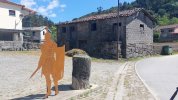
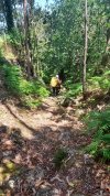
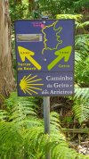
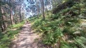
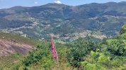
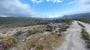
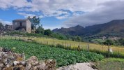
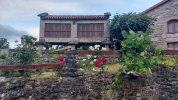
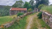
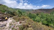
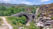
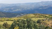
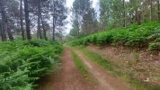
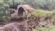
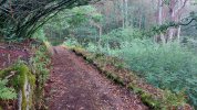
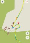
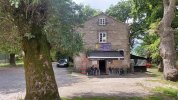
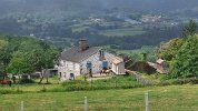
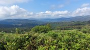
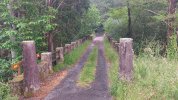
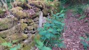
Day 1 Caldelas to Terras de Bouro 13km, 405m up

After the last 3 days of 'Urban' walking on the Torres into Braça we decided to avoid another day's urban trials and caught an 8:15 bus to Caldelas and walked from there.
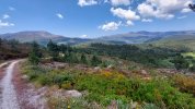
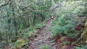
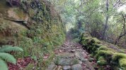
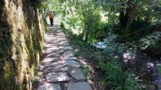
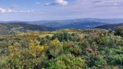
Beautiful scenery and walking. Great to be up in the hills.
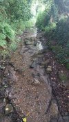
Signage was fantastic up to the point where we took the left fork on the shorter path so we could stay at Torres de Bouro. As well the signs and the epath aligned. Then nothing!
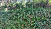
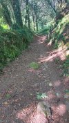
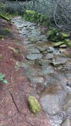
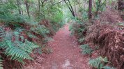
At first a very steep rutted overgrown rocky path down. After that we compared the paths to a longer road each time.
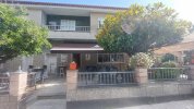
Stayed at Pension Rio Romem, (€52 booked via Booking.com) has a bar and good Restraunt.
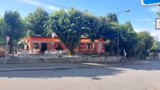
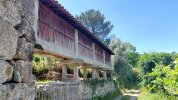
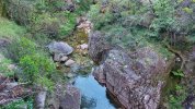
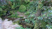
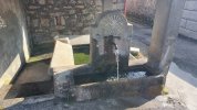
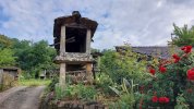
20230523_090909.jpg20230523_111355.jpg20230523_094853.jpg20230523_094736.jpg
 

Attachments

Last edited:
Ideal sleeping bag liner whether we want to add a thermal plus to our bag, or if we want to use it alone to sleep in shelters or hostels. Thanks to its mummy shape, it adapts perfectly to our body.

€46,-
Hola
The Geira y Arrieiros from Braça to Santiago.

We had heard great things about this remote mountainous walk and were looking forward to it. We are not disappointed!

The information is direct, accomodation may be complex and book a few days ahead, its not busy, and you must bring a GPS/App and a powerbank.

I will collect the info sources I came across and put them here.

First is an updated doco on accomodation, services, where to find the epath/kml, the pros snd cons of going to Torres de Bouro etc. I believe it is authored by Henrique Malheiro and obtained by Garis.

We started on Tuesday 23rd May just after finishing the Torres from Salamanca- which was just after the Mozarabie from Almeria!

Day 1 Caldelas to Terras de Bouro 13km, 405m up

After the last 3 days of 'Urban' walking on the Torres into Braça we decided to avoid another day's urban trials and caught an 8:15 bus to Caldelas and walked from there.
Beautiful scenery and walking. Great to be up in the hills.
Signage was fantastic up to the point where we took the left fork on the shorter path so we could stay at Torres de Bouro. As well the signs and the epath aligned. Then nothing!
At first a very steep rutted overgrown rocky path down. After that we compared the paths to a longer road each time.
Stayed at Pension Rio Romem, (€52 booked via Booking.com) has a bar and good a Restraunt
Day2 TdB to Campo de Geres 16km, 600m up.
From Terras de Bouro to rejoin the track is 2.5km with a 250m steep climb, again with no signs at any of the junctions. But at least this way the track is good.
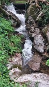
Once back on the main track the signs are great, beautiful track, some water streams to dodge along the way, flowers, great views, lots of Roman Mileposts, cafes, etc.

We have since learned that the lower path is not recommended as not maintained, we didn't find it that difficult but it was not easy.

We had an extra 2km of the EN307 as one of the path bookmarks says there has been a landslide on a section and its best to take the road. No long horn steers around which was a relief.

First cafe at Covide. After this the path wanders pleasantly through the settlement until it joins the EN again at a corner.

The epath says go left but the great Geira signs say right, checked my App and could see a maze of possible tracks along the road, so we followed the signs. The right decision as great signage continued, more Roman Mileposts, flock of roaming goats, etc

Our accommodation was Albergaria STOP (booked by sending a message via their website) on the highway so we went direct rather than going to into Campo de Geres first. We wandered back there later without packs and found a pleasant small bar. Another great days walking on the Geira.

No other walkers so far.

20230523_123749.jpg20230523_121234.jpg20230523_115810.jpg20230523_115350.jpg20230523_113634.jpg
 
Last edited:
The focus is on reducing the risk of failure through being well prepared. 2nd ed.
Day2 TdB to Campo de Geres 16km, 600m up.
From Terras de Bouro to rejoin the track is 2.5km with a 250m steep climb, again with no signs at any of the junctions. But at least this way the track is good.
Once back on the main track the signs are great, beautiful track, some water streams to dodge along the way, flowers, great views, lots of Roman Mileposts, cafes, etc.

We have since learned that the lower path is not recommended as not maintained, we didn't find it that difficult but it was not easy.

We had an extra 2km of the EN307 as one of the path bookmarks says there has been a landslide on a section and its best to take the road. No long horn steers around which was a relief.

First cafe at Covide. After this the path wanders pleasantly through the settlement until it joins the EN again at a corner.

The epath says go left but the great Geira signs say right, checked my App and could see a maze of possible tracks along the road, so we followed the signs. The right decision as great signage continued, more Roman Mileposts, flock of roaming goats, etc

Our accommodation was Albergaria STOP (booked by sending a message via their website) on the highway so we went direct rather than going to into Campo de Geres first. We wandered back there later without packs and found a pleasant small bar. Another great days walking on the Geira.

No other walkers so far.View attachment 147926View attachment 147927View attachment 147928View attachment 147929View attachment 147930
Day 3 CdG to Lobios and Spain, 24km, 660m

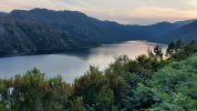
A fantastic days walking, first up above the Reservoir of Valarinho das Furnas, then through the National Park to the Spanish border. Lovely walking paths and tracks, mountain streams, amazing old and more recent bridges, Pines rule, great wildflowers, etc.

Met 2 locals out for a day walk, but still no pilgrims.

After the disappointment that the frontier bar was long shut we headed down the scenic valley with its ever changing path to O Banos, a big commercial spa resort and luckily some bars.

Recharged we flew up the hills, enjoying panoramic 360 views at the top, to Lobios. I have never seen so many beautiful and broken Horreos on any Camino!

Once in Spain there is less impressive Geira signage, but its still pretty good. The competitor to the Geira, the Camino Minoto Ribeiro, gets much more publicity. Just keep using your App!

Also it seems that after we enter Spain our Roman Military Road has veered off in silence. But there are still lots of rocky tracks to exercise your ankles. Now Australian Gum Trees compete with Pines for space.

Our accomodation was Hotel Lusitano (email to address on their website) a comfortable place with a good resteraunt (Menu del Dia) and an early opening bar.
20230525_190509.jpg20230525_134727.jpg20230525_081154.jpg20230525_072309.jpg20230525_063137.jpg
 
Last edited:
Day 3 CdG to Lobios and Spain, 24km, 660m

A fantastic days walking, first up above the Reservoir of Valarinho das Furnas, then through the National Park to the Spanish border. Lovely walking paths and tracks, mountain streams, amazing old and more recent bridges, Pines rule, great wildflowers, etc.

Met 2 locals out for a day walk, but still no pilgrims
Day 4 Lobios to Castro Laboreiro, 21.5km, 920m up

Coffee at our hotel at 7 then full breakfast across 2 great bars in Entrimo.

As you get near the border the famous ' lunar landscape is fantastic along with 360 degree views, but I can't reconcile 'lunar' with all the greenery and water!!

Carol and I agreed that today had the best scenery and walking tracks so far, a big compliment as everyday has been spectacular. The spectacular Gallician Horreos continue to impress. Some of the scenery today rivalled the Great Walks in New Zealand.

The forecast was rain throughout the day and thunderstorms in the afternoon. Apart from strong winds early and the threat of rain we finished dry. Later in the afternoon the Yellow Alert Rain snd Thunderstorm warnings came true in the early evening and even featured hail! Very lucky!

Our accommodation was Hotel Castrum Villae ( via booking.com), had to venture out to find a bar.
20230526_113822.jpg20230526_105721.jpg20230526_075723.jpg20230526_122040.jpg20230526_132037.jpg20230526_132427.jpg
 
Last edited:
Day 5 Castro Laboreiro to Cortegada 28km, 380m up, 1400m down.

Away early today trying to avoid the forecast Thunder and Rain Yellow Alerts. Walking with head torches at 5:15am and in by 1:30 Portugese Times.

Early morning a high road at over 1000m winding its way down the valley with great views. Luckily the eeather was great as this is a very exposed section.

The great news is that as well as lots of water fountains THERE IS A LOVELY BAR at San Amaro.

After about 16km "mãs o menos" when the track reaches the OU-411 for you to turn left, if you go 20m to the right you will find the bar on the left (cant see it for the trees). It welcomes pilgrims and has signs up for the CMR.
20230527_100511.jpg

Great views again, a little bit too much tarmac, but some lovely pine forest walking.

Signage in Spain continues to be less than in Portugal with the competing Camino Minoto Ribero (CMR) having more signage - and sometimes a different path!

Another surprise was meeting two Portugese Camino walkers, the first since the start of the Torres nearly 3 weeks ago.

Our accommodation was Casa do Condo (all arranged by WhatsApp messages). Great for pilgrims with an excellent self serve breakfeast so you can leave early if needed.

Another great day on the Geira.
20230527_084155.jpg20230527_075714.jpg20230527_115601.jpg20230527_075703.jpg
 
Last edited:
...and ship it to Santiago for storage. You pick it up once in Santiago. Service offered by Casa Ivar (we use DHL for transportation).
Day 6 Cortegada to Ribadavia 14km 380m up.

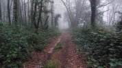
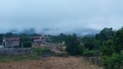
Low clouds on hills and in valleys along with mist made for an atmospheric start.

More Yellow Thunderstorm and Rain alerts, rain gear on and off a few times, but while damp from the wet grass and shrubs gave us damp feet we stayed largely dry.

The CMR took a low route initially while the Geira climbed way up above the Rio Mino, later it was reversed when the Geira went down and CMR went up. At times neither was well marked, while 1 section of the Geira near the Rio was so overgrown we had to find a by-pass.

Lovely forest walking, rambling along the river and then the final climb to our home for the night. In before 12 for a restful day in the lovely Plaza Mayor. Locals very helpful and drinks with our new Portugese Pilgrim friends.

Our Accomodation was Piso Top in the Plaza, A huge apartment with balconies overlooking the Plaza ( booking.com). And surprisingly cheap! Also a good Pension in the Plaza.
20230528_100412.jpg20230528_082248.jpg20230528_081255.jpg20230528_073005.jpg20230528_071638.jpg
 
Last edited:
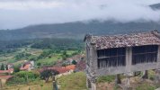
Day 7 Ribadavia to Feas 28km, 990m up

An early start at 6 again to try and get in before the storms.

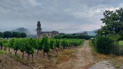
Headtorches for the long walk out of town and the path till it got light, then small vinyards, cloud covered valleys, disappointment at both Brade and Beran as nothing was open, and scenic tracks that would give Lord of the Rings a run for its money and make Hobbits feel at home.

It also struck me today the enjoyment of such a simple thing as the sounds of water. Gushing, thundering, roaring or just swirling, it's not a sound you often hear on the Torres.

The track bookmark says keep left for the Quarry before Lebosende, there is a split with a blue path on the right and yellow on the left. Whether it was overgrown or what, we saw no split or decision sign and ended up on the yellow path with the sounds of the active Quarry ahead. When you emerge from the shaded overgrown track onto a quarry dirt road, with the quarry on your left, aim just left of the building, then go up the track to a later road. Dont go through any of the quarry gates!

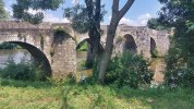
Just before Pazos Arenteiro is another fantastic ancient bridge, the Ponte de Cruz and when we got to the village the Bar le Ponte was open! This is also where the CMR Camino comes in after being far east of the Geira all day so far, it finally joins for the steep climb to Feas.

It's 500m straight up from just before Salon to Distriz, not easy, with just 1 fountain near the start, but luckily most is in shade and there is often a soft track.

Just before Feas on your left is Bar Nictron. It is a social hub and the lady will prepare a hot meal by agreement on timing. Very welcoming to pilgrims with a Geira sign on the window.

Our accommodation was Forno do Couro, about 700m from the bar (booked using WhatsApp). Just as we knocked on the door the heavens opened up and the rumble of thunder echoed around the hills. Pilgrim friendly, they even put the heaters on for us and loaned us an umbrella to go to dinner at the bar.
20230529_110457.jpg20230529_090402.jpg20230529_080606.jpg20230529_074340.jpg20230529_071451.jpg
 
A selection of Camino Jewellery
Day 8 Feas to Soutelo de Mentes, 22km, 780m up

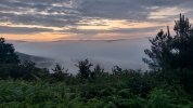
Another early start after yesterday's near miss with the rain was rewarded by walking in mist, more cloud filled valleys and a lovely sunrise above the clouds.

Another 300m+ climb straight up on top of yesterday's big climb made this a tiring day initially but once the Geira headed downhill and the CMR went further up the lovely forest walking cured any aches.

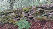
Both sides of Magros have spectacular narrow lanes, moss covered rock walls, every shade of green you could want and stone paths some of which are part time streams. Great Hobbit country!!

Beariz is a good place for great coffee and a ' Cafe bar crawl', we got to 2 of the 3 open bars. Then it's back up into the hills for more enjoyable forest walking.

We had heard this was a hard day with overgrown track but it didn't turn out that way. The only place the track was overgrown was 4.5km after Beariz where the kml did a short right loop but the signs now go left (see my App screen shot, walk in at bottom and out at top, black bookmarks are current path). You can hardly recognise a path in the overgrown area where the kml rejoins.

Our accomodation was the Hotel Restraunt Millenium (I rang using my limited Spanish!) which also has a good Menu del Dia. Very reasonably priced for a big comfortable room with private bathroom.

Well in before the 5pm thunder arrived, happy after another great, but not easy, days walking.
20230530_065022.jpg20230530_083100.jpg20230530_084520.jpg20230530_084910.jpg20230530_085420.jpg20230530_085814.jpgScreenshot_20230530_164247_Organic Maps.jpg
 
Day 9 Soutelo de Mentes to Codeseda, 20km, 410m up

Initial road walk before a path, this time a path that is a stream, so eventually our feet get wet despite our Sealskin 'water proof' socks. Lovely path just wet. The bar at Cachafeiro was open, so powered by caffine we conquered the next big climb. Great Valley views again. The CMR diverges her only to rejoin for the entry to Santiago.

Near Vilaboa we took the advice in the Geira guide book and took the road option for nearly 2km to A Portela despite lots of signs saying take the track on the left ( no way of telling if this is current or not).

Our accommodation is the Casa Rural O Palomar (only option in village, use WhatsApp as no response to email on website, Frank speaks English). This is the only option in the village.

Great Bar Caminho de Geira nearly, very pilgrim friendly, has a visitors book. We were told we were numbers 286 and 287 this year which seems high given the book entries but Frank later told us he has had about 300 pilgrims so far this year. Also 3rd and 4th Aussies ever.

20230531_130021.jpg20230531_124841.jpg20230531_112224.jpg20230531_081917.jpg
 
Last edited:
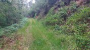
Day 10 Codeseda to Pontevea, 26km, 410m up, 850m down

This was supposed to be an easier day, but while it did go down there was still lots of ups in ongoing undulations. Luckily the almost perfect weather continued.

We were away early sgain with the fog/ mist persisting till 9am. Consider staying on the road in the first non road section of the day as the track is overgrown, lots of cow droppings, a low road bridge and a raging stream to negotiate plus a long ago used ladder all for a few hundred meters of road.

Today the lovely burbling streams knew their place and kept off the path, the tracks were pleasant, and there was a fair bit of forest walking. Although the wild Geira seems gone, the countryside is increasing built up and being used for agriculture.

The bar at Tabeiros was closed when we passed early but after Estrada ( lots of choices to eat and drink) Bar O Rollo just 5km from Pontevea on the PO-841 was open.

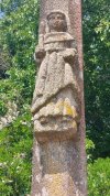
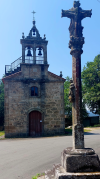
Highlights were old churches, ancient crosses, a tower or two and the middle ages Ponte de Pontevea. The bridge is closed for resurfacing and while we still crossed it you may be better to take the busy road bridge.

The main highlight was Carol seeing a bird of prey carry off a snake on a forestry stretch of track. A few days ago we saw a dead snake, about 30cm long, on the road. Earlier on the Camino Torres we saw 3 dead snakes on the road in one day! So there are snakes in Portugsl and Spain!

Our accommodation was the Albeitaria Pontevea. It offers a good pilgrim discount and is 750m from the nearest bar on the edge of town (booked on WhatsApp 682874879).

Just 1 more day to go, a mere 17km, and our journey that started in Almeria on the far side of Spain will be over.
20230601_140302.jpg20230601_130248.jpg20230601_130223.png20230601_085657.jpg20230601_070419.jpg
 
Last edited:
Ideal sleeping bag liner whether we want to add a thermal plus to our bag, or if we want to use it alone to sleep in shelters or hostels. Thanks to its mummy shape, it adapts perfectly to our body.

€46,-
Day11 Pontevea to Santiago 18km, 560m up.

Only a few minor forest stretches today with lots of tarmac as you would expect. While only 18km there are two significant climbs giving more than 500m of climbing for the day.

Early morning and school bus traffic was a bit of a shock after all the remote mountains and small towns.

First chance for coffee is just after you cross Rue de Clara Campoamor after about 11km of walking as you near the AC 841.

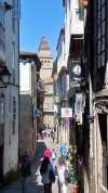
Glimses of the Santiago Cathedral first appear as you approach the AP-9, and it is very clear from the AP-9 overpass being just 3km away.

Once you get to Parque de Eugenio Granell in Santiago all the Geira signs disappear and you can follow your App as we did or "free lance" to get to the Cathedral. The Geira joins the Via de la Plata to enter Santiago just east of the Santiago train station well after the park.

The Pilgrim.House in Rue Nova recommended the Albergue Azabache near the Cathedral for a shower, they will charge you €5 for the shower and a towel.

Our accomodation is in Madrid today via a mid afternoon train trip as we are short on time and have been to Santiago many times before.

We only met 2 Portugese Pilgrims and they were walking the CMR, and prior to that on the Torres only one Italian. Both solitary walks.

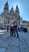
So our great adventure on the Geira y Arrieiros draws to a close on 2nd June.

I will tidy up my posts later and add some considered reflections.

Mick and Carol, 2 Australian Pilgrim addicts.
IMG-20230602-WA0001.jpg20230602_113635.jpg20230602_111207.jpg20230602_074732.jpg
 
Last edited:
I have decided to add to my last post to attach information on how I navigated this walk, what APPS I used and my overall impressions of this fantastic short Camino.

1. Navigation and Applications

These days you should ensure you have an App with the path for your Camino.

Even on the popular Caminos where you usually just have to "follow the crowd" it makes finding your accommodation easier, and if there is a problem you can find the shortest way to a village, road, pharmacy, etc.

You may not be where you want to be but you should never be lost!

For the Torres and Geira y Arrieiros an App is essential as you cannot rely on the signs.

At least the Geira information is honest, they tell you to take an App. Both walks provide official kml and gpx paths for your favourite apps, and if you search you can find others.

I use a combination of:
- Organic Maps as my main App to ensure I stay on path
- Google Maps in a town if I want to find extra services, opening times etc
- AllTrails to track my distance walked and elevation data e.g.how far I have climbed up

Organic Maps is free, has no adverts, once maps are downloaded it works fully in Flight Mode, and it works for Apple and Android phones. It was released by the original developers of Maps.Me. I previously used Maps.Me.

It will find you a walking, cycling or driving path between any 2 points, and for the walking and cycling paths it will show you an reasonably good profile and distance up and down. If you don't like it's path or want to follow a Camino path you have loaded you can add numerous mandatory 'stops' to align its path as you want.

Very handy for finding shortcuts and comparing them. Great if you are tired, the path is too muddy/wet etc.

You can add 'bookmarks' on bars, places of interest etc and share them if you wish.

It also has many service categories you can search for, e.g.food, accommodation, ATM etc - but not as many as Google Maps.

It accepts kml and kmz path files and can load them automatically when you open the file in your Android smartphone ... only an extra step required for Apple phones. Files in gpx format can easily be converted to kml.

Google Maps has comprehensive information on services you may want, will try and tell you opening hours provide contact details, link to websites etc. It will give you a driving but not a walking path and really needs internet data access to work.in map mode.

On a Camino I only use it in towns if I need something Organic Maps does not have. I have found it useful even in the small villages the Torres and Geira venture into.

AllTrails is a commercial App with lots of already loaded tracks and the ability to record your walk if you like, share it etc.
It has the full Torres and Geira y Arrieiros paths available, and can alert you if you wonder too far from the track. I only used it to record my distance walked, height climbed, and my track.

So always take an App you are familiar with and load it with your Camino path, you won't regret it!!
 
Thanks, @mick53. I walked the Torres/Geira in September 2022 and absolutely loved it. It is a camino with no albergues to speak of, no pilgrims at all, yet it has some of the most spectacular scenery of any camino. A perfect camino for those who relish walking alone and appreciate beautiful scenic backdrops as they churn through their minds. And especially the stages before Braga are just full of wonderful towns to explore with a lot of historical importance.

I totally agree with the recommendation of having GPS. In fact, I would say that walking without a GPS would be foolish and ill-advised.

I am surprised that you don’t mention wikiloc.com or the wikiloc app. It is by far the most used GPS site in Spain and you can find lots of tracks there for anyone who wants to walk the Geira and/or the Torres in combination.
 
3rd Edition. More content, training & pack guides avoid common mistakes, bed bugs etc
I have decided to add to my last post to attach information on how I navigated this walk, what APPS I used and my overall impressions of this fantastic short Camino.

1. Navigation and Applications

These days you should ensure you have an App with the path for your Camino.

Even on the popular Caminos where you usually just have to "follow the crowd" it makes finding your accommodation easier, and if there is a problem you can find the shortest way to a village, road, pharmacy, etc.

You may not be where you want to be but you should never be lost!

For the Torres and Geira y Arrieiros an App is essential as you cannot rely on the signs.

At least the Geira information is honest, they tell you to take an App. Both walks provide official kml and gpx paths for your favourite apps, and if you search you can find others.

I use a combination of:
- Organic Maps as my main App to ensure I stay on path
- Google Maps in a town if I want to find extra services, opening times etc
- AllTrails to track my distance walked and elevation data e.g.how far I have climbed up

Organic Maps is free, has no adverts, once maps are downloaded it works fully in Flight Mode, and it works for Apple and Android phones. It was released by the original developers of Maps.Me. I previously used Maps.Me.

It will find you a walking, cycling or driving path between any 2 points, and for the walking and cycling paths it will show you an reasonably good profile and distance up and down. If you don't like it's path or want to follow a Camino path you have loaded you can add numerous mandatory 'stops' to align its path as you want.

Very handy for finding shortcuts and comparing them. Great if you are tired, the path is too muddy/wet etc.

You can add 'bookmarks' on bars, places of interest etc and share them if you wish.

It also has many service categories you can search for, e.g.food, accommodation, ATM etc - but not as many as Google Maps.

It accepts kml and kmz path files and can load them automatically when you open the file in your Android smartphone ... only an extra step required for Apple phones. Files in gpx format can easily be converted to kml.

Google Maps has comprehensive information on services you may want, will try and tell you opening hours provide contact details, link to websites etc. It will give you a driving but not a walking path and really needs internet data access to work.in map mode.

On a Camino I only use it in towns if I need something Organic Maps does not have. I have found it useful even in the small villages the Torres and Geira venture into.

AllTrails is a commercial App with lots of already loaded tracks and the ability to record your walk if you like, share it etc.
It has the full Torres and Geira y Arrieiros paths available, and can alert you if you wonder too far from the track. I only used it to record my distance walked, height climbed, and my track.

So always take an App you are familiar with and load it with your Camino path, you won't regret it!!
Thanks for the info. I’m slowly making my way from Tavira to SdC following @jungleboy’s route. Over 2 trips I’ve made it to Trancoso so far and would love to complete the Torres and Geira sections in my final tranche. Maybe next year if the stars (and Q) align 😂😂😂
All of the details provided by you helpful peeps are wonderful. Thanks again @mick53 👍👍
 

❓How to ask a question

How to post a new question on the Camino Forum.

Featured threads

❓How to ask a question

How to post a new question on the Camino Forum.

Featured threads

Forum Rules

Forum Rules

Camino Updates on YouTube

Camino Conversations

Most downloaded Resources

This site is run by Ivar at

in Santiago de Compostela.
This site participates in the Amazon Affiliate program, designed to provide a means for Ivar to earn fees by linking to Amazon
Official Camino Passport (Credential) | 2024 Camino Guides
Back
Top