• For 2024 Pilgrims: €50,- donation = 1 year with no ads on the forum + 90% off any 2024 Guide. More here.
    (Discount code sent to you by Private Message after your donation)
  • ⚠️ Emergency contact in Spain - Dial 112 and AlertCops app. More on this here.

Search 69,459 Camino Questions

Puzzled about route finding

NotLostYet

New Member
Time of past OR future Camino
Camino Nascent
Ola,
I am new to the community and have just spent several days walking south to north on the Caminhos Nascente. On two sequential days (Cuba to Alvito & Alvito to Viana do Alentejo) we ran into trouble after following the recently downloaded GPS track. In both cases the path gradually faded until we were walking through rough pasture, with possibly aggressive cattle and had to climb over several tall barbed wire fences. There seems to be a divergence between the GPS track and the route with waymarkers.
I am not sure if this is a regular issue or due to my own inexperience. I wanted to pass this on regardless to others who plan to walk these section.
Obrigado
 
Down bag (90/10 duvet) of 700 fills with 180 g (6.34 ounces) of filling. Mummy-shaped structure, ideal when you are looking for lightness with great heating performance.

€149,-
Sorry to hear this but I hope you otherwise enjoyed the Caminho Nascente (it is my favourite camino).

I went back through what I wrote for the Wise Pilgrim guide in 2021 and found these waymarking notes for the two days you mention -- I'm not sure if they are related to the issues you had but it seems possible.

About 2km outside Cuba, a left turn off the main road at the Toros de Núñez sign is possible, but arrows don’t point this way. This route goes through private property and several signs warn of the danger of ‘gado bravo’ (aggressive cattle). Alternatively, stay on the road.

At a fork in the road shortly after leaving Alvito, the arrows point left. This is the most direct route but consider taking the right fork to go through Água de Peixe. This unusual village consists of little more than a 16th-century palace (no entry) with ruins of millstones scattered around the entrance.

Also, for what it's worth, here are my waymarking notes for the following stage, which is a difficult one:

Leaving Viana do Alentejo, the camino to Évora is a tough stage of 36km, including 15km on a busy road (the N254) after Aguiar with possibly no shoulder to walk on depending on how recently the weeds on the side of the road have been cut. An unofficial option to break up this stage and avoid the difficult road stretch would be to head northwest from Viana do Alentejo on the N257 and join up with the N380. This would still entail road walking but the N380 is a secondary road and there are accommodation options to break up the stage, unlike on the N254.
 
An unofficial option to break up this stage and avoid the difficult road stretch would be to head northwest from Viana do Alentejo on the N257 and join up with the N380. This would still entail road walking but the N380 is a secondary road and there are accommodation options to break up the stage...
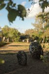
The N380 route also opens up the possibility of a detour to see the Cromeleque dos Almendres prehistoric site, if that piques your interest!

1711646895842.jpeg

 
Very light, comfortable and compressible poncho. Specially designed for protection against water for any activity.

Our Atmospheric H30 poncho offers lightness and waterproofness. Easily compressible and made with our Waterproof fabric, its heat-sealed interior seams guarantee its waterproofness. Includes carrying bag.

€60,-
Sounds like your route was out of date.
Always have an extra app like "gronze maps" and "buen camino" installed which are updated more frequently.

I'd suggest the arrows take precedence although sometimes they take you a scenic route rather than a direct route - e.g once it led me to a river that may have been safe but wet to cross, when gronze maps currently suggested the road.

There should never be a need to cross a fence especially not a barbed wire fence.
Only once did I do a route that crossed a small fence I could step over with little difficulty.
 
New Original Camino Gear Designed Especially with The Modern Peregrino In Mind!
Sounds like your route was out of date.
Always have an extra app like "gronze maps" and "buen camino" installed which are updated more frequently.

I'd suggest the arrows take precedence although sometimes they take you a scenic route rather than a direct route - e.g once it led me to a river that may have been safe but wet to cross, when gronze maps currently suggested the road.

There should never be a need to cross a fence especially not a barbed wire fence.
Only once did I do a route that crossed a small fence I could step over with little difficulty.
Hi,
Thank you very much for your input. The route we followed was downloaded 10 days ago from the Caminhos site
I will follow up with Gronze maps.
Cheers
Andy
 
The route we followed was downloaded 10 days ago from the Caminhos site

I will follow up with Gronze maps.
Always a good idea with "official" Pt tourism sites. They are unveiled with great fanfare, but in my experience so far--living in central Portugal--they rarely are re-visited to update when conditions on the ground may change. And because they're mainly aimed at tourists (there are not that many Portuguese pilgrims to Santiago), they're looked upon as a bit of an afterthought to "the really important things" even though Portugal is heavily dependent on tourism revenue.

A site like Gronze, dedicated to the caminos, is much more likely to be reliable.

Sad but true.
 

❓How to ask a question

How to post a new question on the Camino Forum.

Forum Rules

Forum Rules

Camino Updates on YouTube

Camino Conversations

Most downloaded Resources

This site is run by Ivar at

in Santiago de Compostela.
This site participates in the Amazon Affiliate program, designed to provide a means for Ivar to earn fees by linking to Amazon
Official Camino Passport (Credential) | 2024 Camino Guides
Back
Top