Search 74,075 Camino Questions

Questions about the Napoleon Route.

Mack

Member
Time of past OR future Camino
April 2017 Sarria to Santiago de Compostela
I walked the Valcarlos route to Roncevalles but am planning to do the Napoleon this April. I have a couple of questions if any pilgrim can help me:

1. I would like to do the shorter but more difficult way down from the top. I have watched a number of videos but everyone I saw took the longer, easier descent. Having done the descent into Zubiri before, is the Napoleon descent much more difficult that that?

2. I understand the ascent to Orisson is the toughest part of the walk and that after that the gradient rise is less severe. Is this so?

Many thanks in anticipation.
 
The 2024 Camino guides will be coming out little by little. Here is a collection of the ones that are out so far.
1) The descent to Roncesvalles is harder than the way to Zubiri in my opinion. I've walked it the one time I walked the Napoleon route, because I had never had problems walking downhill before (actually like it, and found the ways down to Zubiri and from the Alto del Perdon not very difficult but fun), so I thought 'it can't be that bad'. The next time I walk that route, I'll definitely take the alternative path. It was a very exhausting and painful descend for me. If it's wet, I imagine it's also dangerously slippery. But it is beautiful, so, your decision :) If you're healthy and careful, and the weather is good, it's doable. Bring walking poles, though! If you found the descent to Zubiri hard, you might suffer at least a bit... In bad weather (rain) I wouldn't recommend it.

2) Yes, it gets less steep after Orisson. On the Valcarlos it is the other way around (first half more flat, then steeper after Valcarlos, as you certainly remember). So expect kind of the opposite of what the Valcarlos felt like. Up to Orisson and a bit beyond you'll mostly walk on a quiet road also. I always find it harder to walk uphill on roads than trails. But you can stop for a nice coffee and / or breakfast in Orisson, and from there on in gets easier.

3) Before you start walking, make sure the weather really allows to pass via the Napoleon route that day. It is generally open from april, but can still be closed later if the weather conditions are bad (snow, storms...). The pilgrim's office can help you with that. Also, bring warm clothes, good rain gear and at least a small emergency kit (enough water, food, space blanket, first aid stuff, flashlight). The weather can change quickly up there and you want to be prepared for that.

Buen Camino!
 
Last edited:
That is very helpful. Yes, I found the Valcarlos route just as you say. I did not find the Zubiri descent too difficult as I took my time on the shale (but it was good weather).

Again, thanks
 
The 2024 Camino guides will be coming out little by little. Here is a collection of the ones that are out so far.
Did the “hard” descent and it wasn’t that difficult. It’s all relative, I guess, but I’d walk it again without question. And yes, the hardest part of the Napoleon is the section directly out of SJPdP
 
There are two areas of the Napolean section hat resemble mountainwalking. Both are off road. The off road switch back section climb up to Orisson, which is typical of alpine hiking and then the unpaved steeper descent - (go left) to Roncevalles. After many, many years of hiking in beautiful alpine regions the rest is IMO mostly paved, domesticated walking with some nice views.
 
On the steep descent there have been injuries when the trail was wet and slippery. If you find it wet consider how far toward Santiago you'll get walking in a cast.

I understand the ascent to Orisson is the toughest part of the walk and that after that the gradient rise is less severe. Is this so?
You have already walked the equivalent steepness on the Valcarlos route. Both routes have 3 km sections with a 15% slope.

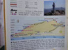
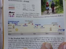
The graph below shows the less steep slope down from Lepoeder, the route the Pilgrims' Office recommends.

 
Last edited:
3rd Edition. More content, training & pack guides avoid common mistakes, bed bugs etc
1. I would like to do the shorter but more difficult way down from the top. I have watched a number of videos but everyone I saw took the longer, easier descent. Having done the descent into Zubiri before, is the Napoleon descent much more difficult that that?
I walked this in July 2019 and it felt only a bit more difficult than the descent to Zubiri. But you can choose two options, a less challenging longer route or the more challenging through the woods. I walked through the woods and was quite happy to get ahead of a bigger group of pilgrims that I overtook. Less waiting in Roncesvalles.
2. I understand the ascent to Orisson is the toughest part of the walk and that after that the gradient rise is less severe. Is this so?
Personally I found the ascent to Orrisson very easy, but I trained well in my local mountain ranges before heading out to the CF. Drank a Coffee in Orrisson and walked on.

Depending on the weather the RN is closed in April. Even on July, 1st in 2019 it was not recommended to walk due to forecasted winds and heavy rain. But it is an alpine region, where forecasts change quickly, so there was some wind, some sun, many clouds and only little rain. After crossing the border the weather got better and warmer but more humid. Half of the way all pilgrims walked in the clouds.

HTH

BC
Roland
 
My opinion.
If it's dry, neither route, into Roncesvalles nor Zubiri, is difficult.
If it's wet, the route down into both are slippery as snot!
That is the danger.

The walk down through the Beech Forest to Roncesvalles is beautiful.
The first few hundred yards are steep and the trail is washed out, so there's some scrambling.

If it is dry and you have poles, it's not too bad but even dry it can be dangerous if you aren't steady on your feet. There are some quite steep places.

The walk down the road into Roncesvalles is much easier on the legs/hips and is just as pretty in my opinion. There's also the benefit of a stream in which to soak your feet.
 
On the steep descent there have been injuries when the trail was wet and slippery.
In mid-April I walked the Valcarlos route, arriving in Roncevalles with dry pants. Most everyone coming in from the Napolean route had muddy pants. I can only assume they slipped and fell on wet leaves or mud.


If you find it wet consider how far toward Santiago you'll get walking in a cast.
😂
Nice helpful maps, btw.
 
€2,-/day will present your project to thousands of visitors each day. All interested in the Camino de Santiago.
I walked it in foggy, wet weather. It was pretty slippery, bc of lots of rotten leaves on the ground in some places. Poles recommended, which I never use...
 
There are loose rocks on the trail, washed down by the rain, on the steep descent into Roncesvalles. When dry, you need to be extra careful. When wet, it could be very hazardous.


-Paul
 
If it's dry, neither route, into Roncesvalles nor Zubiri, is difficult.
If it's wet, the route down into both are slippery as snot!
That is the danger.
I agree with Annie. There is nothing extraordinarily difficult about the "hard" route.

However, at the end of a long day, on a fairly steep downhill covered with wet leaves, it is very easy to slip and injure yourself. That is what makes it hazardous. It helps a lot to use 2 walking sticks. Or take the slightly longer route - you will arrive at about the same time and feel just as pleased with yourself!
 
The 2024 Camino guides will be coming out little by little. Here is a collection of the ones that are out so far.
Day one for me, SJDP to Roncesvalles in early September 2018 via Napoleon was warm and dry. The initial climb up to Orrisson is on road and quite steep in parts - especially having travelled from New Zealand via Paris in two days. The route down through the forest was fairly steep in parts - given my age I depended on my trusty walking poles. I imagine in wet weather the track would be more challenging. The walk from Roncesvalles to Zubiri includes rock and shale under foot. It was an enjoyable descent, however there were two casualties encountered on the track - a gent with a 'blown knee' and a woman who tripped requiring muliple stiches to the head.
 
The first edition came out in 2003 and has become the go-to-guide for many pilgrims over the years. It is shipping with a Pilgrim Passport (Credential) from the cathedral in Santiago de Compostela.
It is a weather dependent experience. I assume you mean the Napoleon route steep section, the descent from Col de Lepoeder to Roncessvalles. In SJPDP May of 1969, they warning pilgrims to take the road at that point, which seems to hook up with the Valcarlos route just before Roncessvalles when I look at the map. I forgot the warning and took the marked trail. It was very steep and slippery from the rain. It did a job on my knees for sure. Regarding the descent to Zubiri the next day, I did not really notice any difficulty compared to the descent to Roncessvalles. It was off and on sprinkling which did make for some slippery sections. A person worked hard to pass me and just after passing me took a spill. I felt really good that day and seemed to be enjoying the equivalent of a runner's high. I kept passing people and did not notice any difficulty with the descent. I did not have poles. The last couple of miles I was gaining on a guy and he took off. I kept trying to catch him and he kept holding me off. When we got to the bridge and the metal arch above it, he was about 15 feet in front of me. He raised his poles like a cross country skier crossing the finish line at a race. That day was one of the highlights of my Camino and to me was much easier than the descent to Roncessvalles.
 
If the weather is good and less snow on the higher elevations, do you think they will open up the Napolean route before April 1st?
 
€2,-/day will present your project to thousands of visitors each day. All interested in the Camino de Santiago.
If the weather is good and less snow on the higher elevations, do you think they will open up the Napolean route before April 1st?
No. It is prohibited to the walk the closed section of the Napoleon route from 1 November until 31 March no matter what. The closure is absolute and does not depend on the weather of the day or the state of the path.

And from 1 April onwards, it is up to each pilgrim to inform themselves whether it is wise to walk on a particular day or not.
 
If the weather is good and less snow on the higher elevations, do you think they will open up the Napolean route before April 1st?
No. @Kathar1na answered above while I was seeking an earlier post of hers that cited the closure law. It's here:
https://www.caminodesantiago.me/com...apoleon-route-open-in-2022.72076/#post-969378

And from 1 April onwards, it is up to each pilgrim to inform themselves whether it is wise to walk on a particular day or not.
Or if the authorities have closed the route due to dangers. Ask at the SJPdP Pilgrims' Office.
 
Last edited:
€2,-/day will present your project to thousands of visitors each day. All interested in the Camino de Santiago.
Oy! My first Camino experience was this stage. I took the “hard” route by mistake on a beautiful day in September. My quads were complaining at me shortly after starting down. I must of stopped to recover at least 20 times. I was relatively fit 59 year old then. I use poles and found them extraordinarily helpful on this portion. I have completed three Caminos. This stage (and this part in particular) is one of my hardest stages in my short history of Caminos.
 
Last edited:
I walked the Valcarlos route to Roncevalles but am planning to do the Napoleon this April. I have a couple of questions if any pilgrim can help me:

1. I would like to do the shorter but more difficult way down from the top. I have watched a number of videos but everyone I saw took the longer, easier descent. Having done the descent into Zubiri before, is the Napoleon descent much more difficult that that?

2. I understand the ascent to Orisson is the toughest part of the walk and that after that the gradient rise is less severe. Is this so?

Many thanks in anticipation.
 

Attachments

  • P1040280.webp
    P1040280.webp
    923.9 KB · Views: 17
  • P1040281.webp
    P1040281.webp
    1.1 MB · Views: 18
Some very good advice here. For perspective, the forest road to Roncesvalles and the descent into Zubiri are both difficult descents, just like the rocky trail coming down from Alto de Perdon. The really ugly descent on the Frances though, is the dragon toothed monster from Cruz de Ferro to Molinaseca via Acebo. Both longer and more hazardous in my opinion.

The weather is your arbiter. If its not slippery, and your knees don't generally bother you on long descents, the forest trail is both short and beautiful. The more prudent trail is the road if your circumstances or the weather are not ideal when you are standing at the fork.
 
Get a spanish phone number with Airalo. eSim, so no physical SIM card. Easy to use app to add more funds if needed.
I walked the Valcarlos route to Roncevalles but am planning to do the Napoleon this April. I have a couple of questions if any pilgrim can help me:

1. I would like to do the shorter but more difficult way down from the top. I have watched a number of videos but everyone I saw took the longer, easier descent. Having done the descent into Zubiri before, is the Napoleon descent much more difficult that that?

2. I understand the ascent to Orisson is the toughest part of the walk and that after that the gradient rise is less severe. Is this so?

Many thanks in anticipation.
Have walked both...
Steeper option was (initially) quite bouldery, and would be slippery if damp - walking sticks would be a advantage, but not totally necessary... It is a very pleasant walk through the trees along a well made gravel pathway once i got past the steep bouldery section.
Less steep alternative is generally along a formed and sealed road - it is longer and more open (less tree cover).
If (when) I get to do it again I would choose the steeper path, if the weather were dry.
 
Last edited:
If the weather is good and less snow on the higher elevations, do you think they will open up the Napolean route before April 1st?

This is not done to "inconvenience" pilgrims, but to save the lives of pilgrims and first responders.

April 1st may be nice weather in Florida, but in the Pyrenees mountains the weather could still be very hazardous at that time of year.


-Paul
 
This is not done to "inconvenience" pilgrims, but to save the lives of pilgrims and first responders.

April 1st may be nice weather in Florida, but in the Pyrenees mountains the weather could still be very hazardous at that time of year.


-Paul
Walked the Pyrenees twice at the start of May - hit snow both times!
 
...and ship it to Santiago for storage. You pick it up once in Santiago. Service offered by Casa Ivar (we use DHL for transportation).
Hi Mack, my dad & I have tried both trail options from Col de Lepoeder to Roncevalles. On our first Camino we walked the "hard" way through the trees. It had rained, & the path was slippery so had to be very careful (a few people I talked with afterwards had knee issues from it) -- walking sticks were essential. Lots of other walkers were on this option too, so it seemed a bit crowded.

On our second Camino we chose the 'long' way. The weather was sunny then, & there were lovely views -- we stopped & watched a hawk slowly circle the valley as it glided with the breeze -- a special memory -- very serene. We were the only people on the path except for one other walker encountered. Needless to say, we enjoyed this option & would choose it again, though it may be more crowded by now (that was in 2013)!

Regarding the Road up to Orisson, yes, it's a steep incline & good to take some breaks -- there's a scenic viewpoint along the way with a map of the valley -- perfect for stopping & enjoying the moment!

Wishing you a wonderful Camino in April!
 
I prefer the walk via the chapel, the offroad path from the chapel is easy and nice. Last time I walked there there were labelled plants along path.So I learnt something along the path.
By mistake in heavy fog I took the caminopath once. Meant to go down the road. The path was steep and slippery and because of the fog I saw nothing at all. Very happy when I saw the convent.
 
I walked the Valcarlos route to Roncevalles but am planning to do the Napoleon this April. I have a couple of questions if any pilgrim can help me:

1. I would like to do the shorter but more difficult way down from the top. I have watched a number of videos but everyone I saw took the longer, easier descent. Having done the descent into Zubiri before, is the Napoleon descent much more difficult that that?

2. I understand the ascent to Orisson is the toughest part of the walk and that after that the gradient rise is less severe. Is this so?

Many thanks in anticipation.
Yes it's a tough descent but if you take it steady and be careful you'll be fine. Just remember that day one is the toughest so take it easy on day two. The 8 k or so to Orisson is just the same no rush take it easy!
 
...and ship it to Santiago for storage. You pick it up once in Santiago. Service offered by Casa Ivar (we use DHL for transportation).

❓How to ask a question

How to post a new question on the Camino Forum.

Most read last week in this forum

Can you tell me anything about the structure in my photograph? What was it part of, when was it built? that sort of thing. Thanks.
Feeling a little alone at CF. Where is it most likely that I won't be the only one in the albergue, Villar de Masarif, Villavante, Hospital de Orbigo or Astorga (which is probably too long for me...
I’m planning another Camino Frances, but this time can only do part of it. I’ll be walking from Pamplona for around 2 weeks; I like to walk around 22km a day, depending on the heat (I’m going...
Our Camino Parcel Saga Pamplona May 02 2024 We had just walked across the Pyrenees from St Jean Pied de Port, France. Our plan was to walk 800km along the Camino de Santiago. As it would...
I’m planning my fourth Frances for September/October of 2025. I’m bringing two friends from England, and they would prefer walking late September and finishing in late October. I’ve started in...
I’m looking for suggestions for a 6/7 day walking stage on the Frances that I can do next year with my older less fit companion. We’ve done the stages from Sarria, Ferrol & Tui in recent years. It...

Featured threads

❓How to ask a question

How to post a new question on the Camino Forum.

Featured threads

Forum Rules

Forum Rules

Camino Updates on YouTube

Camino Conversations

Most downloaded Resources

This site is run by Ivar at

in Santiago de Compostela.
This site participates in the Amazon Affiliate program, designed to provide a means for Ivar to earn fees by linking to Amazon
Official Camino Passport (Credential) | 2024 Camino Guides
Back
Top