ficklefancyfree
Active Member
- Time of past OR future Camino
- Next Camino Ingles Ferrol
So I decided to get a head start on yet another Camino that has a UK element and am walking the St James Way from Reading to Southampton over the next 5 days.
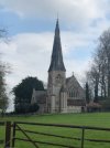
Day one, firstly, stunning weather. Having checked Google Maps to find out when St James Church was open, I planned my arrival from London to ensure I had time to have a dirty McDonald’s breakfast (guilty pleasure) and pick up a walking pole from Decathlon beforehand.
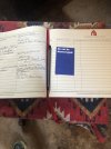
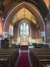
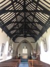
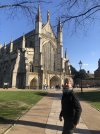
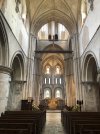
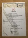
I arrived at the church at around 10:30 only for it to look like I was trying to break in as I went round and tried, unsuccessfully, to open any of the doors. I then phoned only to find out that the church didn’t open until midday but the lady was kind enough to ask me over to the office next door to get my starting stamp, phew!
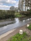
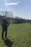
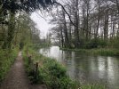
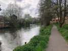
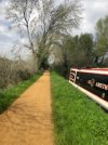
I spotted the first marker and off I went. The signposting was spot on, up to a point, more on that later. The start of the walk is along the Kennet canal for a good 7 miles or so, lovely walk, impossible to get lost, just beware of geese and their young. Geese hiss! Who knew.
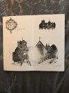
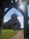
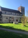
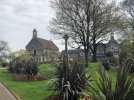
Second stamp at the Cunningman Pub very conveniently located on the canal, I love it when that happens. Once sufficiently watered, onwards to St Mary’s Church at around mile marker 9. The guidebook says call so I phoned to see if anyone was around to stamp my passport. Ros was not available at such short notice, not a problem I said just wanted to see on the off chance. However she was adamant that I get a stamp as this is the true first pilgrim stamp from Reading, not the pubs! So she arranged lovely Jenny to meet me at the church to give me some new ink and send me on my merry way. At this time I bumped into 4 gentlemen who were also walking the way, however it may have turned into a more of a Camino (Pub) Crawl!
From here we went our separate ways and I mean separate, they carried on straight whereas I turned right following the map..perhaps they needed another tipple(!) or perhaps they were taking a more direct route to the train station as they were heading back to Reading. Who knows, my map told me to turn right so I turned right, from here on, no more markers. It was fine though, the map was super clear and I just had to keep checking it every so often.
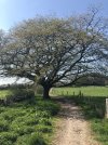
It was a fair bit of road walking now and some roads had a bit of traffic that didn’t care for me. Case in point, I looked right, I looked left, I looked right, started to cross only to see a van hurtle round the corner from the left as I bolted across as quick as I could. From that point I consulted good old maps and I saw a possible shortcut and low and behold there was a public path. Holding the phone out in front of me like some kind of magic divining tool, I found my way out the other side and decided to continue the next stretch through the woods also. I’m overnighting in an AirBnb and this way much quicker than walking the roads, the woods almost come up to behind the house.
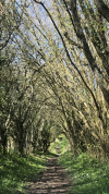
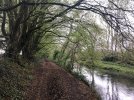
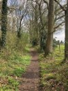
The first section of the woods was great on paths that were actual paths and easy peasy, when I had about 200m or so to go I came to a mud track that was so horrifying, I couldn’t bring myself to do it. Not just because I have brand spanking new shoes but because I was going to turn up to someone home, I back tracked and then for some reason lost my ability to read the map! Luckily for me a man, his son and their dog were just there and having checked that he knew these woods, I asked him for the easiest path to Windmill Road. Windmill Road? It’s off the other way! You’re not a natural navigator are you?! Well, I made it this far from Reading so I can’t be that terrible! Any way he pointed me off the other direction, go over the dip, not the first left that has the no entry sign but the second one, that will take you back to civilisation. I thanked him and off I went, here it all went terribly wrong and terribly funny. I couldn’t see a no entry sign and there were several ‘paths’ off to my left so I took each of them to see if it was the one. I basically spent about 30 minutes doing circles in about an area of less than 20 square metres!! At one point I honestly thought I was going to have to phone in a rescue which was bonkers because I could see the houses but every path lead to someone’s back garden. I was imagining standing at someone fence shouting for help… After that I gave myself a good talking to and went back up to the dip and then proceeded to systematically try each left in turn, when it was the wrong one I backtracked to the main path carried on a little further until the next left to test that one. Happily this method worked, Eureka! In less than 10 minutes I made my way to a car park of a cul de sac. Recuse averted!
Back to the land of pavements and road names, I was safe. I bought some tortellini and a celebratory Coke from the very conveniently located Co-op and made my way to home for the night.
It was a great day, it took me about 7 hours in total with about 5 hours of actual walking time, I have no idea what I did for the other 2 hours, map reading maybe?!! Maybe that guy was right after all!
Goodnight, sorry for the long post, I guess I just had to let it out!
Fi


