I was going to submit this picture to the thread "
On the Camino: One Day at a Time, one Photo at a Time 8.0" where a small theme of hills had developed. Then I thought that I should look up and report on the actual elevation values. Then one more thought came to me, the post really belongs here.
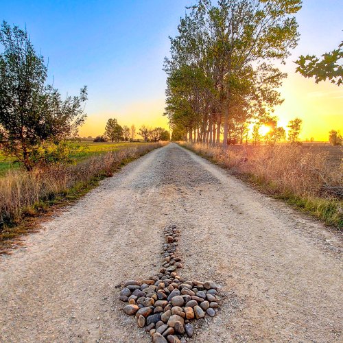
Here is the view I had 4 kms out from Ena on my way to the "new" (c. 1600) and old monasteries of San Juan de la Peña. It is pretty much looking north so the area with the monasteries is hidden by the trees on the right.


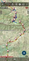
Curiosity grabbed me so I brought up the Ena to Santa Cilia stage of the Camino Catalan on the
Mapas de España app and got some approximate numbers. I was at about the "4" spot at 850 m elevation when I took the picture. The monasteries are at about 1,250 m. So I'm looking at a cliff (peña) 400 m (1,300 feet) above me. Things on the way didn't get steep until a short ways past Botaya near kilometer 8 at 900 m. The old monastery is at "12" (the "new" one is near 10.5). So 350 m over 4 km or about a 9% upward slope. Going down to Santa Cruz it's an elevation loss of 450 m over 3 km for a slope of -15%.
Both the routes from SJPdP to Roncesvalles have a 3 km stretch with an average 15% climb.
This webpage (in Spanish) has a couple of aerial photos that show both monasteries in the same picture and some that show the old monastery's setting under the cliff:
http://www.romanicoaragones.com/0-Jacetania/25-SanJuanPena.htm
The next pic was deleted but shows up anyway. It is a not as clear picture of the map that is shown better above.