• For 2024 Pilgrims: €50,- donation = 1 year with no ads on the forum + 90% off any 2024 Guide. More here.
    (Discount code sent to you by Private Message after your donation)
  • ⚠️ Emergency contact in Spain - Dial 112 and AlertCops app. More on this here.
  • Get your Camino Frances Guidebook here.

Search 69,459 Camino Questions

Who Uses GPS

Waka

Veteran Member
Time of past OR future Camino
Some but not all, and other routes too.
I managed to complete the CF without the aid of a GPS, I used my iPhone occasionally to direst me to accommodation and the rest was down to the Brierley guide, it got me to the end point and I only got lost once.
Now with the view of doing less populated camino routes I am wondering if a GPS would be useful, so if you're a GPS technophobe your comments, suggestions positive or negative would be very welcome, also the type you use would be helpful.
 
Get a spanish phone number with Airalo. eSim, so no physical SIM card. Easy to use app to add more funds if needed.
Hi, Waka,
Two years ago, when I walked the Camino Olvidado from Bilbao to Ponferrada, on the advice of several forum pals, I got a GPS. It was worth its weight in gold when on one stage, I was up at an abandoned mine and couldn't figure out where the Camino was. On several other occasions, it was helpful but I would have figured it out without it. Last summer on the first part of the Catalán before Montserrat I was also glad I had it at one or two spots, but from Montserrat onward, the only time I needed it, I couldn't figure out how to use it. ;) I'm walking another solitary camino this summer, the Ebro to Burgos, and am pretty certain I will bring it with me, hoping that I will finally be able to use it. Last year I had the problem that some of my tracks seemed to disappear, and also that some had been moved over to the "archives" where I couldn't use them, it was frustrating.

I've walked several solitary caminos without one (Invierno, Vadiniense/Lebañiego) and was fine, though.

Which caminos are you thinking about walking? I know from the other threads that you're considering the Vdlp and the Portugués. I don't think there's any need for one on either of those caminos, in fact I didn't use a guidebook on the Vdlp, and from Lisbon to Porto there were only some internet notes available.

I have a Garmin Dakota. It can do four million things that I don't understand, but I am trying to focus on learning the three or four things that I need and I am hopeful that on the Ebro it will be there if I need it.

There are some very knowledgeable GPS folks on the forum. They exist on a different technological plane than I do, however. If you're like them, you will probably love the GPS. If you're like me, it will be a source of much frustration and on occasion a godsend!
 
A selection of Camino Jewellery
Hi Waka,

Basically, I'm using 2 GPS systems :eek:

The first one is a bluetooth GPS logger, which I switch on in the morning, and switch off in the evening.
It records all my moves and I'm using the results to play with my PC during the long winter nights...
There is a lot of interesting possibilities, from geo tagging pictures to replay a walk in Google StreetView.

The second one is the integrated GPS in my smart-phone, which I use with a mapping app (OruxMaps or OziExplorer).
This is my help when I'm not sure of my position or of the way to go.
As both are using locally stored maps, I don't need an Internet connection permanently.

Buen Camino, Jacques-D.
 
I didn't use or need GPS on the Camino Frances. I didn't use it on the Camiho Portuguese but I wish I had it between Lisbon and Porto. I used a GPS app for my iphone daily on the Camino Ignaciano and found it invaluable in keeping me on the right path. I got lost on the CI once when taking an alternate path not on the GPS but never went far off course otherwise. Another pilgrim we met barely used his GPS on that route and said he managed but was often off the main route and walking an extra km or two everyday because of it. He did refer to a general map regularly and often walked on roadsides to get from town to town.

FYI, I also used the HERE offline maps app on the CI and found it extremely useful.
 
Last edited:
@peregrina2000, @jdpiquet, @MichaelSG.
Thanks for the information. My plan as Laurie has pain ted out is to do the Portuguese and the VDLP as my next two camino's, been doing so much reading on both, the information on way marking appears to be ok, but then it was on the CF and as mentioned I did get lost once.
Although on the CF I walked alone for 4 weeks there is always someone in the distance to follow. Travelling on other routes where you might not see anyone for days on end, in itself is not a problem if you're going the right way, but could be a bummer if you take the wrong path.
I guess I need to put cost against necessity.

Michael, I see your location is Singapore, my daughter + family have been living there for the last 9 years.
 
Join our full-service guided tour of the Basque Country and let us pamper you!
@peregrina2000, @jdpiquet, @MichaelSG.


Michael, I see your location is Singapore, my daughter + family have been living there for the last 9 years.

I used to live there too....sure miss the pepper crab!

We use GPS all the time. I save a track from each day, and they are like a diary. I can see just where we went for lunch, where I took a photo, even what bush I watered years later.

We get a google earth track before going and it really helps with routes such as the Vezelay route with many options.
 
... the integrated GPS in my smart-phone ...

Firstly, I do not have a dedicated GPS device. Rather I use the GPS facility in both my Android phone and tablet. I also use the OSMAnd+ app. This provides offline use with previously down-loaded vector maps meaning one brief download covers all of your desired region rather than getting a whole bunch of tiles for each zoom level. OSMAnd offer monthly updates: you can choose when/if to download.

I use GPS in four ways.

1) (tablet) As a planning tool.
a) When planning a new trip I use the app to prepare and save a GPX track for later use.
b) Download GPX tracks prepared by others, with discernment. I will check against the map before field use to ensure it follows known routes or understand why it does not and be prepared to discard.
c) Transfer relevant GPX tracks to the phone: see 3 below

2) (tablet) Before setting off I consult the GPX track/map and relevant guides (also on the tablet) of my intentions for the day ahead

3) (phone) If I am in doubt (not all trips have yellow, or any, markers) as to my location with respect to my intention then bring up app, inspect and close the app (battery saving)

4) (phone) If I'm on a route that hasn't been mapped yet I will turn on GPS logging. Later I will offer the route (or change of detail) to the mapping service.

When underway I do not look at the map, except for item 3) above. Like most, I prefer to look ahead and around and enjoy.

Now with the view of doing less populated camino routes I am wondering if a GPS would be useful

As I plan to do some side trips (one just before Leon) GPS and related maps will give me confidence to get around. As well as way finding around the cities and town when stopped for the day.

I help this helps you.

Kia kaha
 
@Waka, I have used a variety of GPS devices for a couple of different reasons, but largely to keep some record of my track and to check my navigation. The devices that I have used include:
  • Garmin etrex Legend Cx - loaded with Openstreetmap map data and a rudimentary track of the CF. Great in open country and towns. Did not cope well with narrow city streets. Replaced this for later Caminos with the Garmin etrex 30 - brilliant little handheld, and an upgraded model has been released recently. It works much better in cities and indoors. Also the newer Garmin desktop application has much more functionality in areas like using one's tracks to geo-tag photos, which means not having to also carry the next device.
  • GPS logger. I have used Phototraker - a simple GPS logger with application for geo-tagging photos. The one I used on the CF had an internal battery that never quite lasted long enough. I replaced it with a version that used a replaceable (AA) battery for St Olav's Way. Haven't carried it since I have upgraded my desktop software to the Garmin Basecamp (see above).
  • Mobile phones. I planned to use my Nokia E5 on St Olav's Way and pre-loaded the maps over a wifi connection before I left. It was okay in cities where the GPS was augmented by using the local mobile signals, but once outside the cities, it was so slow to get an initial location that I didn't bother using it. Was definitely a battery hog, as was the GPS on the replacement Medion Android that I used on the CI in 2014. I now have a Samsung that appears to have reasonable battery life with the GPS turned on, but I haven't used it consistently for longer walks. I have looked at a number of mapping apps that allow maps to be pre-loaded.
  • Tablet. I ended up taking a tablet (Nexus 7) on the CI, and had the OSM+ app installed and the maps downloaded before I left Australia. It is quite a competent combination, but is not on the list to make a return appearance this year for the CF.
Most of the issues around using a GPS have been touched on. I didn't rely on the loaded track for minute to minute navigation, but would check every so often or when I was uncertain to see if I was on track. If I wasn't, it was useful to have somewhat better mapping than provided by the guidebooks, and be able to work out if there was a way forward from my current location rather than having to return to where I had deviated from the marked route. This helped my many times in both Spain and Norway.
 
The 2024 Camino guides will be coming out little by little. Here is a collection of the ones that are out so far.
Ok it maybe a dumb question but if one s using a GPS don't one need a map or route or something so the gps stays on that path?

Zzotte
 
Ok it maybe a dumb question but if one s using a GPS don't one need a map or route or something so the gps stays on that path?

Zzotte

You download the map to your device (smartphone/tablet) so that the GPS can mark it on that map to give you a visual hint where you are. Buen Camino, SY
 
Thanks SYates I did not know was as simple as that I have never used a gps I'm old school I still use a map even around town :)

Zzotte
 
A selection of Camino Jewellery
Ok it maybe a dumb question but if one s using a GPS don't one need a map or route or something so the gps stays on that path?
This is a good question. The basic GPS function is to locate the device, and whoever is using it, in relation to the surface of the earth. Simpler GPS units don't do much more than that, and can keep a record of successive locations, known as a track. They can store other locations as well, which allows for basic navigation, but such techniques still rely on having a paper map - one that has sufficient detail to allow you to determine your location from the location information given by the GPS, and to work out where you want to go next. Normally this would be a topographic map of some sort. You will still see non-mapping devices on the market and they are perfectly good for a range of uses without the map being on the device.

Putting the map onto the GPS device as a data file allows similar mapping information to be displayed on the device screen. At one level, this just replaces a paper map, but it allows a lot more to be done if the underlying information is included in the data file. For example, vector mapping can include information about how road and track networks are connected, which allows for route calculations to be performed by the device.

Last, if one wants to follow a particular path, a route can be created for that path. That route would normally comprise a series of waypoints that could be stored on either a mapping or non-mapping GPS device. The device could perform calculations like determining the distance the device is currently off the selected route, an adjusted heading to reach the next waypoint, etc. For the camino, people have also provided their track data - the history of the way they walked. These can then be turned into routes, or just loaded up and 'followed' on the GPS.

On the last point, I am waiting for a GPS that stays on the path! Mine seem to accompany me whether I am on the path or not. A GPS is an aid to navigation, and used that way, is an incredibly useful tool for aviators, sailors, drivers and walkers. But that, in my view, does not include having to follow someone else's track slavishly.
 
Last edited:
I'm old school I still use a map even around town

Last week I was half way up a hill in the middle of nowhere having a siesta before doing the next leg. A lot of people came by (the nearest car parks were 10 km either way and the nearest watering hole at least another 10 km further again either way). One youngish couple got my attention as they paused for lunch. They had bikes fitted with panniers either side of both wheels: I went to talk with them. They were making for a city some considerable distance away. I noticed she had a map open on a "table" spread over the handlebars: looking closer I could see the map was pretty high level and didn't show much at all of the region we were in and certainly not the path we were on. She said her partner had the GPS stuff and she (like you) preferred the comfort of having something in front of her.

With much tramping around the hills (anything up to 5,000' / 1500 m) I grew up with paper maps and loved to have a collection of topographical maps of my area. Even now they are online they are also out of date and typically include only the more popular off-road tracks.
 
New Original Camino Gear Designed Especially with The Modern Peregrino In Mind!
With much tramping around the hills (anything up to 5,000' / 1500 m) I grew up with paper maps and loved to have a collection of topographical maps of my area. Even now they are online they are also out of date and typically include only the more popular off-road tracks.
I found that the mountain biking fraternities in some countries, including NZ, publish map sets where they have added current road and track information to the standard OpenStreetMap data. There is also the option of becoming a contributor to the OSM effort to keep their mapping up to date if one is using the OSM and OSM+ apps.
 
This is relevant to my interests. Introduction to follow, but I'm fairly young (although can read a map..! ;) ) and plan on following paths via GPS on my smartphone as opposed to using physical maps. Especially interested in the Clisson - Saint-Jean-dAngély route at the moment. (Yes, I'm walking from l'Angleterre with limited French.) Only just at the beginning of planning but want to plot a preliminary route... Merci, Gracias, Much Obliged!
 
On a long distance pilgrimage GPS is certainly of an advantage as the weight and costs of paper maps add up quickly. Buen Camino, SY
 
3rd Edition. More content, training & pack guides avoid common mistakes, bed bugs etc
I have never used GPS and have never been seriously lost, even on routes with no waymarking and no guidebook. But then I can read maps, however this can get expensive on some routes: I needed nineteen 1:50,000 OS maps on the Mary/Michael route.
 
Thanks Dougfitz, very nice explanation, the cost of paper maps adds up quickly too, unfortunately the cost of a topo map for a gps (europe) with an american GPS its in the hundreds one is heavy on the backpack the other lighter on the the wallet :) I personally don't think its a need for either on the camino but it would be fun to track it, thanks again

Zzotte
 
The focus is on reducing the risk of failure through being well prepared. 2nd ed.
..., unfortunately the cost of a topo map for a gps (europe) with an american GPS its in the hundreds ...

Ouch! You might want to look into digital, open source maps then! Buen Camino, SY
 
There is also the option of becoming a contributor to the OSM effort to keep their mapping up to date if one is using the OSM and OSM+ apps.

Doug, thanks and yes I do this. OSM for my region is littered with additions and changes I have uploaded after having walked and observed.

I obliquely referred to this in my original post.
 
Thanks SYates I'm going to look into it
 
Very light, comfortable and compressible poncho. Specially designed for protection against water for any activity.

Our Atmospheric H30 poncho offers lightness and waterproofness. Easily compressible and made with our Waterproof fabric, its heat-sealed interior seams guarantee its waterproofness. Includes carrying bag.

€60,-
I have never used GPS and have never been seriously lost, even on routes with no waymarking and no guidebook. But then I can read maps, however this can get expensive on some routes: I needed nineteen 1:50,000 OS maps on the Mary/Michael route.

Topo maps in Switzerland were outrageously expensive. I usually can find something free or (gasp) maybe a little pirated for my GPS.
 
The one from Galicia (the round) and the one from Castilla & Leon. Individually numbered and made by the same people that make the ones you see on your walk.
I'm going to look into it


other forum members might even know better ones.

Sy, thanks. I think what you have cited for @zzotte are for desktop computers. This is a good way to start ans see how the maps look. And, no, I don't know better that what you have listed.

A warning: they are likely to look quite different to the papers may you use. Not because they are on a computer. Rather the styles used are different. A way to explain this difference is to consider maps for metro/underground rail networks for different major cities. While the detail will be different the styles are also quite different.

Having become accustomed to the look and style of the map the next question is what hardware and what software (app) to use.

the type you use would be helpful

To look at the app first. As it is the app you work with most, the hardware is just what makes that work for you.

Some background first.

On a desktop load up a map (Google or OSM or whatever). As to scroll the mouse wheel you will zoom in and out to see more or less detail. If you look carefully in the address line you are likely to see a number between, say, 3 and 21: this is known as the "zoom level". As you scroll and the number increases you see greater and greater detail for a smaller and smaller area.

Mapping apps fall into one of two broad categories. tiles (pictures) or vectors (lines).
And, as with most things there is a trade off.

Tiles: The app down loads a tile for each zoom level for the area you are interested in. As you go up in zoom levels so you exponentially go up in the number of tiles you need. At the higher levels you need many thousands of tiles for a relatively small area. With tiles I soon learnt there was not enough space to down load all the tiles for my region, and that if I could the downloading would take a long time. And maintaining the latest versions was going to be a large task.

Vectors: The app down loads one file for the region you are interested in. The app decides how much detail to put on screen for each zoom level. For my region all detail is in one medium (for me) sized file. And as I can choose when to update the maintenance issue is minimized.

So I look for apps that work with vector files

The app I currently use is OSMand+ at a small cost (less than $10 from memory)

Hardware. As I have an iPad 2 every now and again I check out what systems are available for it. My test is not what is great but is it better than what I currently use.

And the hardware I use is an Android based 10' tablet. While the app can run on a phone the small screen make it hard to see.

Possibly best to stop there and answer any questions.

And I am sure DougFitz may wish to add to this as well.
 
Topo maps in Switzerland were outrageously expensive. I usually can find something free or (gasp) maybe a little pirated for my GPS.

I have a nice collection of England/France maps at home, the thing is though, they get dated, quickly. Par Example even on my local OS map in the last 3 years they've changed junctions on an A-road which affects bridleways etc. in a big way. My first Camino this year -- and I accept I might be a lot younger than most on here -- but I plan on putting initial routes into Google Maps and let SKYNET figure out appropriate hébergements -- then go off the back of that.

I agree that on the flipside tech will never replace traditional maps & bearings etc. There's a margin of error with all tech (especially military --> civ stuff) and those skillswill always come in handy, but I'm taking a higher tech approach :) Any GPS files from St. Malo (via way of capitals) Santiago appreciated!
 
@AlwynWellington, there isn't much to add to your comments, other than the Spanish mapping agency (Centro Nacional de Información Geográfica (CNIG)) produces some brilliant raster mapping (aka tiles) in formats suitable for android apps (I haven't checked their Apple support). The downside, as you have identified, is that this results in enormous storage demands.
 
Join our full-service guided tour and let us convert you into a Pampered Pilgrim!
I'm afraid I don't get how the GPS would help. It's not as if the Camino itself is programmed in it, right? I can see its use if you are lost and it shows you which way you are moving, and show you a town or village, but it won't neceserally but you back on the Camino. Or am I missing something? Perhaps good for those wanting to create a new Camino ;)?
 
Any GPS files from St. Malo (via way of capitals) Santiago appreciated!

It is possible for anyone to create a GPX file between two points, or a series of waypoints. But just letting some app choose your route may lead into all sorts of difficulties. Reasons for these difficulties include:
  • changes on the ground not reflected on the source map - see your post #29 above
  • if the creator has no knowledge of the region the resulting path may either miss interesting aspects, natural or built, or take you alongside busy/noisy roads when a nearby, but slightly longer, less busy route is available.
If you can read/write in French you may consider emailing i-sites (or similar) along your proposed way and see what they can suggest.

But if you have a series of hébergements, you could load their locations into an app as favourites. Then, in route planning mode, use those favourites as way points. Despite what I have said above, let the app create a GPX. Look at where it takes you. If you don't like some aspects add or delete some intermediate way points: repeat until deliriously content (or sadly unhappy).

Please let the Forum know how you get on
 
Down bag (90/10 duvet) of 700 fills with 180 g (6.34 ounces) of filling. Mummy-shaped structure, ideal when you are looking for lightness with great heating performance.

€149,-
I'm afraid I don't get how the GPS would help. It's not as if the Camino itself is programmed in it, right? I can see its use if you are lost and it shows you which way you are moving, and show you a town or village, but it won't neceserally but you back on the Camino. Or am I missing something? Perhaps good for those wanting to create a new Camino ;)?

It is easy to put the Camino in any GPS or phone. Just find a .gpx file and load it. There are many in the resources section of this fine forum. It will let you know within a few meters where the route is. Very nice for leaving the route and rejoining in a big town. This image will zoom up to any scale.


iphone frances.JPG
 
@AlwynWellington, @dougfitz,
I am totally overwhelmed with the technical detail you've supplied, it makes me think I need to go back to school. I have to admit that a lot has gone right over my head although, I'm sure it's the terminology rather than the technical nohow that at first sight is completely baffling.
Step one I think is to understand the terminology, then move onto the app side, I also think I need one to one hands on tuition before I dive into the GPS route.
I have to say I feel that it could be a useful tool, possibly not so much for the well marked camino's but for other walking I do in the UK. My wife is a lover of maps whereas I love technology, but I think there's room for both in our household
 
It is easy to put the Camino in any GPS or phone. Just find a .gpx file and load it. There are many in the resources section of this fine forum. It will let you know within a few meters where the route is. Very nice for leaving the route and rejoining in a big town. This image will zoom up to any scale.


View attachment 23162

@newfydog, What GPS unit are you using?
 
A selection of Camino Jewellery
Thanks Dougfitz, very nice explanation, the cost of paper maps adds up quickly too, unfortunately the cost of a topo map for a gps (europe) with an american GPS its in the hundreds one is heavy on the backpack the other lighter on the the wallet :) I personally don't think its a need for either on the camino but it would be fun to track it, thanks again

Zzotte
Hi Zzotte - @dougfitz and @SYates mentioned, there is a great resource called OSM (Open Source Maps). You can go to the OSM website and download an OSM map that can be easily loaded on your GPS. I've done this for various regions around the world and has always worked perfectly. In addition to being free, you can specifically define your map area so you don't download, in this scenario, all of Europe to get just your limited need of the Camino. And the best part... totally free!
 
... it makes me think I need to go back to school.

I was at the same stage as you about two years ago. As @dougfitz has implied, it is a Robert the Bruce effect: try, try and try again until something works for you.

Just take it in stages. If you have some hardware, look at what apps are available for that. As you read the write ups think about tiles/raster and vector/lines. Consider what Doug has said about raster/tiles taking a lot of space, and what I have said about raster/tiles taking a lot of maintenance. In other words have a bias to vector based maps. Underlying this is the extremely high probability you will be offline when using your chosen app.

Then pause and ask some more questions of the forum.

PS: What does "waka" mean to you?

Canoe in Maori.
 
The one from Galicia (the round) and the one from Castilla & Leon. Individually numbered and made by the same people that make the ones you see on your walk.
@newfydog, What GPS unit are you using?

That is an iPhone with the motionX app. I use a Garmin Dakota 20 when biking because it is tough, waterproof and has good battery life. Walking I just use the phone

We talked about a fair bit here:

https://www.caminodesantiago.me/com...the-camino-in-google-earth.12695/#post-204839


" Just putting together all information that newfydog and Jim have said:

1- Go here and download the kml version of the Camino Frances (just click the download button)

2- Go here and convert the kml file to a gpx file (mark the option GPX, select the kml file you have downloaded to your PC/Mac and click on convert button). The answer takes one minute or so)

3- Download the file converted to your PC/Mac (just click the download button)

4- Get the GPX file downloaded and e-mail it to gpsimport@motionx.com (they will respond in a few seconds)

5- install motionx gps (for iPhone) or motionx HD (for iPad), US$1,99

6- Open the e-mail received and click one of the two links (iPhone or iPad)

7- now the track is loaded into your iPhone/iPad and you're done"

Thanks for the guide, I'll give it a try on my iPhone.
 
The one from Galicia (the round) and the one from Castilla & Leon. Individually numbered and made by the same people that make the ones you see on your walk.
That is an iPhone with the motionX app. I use a Garmin Dakota 20 when biking because it is tough, waterproof and has good battery life. Walking I just use the phone

We talked about a fair bit here:

https://www.caminodesantiago.me/com...the-camino-in-google-earth.12695/#post-204839


" Just putting together all information that newfydog and Jim have said:

1- Go here and download the kml version of the Camino Frances (just click the download button)

2- Go here and convert the kml file to a gpx file (mark the option GPX, select the kml file you have downloaded to your PC/Mac and click on convert button). The answer takes one minute or so)

3- Download the file converted to your PC/Mac (just click the download button)

4- Get the GPX file downloaded and e-mail it to gpsimport@motionx.com (they will respond in a few seconds)

5- install motionx gps (for iPhone) or motionx HD (for iPad), US$1,99

6- Open the e-mail received and click one of the two links (iPhone or iPad)

7- now the track is loaded into your iPhone/iPad and you're done"

I really like the MotionX app as well. One feature I really appreciate is that it allows one to 'track' another (with their permission, of course) person using the app. My wife and I spend time together and apart whilst walking and this gives her a great sense of security knowing that I get an update to her location in the interval of our choosing. In fairness, it also give me peace of mind too...
 
And may I say, one more time:

A PHONE DOES NOT NEED any cellular data for the GPS to work. Turn off your data and the battery will last longer. The GPS will work anywhere on the planet.
 
Ideal sleeping bag liner whether we want to add a thermal plus to our bag, or if we want to use it alone to sleep in shelters or hostels. Thanks to its mummy shape, it adapts perfectly to our body.

€46,-
The first edition came out in 2003 and has become the go-to-guide for many pilgrims over the years. It is shipping with a Pilgrim Passport (Credential) from the cathedral in Santiago de Compostela.
I find this all amusing. While I use electronic devices, as needed and on occasion, I try not to over rely on them.

During the walking day, the mobile phone kept OFF and is for emergency voice calls, or reference only as absolutely needed. In the evening, the Wi-Fi and internet capabilities of my iPhone are used to plan the next day or three's route, accommodation and route. I plan routing using downloaded or online maps.

During the day, I prefer to follow the arrows....

Getting lost is part of the experience...
 
Join our full-service guided tour and let us convert you into a Pampered Pilgrim!
Thanks for the info Jozero I like that specially when its free :)

zzotte
 
I realize the OP was addressing the less popular routes in Spain, but there will surely be a reading audience with related interests. I used downloaded map routes throughout my walks in the Czech-German-Swiss sections, and found them invaluable for three reasons.
(1) The route marking is significantly less frequent, as they only mark the turns. Also since the route-minders seem to refresh the marks in early spring, the marks can be obscured by foliage once things leaf out.
(2) Finding the lodging. I always book in advance, so I have a street address - which is not directly on the route 99% of the time. Before I started using the phone map, this was always the most dreaded hour of the day - being exhausted at end of a long day, did not help matters.
(3) Returning to the route the next morning.
Paper maps don't tell you where you actually are -- which is often not the same place as where you think you are.
 
New Original Camino Gear Designed Especially with The Modern Peregrino In Mind!
Just gotta say it: Over a million pilgrims have arrived in Santiago, Spain without the use of any electronics whatsoever.
In fact, entire oceans and continents have been successfully crossed just by looking up. It's not. That hard. Unnerving yes, but difficult? No.
...so says the person who walks to work because great-granddad didn't need no car, who handwrites letters to friends because Grandmom didn't need no stinking wordprocessor or e-mail, who doesn't use Google because it was never needed 20 years ago. Just gotta say it.
 
I'm afraid I don't get how the GPS would help. It's not as if the Camino itself is programmed in it, right? I can see its use if you are lost and it shows you which way you are moving, and show you a town or village, but it won't neceserally but you back on the Camino. Or am I missing something? Perhaps good for those wanting to create a new Camino ;)?
If you have an Android smartphone or tablet, look at Camino Guide Offline. Shows the Camino in red and your position. Used it this spring and it was great. Lots of information, in addition to being a great offline GPS with the track.
 
If you have an Android smartphone or tablet, look at Camino Guide Offline. Shows the Camino in red and your position. Used it this spring and it was great. Lots of information, in addition to being a great offline GPS with the track.
Thank you. I went to the Resource sectionof the forum as suggested but could only find GPS material to download for the Frances, 1 for the Portuguese and 1 for VDLP. There is 1 link"for all the Caminos" but I will have to use another browser to download that since it will not work with Safari. But this leads me to think much of the GPS talk here is about the super well marked and very walked Frances for which no electronic device is needed. Or did I not look t the right section of the Forum?
 
Technical backpack for day trips with backpack cover and internal compartment for the hydration bladder. Ideal daypack for excursions where we need a medium capacity backpack. The back with Air Flow System creates large air channels that will keep our back as cool as possible.

€83,-
If you do not have any interest in GPS...That is great! But....the purpose of this thread was to assist those who want to use GPS.
It is not about whether or not it is needed...or if your opinion is against it.

Please just ignore the thread if you are negative on the idea.
Some people just like to use such things as a hobby or to pass the time. Many like to record a record of the journey.

Please allow them to discuss the subject in peace! :cool:

Thank you for your cooperation.
I beg to differ, this thread is about GPS for "less populated" Caminos, not " assisting those who want to use GPS". As suchf I do not believe my post was uenwarranted. It was kindly suggested we could find suCh GPS tracks in the Ressource section but I came up with very little for "less populated" Caminos. So I have simply asked if I may have missed something or no looked in the right place. Clearly because I am open to learning and have interest in seeing if these tools may also be helpfull to me on the lesser walked roads.
 
, this thread is about GPS for "less populated" Caminos, not " assisting those who want to use GPS"..

Well, geez, maybe with your permission, we could discuss both. They overlap. And some people like to have GPS on the Frances. I did the entire Camino without a cup of coffee, but take no offence about discussions of where to find a good one, no matter how unnecessary it is.

A good place to start looking for remote routes is here:

http://pilgrim.peterrobins.co.uk/routes/list.html

Or google "Google earth track" or .kmz file for your route. Getting from the track on google earth to your device is not always simple, so we have been offering help on that.
 
Last edited:
Very light, comfortable and compressible poncho. Specially designed for protection against water for any activity.

Our Atmospheric H30 poncho offers lightness and waterproofness. Easily compressible and made with our Waterproof fabric, its heat-sealed interior seams guarantee its waterproofness. Includes carrying bag.

€60,-
I beg to differ, this thread is about GPS for "less populated" Caminos, not " assisting those who want to use GPS". As suchf I do not believe my post was uenwarranted. It was kindly suggested we could find suCh GPS tracks in the Ressource section but I came up with very little for "less populated" Caminos. So I have simply asked if I may have missed something or no looked in the right place. Clearly because I am open to learning and have interest in seeing if these tools may also be helpfull to me on the lesser walked roads.
I think you should avoid interpreting the juxtaposition of @grayland's advice and your penultimate post as an indication that your post was unwarranted. I think the advice should be interpreted within the overall flow of comments.

On your concern that you cannot find track information for other than the most popular routes, might I suggest that you try this site: http://centrodedescargas.cnig.es/CentroDescargas/loadCaminoSantiago.do. You will find these tracks are in Google's kml format, but these can be used by the current Garmin desktop application, Basecamp. If you are using an Android or other GPS, I haven't personally confirmed that kml files are useful.

Be aware of the caution offered by the Centro Nacional de Información Geográfica (CNIG):
The routes were created with the best tools available today, either by direct recording for many pilgrims, or through digital mapping of IGN. But they should be considered as an aid to the march, never as a final route. We must use them wisely, always giving priority to what is observed directly in the path.
 
Well, geez, maybe with your permission, we could discuss both. They overlap. And some people like to have GPS on the Frances. I did the entire Camino without a cup of coffee, but take no offence about discussions of where to find a good one, no matter how unnecessary it is.

A good place to start looking for remote routes is here:

http://pilgrim.peterrobins.co.uk/routes/list.html

Or google "Google earth track" or .kmz file for your route. Getting from the track on google earth to your device is not always simple, so we have been offering help on that.
Hey, if I'm going to get slapped on the wrist based on someonés interpretation that the thread is about something in particular when it is not, and all I am doing is asking for further information to answer the OP's question, then I think my response was fair game. This being said, thank you for the additional information, I look forward to reading it, and the OP may also as it may get him closer to answering his questions.
 
Join our full-service guided tour of the Basque Country and let us pamper you!
For the record...my post had no particular post or person in mind.
It certainly did not pertain to the post immediately above mine.

The "warning" was intended to keep the discussion on the use of GPS and to discourage the negative comments by those who find GPS to be less than desirable.

Sorry for any misunderstanding..but the warning in regard to sidetracking the thread remains.
 
OK. back to earth.

The worst slap I've received in awhile was when I checked in on Peter Robbin's wonderful site, The Walking Pilgrim. It is the best starting point in any search for a GPS track.

http://pilgrim.peterrobins.co.uk/

This message is posted across the top:

These pages are no longer maintained and most will disappear in Spring 2016.

Say it ain't so Peter! He used to post here. Anyone know more about why his site is going off-line?

If you have never visited the site, do so soon. He has a list of 305 (yes that is correct) modern pilgrimage routes, with links to guides, GPS data, maps websites etc. It has history, hiking advice, all sorts of good stuff. It is a monumental compilation of data.

I urge anyone looking for information on routes to visit the site soon. Here's his over-view map

robbins overview.JPG
 
€2,-/day will present your project to thousands of visitors each day. All interested in the Camino de Santiago.
Today I downloaded the motions app to my iPhone as suggested by @newfydog,
Had a little play to get my bearings of the app, then went for a walk to try it out. Not sure what others think of the app, but I was impressed with the tracking side of it.
Now I know I've only scratched the service of its capabilities, but I will persevere.

I'm sure I'll be back with a lot more questions as time goes by.
 
MotionX is my favorite. After a day of anything, I just press a button and it emails me a track in both GPS and goggle earth format

bachy.JPG
 
Ideal sleeping bag liner whether we want to add a thermal plus to our bag, or if we want to use it alone to sleep in shelters or hostels. Thanks to its mummy shape, it adapts perfectly to our body.

€46,-
Menu
Record track

after you are done

Pause
save
share this track

initially you will have to enter your email address, after which it is automatic
 
A selection of Camino Jewellery
I still find this all somewhat entertaining. But, at the risk of sounding pedantic, I feel I should politely interject one of the basic "Camino Rules" here:

"Every pilgrim walks his or her own Camino. They do it their way, in their time, according to their own preferences, needs, time frame and capabilities...put another way...que sera, sera..."

No other pilgrim has the right to tell another how they should accomplish their private pilgrimage...period. Literally, anything goes...

Modern electronic navigation tools are just that, tools. People can choose to use them, or not.

Yes, it is true that millions of pilgrims have successfully completed pilgrimages without these navigation aids. It is also true that, before modern vaccines, proper sanitation, and food safety, pilgrims literally put their lives on the line to make pilgrimage, and many more die on The Way than at present.

Also, true, is that modern fabrics, footwear, and hiking equipment did not exist until recent years. We are, none of us, luddites. We are all "guilty" of cutting corners by using the many, varied, and indeed wonderful tools and gear available to us. Truth be told, I am among the biggest "gear heads" out there.

In fact, part of my "ministry" to the Camino community and this forum is to evaluate and opine about gear that works for me, and gear that does not. My mission is to try to be be helpful to those who follow us veterans. Why should someone else suffer hypothermia, catch pneumonia, or endure foot problems because of poor clothing or gear selection? I hold that the paradigm is the same for electronic way finding.

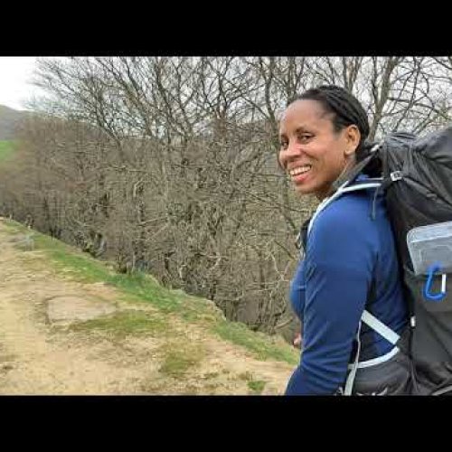
Taken together, contemporary pilgrimages likely look nothing like "old time" pilgrimages. Yet, the journey has the same deep affects on each of us, each time we do it, and regardless of our personal accoutrements, tools, or "toys" we carry and use.

So, I do not judge. In my earlier contribution, above, I merely stated my preference, as did others. I actually carry the same modern electronic tools that others do, except for a dedicated GPS unit, as I regard it as redundant and a tad excessive to the well marked and researched routes. But, again, that is MY personal opinion and chosen style. I believe in being very prepared for any eventuality. But, I work diligently to not permit the tools to determine my journey. That, I try to keep as old-school as practicable.

As a humorous aside, on my first Camino Frances in 2013, I walked for several weeks on and off, with a delightful, then 70-year old woman from County Cork, Ireland. She informed me early on, while we were in the Pyrenees, of her personal fail-safe and fool proof method for following the route and not getting lost.

She told me that when she hiked, anywhere, she ensured that at least one person was ahead of her, but within eyesight, and another was trailing behind her at a distance, but also within eyesight. As long as these "human way-markers" were present, she felt she was on the correct route. Also, she was convinced that, if she DID end up off the marked route or lost, there would be at least two other people lost with her... It was simple, crude, old-school, but effective. I thought it brilliant.

I hope this helps the dialog...
 
...

http://pilgrim.peterrobins.co.uk/

This message is posted across the top:

These pages are no longer maintained and most will disappear in Spring 2016.

Say it ain't so Peter! He used to post here. Anyone know more about why his site is going off-line?

...

No, but I would be more than happy to host it for free for him if that would help. Anybody here is in current contact with him? Would be sad to lose that excellent resource, SY
 
Join our full-service guided tour of the Basque Country and let us pamper you!
I plan to take my GPS (a Garmin Oregon 450t, in case anyone's interested), just for added peace of mind -- mine and that of my wife at home, who worries about me. I'll also have my SPOT Gen3, otherwise my wife wouldn't let me go alone.

I can understand the arguments against taking a GPS, but the way I see it, I have the device, I have the topo map for Spain, I have the tracks, so why not? It offers some useful advantages and no real drawbacks.
 
Just gotta say it: Over a million pilgrims have arrived in Santiago, Spain without the use of any electronics whatsoever.
In fact, entire oceans and continents have been successfully crossed just by looking up. It's not. That hard. Unnerving yes, but difficult? No.
Columbus didn't use GPS to get to the new world either... but not many ships sailing the seven seas without it today. Is it easy to get to SDC without a GPS? Of course! But there are other reasons that people use tech and it should be second nature for the followers of this forum to respect that each Peregrino is entitled to their own experience, their own way. Me? I love tech! I love sharing my experiences with family and friends and when they see places I've gone and the specific trails I've taken, they are happy to share that experience. This is just my experience and I'd bet there are many, many other reasons :D
 
Join our full-service guided tour and let us convert you into a Pampered Pilgrim!
Dipping a toe here, because I plan to walk a quiet Camino in the spring and I want both maps and maybe the capacity to follow GPS tracks.
Please can someone help a totally overwhelmed 'not-luddite-but-not-a tecchie-either.' Honestly I vastly prefer a paper map but times are changing...

I'm very sorry for the duplication, but what I tried to read above (and in another thread somewhere here) is WAY over my head. I need simple instructions in ordinary English...think 'GPS for super-Dummies.' A PM might be better than cluttering up the thread..

I have a Samsung Android phone--and I've just successfully downloaded OruxMaps and Mapas de Espana. Both seem to work fine offline (my intended use).
So what do I need to do to use WikiLoc tracks of the Castellano-Aragones and/or Invierno offline, using the phone's GPS capacity?
Planning on having a Spanish SIM but want to be able to use the tracks offline.
 
I find this all amusing. While I use electronic devices, as needed and on occasion, I try not to over rely on them.

T2, I think you and I (and others) are on the same page, just expressing it differently. For corroboration of that assertion see post #8 above. And those of others subsequently.

As @grayland says, @Waka started this thread asking technophobes for advice. I suspect you and I are tending towards being techophiliacs, keen to keep the use of technology relative for the key purpose, in this case enjoying each day one at a time.:cool::)
I had earlier assumed from the context of the question that @Waka had mistakenly used the word technophobe and was interested in knowledgeable advice from technophiles. I am now wondering if I should have read the OP literally, and not responded.o_O:confused:
 
Last edited:
The focus is on reducing the risk of failure through being well prepared. 2nd ed.
I had earlier assumed from the context of the question that @Waka had mistakenly used the work technophobe and was interested in knowledgeable advice from technophiles. I am now wondering if I should have read the OP literally, and not responded.o_O:confused:

@dougfitz you are so right I did get the words mixed up, it should have been technophiles.
There has been so much good advice here, its put me on a steep learning curve. I'm fully aware (having done the CF) that these devices may not be necessary, but I see the functionality being more than getting from A to B.
Thanks for responding.
 
On your concern that you cannot find track information for other than the most popular routes, might I suggest that you try this site: http://centrodedescargas.cnig.es/CentroDescargas/loadCaminoSantiago.do. You will find these tracks are in Google's kml format, but these can be used by the current Garmin desktop application, Basecamp. If you are using an Android or other GPS, I haven't personally confirmed that kml files are useful.

For an all purposes Swiss army knife for GPS data translations between the different file formats: http://www.gpsbabel.org/
It needs a little "ramp up" to learn, but it can convert almost anything to anything...

Good GPSeing and Buen Camino,
Jacques-D.
 
Dipping a toe here, because I plan to walk a quiet Camino in the spring and I want both maps and maybe the capacity to follow GPS tracks.
Please can someone help a totally overwhelmed 'not-luddite-but-not-a tecchie-either.' Honestly I vastly prefer a paper map but times are changing...

I'm very sorry for the duplication, but what I tried to read above (and in another thread somewhere here) is WAY over my head. I need simple instructions in ordinary English...think 'GPS for super-Dummies.' A PM might be better than cluttering up the thread..

I have a Samsung Android phone--and I've just successfully downloaded OruxMaps and Mapas de Espana. Both seem to work fine offline (my intended use).
So what do I need to do to use WikiLoc tracks of the Castellano-Aragones and/or Invierno offline, using the phone's GPS capacity?
Planning on having a Spanish SIM but want to be able to use the tracks offline.

Hello Viranani,
In Wikiloc, download the track you want (use "GPX (GPS Exchange Format)", reduced to max 500 points).
Transfer the file to your phone.
Start OruxMaps, open the "Routes" menu (third icon on the top, looks like a highway symbol).
Open "Load KML/GPX file", and navigate where you have stored your GPX file, open it.
The track will now be displayed on the loaded map...

Buen Camino, Jacques-D.
 
Get a spanish phone number with Airalo. eSim, so no physical SIM card. Easy to use app to add more funds if needed.
Perfect, Jacques, thank you so much! It sounds pretty straightforward.
I will try this and hope not to come back with more questions!
 
When someone says heroically that they got all the way to Santiago without GPS, I feel they are missing much of the point of being GPS literate. To me, that is like proclaiming you got all the way there without a camera.

One of the most remarkable maps in the history of mapping is the Strava Global Heat Map

http://labs.strava.com/heatmap/#5/-0.98877/45.02695/blue/both

It is a compilation of millions of tracks recorded by hikers and bikers around the world. Here you see the Camino very clearly:

strava1.JPG

Looking close up at the detail between Tricastela and Sarria, you can see all the options.

strava2.JPG
This is far better than a regular map---it shows you where people on foot or by bike have actually gone. The more popular the route, the brighter the line.

With a GPS you can contribute to this wealth of information, and you can put together a custom route, based on how people voted with their feet.
 
Very light, comfortable and compressible poncho. Specially designed for protection against water for any activity.

Our Atmospheric H30 poncho offers lightness and waterproofness. Easily compressible and made with our Waterproof fabric, its heat-sealed interior seams guarantee its waterproofness. Includes carrying bag.

€60,-
Nice, now can you make a map only showing the different Caminos? This could be great visualisation about masification/non-masification on the different Caminos. Oh, and if that could be in time lapse, over the course of a year that would be awesome. Buen Camino, SY
 
Actually there is a function to show year by year trail usage. Sorting out official Caminos vs regular trails is more difficult.
 
I absolutely love reading this technical stuff.

Trouble is I can't understand a word of it. There can't be too many other luddites like me. I've done a lot of XC skiing and bushwalking in wilderness areas and only ever used a map and a compass. And arguing with my mates when we got lost, usually in a blizzard or whiteout.There were seldom any tracks.

I would love to have the benefits of a GPS. But I'm so technically compromised with this new stuff that I can't make head nor tail of it. I bought a basic GPS just for the coordinates. But I couldn't work out how to use it, and I'm sure I followed the instructions to the letter, so I returned it and got my money back. My wife has an iPhone 5. Try and struggle as I might, I can't work the thing. My mobile is dead simple - it does phone messages and some other mysterious things I can't fathom. But after 3 years I can just now start sentences with a capital letter!

Are there any other trogs out there like me still? Not sure whether I should be pitied or envied. It would be marvellous to be able to make downloads onto a device which could then track where you were at any time without the need for a separate paper map. But those of us who can't do it can still have just as much fun (like getting lost). Sort of like the sign I saw on the back of a car once "I don't suffer from insanity. I glory in it!"

De Colores

Bogong
 
3rd Edition. More content, training & pack guides avoid common mistakes, bed bugs etc
Bogong--

There is no "best software" The best software is the one you know how to use.

Start with one task at a time....receiving emails on the phone for example... Learn one way to do it, write it down on a cheat sheet and don't let other buttons distract you. Then move on to sending them. Then learn to check the news. Bit by bit you'll get the hang of it and learn to guess correctly.
 
OK. back to earth.

The worst slap I've received in awhile was when I checked in on Peter Robbin's wonderful site, The Walking Pilgrim. It is the best starting point in any search for a GPS track.

http://pilgrim.peterrobins.co.uk/

This message is posted across the top:

These pages are no longer maintained and most will disappear in Spring 2016.

Say it ain't so Peter! He used to post here. Anyone know more about why his site is going off-line?

If you have never visited the site, do so soon. He has a list of 305 (yes that is correct) modern pilgrimage routes, with links to guides, GPS data, maps websites etc. It has history, hiking advice, all sorts of good stuff. It is a monumental compilation of data.

I urge anyone looking for information on routes to visit the site soon. Here's his over-view map

View attachment 23165
Oh no! That site is a gold mine. I'm sad to hear that it will be taken down. That is the first place i go when I want more info about a route.
 
Columbus didn't use GPS to get to the new world either... but not many ships sailing the seven seas without it today. Is it easy to get to SDC without a GPS? Of course! But there are other reasons that people use tech and it should be second nature for the followers of this forum to respect that each Peregrino is entitled to their own experience, their own way. Me? I love tech! I love sharing my experiences with family and friends and when they see places I've gone and the specific trails I've taken, they are happy to share that experience. This is just my experience and I'd bet there are many, many other reasons :D

Of course Columbus was looking for INDIA . . . .
 
3rd Edition. More content, training & pack guides avoid common mistakes, bed bugs etc
Took a GPS (Garmin eTrex 30 + OSM) loaded with Luis do Freixo's gpx routes for the CP last summer (was it really that long ago?) and it WAS useful except where a path was overgrown and another location where a car park was being driven across the path.

We also used Maps.Me (android in my case) preloaded with the places we were going to be staying in which was often useful.

On the CF with its host of yellow arrows you probably don't need a gps - I tend to rely on the fact that, in the morning the sun will be behind you; at mid-day on your left shoulder and in the afternoon in front of you. If it's the other way around you might be heading towards France not SdC.

Of course this doesn't apply to Galicia where the rain clouds obscure the sun ;)

Above all never forget the legion of Spanish locals who provide a free service in directing you along your way.

I remember one old man in his vest hanging out of his apartment window in Viana shouting "a la derecha, a la derecha" at us!
 

Most read last week in this forum

Zubiri was full early yesterday (by 2:30, according to some pilgrims who came to Pamplona today), but Zubiri opened up a municipal building just past the town for some pilgrims to sleep on the...
My friend is trying to figure out bookings/lodging. She started in SJPDP Friday, ended up walking the Winter route to Roncesvalles in one day, only to find no bed so bused back to SJPDP to sleep...
Hello everyone, This is a cry for help. I post this on behalf of my wife, who is walking the camino at the moment. Her backpack was taken away from the reception of the albergue Benedictina's...
A message has just been posted on the Facebook account of the albergue in Roncesvalles. It seems the combination of pilgrim numbers beyond their capacity and poor weather has made this a difficult...
The group running the albergue in the ruins of the San Anton monastery near Castrojeriz have announced that the albergue and the ruins will be closed from 1 May until the ruins have been made...
Within the past few hours there have been two stories on local news media reporting that the Guardia Civil have been successful in returning lost passports to pilgrims. One in Najera, the other in...

❓How to ask a question

How to post a new question on the Camino Forum.

Forum Rules

Forum Rules

Camino Updates on YouTube

Camino Conversations

Most downloaded Resources

This site is run by Ivar at

in Santiago de Compostela.
This site participates in the Amazon Affiliate program, designed to provide a means for Ivar to earn fees by linking to Amazon
Official Camino Passport (Credential) | 2024 Camino Guides
Back
Top