newfydog
Veteran Member
- Time of past OR future Camino
- Pamplona-Santiago, Le Puy- Santiago, Prague- LePuy, Menton- Toulouse, Menton- Rome, Canterbury- Lausanne, Chemin Stevenson, Voie de Vezelay
Google Earth is a wonderful program. I’m sure many of you know it well, but I know from some of the PM’s I’ve answered, some have not fully used this great toy.
Google Earth is free. You need to go to Google and download it. Once it is on your computer, there are various tutorials available, but basically, it allows you to view the whole earth, from the edge of the solar system to standing in some streets.
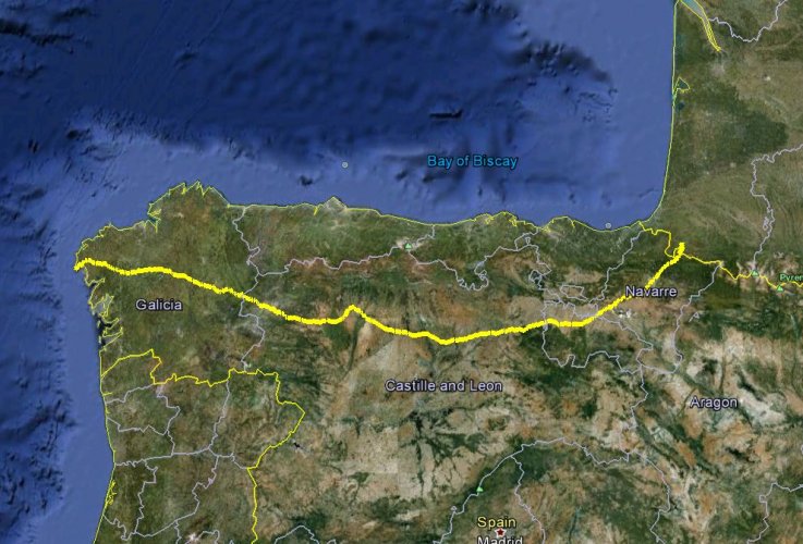
To see the Camino, you need to download a track. A track is a line on the image, and it can be downloaded from a file with a ,kml or ,kmz suffix. Download one of these files and put it where you can find it. From Google Earth, click file pen, and click on that file---whoosh, it will zoom to the track. Several tracks of different variations can be opened.
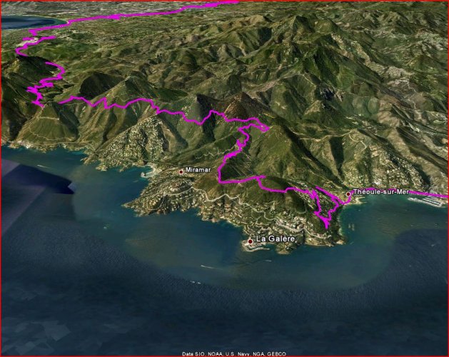
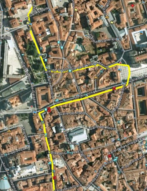
Once the track is open, you can turn on all sorts of layers, photos people have loaded, stores, hotels, restaurants, roads ,etc. You can tilt it to 3-d view.
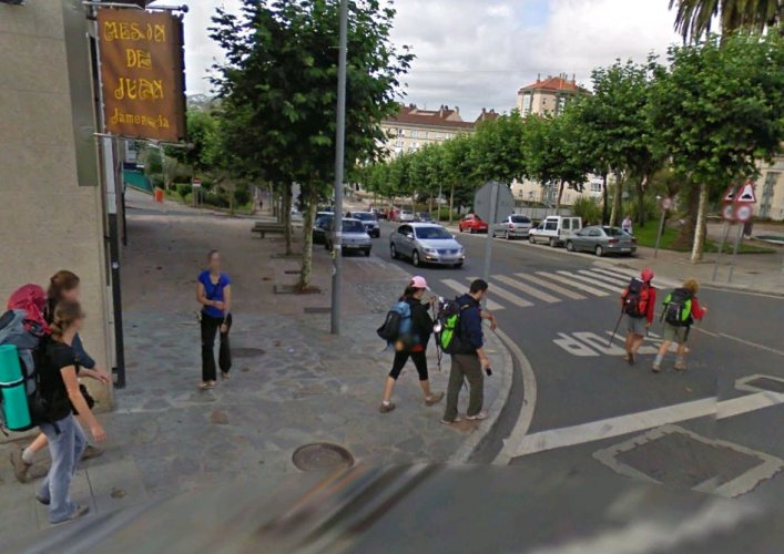
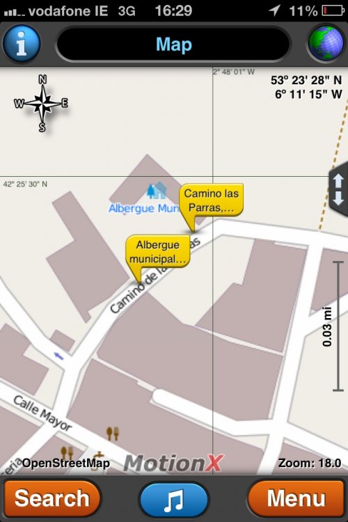
In the top right corner is the icon of a little man. Drag him onto the image, and “street view” roads become visible. Drag him to a place where the Camino crosses a road, and you’ll get a view from the street, often with pilgrims on the trail. This feature is great to see places you stayed, check out trail conditions for a bike, or just relive your trip. It is the most addictive time- waster you could ever dream of.
I’ll attach two files of different variations. They can be converted to .gpx files and loaded into a GPS with a site such as http://www.gpsvisualizer.com/convert_input
You can also draw the route you would like to take on Google Earth and save it, and load that into your GPS.
Google Earth is free. You need to go to Google and download it. Once it is on your computer, there are various tutorials available, but basically, it allows you to view the whole earth, from the edge of the solar system to standing in some streets.
To see the Camino, you need to download a track. A track is a line on the image, and it can be downloaded from a file with a ,kml or ,kmz suffix. Download one of these files and put it where you can find it. From Google Earth, click file
pen, and click on that file---whoosh, it will zoom to the track. Several tracks of different variations can be opened.Once the track is open, you can turn on all sorts of layers, photos people have loaded, stores, hotels, restaurants, roads ,etc. You can tilt it to 3-d view.
In the top right corner is the icon of a little man. Drag him onto the image, and “street view” roads become visible. Drag him to a place where the Camino crosses a road, and you’ll get a view from the street, often with pilgrims on the trail. This feature is great to see places you stayed, check out trail conditions for a bike, or just relive your trip. It is the most addictive time- waster you could ever dream of.
I’ll attach two files of different variations. They can be converted to .gpx files and loaded into a GPS with a site such as http://www.gpsvisualizer.com/convert_input
You can also draw the route you would like to take on Google Earth and save it, and load that into your GPS.