What am I reading wrongly in Gronze.

Jan Jones

Active Member
Oct 9, 2017
142
224
Time of past OR future Camino
Frances 2018, Norte, 2019, Camino Primitivo 2023
I have recently returned from walking the Salvador and Primitivo routes and just playing around with what next and so I have just been looking at the Gronze thread on this route and am confused by what appears to be conflicting advice about it‘s suitability .

On the one hand it seems to rule it out for anyone but the experienced mountain walking Pilgrims -

“The Camino Vadiniense is the hardest of all the Caminos de Santiago in Spain that we deal with in Gronze. The harshness focuses on the Cantabrian stages, especially if you follow the marked itinerary (as it should be) avoiding the roads; On the Leonese stages, on the other hand, the path softens considerably. The itinerary through Cantabria presents some considerable unevenness, which condemns this beautiful path to be available only to those pilgrims accustomed to mountain walks.”

But then goes on to say ….

“ Despite the altitude that the Vadiniense Way reaches (1,794 meters) and the mountainous territory that it crosses, the signposted itinerary does not present dangerous or aerial sections; It is suitable, therefore, for quiet hikers without an excessive spirit of risk.”

My Spanish isn’t good enough to read It in the original with confidence.

I will spend time working through the discussions on this thread but am I misreading this section in Gronze?
 
Last edited:
  • Like
Reactions: MaryLynn
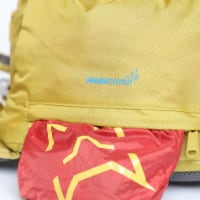
Technical backpack for day trips with backpack cover and internal compartment for the hydration bladder. Ideal daypack for excursions where we need a medium capacity backpack. The back with Air Flow System creates large air channels that will keep our back as cool as possible.

€83,-
F

Former member 104756

Guest
Hi Jan. I don’t speak / read Spanish either - the translation tools often make for some odd wording, eg the word ‘condemns’ in the first quoted para above.

I haven’t walked this path so no first hand knowledge. But I don’t think the paras are conflicting. My reading of the sections quoted is that it’s a tough and mountainous path (in Cantanabria) - but not dangerous. In looking at the elevation profiles on Gronze, there look to be some very challenging climbs. I’ve seen photos of the Cantanabrian mountains and it does look like tough terrain. So I can understand the comment that the path may not be suitable for those who’ve not walked in the mountains.

Maybe someone who has walked this path will come along. I’ll be interested to see what they say. 😎
 
Last edited by a moderator:
Feb 22, 2009
1,258
3,842
Swiss Valley, Clevedon UK
Time of past OR future Camino
.
Maybe someone who has walked this path will come along.
Hi Jan and Pelerina,
I'd say Gronze is pretty much spot on. Most of the walking is straightforward, but a couple of stages have sections with narrow steep paths which are wilder than what you'd normally expect on the camino.
Firstly the stretch between Cicera and Lebena - hard yards but delightful.
And secondly the section after Potes up to either Espinama or Fuente De (in my case). Here the road, hogs the easy route up the valley, so the camino path jumps off at intervals into detours (often steeply) up the side of hills that bring you back down to the same road again. About halfway along I decided that leaving the road (and often getting lost due to poor signage) was a mug's game and just stuck with the road, which was fine. Actually I arrived in Espinama much earlier than expected, suprised at how easy the road was. If I did it again I'd just consult Mapy.cz and either do all the off-road detours or select a few, depending on how energetic I was feeling. In fact I recommend looking at this section on Mapy.cz (select outdoor map) now, and you'll see exactly what I mean. I think this is the section Gronze is referring to when it says The harshness focuses on the Cantabrian stages, especially if you follow the marked itinerary (as it should be) avoiding the roads
For the section up to the highest point (from Fuente De in my case) you just follow a wide track used by the local 4x4 vehicle club which winds gently up and up to the highest point. There you follow the signage on an easy path for about 2.5km until you hit the tarmac road. Then you have a long descent along the road to Portilla de la Reina. And that's it really - all the rest of the Gronze stages to Leon have only one or two stars of difficulty.
 
3rd Edition. More content, training & pack guides avoid common mistakes, bed bugs etc

lt56ny

Veteran Member
Jul 28, 2012
4,715
12,682
Bucerias, Mexico
Time of past OR future Camino
2024 Aragones, Madrid, Portugues Coastal
Hi Jan and Pelerina,
I'd say Gronze is pretty much spot on. Most of the walking is straightforward, but a couple of stages have sections with narrow steep paths which are wilder than what you'd normally expect on the camino.
Firstly the stretch between Cicera and Lebena - hard yards but delightful.
And secondly the section after Potes up to either Espinama or Fuente De (in my case). Here the road, hogs the easy route up the valley, so the camino path jumps off at intervals into detours (often steeply) up the side of hills that bring you back down to the same road again. About halfway along I decided that leaving the road (and often getting lost due to poor signage) was a mug's game and just stuck with the road, which was fine. Actually I arrived in Espinama much earlier than expected, suprised at how easy the road was. If I did it again I'd just consult Mapy.cz and either do all the off-road detours or select a few, depending on how energetic I was feeling. In fact I recommend looking at this section on Mapy.cz (select outdoor map) now, and you'll see exactly what I mean. I think this is the section Gronze is referring to when it says The harshness focuses on the Cantabrian stages, especially if you follow the marked itinerary (as it should be) avoiding the roads
For the section up to the highest point (from Fuente De in my case) you just follow a wide track used by the local 4x4 vehicle club which winds gently up and up to the highest point. There you follow the signage on an easy path for about 2.5km until you hit the tarmac road. Then you have a long descent along the road to Portilla de la Reina. And that's it really - all the rest of the Gronze stages to Leon have only one or two stars of difficulty.
Tom you really know your caminos!! Impressive!
 

Liltravlr

Active Member
Sep 16, 2019
117
278
Vancouver
Time of past OR future Camino
Francés (2020)
Very impressive! I do speak Spanish but not too sure what I’m supposed to do with Gronze. My sister & I leave in 5 days for our 1st Camino (Sarria to Santiago). I do have an iphone but I was hoping the route would be clear enough that I don’t have to use it as the battery dies so fast. Santiago Ways booked our accommodations so we don’t really know where they are. Am I being naive? Do I need a compass? Thanks!
 
  • Like
Reactions: Michael L.
F

Former member 104756

Guest
@Liltravlr Thé camino route written about in this thread is much more remote and much less travelled than the Camino Frances. You can be confident that you do not need your phone, a compass or reference to Gronze to follow the path from Sarria to Santiago, which is the busiest section of the busiest camino route. The path is very well marked with many pilgrims walking. I feel sure that the company that has booked your accommodation will advise you the details so that you can find your accommodation.
 
Last edited by a moderator:
The one from Galicia (the round) and the one from Castilla & Leon. Individually numbered and made by the same people that make the ones you see on your walk.

❓How to ask a question

How to post a new question on the Camino Forum.

Forum Rules

Forum Rules

Camino Updates on YouTube

Camino Conversations

Most downloaded Resources

This site is run by Ivar at

in Santiago de Compostela.
This site participates in the Amazon Affiliate program, designed to provide a means for Ivar to earn fees by linking to Amazon
Official Camino Passport (Credential) | 2024 Camino Guides