• For 2024 Pilgrims: €50,- donation = 1 year with no ads on the forum + 90% off any 2024 Guide. More here.
    (Discount code sent to you by Private Message after your donation)
  • ⚠️ Emergency contact in Spain - Dial 112 and AlertCops app. More on this here.

Search 69,459 Camino Questions

Vila do Conde to Rates - river or aqueduct?

caminocdndave

New Member
Time of past OR future Camino
2022
Hello fellow pilgrims,

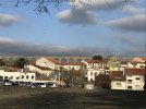
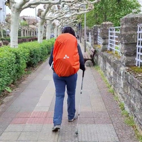
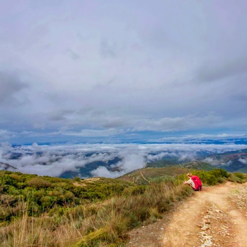
We are walking the Portuguese Camino for our first Camino and start on May 5th. We will be leaving from Vila do Conde and walking to Rates the first day. I know that there are two routes - the river route which is the one that is well marked but has lots of traffic and the aqueduct route that is not well marked (and identified but not recommended in Brierly). We would rather not face a lot of crazy traffic, especially on our first dat so I was wondering....

1. Has anyone gone on both routes?
2. What is the traffic like on the aqueduct route? What is the route itself like?
3. Is there a problem with pilgrims walking along the aqueduct route - as in, will this upset the people that live there?

I've got both routes on maps.me and wikiloc as well as a pdf showing the route that I got on this forum.
Thanks!

viladoconderoutes.jpg
 
Ideal sleeping bag liner whether we want to add a thermal plus to our bag, or if we want to use it alone to sleep in shelters or hostels. Thanks to its mummy shape, it adapts perfectly to our body.

€46,-
If you do not like the Formula1 style of driving Portuguese , take the “Aquaduct “ route
With your map you will find your way in this more rural area
 
Ideal sleeping bag liner whether we want to add a thermal plus to our bag, or if we want to use it alone to sleep in shelters or hostels. Thanks to its mummy shape, it adapts perfectly to our body.

€46,-
Do you have a kml file of the aqueduct route and specific directions about the route. If this is safer, I would like to take this way to Rates. Descriptions of the other route are terrifying me!
 
I went to the bother of trying to track down my notes... I was so lazy! However, I know from what others have written that we proceeded to the bridge, on the morning leaving Vila do Conde, and took a left, so I guess the river was on our right. The harbour was on our right at that point. Almost immediately, we came upon a most wonderful market selling all kinds of fruit and veg, ugly as sin. Not the people, the produce! Ignore it at your peril. No beautifying for the influencers at all...
I have absolutely no memory of any danger, nor if there was an aqueduct, and we made it in one piece to Rates. The local fiestas put paid to the peace though!!!
 
3rd Edition. More content, training & pack guides avoid common mistakes, bed bugs etc
Thanks for the opinions - it is much appreciated. Much as I love watching Formula 1 racing, we will be taking the Aqueduct route!
 
I only took the River route, so I can't really compare. I don't remember feeling it was terribly unsafe in 2018. Perhaps I just got lucky on a low traffic day. There were definitely some nice spots along it. I remember reading that it was easier to follow and it was relatively well-marked. Maybe next time I'll try the Aqueduct route.
 
We took the aqueduct way last week. It was somewhat marked and we didn’t lose our way. Not busy with traffic at all. Highly suggested - just download the file and import to Maps.me and you are golden!
 
The 2024 Camino guides will be coming out little by little. Here is a collection of the ones that are out so far.
We took the aqueduct way last week. It was somewhat marked and we didn’t lose our way. Not busy with traffic at all. Highly suggested - just download the file and import to Maps.me and you are golden!
@caminocdndave

Hi Dave,

Thanks a million for the link in your earlier post.

I was planning to do that next week but was a bit unsure about doing it solo esp. after reading Brierly.

Have your route now on maps.me and all Portugal and Northern Spain downloaded for offline use so I think I should be good to go.

Can you give me an idea of how long it took to Rates?

I'm planning on going all the way to Barcelinos on the same day so it would be good to know.

Thanks again,

Phil
Hi Phil,

I’m not sure the exact time as we had to make our way from Porto to Villa do Conde by metro first. Also it was our first day so we took it easy. It was about 12 or 13km and was pretty flat most of the way with some elevation gain at the end. Very little traffic so we really enjoyed it!
 
Hi Phil,

I’m not sure the exact time as we had to make our way from Porto to Villa do Conde by metro first. Also it was our first day so we took it easy. It was about 12 or 13km and was pretty flat most of the way with some elevation gain at the end. Very little traffic so we really enjoyed it!
thanks Dave
 
The 2024 Camino guides will be coming out little by little. Here is a collection of the ones that are out so far.
@caminocdndave

Hi Dave,

Thanks a million for the link in your earlier post.

I was planning to do that next week but was a bit unsure about doing it solo esp. after reading Brierly.

Have your route now on maps.me and all Portugal and Northern Spain downloaded for offline use so I think I should be good to go.

Can you give me an idea of how long it took to Rates?

I'm planning on going all the way to Barcelinos on the same day so it would be good to know.

Thanks again,

Phil
Do not forget to get a stamp in your credential in São Pedro de Rates.
in the albergue they have a nice bi coloured stamp
 
Did this today. There is a point where the route follows a farmer's track across some fields that should be avoided in wet weather (at 41.4101067, -8.6940894 just after you turn at the school). It appears as a road on some apps but it's a just tractor track. A stream diverts down the track during rain, and it's already a mess from tractor wheels. No way to follow this without getting feet thoroughly soaked and covered in mud. Better to continue on the road and take next left ( at 41.4067621, -8.692042) which according to map will connect you back onto the route. So if it's wet, or has rained in the previous days, take a detour as it's not going to be pleasant.
 
Last edited:

Most read last week in this forum

Barcelos was having a huge May 1 celebration when we passed through. There was a major unveiling of a sculpture titled Peregrina the following day—very big event. We weren’t there, so I lifted a...
Hi, I am trying to confirm that starting my walk from O Porriño qualifies for the last 100 km, and qualifies for a Compostela. I am finding conflicting information in different places. Camino...

❓How to ask a question

How to post a new question on the Camino Forum.

Forum Rules

Forum Rules

Camino Updates on YouTube

Camino Conversations

Most downloaded Resources

This site is run by Ivar at

in Santiago de Compostela.
This site participates in the Amazon Affiliate program, designed to provide a means for Ivar to earn fees by linking to Amazon
Official Camino Passport (Credential) | 2024 Camino Guides
Back
Top