A waymarker near the pass on the Route Napoleon has been improved by the local camino association of Saint-Jean-Pied-de-Port
..... a Google Earth screenshot
View attachment 83143
This was to be the site of one of my first lessons on the Camino.
I was tired after the climb up the roadway and I was using Google Maps on my phone to look for a flatter path rather than one that dipped then climbed again as the various off-road shortcuts often do.
Unfortunately, the lack of a magnetometer sensor in my phone (at that time), Southern hemisphere to Northern hemisphere maladjustment and lack of local knowledge meant that when I looked at the map it was orientated so that the route back down to SJPdP looked as if it was the path ahead of me.
This meant that I thought that there was a coffee stop just around the corner of the road ahead and that the great crowd of people ahead of me were all heading off in the wrong direction!
With great self satisfaction, I laughed to myself about the fools who were all going in the wrong direction and pushed on, on the road ahead, eagerly anticipating a nice Mochachino without having to wait for a line of other pilgrims ahead of me.

After about 20 minutes walking with no coffee stop in sight I started having some doubts but I pushed on. After another 10 minutes walking I realised that I must have read the map back to front and stopped to decide what to do.
I was even more tired by then and I really didn't want to retrace my steps 30 minutes. I thought about leaving the road and just heading overland in the general direction that I thought the path might be but that meant climbing straight up this huge hill (Mt. Lietzarateka, 1414mt) with prospects of really becoming lost and I had no mobile phone reception and so I couldn't phone for help if I needed to!
I had only had a single vehicle pass me during the 30 minutes and had seen no other walkers. The third option that I considered was continuing on the road ahead. I figured that the road must go somewhere and perhaps the Camino wanted me to be on this road for some reason and so I took this third option and continued following the road.
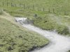
After about another 5 minutes walking I came across a side path to the right with a couple of small signs, what looked like some stock pens and the possibility of a view in the general direction that I was interested in (Col. D'Arnostesguy) I almost didn't go up this path but I needed to sit down somewhere and drink some water and I thought there may be something to sit on up there and so up I walked, see screenshot from G Maps:

No cars for me though!
As I got closer I spotted a small herd of horses so I perked up and wandered over to give them a pat, enjoyed the view and then turned around to walk over to the stock pens to find a seat.
What I didn't realise at the time was that this spot is right on the French/Spanish border and there is a fence that more or less follows the border and just inside the French side of the border there runs a (farm) track.
As I sat there drinking my water I noticed a tiny sign that pointed North West along the track with the word Roncesvaux on it. At last! I had found another way to Roncesvalles, around the South East side of Mt. Bentarte and Mt. Lietzarateka.
I followed this ill-signed track, often wondering if I was on the correct track until eventually I came to an intersection and there realised that I was back on the Frances Camino and headed for Roncesvalles with the rest of the crowd.