• Get your Camino Frances Guidebook here.
  • For 2024 Pilgrims: €50,- donation = 1 year with no ads on the forum + 90% off any 2024 Guide. More here.
    (Discount code sent to you by Private Message after your donation)
  • ⚠️ Emergency contact in Spain - Dial 112 and AlertCops app. More on this here.

Search 69,459 Camino Questions

Every map tells a story

Time of past OR future Camino
VdlP(2012) Madrid(2014)Frances(2015) VdlP(2016)
VdlP(2017)Madrid/Sanabres/Frances reverse(2018)
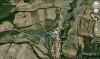
I don't know about the rest of you, but I'm addicted to maps. In a month I'll be off on my third Camino, and every day now I'm spending hours gazing at the fantastic IGN maps which Peter Robbins has made available on his website, The Walking Pilgrim. I'm slowly making my way across northern Spain in my imagination, at a scale of 1:20000 or greater. Talk about a surrogate experience!
When I was a boy, going hiking across the English countryside, I had a similar obsession with the 1inch to 1mile OS maps. (I'll bet some of you remember that scale, 1:63360! ....In those days some of us grwe up to be good at maths).
Anyway I'm off the point. If you are a first timer, delve into those maps. Find Cruz de Fero, and dream.
 
Join our full-service guided tour and let us convert you into a Pampered Pilgrim!
Thank you for this, @Peregrinopaul. I am a map fiend myself - paper maps though. But I guess, with a little experimenting, I will learn to navigate these web based maps and hopefully get something out of them. :) :)
 
Thank you for this, @Peregrinopaul. I am a map fiend myself - paper maps though. But I guess, with a little experimenting, I will learn to navigate these web based maps and hopefully get something out of them. :) :)
Paper maps, ......me too. Being retired, I have a lot of time on my hands, and I print off every km of the way, (in colour), and stick them in a small notebook. I change scale according to the complexity of the route. I did this for the entire route of the VDLP in 2012, and had 3 volumes of maps. (But then, I am on a bike so not quite so paranoid about extra weight). On my last Camino, from Madrid, I took an iPad with my selected maps downloaded. Not a good idea. Try finding your location on an iPad in Spanish sunshine. No substitute for paper, Mr Jobs.
But do have a look at http://pilgrim.peterrobins.co.uk/routes/details/frances.html. You'll be in map heaven.
 
Get a spanish phone number with Airalo. eSim, so no physical SIM card. Easy to use app to add more funds if needed.
Paper maps, ......me too. Being retired, I have a lot of time on my hands, and I print off every km of the way, (in colour), and stick them in a small notebook. I change scale according to the complexity of the route. I did this for the entire route of the VDLP in 2012, and had 3 volumes of maps. (But then, I am on a bike so not quite so paranoid about extra weight). On my last Camino, from Madrid, I took an iPad with my selected maps downloaded. Not a good idea. Try finding your location on an iPad in Spanish sunshine. No substitute for paper, Mr Jobs.
But do have a look at http://pilgrim.peterrobins.co.uk/routes/details/frances.html. You'll be in map heaven.
Yes, that's the site I looked at. :D:D Like I said, I'll have to do some experimenting to figure the ins and outs of it!
 
Hi, I printed all the maps from Peter Robbins website for the route from Le Puy to SJPdP, and used them every day. Because the GR65 often meanders around villages, instead of going through them, the maps often helped us find better routes, which we would never have known about otherwise. I hope I won’t regret leaving Brierley at home on my next camino. I’ve downloaded his maps onto my smartphone, so I don’t have to carry the guidebook, but it’s not the same as having a detailed printed map in your hand, is it? Jill
 
Flying out to Lourdes to start the great trek to Santiago, and I have the full route on in KML files on an off-line Openstreets map on my iPhone. I'm now am so used to being able to drill down on electronic maps to find little backroads, points of interest and added information that paper maps feel a bit inadequate. I've been able to add a lot of side attractions on the route this way. Plus you can place yourself on an electronic map via GPS. However there still is something quite romantic about poring over a large paper map spread open on the table. And of course a paper map's battery never dies! Lastly, the thing about electronic maps I find most fascinating is the ability to pinpoint a particular location on Google maps and at the press of a button bring up a street view photo. That is surreal.
 
3rd Edition. More content, training & pack guides avoid common mistakes, bed bugs etc
Flying out to Lourdes to start the great trek to Santiago, and I have the full route on in KML files on an off-line Openstreets map on my iPhone. I'm now am so used to being able to drill down on electronic maps to find little backroads, points of interest and added information that paper maps feel a bit inadequate. I've been able to add a lot of side attractions on the route this way. Plus you can place yourself on an electronic map via GPS. However there still is something quite romantic about poring over a large paper map spread open on the table. And of course a paper map's battery never dies! Lastly, the thing about electronic maps I find most fascinating is the ability to pinpoint a particular location on Google maps and at the press of a button bring up a street view photo. That is surreal.
Hi Charl. How do you download an off-line version of OSM? I can see why that would be invaluable.
 
Peregrinopaul what device do you have? I use an app called Galileo on iPhone. You then import first the OSM into Galileo and then kml files.
 
Peregrinopaul what device do you have? I use an app called Galileo on iPhone. You then import first the OSM into Galileo and then kml files.
I'll follow up on this. My wife just presented me with an iPhone 6 to take with me on my upcoming camino in a month. Thanks for the response
 
St James' Way - Self-guided 4-7 day Walking Packages, Reading to Southampton, 110 kms
Fabulous! I had no idea those existed so spent many (enjoyable!) hours on Google Earth plotting my own :rolleyes:
Thanks.
 
I used an app called Open GPS Tracker on my android tablet to record where I walked each day. Every morning, I would open up the app, and start a new track. The app then made files I could pull into Google Earth. This is the result.

track1_zpsk1y1dsmj.jpg

This is "Day 15," Villambistia to Atapuerca.

I am so glad I decided to do this. It's really helped me recall where I was each day. By zooming in, I can even see where I stopped to take breaks! (You can tell by how the blue line gets squiggly in places.)

track1_zpsk1y1dsmj.jpg
 

Attachments

  • track2_zpsjvi4vs7o.jpg
    track2_zpsjvi4vs7o.jpg
    74.8 KB · Views: 22
Technical backpack for day trips with backpack cover and internal compartment for the hydration bladder. Ideal daypack for excursions where we need a medium capacity backpack. The back with Air Flow System creates large air channels that will keep our back as cool as possible.

€83,-
Very cool Jeff, did you use an external battery pack or did your device last the whole day? I bought a 6000ma battery pack because when testing my iPhone didn't quite last the twelve hours of gps use, photography etc that I'll need on the walk.
 
Transport luggage-passengers.
From airports to SJPP
Luggage from SJPP to Roncevalles
Very interesting app @jeffnd! Thanks for sharing. I just wonder if it's going to use up a lot of data on a roaming mobile phone account. Cheers!
 
Hi, I printed all the maps from Peter Robbins website for the route from Le Puy to SJPdP, and used them every day. Because the GR65 often meanders around villages, instead of going through them, the maps often helped us find better routes, which we would never have known about otherwise. I hope I won’t regret leaving Brierley at home on my next camino. I’ve downloaded his maps onto my smartphone, so I don’t have to carry the guidebook, but it’s not the same as having a detailed printed map in your hand, is it? Jill
Exactly, Jill. A digital screen has its limitations in Spanish sunshine.
 
New Original Camino Gear Designed Especially with The Modern Peregrino In Mind!
Very cool Jeff, did you use an external battery pack or did your device last the whole day? I bought a 6000ma battery pack because when testing my iPhone didn't quite last the twelve hours of gps use, photography etc that I'll need on the walk.

I had a second generation Nexus 7 tablet that I used. During the day, I had wifi turned off and only the GPS was running. The battery life held out well during the day and I would charge it at night. If you are going to use your phone, turn off data and wifi to save the battery. I don't know much about the iphone's battery life, but I would guess with an external battery you should be fine.

Very interesting app @jeffnd! Thanks for sharing. I just wonder if it's going to use up a lot of data on a roaming mobile phone account. Cheers!

The whole process used no data. My tablet simply recorded the GPS signal from the satellites and recorded the data. During the day, I could see the distance and elevation I had traveled, but I couldn't display the track on a map until I connected to the internet. There was an option to download an offline map, but that cost money so I didn't use it.
 
I’ve downloaded his maps onto my smartphone, so I don’t have to carry the guidebook, but it’s not the same as having a detailed printed map in your hand, is it? Jill

Hi Jill - Can you explain how you got the Peter Robbins maps onto your iphone? Thanks!
Mary Louise
 
New Original Camino Gear Designed Especially with The Modern Peregrino In Mind!
Hi Jill - Can you explain how you got the Peter Robbins maps onto your iphone? Thanks!
Mary Louise

Hi Mary Louise
It was Brierley’s maps, from his guide book, that I’ve put on my smartphone (android), but I guess you could do the same with Peter Robbins’ maps in the same way once printed out. That is, I scanned the maps into a file on my computer in pdf form, then connected my smartphone to the computer, and copied the pdf files across to My Files on my smartphone. You might have to download and install Adobe Acrobat onto your phone to read the files if there is no software there already. I am VERY technologically challenged, so it did take me most of a day to work all that out! Jill
 
Hi Jill - Can you explain how you got the Peter Robbins maps onto your iphone? Thanks!
Mary Louise
As a matter of fact I'm doing it right now. (I think Jill was referring to downloading the Brierly maps, and I don't know about that, no doubt she will clarify). Fortunately, I own a a collection of Apple wizardry, and my process is to use my Mac to screenshot a consecutive series of maps for each segment, then airdrop to my phone which takes only seconds. I'm still considering Charl's suggestion about the Galileo app above, but I can't get over my love for the beautiful IGN maps on Peterobbins site; a different class to OSM and the rest. I'm using them at scale 8, which seem to be quite readable when you zoom in, even outside. You can't beat good contour maps, can you.
you need plenty of memory though.
 
Hi Peregrinopaul - I managed to get the maps onto my phone once before but I can't seem to remember how. When you use the screenshot you can still zoom on the map on the phone? Thanks so much!

Thanks Jill too...
 
3rd Edition. More content, training & pack guides avoid common mistakes, bed bugs etc
I use an app called Galileo on iPhone.

Charl - I just downloaded Galileo onto my phone -- and it is telling me not just what street I am on but what building (correctly named) I am in. Kind of freaky, but cool.
 
Hi Peregrinopaul - I managed to get the maps onto my phone once before but I can't seem to remember how. When you use the screenshot you can still zoom on the map on the phone? Thanks so much!

Thanks Jill too...
Hi Mia
When I double tap the screen, the map scale on my iPhone 6 is almost exactly 1cm to 150m. That's using the maps on scale number 8. Scale 9 would be terrific, but that'd be an awful lot of maps. I'll probably include the occasional one though. How I got them on the phone is in my previous post. Do you have a Mac?
 
Yes, that's the site I looked at. :D:D Like I said, I'll have to do some experimenting to figure the ins and outs of it!
Hi. How did you go with the PeterRobbins site? I'm halfway through adding maps to my iPhone at a scale where I can read the contours. Great! I'm off in a month.
 
St James' Way - Self-guided 4-7 day Walking Packages, Reading to Southampton, 110 kms

Most read last week in this forum

The Burguete bomberos had another busy day yesterday. Picking up two pilgrims with symptoms of hypothermia and exhaustion near the Lepoeder pass and another near the Croix de Thibault who was...
Between Villafranca Montes de Oca and San Juan de Ortega there was a great resting place with benches, totem poles andvarious wooden art. A place of good vibes. It is now completely demolished...
Just an FYI that all available beds are taken in SJPDP tonight - fully, truly COMPLETO! There’s an indication of how busy this year may be since it’s just a Wednesday in late April, not usually...
Left Saint Jean this morning at 7am. Got to Roncesvalles just before 1:30. Weather was clear and beautiful! I didn't pre book, and was able to get a bed. I did hear they were all full by 4pm...
Hi there - we are two 'older' women from Australia who will be walking the Camino in September and October 2025 - we are tempted by the companies that pre book accomodation and bag transfers but...
We have been travelling from Australia via Dubai and have been caught in the kaos in Dubai airport for over 3 days. Sleeping on the floor of the airport and finally Emerites put us up in...

âť“How to ask a question

How to post a new question on the Camino Forum.

Forum Rules

Forum Rules

Camino Updates on YouTube

Camino Conversations

Most downloaded Resources

This site is run by Ivar at

in Santiago de Compostela.
This site participates in the Amazon Affiliate program, designed to provide a means for Ivar to earn fees by linking to Amazon
Official Camino Passport (Credential) | 2024 Camino Guides
Back
Top