• For 2024 Pilgrims: €50,- donation = 1 year with no ads on the forum + 90% off any 2024 Guide. More here.
    (Discount code sent to you by Private Message after your donation)

Search 69,459 Camino Questions

GPS on Camino Frances

Carolyn G

Active Member
Time of past OR future Camino
May 2018
May 2019
(Future - CP September 2020)
Is there an easy, practical way to determine where you are on the Camino? I’m mostly interested in being better able to make a decision when I come up on signs pointed in 2 directions. I’ve seen comments about GPS on the Camino but not sure what’s the best program or App.
I’ll appreciate your input. Thanks!
 
A selection of Camino Jewellery
The focus is on reducing the risk of failure through being well prepared. 2nd ed.
My iPhone WITHOUT cell service still works as a god device. When paired with various programs (google maps, maps.me, buen camino app), it’s impossible to get lost. We wandered all day and only looked at the gps if we felt hopelessly lost.
 
I used the „Camino Pilgrim“ app (for android) and it worked perfectly. It has a map function which uses GPS to show you where you are on the Camino. You can download maps too so it works offline. I never really needed GPS, but sometimes it was nice to have if I wanted to really be certain I was going the right way.
 
There are downloadable kmz/gps files for most (all?) of the Camino routes posted in the Resources section, in the Camino GPS Tracks folder.

The Wise Pilgrim app also has the path overplayed on a google map.

Having a map downloaded in advance is very helpful for when you want to get a visual of where the path goes, or how to get back to it if you leave the route. I had the GPS tracks downloaded for the Portuguese and it helped me out several times. Buen Camino!
 
The one from Galicia (the round) and the one from Castilla & Leon. Individually numbered and made by the same people that make the ones you see on your walk.
I used an app (I think Guthook) the entire CF. It was invaluable to use in larger cities and I was able to tell when the “official” route was clearly navigating me through what would be the most financially beneficial for the local businesses and not necessarily the most scenic, shortest, etc. An app added zero weight to my pack too!
 
I am an old fort, one who doesn't fully appreciate technology. In my opinion the cellular phone has destroyed half of the pilgrim camaraderie on the Camino since everyone seems focused on their little screens. GPS is not needed, the CF is well marked and should there be a fork any guidebook would have told you that even before you left home. Forget the GPS save your "valuable" battery time for photos, Instagram if you must, searching for friends you left in that cafe/bar, and evening whats app to those back home. And p-l-e-a-s-e no Tweeter - that incessant and infuriating call sign rising from every corner will drive a person mad!
 
Ideal sleeping bag liner whether we want to add a thermal plus to our bag, or if we want to use it alone to sleep in shelters or hostels. Thanks to its mummy shape, it adapts perfectly to our body.

€46,-
I used the Trail Smart app (free) and purchased the Camino data set that includes offline maps.

It was reassuring to know where I was st all times. While the Camino is well marked there were a few times when there are alternate routes can become confusing and having the GPS guidance from the app helped. Buen Camino.
 
3rd Edition. More content, training & pack guides avoid common mistakes, bed bugs etc
I used the „Camino Pilgrim“ app (for android) and it worked perfectly. It has a map function which uses GPS to show you where you are on the Camino. You can download maps too so it works offline. I never really needed GPS, but sometimes it was nice to have if I wanted to really be certain I was going the right way.
 
Thank you ! That’s the info I was looking for!
Buen Camino
 
Join the Camino Cleanup in May from Ponferrada to Sarria. Registration closes Mar 22.
I agree with @oldfort! But then, I turned 70 in Burgos!

We got lost twice on CF, once when leaving Leon due to a lack of attention on our part, and getting to Fromista. This was on the only morning we started in the dark. We took a wrong turn and ended up on a road that dead ended in a farmers field. Just an interesting moment on the CF!
 
All smartphones have a built in GPRS beacon. This is what supports finding things near your location. It also locates you along a Camino, provided that:

1. You have your device turned on and you have a cellular phone signal.

2. You are using an app that maps the Camino route AND shows exactly where you are.

IMHO, the best of these apps are the newly revised Wise / Wisely Pilgrim Guides. The most recent revisions incorporate a downloaded topographical map with the GPRS locator 'spot.'

This means your data use is non-existent, as the already working GPRS locator beacon is just super-imposed on the downloaded map. You simply keep the locator spot or arrow (you) on the dotted line Camino track and voila! You always know where you are.

The best thing about these apps is that they are closely integrated to the accompanying Camino guides. The author of these guides lives in Santiago and spends most of his time on a hybrid bicycle updating content and mapping. His distances are based on GPS measurements.

Check out the homepage here: http://www.wisepilgrim.com/

Also, check out this forum thread: http://www.caminodesantiago.me/community/threads/who-has-used-iphone-app-wise-pilgrim-guide.50632/

Hope this helps.
 
New Original Camino Gear Designed Especially with The Modern Peregrino In Mind!
All smartphones have a built in GPRS beacon. This is what supports finding things near your location. It also locates you along a Camino, provided that:

1. You have your device turned on and you have a cellular phone signal.

2. You are using an app that maps the Camino route AND shows exactly where you are.
There are some errors in this description, although the general thrust of @t2andreo's comments are correct.

First, smartphone and other handheld GPS units are not beacons. They don't send out a radio signal that allows the unit to be located as might happen with an EPIRB or PLB. Mobiles can support a form of location service by an application sending your location information back to a server that then searches for local points of interest, and sends these details back to your phone.

GPRS (General Packet Radio Service) is the communications protocol that supports this data exchange, but doesn't provide the location information. That is provided by a GPS receiver built in to modern smartphones. As a data exchange protocol, GPRS requires your phone to be on, connected to a service and the phone's data service enabled.

The GPS, on the other hand, doesn't require the phone to be connected nor does it require the phone's data services to be enabled. It provides location information to any applications on the phone that ask for it.

Off-line mapping and tracking applications provide the information about the local area by storing this information on your phone. They match the location information given by the phone to this locally stored data. The more memory you have, the more information can be stored. Once loaded this information becomes static, and fast changing information like the location of road works and traffic (hardly relevant to the Camino!!) won't be available in these apps.

There is much more that might be said about this subject, but much of it tends to become technical detail, and I won't venture there now.
 
Last edited:
Hi - I was going to buy a GPS for my Camino and never did which I am glad - another item to care for, charge at night, worry about. . There are phone apps your can download several of which have been mentioned in posts. I can think of 2 spots on the Camino Frances where there were 2 choices and I was unsure - other pilgrims came along and we quickly figured out the best route.
 
IMHO, don't invest in a separate GPS device. Your phone can do everything you need to do.

DougFitz is correct in his charitable corrections above. I always welcome his input. THANK YOU!

The bottom line is that the Wisely. Wise Pilgrim Guide apps work with you phones cellular capability without using your data, except to download the offline map the first time. My technical description was not as good as Doug's. I appreciate his correction.
 
Ideal pocket guides for during & after your Camino. Each weighs only 1.4 oz (40g)!
I ran the last 100km+ of the Via de la Plata in one day, as an ultramarathon. I was very anxious not to add needless kilometres to what would already be a major challenge by going wrong, so I downloaded the only routes I could find (two different ones, from different sources) and installed them on my running watch and phone. See the end of my video at http://www.wartnaby.org/running/camino/ .

BUT they proved out of date; since being recorded, the Camino had changed, and the old route was cut by a high-speed rail line and deeply cut major road. So I still ended up going rather off piste and having to back-track. On the other hand, had I only followed the arrows, I would surely have got very lost by missing the odd subtle and poorly marked turn, and only realising my mistake some considerable time later. So if you can get recent GPS tracks, I think that is a very worthwhile backup. At least with a GPS track, you realise pretty quickly if you've gone wrong, rather than walking perhaps for kilometres in the wrong direction without knowing. Though the Frances should be easier to follow, being so much more popular.
 
I used the Trail Smart app (free) and purchased the Camino data set that includes offline maps.

It was reassuring to know where I was st all times. While the Camino is well marked there were a few times when there are alternate routes can become confusing and having the GPS guidance from the app helped. Buen Camino.

I loved TrailSmart and the extra maps, too. There were a number of times I missed arrows or had questions where the trail forked and was not well marked, and TrailSmart really saved my hide.
 
Is there an easy, practical way to determine where you are on the Camino? I’m mostly interested in being better able to make a decision when I come up on signs pointed in 2 directions. I’ve seen comments about GPS on the Camino but not sure what’s the best program or App.
I’ll appreciate your input. Thanks!
Maps.me wirked well. Once you load the maps, you don’t need data and it doesn’t drain batteries. I way marked each daily destination and I could mark my progress very accurately
 
The one from Galicia (the round) and the one from Castilla & Leon. Individually numbered and made by the same people that make the ones you see on your walk.
IMHO, the best of these apps are the newly revised Wise / Wisely Pilgrim Guides. The most recent revisions incorporate a downloaded topographical map with the GPRS locator 'spot.'

This means your data use is non-existent, as the already working GPRS locator beacon is just super-imposed on the downloaded map. You simply keep the locator spot or arrow (you) on the dotted line Camino track and voila! You always know where you are.

The best thing about these apps is that they are closely integrated to the accompanying Camino guides. The author of these guides lives in Santiago and spends most of his time on a hybrid bicycle updating content and mapping. His distances are based on GPS measurements.

Check out the homepage here: http://www.wisepilgrim.com/

Also, check out this forum thread: http://www.caminodesantiago.me/community/threads/who-has-used-iphone-app-wise-pilgrim-guide.50632/

Hope this helps.
I second the motion. I found the map feature in Wise Pilgrim to be a great resource. It’s especially handy when trying to locate a particular albergue. I only got lost once, but the Wise Pilgrim app was a big help in getting us back on track.
 
Is there an easy, practical way to determine where you are on the Camino? I’m mostly interested in being better able to make a decision when I come up on signs pointed in 2 directions. I’ve seen comments about GPS on the Camino but not sure what’s the best program or App.
I’ll appreciate your input. Thanks!
The ancient pilgrims would be laughing in their graves. Put a small compass on top of one of your poles and just follow your nose.
 
Is there an easy, practical way to determine where you are on the Camino? I’m mostly interested in being better able to make a decision when I come up on signs pointed in 2 directions. I’ve seen comments about GPS on the Camino but not sure what’s the best program or App.
I’ll appreciate your input. Thanks!
Brierley
 
Ideal pocket guides for during & after your Camino. Each weighs only 1.4 oz (40g)!
The ancient pilgrims didn’t have to deal with crossing super-highways, anti-camping laws, fixed vacation days, and so on. Having technological assistance to ease one’s burden and fears should be seen as welcome help for those approaching what can be a physically/emotionally/mentally challenging journey.
 
There was one comment about phone use on the Camino Frances on another thread, with the arguments going back and forth whether you should take one or not. One person commented that if the first pilgrims had a phone they would have used one. Which is probably true, but if they had trains, planes and automobiles they probably would not have walked the route.
 
I use View ranger. It is free, can be used offline and tracks your actual walk so if you do go wrong by a lot you can follow your own erroneous track back to where you need to be. It also, though not offline, can send your position back to a buddy. I find this feature reassuring on truly wildernesses walks. On the Camino I'm not sure it's necessary as a safety feature, but may help you keep in touch with a loved one.

One thing that is pointed out above is the changing, however slowly, nature of whichever Camino you walk. For this reason it may be useful to post up to date GPS or KML files into the resources section, to help those who feel the need to use them.

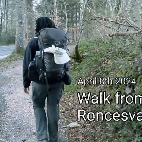
By the way I never felt the need to use it once I got to Roncesvalles. I walked the Valcarlos route, using as much of the off-road paths as possible. I was on my own and felt it necessary to ensure I was on the correct route. Sadly I deleted the track on completion.
Next walk I will go that same route, because I enjoyed it so much, even if my legs didn't like the last uppy downy climb. It was beautiful in early April
 
3rd Edition. More content, training & pack guides avoid common mistakes, bed bugs etc

Most read last week in this forum

https://www.lodgify.com/blog/es/observatorio-lodgify-febrero-2024/?utm_campaign=ES%20-%20Content%20Newsletter&utm_medium=email&_hsmi=298376570&_hsenc=p2ANqtz--KQkkCIbmVh11e1l-9P2514JyKrTN8_nNki9ioi...
Have you had Communion while attending the Cruz de Ferro?
Hi there Can anyone tell me where on the Camino Frances there is a mural on a wall depicting “the three wise men”. I’ve admired it on several occasions, over the years, but I can’t remember where...
I wonder how many,if any get caught up in the idea...or ideal of the Camino To be sure it captured my imagination and reinforced by videos and pictures. I am quick to seek and find the good in...
What does the abbreviation "Rda" mean in Spanish? In context: "Calle la Rda, Villalcázar de Sirga". I have googled (of course), but I've obviously not been asking the right questions, as I've...
Can someone please describe the difference between the Wise Pilgrim print edition, the kindle edition, and the app for the Camino Primitivo? I mean up-to-date info, ease of use, etc. If I got the...

❓How to ask a question

How to post a new question on the Camino Forum.

Similar threads

Forum Rules

Forum Rules

Camino Updates on YouTube

Camino Conversations

Most downloaded Resources

This site is run by Ivar at

in Santiago de Compostela.
This site participates in the Amazon Affiliate program, designed to provide a means for Ivar to earn fees by linking to Amazon
Official Camino Passport (Credential) | 2024 Camino Guides
Back
Top