• For 2024 Pilgrims: €50,- donation = 1 year with no ads on the forum + 90% off any 2024 Guide. More here.
    (Discount code sent to you by Private Message after your donation)
  • ⚠️ Emergency contact in Spain - Dial 112 and AlertCops app. More on this here.

Search 69,459 Camino Questions

Reflections on the Lana, May-June 2023

peregrina2000

Moderator
Staff member
@C clearly and I walked into Burgos last Saturday after the Lana (me) and the Requena/Lana (her). We talked about starting a thread with overall observations on the Lana (and I think she plans to do something similar on her Requena from Valencia to Monteagudo de las Salinas, where we met up) — reflections, specific tips, etc. This will not be another “detailed planning thread,” since the two we have are still quite current. See Alicante to Cuenca and Cuenca to Burgos.

In no particular order, here are some takeaways. Written by a jet-lagged peregrina unable to sleep.

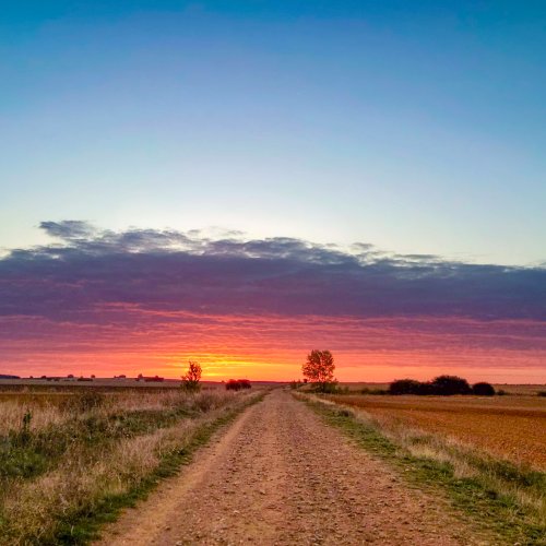
This camino has less asphalt than any I have walked, except maybe the Madrid.

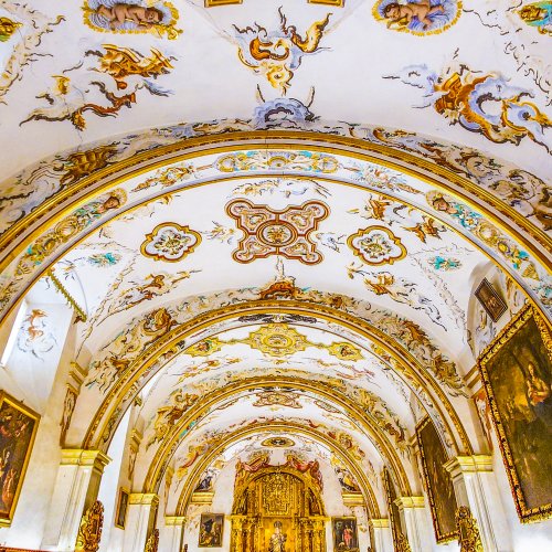
There are some fabulous detours/stops that enhanced our experience quite a bit (rest day in Cuenca, Noheda Roman ruins, taxi to San Baudelio (though you could work out a walking option and stop in Berlanga de Duero), Clunia Roman ruins, Sad Hill, Desfiladero de la Yecla, Monasterio de San Pedro de Arlanza, church in Quintanilla de las Viñas. We did not make it to Tiermes, though @Bachibouzouk has raved about his decision to go there.

Movistar has better coverage. I had Vodafone and did not have coverage in Monteagudo de Salinas, Viana de Mondejar, Caracena, Quintanarraya and maybe one or two other places (locals could frequently point me to one specific spot in or near town that could pick up Vodafone, though). In spite of that, I will probably continue to use Vodafone because of the price and the ease (Vodafone employees will take our your home sim card and put in a new one; renewal was a snap and online).

Starting in Villajoyosa was a great decision for me and @Krimpa, who walked with me/us till Cuenca. Those first three days were in the mountains, lots of off-road. It adds a day to the Lana maybe, because we went Villajoyosa - Relleu - Torremanzanas - Onil - Caudete, whereas the “normal” Lana would be Alicante - Novelda - Sax- Caudete. And our Onil-Caudete day was quite the long penitential day, 38 km, which we could have broken up in Villena, so that might add yet another day to the Villajoyosa alternative.

Alcalá del Júcar is a touristy place, but there’s no denying its spectacular setting. Stopping there after 18 km allowed for an afternoon walk of about 15 km without backpack, further along the river, which I totally enjoyed.

Private accommodation is usually available and may range from basic pensión to upscale hotel. I went to private places when possible. But there was a stretch where that was not possible, and I was very thankful for the albergues. Villaconejos - Salmerón - Viana de Mondéjar - Cifuentes. All of them were perfectly fine, and we had some great camino experiences (many have described the bodega visit in Villaconejos, for an 11 pm bedrime; Salmerón’s albergue is allegedly in an Inquisition prison but equipped with everything you need; stopping in Viana de Mondejar allowed for an afternoon ascent to the Tetas, without backpack, which I would describe as exhilirating — there may be signs saying the trail is closed because of a rockslide, but it is perfectly and safely passable; Cifuentes was a hard nut to crack despite having been in touch with the ayuntamiento the Friday before arrival, and in the end the mayor himself had to come out to show us where the keys were hidden). We also stayed in the albergue in Quintanarraya, in order to make our visit to Clunia, and it too was very adequate for two old peregrinas. The current mayor enjoys checking in peregrinos and seems happy with the situation, but I know he has told others that the days of this service may be on the wane. With the closure of two private places in Alcubilla de la Avellaneda, this closure would complicate things a bit.

The towns of Trillo and Cifuentes were both full with workers who come twice a year to shut down and check up on the nuclear power plant. If you coincide with those schedules, you will find nothing for many many kms. But the public albergues are there.

I would not walk this camino without GPS tracks. If you look at my tracks (all on wikiloc under peregrina2000), you will see multiple times when I continued walking till wikiloc beeped at me and I backtracked to find the trail. Not having to walk looking at the GPS was very important to me.

In two situations particularly, when we were trying to take an off-road route from Peñacoba to the Desfiladero de Yecla and then from Santo Domingo to Sad Hill, our wikiloc tracks gave us some hiccups. Especially in the first case, where the only off-road wikiloc track I could find wound up having a short section of straight lines, indicating that the GPS had not been recording the member’s movements. We essentially lost the trail and thanks to C Clearly’s skills with contour lines, we navigated safely and without too many complications down to the start of the desfiladero. For the Sad Hill detour, instead of following the nice trail that the municipality has set up, we took an off-road wikiloc option that involved crawling through a hole in a barbed wire fence and heaving our packs over the fence. This just emphasizes maybe the obvious point that if you are going to navigate an off-camino track, make sure to try to have options, or to be in touch with the author of the track for advice. I did this on several occasions, but not in these two instances.

Happy to answer questions and reverberate more. C Clearly will have much to add to this thread, I think.
 
Last edited:
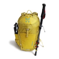
Technical backpack for day trips with backpack cover and internal compartment for the hydration bladder. Ideal daypack for excursions where we need a medium capacity backpack. The back with Air Flow System creates large air channels that will keep our back as cool as possible.

€83,-
@C clearly and I walked into Burgos last Saturday after the Lana (me) and the Requena/Lana (her). We talked about starting a thread with overall observations on the Lana (and I think she plans to do something similar on her Requena from Valencia to Monteagudo de las Salinas, where we met up) — reflections, specific tips, etc. This will not be another “detailed planning thread,” since the two we have are still quite current. See Alicante to Cuenca and Cuenca to Burgos.

In no particular order, here are some takeaways. Written by a jet-lagged peregrina unable to sleep.

This camino has less asphalt than any I have walked, except maybe the Madrid.

There are some fabulous detours/stops that enhanced our experience quite a bit (rest day in Cuenca, Noheda Roman ruins, taxi to San Baudelio (though you could work out a walking option and stop in Berlanga de Duero), Clunia Roman ruins, Sad Hill, Desfiladero de la Yecla, Monasterio de San Pedro de Arlanza, church in Quintanilla de las Viñas. We did not make it to Tiermes, though @Bachibouzouk has raved about his decision to go there.

Movistar has better coverage. I had Vodafone and did not have coverage in Monteagudo de Salinas, Viana de Mondejar, Caracena, Quintanarraya and maybe one or two other places (locals could frequently point me to one specific spot in or near town that could pick up Vodafone, though). In spite of that, I will probably continue to use Vodafone because of the price and the ease (Vodafone employees will take our your home sim card and put in a new one; renewal was a snap and online).

Starting in Villajoyosa was a great decision for me and @Krimpa, who walked with me/us till Cuenca. Those first three days were in the mountains, lots of off-road. It adds a day to the Lana maybe, because we went Villajoyosa - Relleu - Torremanzanas - Onil - Caudete, whereas the “normal” Lana would be Alicante - Novelda - Sax- Caudete. And our Onil-Caudete day was quite the long penitential day, 38 km, which we could have broken up in Villena, so that might add yet another day to the Villajoyosa alternative.

Alcalá del Júcar is a touristy place, but there’s no denying its spectacular setting. Stopping there after 18 km allowed for an afternoon walk of about 15 km without backpack, further along the river, which I totally enjoyed.

Private accommodation is usually available and may range from basic pensión to upscale hotel. I went to private places when possible. But there was a stretch where that was not possible, and I was very thankful for the albergues. Villaconejos - Salmerón - Viana de Mondéjar - Cifuentes. All of them were perfectly fine, and we had some great camino experiences (many have described the bodega visit in Villaconejos, for an 11 pm bedrime; Salmerón’s albergue is allegedly in an Inquisition prison but equipped with everything you need; stopping in Viana de Mondejar allowed for an afternoon ascent to the Tetas, without backpack, which I would describe as exhilirating — there may be signs saying the trail is closed because of a rockslide, but it is perfectly and safely passable; Cifuentes was a hard nut to crack despite having been in touch with the ayuntamiento the Friday before arrival, and in the end the mayor himself had to come out to show us where the keys were hidden). We also stayed in the albergue in Quintanarraya, in order to make our visit to Noheda, and it too was very adequate for two old peregrinas. The current mayor enjoys checking in peregrinos and seems happy with the situation, but I know he has told others that the days of this service may be on the wane. With the closure of two private places in Alcubilla de la Avellaneda, this closure would complicate things a bit.

The towns of Trillo and Cifuentes were both full with workers who come twice a year to shut down and check up on the nuclear power plant. If you coincide with those schedules, you will find nothing for many many kms. But the public albergues are there.

I would not walk this camino without GPS tracks. If you look at my tracks (all on wikiloc under peregrina2000), you will see multiple times when I continued walking till wikiloc beeped at me and I backtracked to find the trail. Not having to walk looking at the GPS was very important to me.

In two situations particularly, when we were trying to take an off-road route from Peñacoba to the Desfiladero de Yecla and then from Santo Domingo to Sad Hill, our wikiloc tracks gave us some hiccups. Especially in the first case, where the only off-road wikiloc track I could find wound up having a short section of straight lines, indicating that the GPS had not been recording the member’s movements. We essentially lost the trail and thanks to C Clearly’s skills with contour lines, we navigated safely and without too many complications down to the start of the desfiladero. For the Sad Hill detour, instead of following the nice trail that the municipality has set up, we took an off-road wikiloc option that involved crawling through a hole in a barbed wire fence and heaving our packs over the fence. This just emphasizes maybe the obvious point that if you are going to navigate an off-camino track, make sure to try to have options, or to be in touch with the author of the track for advice. I did this on several occasions, but not in these two instances.

Happy to answer questions and reverberate more. C Clearly will have much to add to this thread, I think.
Thank you, this is great. I think this might be my next camino, probably in October so keep the information coming please ! Susan
 
Thank you Laurie! Off on Sunday and plan to meet the Alicante amigos on Tuesday and set off on Wednesday… Your ‘Penguin’ blog was much appreciated and enjoyed and I am grateful to know your Wikiloc handle now that I have begun to master that app.
ps perhaps you could give the link to your alternative blog for others…
 
Get a spanish phone number with Airalo. eSim, so no physical SIM card. Easy to use app to add more funds if needed.
ps perhaps you could give the link to your alternative blog for others…

I don’t post much on the forum while I’m walking, because most of my family and friends are not on it. So, like a lot of us, I do a Find Penguins blog.

and I am grateful to know your Wikiloc handle now that I have begun to master that app.
Just two heads up:
My tracks from Peñacoba to the beginning of the desfiladero come with a warning. A road route is available and may be recommended, but it won’t be as much of an adventure!

My tracks to Sad Hill involved crawling through a barbed wire fence, so I would take the town’s route to Sad Hill, but from there to San Pedro de Arlanza and on to Covarrubias, the tracks are fine.
 
Thank you, this is great. I think this might be my next camino, probably in October so keep the information coming please ! Susan
Dear Susan,

I admire you! Yes please undertake this Camino!! Even after my contretemps yesterday, I rate this one as a ‘tops’ and I already plan to do it again. I would probably start in Vilajoyosa UNLESS the Alicante St Johns festival was on! Alicante was great for museums/street life/swimming but the first few days were a little dismal. I would take an easy first day and stay in Orito which also gives you an easy second day to get your body/backpack time to settle in.

When to go is probably the main ‘issue’ but no wish to get ‘bogged down here’ ( lodo is the Spanish word for mud, I believe). I personally would probably go for autumn as it reflects my disposition…
 
I don’t post much on the forum while I’m walking, because most of my family and friends are not on it. So, like a lot of us, I do a Find Penguins blog.


Just two heads up:
My tracks from Peñacoba to the beginning of the desfiladero come with a warning. A road route is available and may be recommended, but it won’t be as much of an adventure!

My tracks to Sad Hill involved crawling through a barbed wire fence, so I would take the town’s route to Sad Hill, but from there to San Pedro de Arlanza and on to Covarrubias, the tracks are fine.
Beautifully concentrated and precise. I can always rely on @ peregrina2000 for advice and clarity of peregrination.

However, this is actually my first ‘outing’ with subscribed Wikiloc (other makes ARE available as the bedevilled BBC insists on pointing out!)

Yesterday and @Cclearly timely observations on contour lines shows me that I need revelatory instructions.

Any chance of a moderator starting a ‘how to’ thread.. or have I yet again, missed something?!
 
Down bag (90/10 duvet) of 700 fills with 180 g (6.34 ounces) of filling. Mummy-shaped structure, ideal when you are looking for lightness with great heating performance.

€149,-
With a date of March-April of this year I think you can be fairly confident that the albergue info is up to date. I only stayed in 4 or 5 albergues (May 2023) so you will have lots of fallback to private places if needed. As the notes in that document say, advance notice is a really good idea. Not because things will fill up but because people may need to make arrangements to get you the key.
 
@C clearly and I walked into Burgos last Saturday after the Lana (me) and the Requena/Lana (her). We talked about starting a thread with overall observations on the Lana (and I think she plans to do something similar on her Requena from Valencia to Monteagudo de las Salinas, where we met up) — reflections, specific tips, etc. This will not be another “detailed planning thread,” since the two we have are still quite current. See Alicante to Cuenca and Cuenca to Burgos.

In no particular order, here are some takeaways. Written by a jet-lagged peregrina unable to sleep.

This camino has less asphalt than any I have walked, except maybe the Madrid.

There are some fabulous detours/stops that enhanced our experience quite a bit (rest day in Cuenca, Noheda Roman ruins, taxi to San Baudelio (though you could work out a walking option and stop in Berlanga de Duero), Clunia Roman ruins, Sad Hill, Desfiladero de la Yecla, Monasterio de San Pedro de Arlanza, church in Quintanilla de las Viñas. We did not make it to Tiermes, though @Bachibouzouk has raved about his decision to go there.

Movistar has better coverage. I had Vodafone and did not have coverage in Monteagudo de Salinas, Viana de Mondejar, Caracena, Quintanarraya and maybe one or two other places (locals could frequently point me to one specific spot in or near town that could pick up Vodafone, though). In spite of that, I will probably continue to use Vodafone because of the price and the ease (Vodafone employees will take our your home sim card and put in a new one; renewal was a snap and online).

Starting in Villajoyosa was a great decision for me and @Krimpa, who walked with me/us till Cuenca. Those first three days were in the mountains, lots of off-road. It adds a day to the Lana maybe, because we went Villajoyosa - Relleu - Torremanzanas - Onil - Caudete, whereas the “normal” Lana would be Alicante - Novelda - Sax- Caudete. And our Onil-Caudete day was quite the long penitential day, 38 km, which we could have broken up in Villena, so that might add yet another day to the Villajoyosa alternative.

Alcalá del Júcar is a touristy place, but there’s no denying its spectacular setting. Stopping there after 18 km allowed for an afternoon walk of about 15 km without backpack, further along the river, which I totally enjoyed.

Private accommodation is usually available and may range from basic pensión to upscale hotel. I went to private places when possible. But there was a stretch where that was not possible, and I was very thankful for the albergues. Villaconejos - Salmerón - Viana de Mondéjar - Cifuentes. All of them were perfectly fine, and we had some great camino experiences (many have described the bodega visit in Villaconejos, for an 11 pm bedrime; Salmerón’s albergue is allegedly in an Inquisition prison but equipped with everything you need; stopping in Viana de Mondejar allowed for an afternoon ascent to the Tetas, without backpack, which I would describe as exhilirating — there may be signs saying the trail is closed because of a rockslide, but it is perfectly and safely passable; Cifuentes was a hard nut to crack despite having been in touch with the ayuntamiento the Friday before arrival, and in the end the mayor himself had to come out to show us where the keys were hidden). We also stayed in the albergue in Quintanarraya, in order to make our visit to Clunia, and it too was very adequate for two old peregrinas. The current mayor enjoys checking in peregrinos and seems happy with the situation, but I know he has told others that the days of this service may be on the wane. With the closure of two private places in Alcubilla de la Avellaneda, this closure would complicate things a bit.

The towns of Trillo and Cifuentes were both full with workers who come twice a year to shut down and check up on the nuclear power plant. If you coincide with those schedules, you will find nothing for many many kms. But the public albergues are there.

I would not walk this camino without GPS tracks. If you look at my tracks (all on wikiloc under peregrina2000), you will see multiple times when I continued walking till wikiloc beeped at me and I backtracked to find the trail. Not having to walk looking at the GPS was very important to me.

In two situations particularly, when we were trying to take an off-road route from Peñacoba to the Desfiladero de Yecla and then from Santo Domingo to Sad Hill, our wikiloc tracks gave us some hiccups. Especially in the first case, where the only off-road wikiloc track I could find wound up having a short section of straight lines, indicating that the GPS had not been recording the member’s movements. We essentially lost the trail and thanks to C Clearly’s skills with contour lines, we navigated safely and without too many complications down to the start of the desfiladero. For the Sad Hill detour, instead of following the nice trail that the municipality has set up, we took an off-road wikiloc option that involved crawling through a hole in a barbed wire fence and heaving our packs over the fence. This just emphasizes maybe the obvious point that if you are going to navigate an off-camino track, make sure to try to have options, or to be in touch with the author of the track for advice. I did this on several occasions, but not in these two instances.

Happy to answer questions and reverberate more. C Clearly will have much to add to this thread, I think.
"This camino has less asphalt than any I have walked, except maybe the Madrid."
We have been home from walking the Mozarabe for a week now, and it is time to begin planning the next walk. I think the Lana is it!
 
€2,-/day will present your project to thousands of visitors each day. All interested in the Camino de Santiago.

❓How to ask a question

How to post a new question on the Camino Forum.

Forum Rules

Forum Rules

Camino Updates on YouTube

Camino Conversations

Most downloaded Resources

This site is run by Ivar at

in Santiago de Compostela.
This site participates in the Amazon Affiliate program, designed to provide a means for Ivar to earn fees by linking to Amazon
Official Camino Passport (Credential) | 2024 Camino Guides
Back
Top