kptorrahk
New Member
- Time of past OR future Camino
- First: Camino del Norte/Primitivo/Finisterre 2005
People that have encountered me on the Camino have probably at some point got to know about my utter dislike for asphalt. As opposed to some puritans I like to adapt my camino if it means nicer paths in nature and less paved roads. With that mindset I looked ahead towards the stage from either Xunquiera de Ambia or Allariz to Ourense and I just couldn´t believe that Gronze offered only a stage describing the entrance into the city as ´the toll you have to pay when we get close to a city´. I was in no mind to pay that toll. If entering Santiago is such a pleasant experience, why can´t we enter Ourense in the same way?
No matter if you´re doing the Laza or Verin Variant, the route I offer you starts just after the point where the routes converge, several kilometers before the much dreaded San Cibrao poligono (business park). It avoids this horrible stretch completely and offers an entrance into Ourense that will not only be much more enjoyable but actually leave a lasting impression of your welcome to the city. Welcome to the ´Barbana variant´, named after the river we keep encountering on this stretch.
Be mindful that this route is 3,7km longer than the normal route, which isn´t nothing. If you´re pressed for time or you´d rather just get to Ourense, you may still walk the normal way. But you will miss a beautiful stretch of camino.
Our route starts 1,4km after Pereira, just after the tunnel under the railway track. At a crossroads we find a restaurant on the left called ´Bbikalla Park´. The normal route proceeds alongside the OU-0102 road, but we take a left turn just before the restaurant, Rua o Rego.
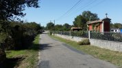
We follow this countryside road for 1,5 km until we get to a T-split. Here we continue straight-left, over a small bridge, into the village of Venda Nova. As soon as we can, we turn right, skirting the side of the village on a narrow countryside road in between a stone wall and corn fields. The road ends in a tunnel under the railway, bringing us to the OU-320 road. We turn right. We encounter the village of Veredo (no facilities).
Unfortunately we have to follow this two-lane road for 700m, the last bit not having a side walk, so take caution. Once the road starts to take a right turn, just before a stone bridge, we take a left (the sign says Segueiros). Very quickly a dirt track appears on our right, taking us down alongside the Molino de Castroverde, an old mill, to the Barbana river.
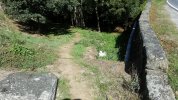
We leave the paved roads behind and follow the winding path with yellow-white markings through the forest (occasionally sign posted with PR-32910-OU). At one point we cross a local road but we keep going straight, initially following the river bank, but then increasingly moving away from it until we´re back on the OU-320. Luckily we only have to follow it several hundred meters until we take a left turn towards a sports complex (Ximnasio Municipal Ponte Noalla). When it is open we can simply traverse the grounds and leave on the other end. In case it is closed a dirt track on the right skirts the perimeter, also leaving you on the other side. The narrow road once again crosses the Rio Barbana and then crossing the infamous N-525 over the guard rails brings us into the village of Ponte Noalla.
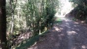
We follow the Camiño dos Campos up, keeping right, until we reach Rua Noalla de Abaixo, where we take a left. In between vinveyards and the N-525 the road takes us down to an underpass under the N-525. On the other end a surprisingly lovely valley awaits us. Directly after the tunnel we have the option to follow the road into the tiny hamlet of Noalla, or take a stone staired path down to the river. I opted for the latter. The path runs through the forest along the rocky river and crosses the river over a cement bridge. We now enter the hamlet of Veiga surrounded by vineyards.
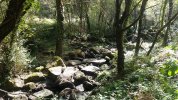
We skirt the farm towards the right and then keep the railway tracks on our right until a slightly elevated underpass appears on our right where we pass through. We take a left onto the Estrada da Veiga. We follow this dirt track up the hill, moving away from the railway amongst forest and low trees. The path takes a right turn and then comes to a split where we take a left. We follow the now sandy track to another double split where we need to pay attention. At the fourway split we keep right and at the next split we take a left onto an even smaller path called Camiño do Gato (The Cat´s Trail); eventually it turns into a narrow trail in between a high fence and a wall leading towards the Rua Santa Agueda (NOTE: at the time of my passing here works were going on on the highspeed trainline but the road itself is still accessible). We follow this road right along the railway to the OU-105 where we take a left under the railway towards Seixalbo.
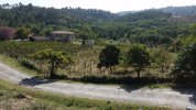
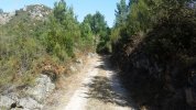
At this point we rejoin the official camino but bear with me because the alternative road doesn´t stop here. We follow the camino signs into Seixalbo (a range of picturesque bars). At the cross however we turn left onto Rua Nova following it to the end. Here we turn right onto the Camiño do Golfo (The Dishonest Road), which starts out as a paved/cemented road amongst houses but further down abruptly transforms into a narrow rocky path, then sandy path down the slope, allowing us our first panorama of Ourense. Just meters before we return to a paved road, we turn left, continuing to follow a sandy track, skirting and then crossing the Rio Barbana once again. It is here we turn right onto the Rua Presa. Among orchards and vineyards we reach a bridge. We keep left now following a pleasant footpath right alongside the river. At the end we cross the busy OU-0517.
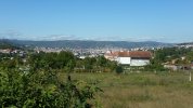
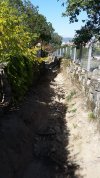
Our final stretch has started! This consists of a riverside park that follows the course of the Rio Barbana as it skirts the city on its left side. We can either walk on the left or right bank and switch several times using bridges and walkways. We will meet locals running, strolling or cycling and all the time the pleasant sound of the stream accompanies us. After several kilometers we get to a split where a coalstained bridge faces us and a white house on our left. It is here that we take leave of the river and follow the coalstained bridge (OU-540) up into the city on the Rua Ponte Codesal, eventually joining the OU-540. We keep walking up until we reach the busy Rua do Progreso. Here we take a left but very soon, at the petrol station, we take the high walled street on its right. Following this road straight we eventually reach the Praza Maior, the end of our stage!
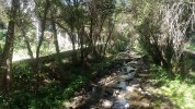
Here is the broad outline on google maps, but beware that some of the offroad tracks aren´t visible because maps doesn´t recognise them: https://goo.gl/maps/F5a3wkEs51Az6Vfx7
No matter if you´re doing the Laza or Verin Variant, the route I offer you starts just after the point where the routes converge, several kilometers before the much dreaded San Cibrao poligono (business park). It avoids this horrible stretch completely and offers an entrance into Ourense that will not only be much more enjoyable but actually leave a lasting impression of your welcome to the city. Welcome to the ´Barbana variant´, named after the river we keep encountering on this stretch.
Be mindful that this route is 3,7km longer than the normal route, which isn´t nothing. If you´re pressed for time or you´d rather just get to Ourense, you may still walk the normal way. But you will miss a beautiful stretch of camino.
Our route starts 1,4km after Pereira, just after the tunnel under the railway track. At a crossroads we find a restaurant on the left called ´Bbikalla Park´. The normal route proceeds alongside the OU-0102 road, but we take a left turn just before the restaurant, Rua o Rego.

We follow this countryside road for 1,5 km until we get to a T-split. Here we continue straight-left, over a small bridge, into the village of Venda Nova. As soon as we can, we turn right, skirting the side of the village on a narrow countryside road in between a stone wall and corn fields. The road ends in a tunnel under the railway, bringing us to the OU-320 road. We turn right. We encounter the village of Veredo (no facilities).
Unfortunately we have to follow this two-lane road for 700m, the last bit not having a side walk, so take caution. Once the road starts to take a right turn, just before a stone bridge, we take a left (the sign says Segueiros). Very quickly a dirt track appears on our right, taking us down alongside the Molino de Castroverde, an old mill, to the Barbana river.

We leave the paved roads behind and follow the winding path with yellow-white markings through the forest (occasionally sign posted with PR-32910-OU). At one point we cross a local road but we keep going straight, initially following the river bank, but then increasingly moving away from it until we´re back on the OU-320. Luckily we only have to follow it several hundred meters until we take a left turn towards a sports complex (Ximnasio Municipal Ponte Noalla). When it is open we can simply traverse the grounds and leave on the other end. In case it is closed a dirt track on the right skirts the perimeter, also leaving you on the other side. The narrow road once again crosses the Rio Barbana and then crossing the infamous N-525 over the guard rails brings us into the village of Ponte Noalla.

We follow the Camiño dos Campos up, keeping right, until we reach Rua Noalla de Abaixo, where we take a left. In between vinveyards and the N-525 the road takes us down to an underpass under the N-525. On the other end a surprisingly lovely valley awaits us. Directly after the tunnel we have the option to follow the road into the tiny hamlet of Noalla, or take a stone staired path down to the river. I opted for the latter. The path runs through the forest along the rocky river and crosses the river over a cement bridge. We now enter the hamlet of Veiga surrounded by vineyards.

We skirt the farm towards the right and then keep the railway tracks on our right until a slightly elevated underpass appears on our right where we pass through. We take a left onto the Estrada da Veiga. We follow this dirt track up the hill, moving away from the railway amongst forest and low trees. The path takes a right turn and then comes to a split where we take a left. We follow the now sandy track to another double split where we need to pay attention. At the fourway split we keep right and at the next split we take a left onto an even smaller path called Camiño do Gato (The Cat´s Trail); eventually it turns into a narrow trail in between a high fence and a wall leading towards the Rua Santa Agueda (NOTE: at the time of my passing here works were going on on the highspeed trainline but the road itself is still accessible). We follow this road right along the railway to the OU-105 where we take a left under the railway towards Seixalbo.


At this point we rejoin the official camino but bear with me because the alternative road doesn´t stop here. We follow the camino signs into Seixalbo (a range of picturesque bars). At the cross however we turn left onto Rua Nova following it to the end. Here we turn right onto the Camiño do Golfo (The Dishonest Road), which starts out as a paved/cemented road amongst houses but further down abruptly transforms into a narrow rocky path, then sandy path down the slope, allowing us our first panorama of Ourense. Just meters before we return to a paved road, we turn left, continuing to follow a sandy track, skirting and then crossing the Rio Barbana once again. It is here we turn right onto the Rua Presa. Among orchards and vineyards we reach a bridge. We keep left now following a pleasant footpath right alongside the river. At the end we cross the busy OU-0517.


Our final stretch has started! This consists of a riverside park that follows the course of the Rio Barbana as it skirts the city on its left side. We can either walk on the left or right bank and switch several times using bridges and walkways. We will meet locals running, strolling or cycling and all the time the pleasant sound of the stream accompanies us. After several kilometers we get to a split where a coalstained bridge faces us and a white house on our left. It is here that we take leave of the river and follow the coalstained bridge (OU-540) up into the city on the Rua Ponte Codesal, eventually joining the OU-540. We keep walking up until we reach the busy Rua do Progreso. Here we take a left but very soon, at the petrol station, we take the high walled street on its right. Following this road straight we eventually reach the Praza Maior, the end of our stage!

Here is the broad outline on google maps, but beware that some of the offroad tracks aren´t visible because maps doesn´t recognise them: https://goo.gl/maps/F5a3wkEs51Az6Vfx7
Last edited:


