• For 2024 Pilgrims: €50,- donation = 1 year with no ads on the forum + 90% off any 2024 Guide. More here.
    (Discount code sent to you by Private Message after your donation)

Search 69,459 Camino Questions

Combined Camino.... Norte - Lebananiego - Vadienese - Olivado - Salvador - Primitivo

imac

New Member
Time of past OR future Camino
April 24
Just wondered if anyone has done this route or if anyone has thoughts

Looking to start around 7 April and to take 5 weeks ( total distance is 773km)

For background I'm an experienced hiker (Pacific Crest Trail) and orientated towards hiking/scenery than a strong social scene - many thanks

1. Camino Norte

Pobena (20k west of Bilbao) to Santander 86k
Santander to San Vincente de Barquera 60k

2. Camino Lebaniego

San Vincente de Barquera to Santo Toribo 73k

3. Ruta Vadiniense

Santo Toribo - Cistierna 93k

4. Camino Olivado

Cistierna - La Robla 51k

5.Camino de San Salvador

La Robla - Oviedo 93k

6. Camino Primitivo

Oviedo - Santiago 320k
 
Very light, comfortable and compressible poncho. Specially designed for protection against water for any activity.

Our Atmospheric H30 poncho offers lightness and waterproofness. Easily compressible and made with our Waterproof fabric, its heat-sealed interior seams guarantee its waterproofness. Includes carrying bag.

€60,-
Sounds like a good plan. There's a variant from the Primitivo (the green route?) that you might like. Others who have walked it will chime in for sure.
 
Looks like good route. You’ll get some “camino” and some bits where few pilgrims tread. The green route @trecile mentions is the Camino Verde from Lugo via Friol to Sobrado dos Monxes and would rejoin you with the Norte. A worthy inclusion
 
The focus is on reducing the risk of failure through being well prepared. 2nd ed.
Looks good. The Vadinense is probably the most rugged route in Spain but if you´ve done the PCT, that won´t be a problem. Accommodation might be though; be prepared to do some booking and a few hotels. It is stunningly beautiful. We´ve done most of your itinerary but not in one go. Good luck and buen camino.
 
Sounds like a good plan. There's a variant from the Primitivo (the green route?) that you might like. Others who have walked it will chime in for sure.
You'd be right there! Loved the Verde
- start's just outside Lugo, which is a must see (consider making it a zero) but because I haven't walked the last few days of the Primitivo I can't compare that to the alternative days I spent on the Norte. Judging by my friends comments - those who continued on the Primitivo - I didn't miss much but then the last couple of days on the Norte are pretty boring too.
The two days on the Verde were very enjoyable - and quiet - although as I wrote on my thread at the time at the end of the last day don't follow the 'official' part, go through the gate on the left with the big cross - if that variant isn't showing on mappy.cz you can easily see the way with Google Maps - it's pretty straightforward and apparently much more pleasant than the stretch alongside the main road on the Norte.
 
Down bag (90/10 duvet) of 700 fills with 180 g (6.34 ounces) of filling. Mummy-shaped structure, ideal when you are looking for lightness with great heating performance.

€149,-
I used this excellent info to find my way:
Hi Peter, if you're looking to avoid the crush after joining the Frances at Melide and all the road walking on the Primitivo after Lugo, the Camino Verde is absolutely the way to go. If you add the Norte Variant so that you join the Frances at the airport, it's even better.

Of all the days we've spent walking our four Caminos, the two days of the Verde were the absolute best! It was so beautiful. We walked the Verde on May 29 and 30, so it was still very spring like, especially after the week of rains. The grass was tall, the flowers in full bloom, the trees full of leaves; it was beautiful. There were sections along the second day where the route takes you through old abandoned farm access roads where at times a weed whacker would have been helpful to make our way.

Yes, the elevated walkway has been repaired.

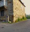
Day 1 to Friol is very well marked with green arrows. We never got lost, but there was an intersection roughly halfway through the day where the arrows pointed both right and left. We ended up going right and it was just fine. There's very little road walking, but where you had to walk along the road, there was very little traffic. The exception is at the end. You walk out of the woods and have roughly two miles of road walking to get to Friol. While we didn't stay here, the food at Casa Benigno in Friol was very good, and the service was excellent.

Leaving Friol on day two was a little confusing since we tried to follow the PDF write up. The write up was, with apologies to the author, far too detailed. For example, it says within the first mile to cross a wooden bridge and "bear right", which gave us the impression that the path divided and we should take the right. There was no divided path. The path simply goes right. A hundred meters further the path comes to a T with no green arrow that we could find. We thought this was where we should bear right, but it didn't make sense for leaving town, so we correctly went left. We only saw two other pilgrims on these two days. They went right at the T and got lost. They got lost several times on day 2, but mostly from not paying attention. The green arrows on the black asphalt can be difficult to see at times, plus some vegetation has grown over some arrows.

Once you merge with the Norte, it's mostly walking along a path beside a very busy road. In a few miles the way takes you away from the busy road and you walk along a suburban road with houses on the left and right until you arrive at Sobrado. We stayed at the very nice Pension Via Sacre. They have one of the best breakfasts that I've seen on Camino, and the café next door does a great pilgrim meal.

The Norte Variant leaves the Norte just past A Gandara and is the right way if you're looking to avoid the Frances. Lots of road walking, but mostly on small secondary roads. I don't think we saw more than four cars pass by us on this section. There's roughly four miles along a road with heavy traffic, but there's a gravel service road alongside that is easy walking, but zero shade. Then you cross a bridge over the A-54 right at the end of the runway and join the Frances.

Do note that there is zero support along the Verde. No cafes. No gas stations. Nothing at all, so you have to bring all the food and water you'll need.
Thanks again, @Telelama !
 
I did the Verde 2 years ago and while it was very enjoyable be aware parts of it were nearly impassable. At that time there were disputes over the ownership/maintenance of the trail and so the wooden walkways and bridges were in terrible shape. You could get through by doing some creative scrambling.
 
Looks good. The Vadinense is probably the most rugged route in Spain but if you´ve done the PCT, that won´t be a problem. Accommodation might be though; be prepared to do some booking and a few hotels. It is stunningly beautiful. We´ve done most of your itinerary but not in one go. Good luck and buen camino.
Thanks - I'm considering taking a tent as I'd like to do some wild camping - I'd like the flexibility to not always have a fixed destination each day as on the PCT...
 
The 2024 Camino guides will be coming out little by little. Here is a collection of the ones that are out so far.
You'd be right there! Loved the Verde
- start's just outside Lugo, which is a must see (consider making it a zero) but because I haven't walked the last few days of the Primitivo I can't compare that to the alternative days I spent on the Norte. Judging by my friends comments - those who continued on the Primitivo - I didn't miss much but then the last couple of days on the Norte are pretty boring too.
The two days on the Verde were very enjoyable - and quiet - although as I wrote on my thread at the time at the end of the last day don't follow the 'official' part, go through the gate on the left with the big cross - if that variant isn't showing on mappy.cz you can easily see the way with Google Maps - it's pretty straightforward and apparently much more pleasant than the stretch alongside the main road on the Norte.
Technical point - mapy.cz vs maps.me which I've generally used maps.me but would be interested to know if mapy.cz has advantages for caminos - thanks
 
Did this route with the exception of the Olvidado piece, in September and October. Great route except for the French parts and the rain. The Vadiniense is tough but beautiful but is also expensive because of a lack of albergues over the last few stages. I imagine you are happy to figure it out for yourself.
 
Get a spanish phone number with Airalo. eSim, so no physical SIM card. Easy to use app to add more funds if needed.
I did the Verde 2 years ago and while it was very enjoyable be aware parts of it were nearly impassable. At that time there were disputes over the ownership/maintenance of the trail and so the wooden walkways and bridges were in terrible shape. You could get through by doing some creative scrambling.
Bill, that is definitely no longer the case everything was in excellent condition.
 
Technical point - mapy.cz vs maps.me which I've generally used maps.me but would be interested to know if mapy.cz has advantages for caminos - thanks
Fairpoint - don't know. When I did the Verde I didn't use an app. As I wrote above on camino I don't use an app or a map I simply follow the arrows. Unlike many of you more experienced adventurous Souls all of this (the Camino, not hiking) is very new to me and so far I've only done the Inglès and the Primitivo with the Variant. For the Verde as mentioned I followed the excellent directions given to me here on the forum. The trail was in excellent condition and well marked. 1 mildly confusing part but I found my way regardless.
I've only downloaded mappy.cz since I've returned to Germany. I have to say for following the camino ( unmarked )here in Germany it's been excellent. If a little hard on the battery of my ancient iPhone. But then Google Maps is rough on it too.
 
Get a spanish phone number with Airalo. eSim, so no physical SIM card. Easy to use app to add more funds if needed.
Once on the Norte it's possible to walk all the way to Lavacolla before joining the Francés.
It is easy from Boimorto to walk to Santiago and never see the frances.
 
Last edited by a moderator:
Sorry David, no idea. I followed the instructions I quoted above from @Telelama. If you read that thread it may help you. I had neither guide book or app.
It looks like there are two routes from Lugo to Friol and one of them goes through Boveda. Although it is a couple of km longer than the alternative, that is definitely the one I would recommend. It is certainly worth it to see the Roman/Visigothic structure hiding under the church! It is less of a detour on the Verde than on the regular Primitivo route.
 
The Vadinense is probably the most rugged route in Spain
I strongly disagree with this. There are two places where the difficulty is the equivalent of the Salvador, but the rest is straightforward or actually easy. All of the second half of the Vad is just following the gentle river/valley of the Esla towards Mansilla.
The 8km on the Leb between Cicera and Lebena is mostly a steep narrow path. And the stage up from Potes to Espinama or Fuente De also has steep and narrow parts where it tries to veer off the road. But you can always choose to walk on the road instead, as both are going to the same places.
After Fuente De the path up to the tops is a wide sedate well-kept 4x4 track. The signage at the top is pretty obvious and you are soon back on an actual road for the long descent to Portilla. The only issue I can see would be if there is substantial snowfall.
 
Join our full-service guided tour of the Basque Country and let us pamper you!
Do you turn off onto the Verde before or after the turnoff to Boveda (for those who take that detour)?

When leaving Lugo, you cross the river Minho and follow Rua Fermin Rivera past the tennis courts, swimming pools on your right. As you get past this recreational area, the Primitivo goes left up a hill and the Camino Verde goes right towards the river.

It follows the river for roughly a mile, then it goes left into the hillside and along a beautiful little creek. The Verde is very beautiful, this way is far better than connecting to the Frances in Melide.

In the image below you can see the green arrow pointing right, just below the Primitivo marker.
 

Attachments

  • Camino Verde.jpg
    Camino Verde.jpg
    3.3 MB · Views: 5
Quick notes...yes, the turn off for the Verde was quite easy to see, as above. The Primitivo was still pretty scenic (bucolic/village) up until the last couple of km into Melide, and then again scenic up until you hit the airport.

What you need to know is that wild camping is technically prohibited in the regions of Spain that you're going through. What this means in practicality is the following:

1. Don't be visible from the Camino.
2. Especially on the early parts of the Primitivo, you're likely to be in somebody's cow pasture. There didn't appear to be public land on either side of many parts of the Primitivo. And Spain doesn't have a "right to wander."
3. No fires. I do mean this last most seriously, as the Primitivo suffered from wildfires last year.

Buen Camino.
 
The focus is on reducing the risk of failure through being well prepared. 2nd ed.

Most read last week in this forum

In the Guardian. Interesting "Letters to the Editor..." https://www.theguardian.com/lifeandstyle/2024/apr/18/a-modern-pilgrimages-transformative-power?CMP=Share_AndroidApp_Other

❓How to ask a question

How to post a new question on the Camino Forum.

Similar threads

Forum Rules

Forum Rules

Camino Updates on YouTube

Camino Conversations

Most downloaded Resources

This site is run by Ivar at

in Santiago de Compostela.
This site participates in the Amazon Affiliate program, designed to provide a means for Ivar to earn fees by linking to Amazon
Official Camino Passport (Credential) | 2024 Camino Guides
Back
Top