• Get your Camino Frances Guidebook here.
  • For 2024 Pilgrims: €50,- donation = 1 year with no ads on the forum + 90% off any 2024 Guide. More here.
    (Discount code sent to you by Private Message after your donation)
  • ⚠️ Emergency contact in Spain - Dial 112 and AlertCops app. More on this here.

Search 69,459 Camino Questions

Map Ideas and/or downloads

sdn8tiv

New Member
Time of past OR future Camino
April/May (2016)
Hi All,

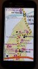
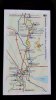
I begin my walk on April 8th. Thus far the only maps I've seen consist of on-line "where to find restaurants, albergues, pharmacias, etc."; all of no interest to me. Then there's The Guide book which has a map so tiny even with my reading glasses it is difficult.

Here's my question:
Has anyone come across a map app I can download that allows me to use GPS? I am alone and not excited by the possibility of being lost. Also, I'd love to walk on parts of the Camino that are an alternate route to being on the highway.

I've looked at the previous 'map' topics but haven't seen on that addresses this specific issue.

Thank you!
 
3rd Edition. More content, training & pack guides avoid common mistakes, bed bugs etc
I don't know what search terms you used, but there is frequent, regular and recent discussion on the topic of the use of GPS on the camino, and similar questions get answered regularly.

WRT you question - yes. Everyone who contributes has their favourites. Look in Google Play or whatever the Apple community uses to distribute their apps.
Comments on your other points:
  1. a GPS won't stop you getting lost. It will tell you where you are when you are lost, which might be equally unhelpful.
  2. very little of the CF is on highways, and it appears to me that only happens when no useful alternative exists.
 
I personally don’t think you’ll require a GPS, as it’s relatively easy to navigate the Camino Frances. Nonetheless, if it provides peace of mind, or as a tool to help you make decisions, then go for it.

The following link provides Google Earth KMZ files of the Camino Frances (and other) Routes for download. http://www.elcaminosantiago.com/Camino-Santiago-Map-Google-Earth-Camino.htm

GPS Files: http://www.elcaminosantiago.com/Camino-Santiago-Map-GPS-Camino.htm

And these two apps, can be useful as well:

1. Camino Pilgrim App (Good as a planning aid): https://play.google.com/store/apps/details?id=de.moemke.android.mycamino

2. Camino de Santiago Guide (Provides basic info along the route): https://play.google.com/store/apps/details?id=com.caminoguide.frances

Both can be useful.

HTHs

Cheers,
Dave
 
3rd Edition. More content, training & pack guides avoid common mistakes, bed bugs etc
The first edition came out in 2003 and has become the go-to-guide for many pilgrims over the years. It is shipping with a Pilgrim Passport (Credential) from the cathedral in Santiago de Compostela.
If you're bring a smartphone then I agree with Dave above that an app would be simplest for your GPS needs. I like Wise Pilgrim but there are plenty so you can browse at the app store or Google Play depending on your platform.

As for seeing maps however, if you're struggling to see a map in a guidebook without glasses, I doubt things are going to be better with a GPS screen or smartphone screen. I don't know which guidebook you've got but I've found the Brierley maps the most inclusive for alternate routes. I'm sure there are others however. The other plus is that the maps in his guidebook are big enough that you can hopefully have a quick check on things without pulling out the glasses.

Last thought: You need to work pretty hard to get lost on the CF. It's really well marked everywhere including cities along the way. Plus, since this is a special holy year, there will be plenty of people around you to help you get found :D

Enjoy your time and Buen Camino
Jordon
 
I got the Brierly maps for my Kindle and also have trouble reading them. A waste of money.
 
I found scanned versions of these maps, which you can zoom in and out off on your device. I personally don’t use them to any real extent. However, the night before the next leg of the journey, I will have a peek at them to see the elevations of that day’s journey.
 
Last edited by a moderator:
The 2024 Camino guides will be coming out little by little. Here is a collection of the ones that are out so far.
I got the Brierly maps for my Kindle and also have trouble reading them. A waste of money.
With my eyes too I have trouble reading the Kindle Brierley maps without my reading glasses. But - even last trip with my paper Brierley (I just took the portion I needed through Burgos and had it spiral bound) I needed my reading glasses to read it too. Did you download a sample before you bought? I did so I knew what the quality was going to be.
 
I too, really, really like the Wise Guides. The problem I have is that they exist for so many routes, but not the Camino from Madrid. I do realize that this route is not as ancient as the others, but still, is is a viable route, is recognized as a formal Camino and an increasing number of people do walk it.

My situation is that I am leaving next Monday (only 6 days!) to fly into Madrid, and to walk to Santiago de Compostela from there. I do have the very good CSJ Guide to the Camino de Madrid, authored by our own Johnnie Walker. It does need some refreshing and I agreed to provide input to the next edition of this popular guide where possible from my direct, current observations.

But, I would have liked something better and usable on my iPhone. I follow the arrows each day, all day. But, I do like to know as much about where I am and where I am about to be, as possible.

I do wish the Wise Guide folks would undertake this as a new version.

I hope this helps.
 
New Original Camino Gear Designed Especially with The Modern Peregrino In Mind!
Device specifications
In my experience the display of a smart phone is just not large enough for any map. Put it another way, in most cases you cannot see enough of the area for it to be useful.

A tablet with a 10" screen seems to be about the minimum, although users of 7" screens may be content with their lot.

Map display alternatives
There are two principal ways for maps to be stored.
1) Raster (or pixel) graphics
This method uses a fixed image (called a tile) of the area to be displayed. Think of JPG style image files. As there can be up to 17 zoom levels these display methods require an image for each level. This can amount to a lot of images and a tremendous amount of storage space required for even a limited area of the worlds surface. Its a long time since I used raster graphic maps: I recoiled from them because of both the storage space required and the extremely long times needed to down load the tiles every time an area was updated.
2) Vector graphics
This method stores a description of the various parts of a map to be displayed including the zoom level at which it will be displayed. Detail can be down to individual buildings and their name/purpose. I can update the several regions of Spain the Camino traverses in about 10 minutes.

Mapping apps - Android (my only experience)
I have been using OSMAnd+ for several years. It is regularly updated. And I have been able to assimilate the new features as they come along. I find it to be stable, but like any apps it has its way of doing things.
I have heard some say it is too complicated and suggest other vector graphic type apps. My take is these apps are more recent offerings and that they are likely to develop the features found in OSMAnd+ as time goes by. There is also OSMAnd (no plus) with, I understand, fewer features.

As with all apps, it is horse for courses.
 
I have a Samsung Galaxy S6 and my JPEG map images are rather easy to shrink/expand and navigate through. The trick with navigation is to name them in a sequential order. As an example, I name the profile as A and the Map as B:

01A SJPdP – Roncesvalles (Profile)
01B SJPdP – Roncesvalles (Map)
02A Roncesvalles – Larrasoaña (Profile)
02A Roncesvalles – Larrasoaña (Map)

On average the file size was around 100 to 200 kb.
Edited: Correction, I was looking at the wrong files. The scanned maps range from 300 to 450 kb.

Overall and for my purposes this worked well.

I have quickly taken some pictures of the graphics viewed on my phone, so you can have an idea of how they look.

HTHs
 

Attachments

  • Phone(1).jpg
    Phone(1).jpg
    912.9 KB · Views: 11
  • Phone(2).jpg
    Phone(2).jpg
    1 MB · Views: 13
  • Phone(3).jpg
    Phone(3).jpg
    767.7 KB · Views: 10
Last edited by a moderator:
I found THIS somewhere.....

Maps from SJPDP to Finisterre in stages.
Lists albergues, atm's etc. for each town you pass through.

Handy .pdf format for on a smarthphone.
 
Last edited:
Get a spanish phone number with Airalo. eSim, so no physical SIM card. Easy to use app to add more funds if needed.
We are on the Camino now and are using the maps we got at the Pilgrim Office in SJPDP with no problems so far. The other easy way is to follow the other Pilgrims, it works.
 
The Brierly maps are hard to read on the kindle, but if you use them with the kindle app on a smart phone you can zoom in and they are easy to read.
 

Most read last week in this forum

Just an FYI that all available beds are taken in SJPDP tonight - fully, truly COMPLETO! There’s an indication of how busy this year may be since it’s just a Wednesday in late April, not usually...
Between Villafranca Montes de Oca and San Juan de Ortega there was a great resting place with benches, totem poles andvarious wooden art. A place of good vibes. It is now completely demolished...
Hi there - we are two 'older' women from Australia who will be walking the Camino in September and October 2025 - we are tempted by the companies that pre book accomodation and bag transfers but...
We have been travelling from Australia via Dubai and have been caught in the kaos in Dubai airport for over 3 days. Sleeping on the floor of the airport and finally Emerites put us up in...
Hi all, Very new to this so please excuse any ignorance or silly questions :) I'm walking my very first Camino in 2 weeks (iieeeek) - the countdown is on and excitement through the roof. I've...
From a friend on the ground in Pamplona https://www.noticiasdenavarra.com/fotos/general/sociedad/2024/04/23/nieve-primaveral-presente-navarra-8152386.html

❓How to ask a question

How to post a new question on the Camino Forum.

Forum Rules

Forum Rules

Camino Updates on YouTube

Camino Conversations

Most downloaded Resources

This site is run by Ivar at

in Santiago de Compostela.
This site participates in the Amazon Affiliate program, designed to provide a means for Ivar to earn fees by linking to Amazon
Official Camino Passport (Credential) | 2024 Camino Guides
Back
Top