• For 2024 Pilgrims: €50,- donation = 1 year with no ads on the forum + 90% off any 2024 Guide. More here.
    (Discount code sent to you by Private Message after your donation)
  • ⚠️ Emergency contact in Spain - Dial 112 and AlertCops app. More on this here.

Search 69,459 Camino Questions

LIVE from the Camino Stage 1: Somport to Canfranc Pueblo (12km)

Vacajoe

Traded in my work boots for hiking ones
Time of past OR future Camino
Frances, Portuguese, Aragon, Norte, SJWayUK, Nive
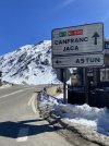
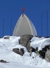
Walked the first stage of this route from the Somport Pass to Canfranc Pueblo which is only 12kms but was more tiring than similar stage distances due to the altitude, weather, and trail conditions. A recent snowstorm dumped over a foot of snow at the pass and even though it is quickly melting, it made for difficult way-finding and footing.

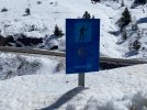
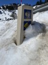
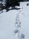
Usually the route from the pass into the Aragon Valley is easy to follow, but snow has covered a number of arrows and signposts. Apparently I was the first to walk the route post-storm so anyone walking this route in the next few days can simply follow the size 14 US footprints! 😎

You’ll drop below the snow line after about 90 minutes of walking, but you can divert to the highway shoulder to avoid most of it. My Altra Timps and Darn Tough wool socks didn’t keep my feet dry, but they did keep them warm and they eventually dried out almost completely while walking finishing the stage. Last year a heavier snowstorm hit this same weekend and all of it had melted off the trail with two weeks. If you don’t mind the challenge, it’s a safe path to walk right now.

The route was changed about two years ago, but the old route is still accessible and signposted as the GR-11. Both trails join together about 1km before Canfranc Estacion. Both are lovely and sign-posted with the main difference being how close to the highway you will walk.

The old route (GR-11) stays on the left side of the highway and follows the Valley down higher up on the hillside away from the traffic noise. It goes closer to various military bunkers and ruins, but can get a bit muddier. If the weather is nice, I highly recommend it. To reach it, follow the signs for GR-11 when you reach the bottom of the hill featuring the ruins of the 12th century Santa Cristina Hospital. As you face the highway, the Camino signs point right across the roadway towards the buildings of Candanchu, but you’ll head left and cross a small roadway bridge (stay on the left side of the highway.) after about 100 meters, you’ll see a sign for the trail pointing UP the hill.

The new route is better during storms and a bit shorter for those walking all the way to Jaca. It’s easy to follow as they have erected large “Camino de Santiago” signs at key points. You will walk near the highway at times on the right side of the Valley and it requires several crossings of that roadway, but none which are dangerous. It also passes by the Santa Cristina Hotel if you are looking for a stop prior to Canfranc Estacion. The path is often gravel or paved road, but it’s an abandoned roadway so no cars will be traveling on it. This path allows you to move to the highway shoulder if a storm hits, especially during sudden whiteout conditions that some experienced this past week.

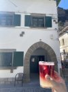
Canfranc Estacion has multiple accommodations, grocery stores, and bar/cafes including the newly renovated train station. Less than an hour further down the trail, you’ll reach Canfranc Pueblo, a very small community with one of the nicest albergues you’ll ever visit. The Elías Valiña municipal donativo is managed by FICS and opened less than two years ago. 16 pilgrim beds, a large lounge space and kitchen, sundeck, and simple breakfast. Stay and give generously! Pueblo also has a small bar with food and some groceries.

3A371BDA-AEC7-4171-9ABE-D1133F74B5B4.jpeg74976D48-D0B2-4754-928C-CE66CF7BC00B.jpegB7E83B6F-D86E-4AAE-A57E-6779E123219A.jpeg83CBB986-E36F-4C60-9CEB-806AAF4B5AB9.jpegF9F861CE-D120-4F10-BA44-F5BC4E2E426C.jpeg3F0FB3B4-8333-43B7-9D72-62B44202B2E8.jpeg7D601138-5452-41E3-9494-65BA054C4069.jpeg
 
A selection of Camino Jewellery
Thank you very much for your detailed account and for the description of the various paths leading down from Somport! I hope that there will be less snow but just as much sunshine when I start out from Somport next Wednesday 12 April.
 
St James' Way - Self-guided 4-7 day Walking Packages, Reading to Southampton, 110 kms
Very detailed! I’m happy my size 12s would fit nicely in the path provided 😂. How did you get to the starting point? I’m considering detouring up when I walk the Catalan and sort of doing two-birds-one-walk.
 
The 2024 Camino guides will be coming out little by little. Here is a collection of the ones that are out so far.
Walked the first stage of this route from the Somport Pass to Canfranc Pueblo which is only 12kms but was more tiring than similar stage distances due to the altitude, weather, and trail conditions. A recent snowstorm dumped over a foot of snow at the pass and even though it is quickly melting, it made for difficult way-finding and footing.

Usually the route from the pass into the Aragon Valley is easy to follow, but snow has covered a number of arrows and signposts. Apparently I was the first to walk the route post-storm so anyone walking this route in the next few days can simply follow the size 14 US footprints! 😎

You’ll drop below the snow line after about 90 minutes of walking, but you can divert to the highway shoulder to avoid most of it. My Altra Timps and Darn Tough wool socks didn’t keep my feet dry, but they did keep them warm and they eventually dried out almost completely while walking finishing the stage. Last year a heavier snowstorm hit this same weekend and all of it had melted off the trail with two weeks. If you don’t mind the challenge, it’s a safe path to walk right now.

The route was changed about two years ago, but the old route is still accessible and signposted as the GR-11. Both trails join together about 1km before Canfranc Estacion. Both are lovely and sign-posted with the main difference being how close to the highway you will walk.

The old route (GR-11) stays on the left side of the highway and follows the Valley down higher up on the hillside away from the traffic noise. It goes closer to various military bunkers and ruins, but can get a bit muddier. If the weather is nice, I highly recommend it. To reach it, follow the signs for GR-11 when you reach the bottom of the hill featuring the ruins of the 12th century Santa Cristina Hospital. As you face the highway, the Camino signs point right across the roadway towards the buildings of Candanchu, but you’ll head left and cross a small roadway bridge (stay on the left side of the highway.) after about 100 meters, you’ll see a sign for the trail pointing UP the hill.

The new route is better during storms and a bit shorter for those walking all the way to Jaca. It’s easy to follow as they have erected large “Camino de Santiago” signs at key points. You will walk near the highway at times on the right side of the Valley and it requires several crossings of that roadway, but none which are dangerous. It also passes by the Santa Cristina Hotel if you are looking for a stop prior to Canfranc Estacion. The path is often gravel or paved road, but it’s an abandoned roadway so no cars will be traveling on it. This path allows you to move to the highway shoulder if a storm hits, especially during sudden whiteout conditions that some experienced this past week.

Canfranc Estacion has multiple accommodations, grocery stores, and bar/cafes including the newly renovated train station. Less than an hour further down the trail, you’ll reach Canfranc Pueblo, a very small community with one of the nicest albergues you’ll ever visit. The Elías Valiña municipal donativo is managed by FICS and opened less than two years ago. 16 pilgrim beds, a large lounge space and kitchen, sundeck, and simple breakfast. Stay and give generously! Pueblo also has a small bar with food and some groceries.
View attachment 144234View attachment 144235View attachment 144236View attachment 144237View attachment 144238View attachment 144239View attachment 144240
Absolutely brilliant but one I will never manage now due to a Plethora of Problems :) so eager to read your story and the pics are great!
Buen Camino

Samarkand.
 
Vacajoe, thanks for the detailed report. Leaving for Spain and the Aragones in 2 weeks!!!
 
Should be a lovely time for that route! Definitely stay at Pueblo if you can
 
Technical backpack for day trips with backpack cover and internal compartment for the hydration bladder. Ideal daypack for excursions where we need a medium capacity backpack. The back with Air Flow System creates large air channels that will keep our back as cool as possible.

€83,-
Walked the first stage of this route from the Somport Pass to Canfranc Pueblo which is only 12kms but was more tiring than similar stage distances due to the altitude, weather, and trail conditions. A recent snowstorm dumped over a foot of snow at the pass and even though it is quickly melting, it made for difficult way-finding and footing.

Usually the route from the pass into the Aragon Valley is easy to follow, but snow has covered a number of arrows and signposts. Apparently I was the first to walk the route post-storm so anyone walking this route in the next few days can simply follow the size 14 US footprints! 😎

You’ll drop below the snow line after about 90 minutes of walking, but you can divert to the highway shoulder to avoid most of it. My Altra Timps and Darn Tough wool socks didn’t keep my feet dry, but they did keep them warm and they eventually dried out almost completely while walking finishing the stage. Last year a heavier snowstorm hit this same weekend and all of it had melted off the trail with two weeks. If you don’t mind the challenge, it’s a safe path to walk right now.

The route was changed about two years ago, but the old route is still accessible and signposted as the GR-11. Both trails join together about 1km before Canfranc Estacion. Both are lovely and sign-posted with the main difference being how close to the highway you will walk.

The old route (GR-11) stays on the left side of the highway and follows the Valley down higher up on the hillside away from the traffic noise. It goes closer to various military bunkers and ruins, but can get a bit muddier. If the weather is nice, I highly recommend it. To reach it, follow the signs for GR-11 when you reach the bottom of the hill featuring the ruins of the 12th century Santa Cristina Hospital. As you face the highway, the Camino signs point right across the roadway towards the buildings of Candanchu, but you’ll head left and cross a small roadway bridge (stay on the left side of the highway.) after about 100 meters, you’ll see a sign for the trail pointing UP the hill.

The new route is better during storms and a bit shorter for those walking all the way to Jaca. It’s easy to follow as they have erected large “Camino de Santiago” signs at key points. You will walk near the highway at times on the right side of the Valley and it requires several crossings of that roadway, but none which are dangerous. It also passes by the Santa Cristina Hotel if you are looking for a stop prior to Canfranc Estacion. The path is often gravel or paved road, but it’s an abandoned roadway so no cars will be traveling on it. This path allows you to move to the highway shoulder if a storm hits, especially during sudden whiteout conditions that some experienced this past week.

Canfranc Estacion has multiple accommodations, grocery stores, and bar/cafes including the newly renovated train station. Less than an hour further down the trail, you’ll reach Canfranc Pueblo, a very small community with one of the nicest albergues you’ll ever visit. The Elías Valiña municipal donativo is managed by FICS and opened less than two years ago. 16 pilgrim beds, a large lounge space and kitchen, sundeck, and simple breakfast. Stay and give generously! Pueblo also has a small bar with food and some groceries.
View attachment 144234View attachment 144235View attachment 144236View attachment 144237View attachment 144238View attachment 144239View attachment 144240
Many thanks great photos
Buen Camino
 
Many thanks great photos
Buen Camino
Walked the first stage of this route from the Somport Pass to Canfranc Pueblo which is only 12kms but was more tiring than similar stage distances due to the altitude, weather, and trail conditions. A recent snowstorm dumped over a foot of snow at the pass and even though it is quickly melting, it made for difficult way-finding and footing.

Usually the route from the pass into the Aragon Valley is easy to follow, but snow has covered a number of arrows and signposts. Apparently I was the first to walk the route post-storm so anyone walking this route in the next few days can simply follow the size 14 US footprints! 😎

You’ll drop below the snow line after about 90 minutes of walking, but you can divert to the highway shoulder to avoid most of it. My Altra Timps and Darn Tough wool socks didn’t keep my feet dry, but they did keep them warm and they eventually dried out almost completely while walking finishing the stage. Last year a heavier snowstorm hit this same weekend and all of it had melted off the trail with two weeks. If you don’t mind the challenge, it’s a safe path to walk right now.

The route was changed about two years ago, but the old route is still accessible and signposted as the GR-11. Both trails join together about 1km before Canfranc Estacion. Both are lovely and sign-posted with the main difference being how close to the highway you will walk.

The old route (GR-11) stays on the left side of the highway and follows the Valley down higher up on the hillside away from the traffic noise. It goes closer to various military bunkers and ruins, but can get a bit muddier. If the weather is nice, I highly recommend it. To reach it, follow the signs for GR-11 when you reach the bottom of the hill featuring the ruins of the 12th century Santa Cristina Hospital. As you face the highway, the Camino signs point right across the roadway towards the buildings of Candanchu, but you’ll head left and cross a small roadway bridge (stay on the left side of the highway.) after about 100 meters, you’ll see a sign for the trail pointing UP the hill.

The new route is better during storms and a bit shorter for those walking all the way to Jaca. It’s easy to follow as they have erected large “Camino de Santiago” signs at key points. You will walk near the highway at times on the right side of the Valley and it requires several crossings of that roadway, but none which are dangerous. It also passes by the Santa Cristina Hotel if you are looking for a stop prior to Canfranc Estacion. The path is often gravel or paved road, but it’s an abandoned roadway so no cars will be traveling on it. This path allows you to move to the highway shoulder if a storm hits, especially during sudden whiteout conditions that some experienced this past week.

Canfranc Estacion has multiple accommodations, grocery stores, and bar/cafes including the newly renovated train station. Less than an hour further down the trail, you’ll reach Canfranc Pueblo, a very small community with one of the nicest albergues you’ll ever visit. The Elías Valiña municipal donativo is managed by FICS and opened less than two years ago. 16 pilgrim beds, a large lounge space and kitchen, sundeck, and simple breakfast. Stay and give generously! Pueblo also has a small bar with food and some groceries.
View attachment 144234View attachment 144235View attachment 144236View attachment 144237View attachment 144238View attachment 144239View attachment 144240
OK, my plan is to walk that very route in my Teva hiking sandals in 3.5 weeks, so you tell all that snow to please MELT. I just read your instructions on the GR-11 into the voice memos in my phone. Thanks for that info!
 
This snow will likely be gone from the trail, but there an always the chance of another storm! Sandals may be a challenge simply due to soggy/muddy conditions.
 
Get a spanish phone number with Airalo. eSim, so no physical SIM card. Easy to use app to add more funds if needed.
This snow will likely be gone from the trail, but there an always the chance of another storm! Sandals may be a challenge simply due to soggy/muddy conditions.
I'll be keeping an eye on weather. If it's just not feasible, I'll start lower down. It could give me an even closer experience of nature to have mud squishing through my toes, right? Sandals themselves should stay on and everything (strap goes round ankle). And they'll be easy to wash off and dry, at least.
 
My tevas pick up rocks like a vacuum cleaner!
 
New Original Camino Gear Designed Especially with The Modern Peregrino In Mind!

❓How to ask a question

How to post a new question on the Camino Forum.

Forum Rules

Forum Rules

Camino Updates on YouTube

Camino Conversations

Most downloaded Resources

This site is run by Ivar at

in Santiago de Compostela.
This site participates in the Amazon Affiliate program, designed to provide a means for Ivar to earn fees by linking to Amazon
Official Camino Passport (Credential) | 2024 Camino Guides
Back
Top